One Planet Nations Online All Countries in the World |
![]() |
![]() ![]() ![]() |
![]() Tatoosh Range located in Mount Rainier National Park and the adjacent Tatoosh Wilderness, view from Paradise. Image: Acroterion |
___ Reference Maps of the State of Washington (WA) |
About Washington![]() Time Zone Pacific:
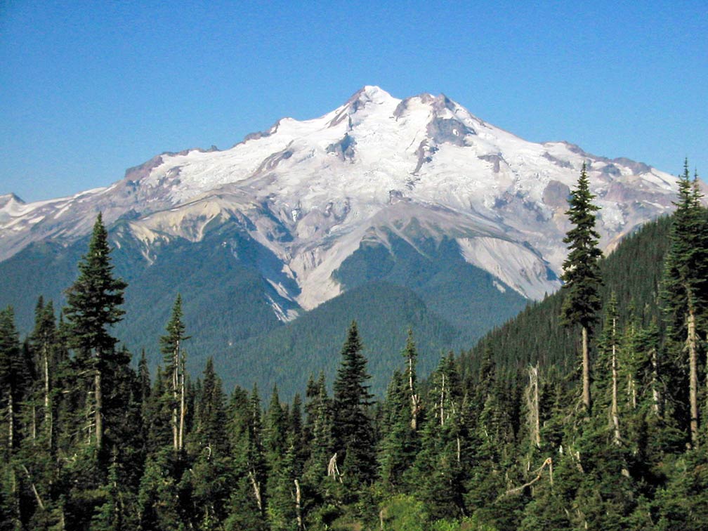
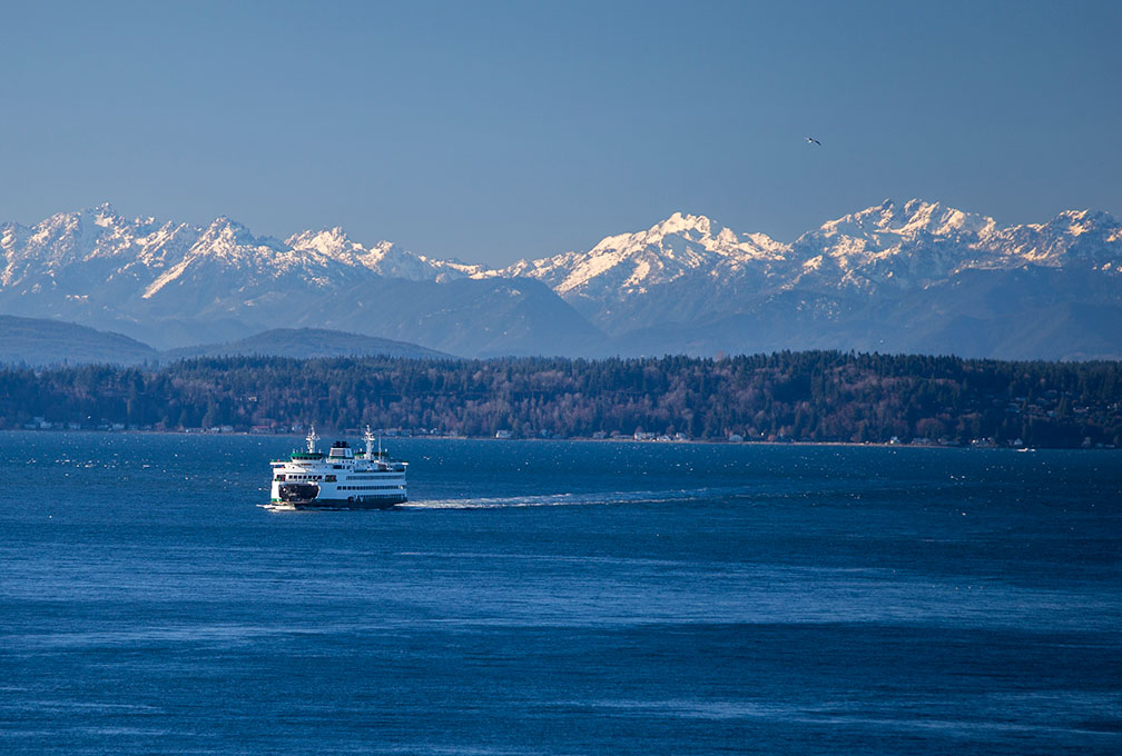
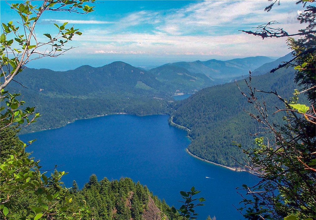
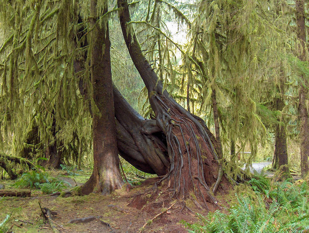
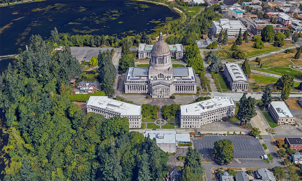
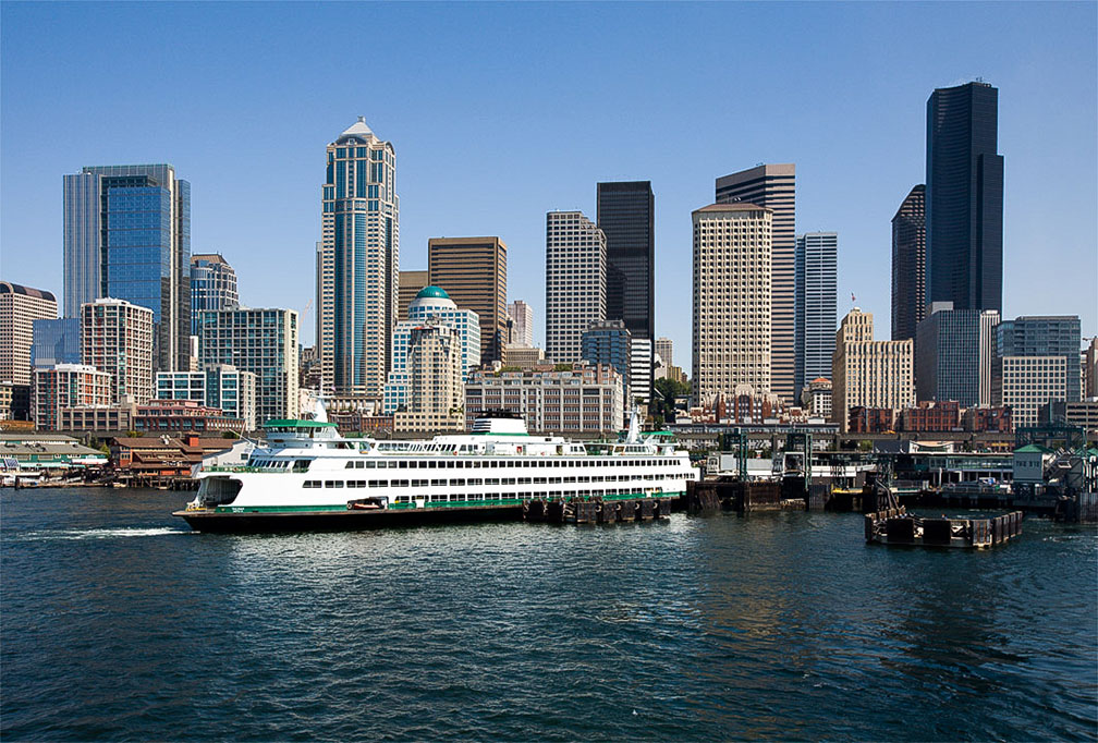
UTC −8/DST−7 Clock shows DST ![]() Where in the United States is Washington state? Location map of the State of Washington in the US. The Columbia River defines a long section of the state line with Oregon in south. Washington state consists of 39 counties. The United States acquired the area of Washington through a treaty with Great Britain in 1846. Washington Territory was organized from part of Oregon Territory on 2nd March 1853; it included all of present-day Washington, northern Idaho, and northwestern Montana. Some Geography The State of Washington covers an area of 184,661 km² (71,298 sq mi) [1], making it slightly larger than half the size of Germany, or slightly smaller than half the size of Japan. Washington state has several distinct geographical regions: there is the serrated Pacific coastline with the Strait of Juan de Fuca, the Salish Sea's outlet to the Pacific Ocean, several other bays and straits, like the Strait of Georgia, the Bellingham Bay, the Admiralty Inlet, and the Samish Bay, the Puget Sound along the northwestern coast of the state, an inlet of the Pacific Ocean, within the sound are fifty plus islands, the largest are Whidbey, Orcas, San Juan, Fidalgo, and Camano. ![]() Cool, Chocolate, North Guardian and Dusty Glaciers (left to right) on the east slopes of Glacier Peak (Dakobed), the stratovolcano in Washington State. Image: Walter Siegmund Within the range are five major volcanoes, from north to south: Mount Baker, an active glaciated stratovolcano at 3,286 m (10,781 ft), Glacier Peak (Dakobed), one of the most active volcano in the state with an elevation of 3,207 m (10,525 ft), dangerous Mount Rainier, the huge active stratovolcano is the highest mountain in the state at an elevation of 4,392 m (14,411 ft). Mount St. Helens, known for its major 1980 eruption, declared the most disastrous volcanic eruption in United States history. Mount Adams, a potentially active stratovolcano has not erupted in more than 1,000 years. The Wenatchee Mountains in the center of the state are a major subrange of the Cascade Range. Rivers ![]() Bainbridge Island Ferry on Puget Sound with Olympic Mountain Range in background. Washington has the largest ferry system in the United States with 20 terminals located around Puget Sound and in the San Juan Islands. Image: Tiffany Von Arnim the Snake River, largest tributary of the Columbia River (most of it in Idaho and Oregon); Okanagan River, another tributary of the Columbia River; Grande Ronde River, a tributary of the Snake River, its mouth is in Washington, Kettle River, a Columbia River tributary, its mouth is in northeastern Washington; Palouse River, a tributary of the Snake River; Crab Creek, a stream in the Columbia Basin; Pend Oreille River, a tributary of the Columbia River. Lakes ![]() View of Lake Crescent in Olympic National Park, seen from Pyramid Peak. Image: Elwhajeff Potholes Reservoir, part of the Columbia Basin Irrigation Project, fed by water from Moses Lake, a lake and reservoir along the course of Crab Creek; Banks Lake, a 45 km (28 mi) long reservoir, also part of the Columbia Basin Irrigation Project; Ross Lake, a large reservoir in the North Cascade mountains; Ozette Lake, is largest unaltered natural lake in Washington state. Lake Crescent, a deep lake located within Olympic National Park. World Heritage Site ![]() Primeval forest in Hoh Rain Forest in the Olympic National Park, a UNESCO World Heritage Site. Image: Goldom ⁂ ![]() To the east of the coast rise the Olympic Mountains, part of the Pacific Coast Ranges, glacier-clad, steep-sided peaks within a vast intact old growth forest, interspersed with alpine meadows. Eleven major rivers radiate outwards to all sides from the mountain range and drain the Olympics. Highest peak is Mount Olympus at 2,432 m (7,980 ft). UNESCO designated the Olympic National Park as an International Biosphere Reserve in 1976, and in 1981 as a World Heritage Site. Population ![]() Rendered image of the Washington State Capitol building in Olympia, the state's capital city. The Legislative Building houses the government of Washington State. Image: Google By far the largest airport in the state is Seattle–Tacoma International Airport (IATA code: SEA), other major airports are Spokane International Airport (Geiger Field; IATA code: GEG), Bellingham International Airport (IATA code: BLI), and Tri-Cities Airport in Pasco (IATA code: PSC). Cities and Towns in Washington The map shows the location of following cities and towns in Washington: Capital city: Olympia (48,000) ![]() Downtown Seattle, largest city in Washington State, Bainbridge Island ferry in foreground. Image: Jamies Other cities and towns in Washington: Aberdeen, Anacortes, Battle Ground, Bellingham, Blaine, Bremerton, Camas, Centralia, Chehalis, Chelan, Cheney, Clarkston, Colfax, Colville, Coulee City, Dayton, Ellensburg, Enumclaw, Ephrata, Federal Way, Forks, Goldendale, Grand Coulee, Hoquiam, Kelso, Kennewick, Lacey, Lakewood, Longview, Lynnwood, Marysville, Morton, Moses Lake, Mount Vernon, Newport, Oak Harbor, Omak, Oroville, Othello, PascoIlwaco, Port Angeles, Pullman, Puyallup, Quincy, Raymond, Redmond, Renton, Republic, Richland, Ritzville, Seattle, South Bend, Spokane Valley, Toppenish, Walla Walla, Wenatchee, Wilbur, Winthrop, and Yakima. The detailed map is showing the US state of State of Washington with boundaries, the location of the state capital Olympia, major cities and populated places, streams and lakes, interstate highways, principal highways, and railroads. ![]() |
|
|
![]() Reference Map of State of Washington Map is based on a state map of The National Atlas of the USA. |
More about Washington and the United States: Cities -- Information about, and searchable maps of: ![]() ![]() U.S. States: ![]() ![]() ![]() ![]() ![]() ![]() Country: ![]() Reference Map of Mainland USA. ![]() ![]() ![]() ![]() ![]() Continent: ![]() ![]() |
Seattle Current Weather Conditions SEATTLE WEATHER |
Explore more:
Related Consumer Information:
|
One World - Nations Online .:. let's care for this planet Promote that every nation assumes responsibility for our world. Nations Online Project is made to improve cross-cultural understanding and global awareness. More signal - less NOISE |
Site Map
| Information Sources | Disclaimer | Contact: ">[email protected] | Copyright © 1998-2019 :: nationsonline.org![]() ![]() ![]() ![]() ![]() ![]() ![]() ![]() ![]() |