Advertising

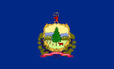
Vermont Flag detail
Home Earth Continents The Americas USA Country Profile US State Capitals Vermont Map

US States Maps Index
World Maps Index

Map of Vermont (VT)


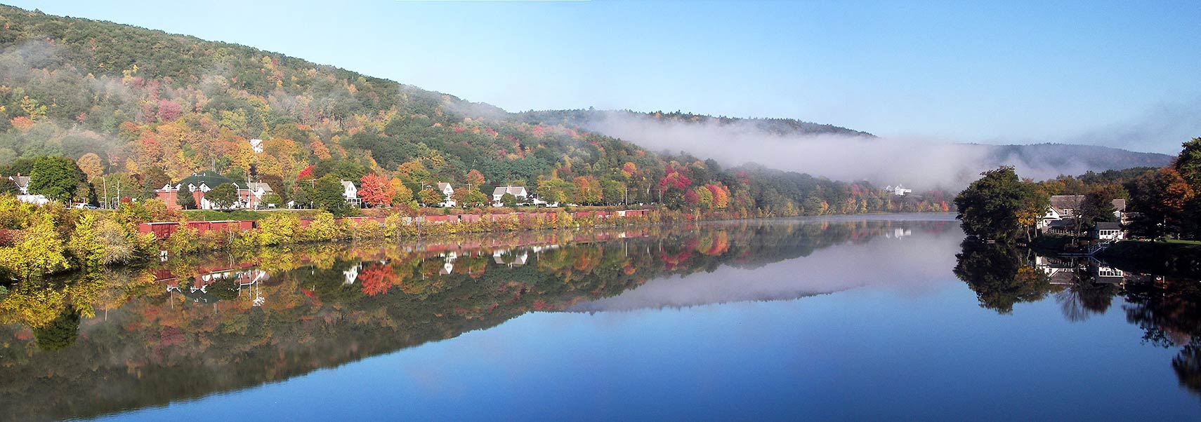
Connecticut River at Bellows Falls village, Rockingham, Windham County
Misty Autumn Morning on the Connecticut River at Bellows Falls village, Rockingham, Windham County, Vermont.
Image: daxtell


Vermont Flag
Vermont State Flag


About Vermont


Location map of Vermont state USA
Where in the United States is Vermont? Location map of the State of Vermont in the US.
 
Vermont is one of the six states in the region known as New England. The State of Vermont is situated in the eastern US mainland. It borders Canada (Québec province) to the north.

The Connecticut River defines its border with New Hampshire in the east; Lake Champlain separates Vermont from New York state in the northwest. A straight line separates Vermont from Massachusetts in the south.


New England was the site of early European settlement. The area of Vermont became part of the original territory of the United States and was included in the Charter of New England in 1620. The region was later included in grants creating New York in 1664 and 1674. On 18 January 1777, Vermont declared itself an independent republic. It was the first state in North America to abolish slavery.
On 18 February 1791, Vermont joined the Union as its 14th state.


Vermont State Map
Reference Map of Vermont
General Map of Vermont, United States.

The detailed map shows the US state of Vermont with boundaries, the location of the state capital Montpelier, major cities and populated places, rivers and lakes, interstate highways, principal highways, and railroads.

You are free to use this map for educational purposes (fair use); please refer to the Nations Online Project.

 
More about Vermont State


Some Geography

Area
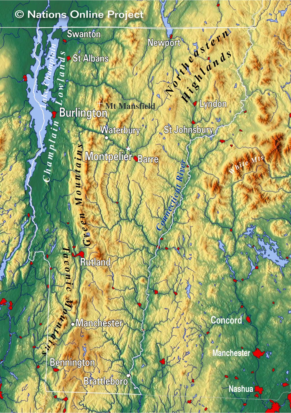
Vermont Topographic Regions Map
Topographic Regions Map of Vermont. (click map to enlarge)

Vermont occupies an area of 24,905 km² (9,616 sq mi) [2], making it the 45th-largest state, compared it is about one quarter the size of South Korea or Iceland. Compared with other US states, Vermont is about the size of New Jersey, but it would fit into Texas 28 times.

Vermont is divided into 14 counties.

As mentioned above, the region was the site of early European settlement. French colonists were the earliest European immigrants to the area.

Colonization is based on natural features, like fertile soil, and watercourses, which provide access to transportation during the settlement period. English settlers, migrating from Boston and central Massachusetts, were using numerous river corridors, especially the Connecticut River, to access the fertile southeastern lands in Vermont.[3]

Vermont's Landscape

Mountains
Vermont's hilly to mountainous landscape is quite forested, giving the state its nickname the Green Mountain State.

The highlight of Vermont's landscape is the Green Mountains, the 310 km (190 mi) long mountain range runs along the western edge of the state in a north/south direction; they are part of the Appalachians.

The Taconic Mountains are also part of the Appalachian Mountains. The New England range includes some well-known summits such as Mount Equinox in Vermont and Mount Greylock, the highest point in Massachusetts.

The Northeast Highlands, a rough, wild region known as the "Northeast Kingdom," is a sparsely populated area, located almost entirely within the borders of Essex County.

Highest point


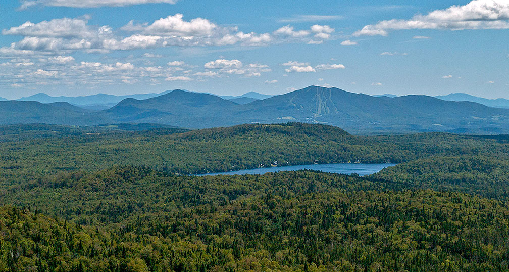
Newark Pond and Burke Mountain in the "Northeast Kingdom"
Newark Pond and Burke Mountain in the "Northeast Kingdom", White Mountains in the distance.
Image: Charles Wohlers

 
The highest mountain in Vermont is Mount Mansfield at 1,339.7 m (4,395.3 ft).

Rivers
Vermont is a state with many small rivers and streams. The Connecticut River marks the border with New Hampshire and drains the south. The Winooski River (formerly the Onion River) is a tributary of Lake Champlain.

Lakes
Lake Champlain is a large freshwater lake in North America with a surface area of 1,270 km² (490 sq mi), shared between the US states of New York and Vermont and Canada's Quebec province. The lake and its islands are a popular tourist destination.
Lake Memphremagog is a freshwater glacial lake shared between Vermont and Canada's Quebec province.


Population


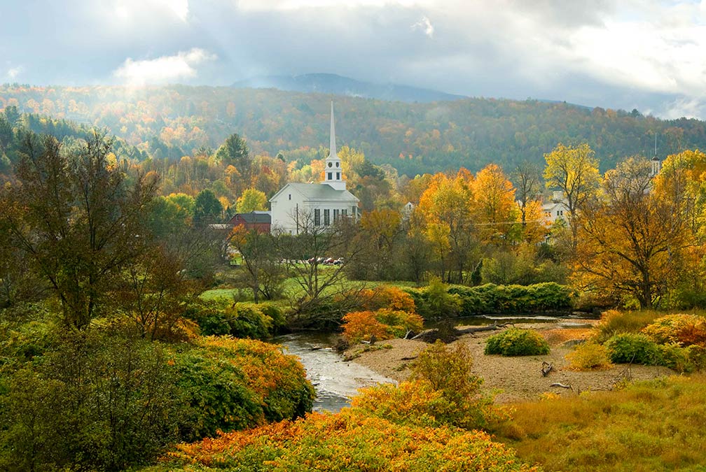
Autumn in Stowe, Vermont
Patches of sunlight and threatening clouds move across the town of Stowe, Vermont.
Image: ©  Ryan Taylor

 
Vermont has a population of 624,000 people (2019 est.) [4]; it is the second least populated state in the US (after Wyoming).

The state capital is Montpelier, the largest city is Burlington (pop. 42,556), the largest metropolitan area is Burlington-South Burlington.


Race and Ethnic groups
The population of Vermont is composed of 92.6% Caucasians, 2.0% Hispanics or Latinos, 1.9% Asians and 1.4% African Americans, 0.4% Native Americans. [5]


Busiest and only international airport in the state is Burlington International Airport (IATA code: BTV).

 
Cities and Towns in Vermont

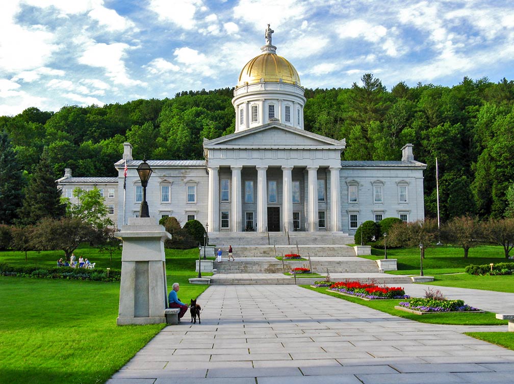
Vermont State House in Montpelier
Vermont State House in Montpelier. The state capitol is the seat of the Vermont General Assembly.
Image: Jasperdo

The map shows the location of following cities and towns in Vermont: Largest cities in Vermont with a population of more than 10,000:


Burlington, (42,500), Essex (26,000), Colchester (17,300), Rutland (16,000), Bennington (15,700), Brattleboro (11,700), Hartford (9,700),
Montpelier (capital city, 7,600)
Population figures in 2016


Other cities and towns in Vermont:

Barre, Bellows Falls, Bethel, Hyde Park, Island Pond, Ludlow, Manchester, Middlebury, Newport, Northfield, South Burlington, Springfield, St Albans, St Johnsbury, Swanton, Vergennes, Waterbury, White River Jct, Windsor, Winooski, and Woodstock.


Weather Conditions Burlington:

BURLINGTON WEATHER


Advertisements:


Maps of the 50 U.S. States
Alabama | Alaska | Arizona | Arkansas | California | Colorado | Connecticut | Delaware | Florida | Georgia | Hawaii | Idaho | Illinois | Indiana | Iowa | Kansas | Kentucky | Louisiana | Maine | Maryland | Massachusetts | Michigan | Minnesota | Mississippi | Missouri | Montana | Nebraska | Nevada | New Hampshire | New Jersey | New Mexico | New York | North Carolina | North DakotaOhio | Oklahoma | Oregon | Pennsylvania | Rhode Island | South Carolina | South Dakota | Tennessee | Texas | Utah | Vermont | Virginia | Washington | West Virginia | Wisconsin | Wyoming

20 Most Populous U.S. Cities (in 2018):
1. New York City 2. Los Angeles 3. Chicago 4. Houston 5. Phoenix 6. Philadelphia 7. San Antonio 8. San Diego 9. Dallas 10. San Jose 11. Austin 12. Jacksonville 13. Fort Worth 14. Columbus 15. San Francisco 16. Charlotte 17. Indianapolis 18. Seattle, 19. Denver, 20. Washington D.C.

Other Major U.S. Cities:
Albany, Anchorage, Annapolis, Atlanta, Atlantic City, Augusta, Baltimore, Baton Rouge, Bismarck, Boise, Boston, Carson City, Charleston, WV, Cheyenne, Cincinnati, Cleveland, Columbia, Concord, Des Moines, Detroit, Dover, DE, El Paso, Frankfort, Harrisburg, Hartford, Helena, Honolulu, Jackson, Jefferson City, Juneau, Kansas City, Lansing, Las Vegas, Lincoln, Little Rock, Long Beach, Madison, Memphis, Miami, Milwaukee, Minneapolis, Montgomery, Montpelier, Nashville, New Orleans, Norfolk, Oklahoma City, Olympia, Orlando, Pierre, Pittsburgh, Portland, Providence, Richmond, VA, Raleigh, Sacramento, St. Louis, St. Paul, Salem (OR), Salt Lake City, Santa Fe, Springfield, Tallahassee, Tampa, Topeka, Trenton, Tucson