Advertising

Wyoming Flag wave detail
Home Earth Continents The Americas USA Country Profile US State Capitals Wyoming Map

US States Maps Index
World Maps Index

Map of Wyoming (WY)


Wind River mountains Wyoming
In the Wind River mountains with Mt Arrowhead on the left in Sublette county, Wyoming.
Image: Kylir Horton


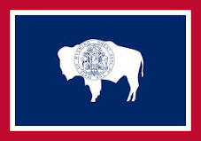
Wyoming Flag
Wyoming State Flag
 

About Wyoming


Location map of Wyoming state USA
Where in the United States is Wyoming? Location map of Wyoming in the US.

Wyoming is one of the 50 states of the United States. The trapezoid-shaped landlocked state is located in the Mountain Division in the western US mainland.

Wyoming borders Montana to the north, South Dakota and Nebraska to the east, Colorado and Utah in the south and Idaho in the west.


Short History
Inhabited by nomadic indigenous tribes for thousands of years, but the sight of free-roaming Native Americans ended soon after the first European 'explorers' reached the Great Plains and the Rocky Mountains, "the Cheyenne and Sioux were the last of the Indians to be controlled and placed on reservations." [1]


Because of Wyoming's location at the intersection of the Louisiana Purchase, the Oregon Country, and the Mexican Cession, the land which became Wyoming has a complicated history of territorial relationships.
The United States acquired portions of the area of Wyoming from France as part of the Louisiana Purchase in 1803, from Great Britain as part of a treaty in 1846, and from territory ceded by Mexico in 1848.


Wyoming State Map
Reference Map of Wyoming
General Map of Wyoming, United States.

The detailed map shows the US state of Wyoming with boundaries, the location of the state capital Cheyenne, major cities and populated places, rivers and lakes, interstate highways, principal highways, and railroads.

You are free to use this map for educational purposes (fair use); please refer to the Nations Online Project.

 
More about Wyoming State

Some Geography

Area
Wyoming Topographic Regions Map
Topographic Regions Map of Wyoming showing Wyoming's main geographical features.

It is the tenth largest state in the US, with a total area of 253,348 km² (97,818 sq mi), [2] compared, Wyoming is somewhat larger than the United Kingdom. Compared with other US states, Wyoming would fit into Texas almost three times but is 11 times larger than New Jersey.


Main geographical Regions

Wyoming's main geographical regions are the Great Plains, the Rocky Mountains, and the Intermontane Basins. Around 85% of the state is considered rangelands.

In the northeast, there is a small extension of the Black Hills. The Powder River Basin supersedes the hills with the Bighorn Mountains in the north and the semi-arid region of the Thunder Basin National Grassland to the west.

In the western and central portions of the state spreads the Wyoming Basin shrub-steppe, an ecoregion surrounded by various subranges of the Rocky Mountains.

 
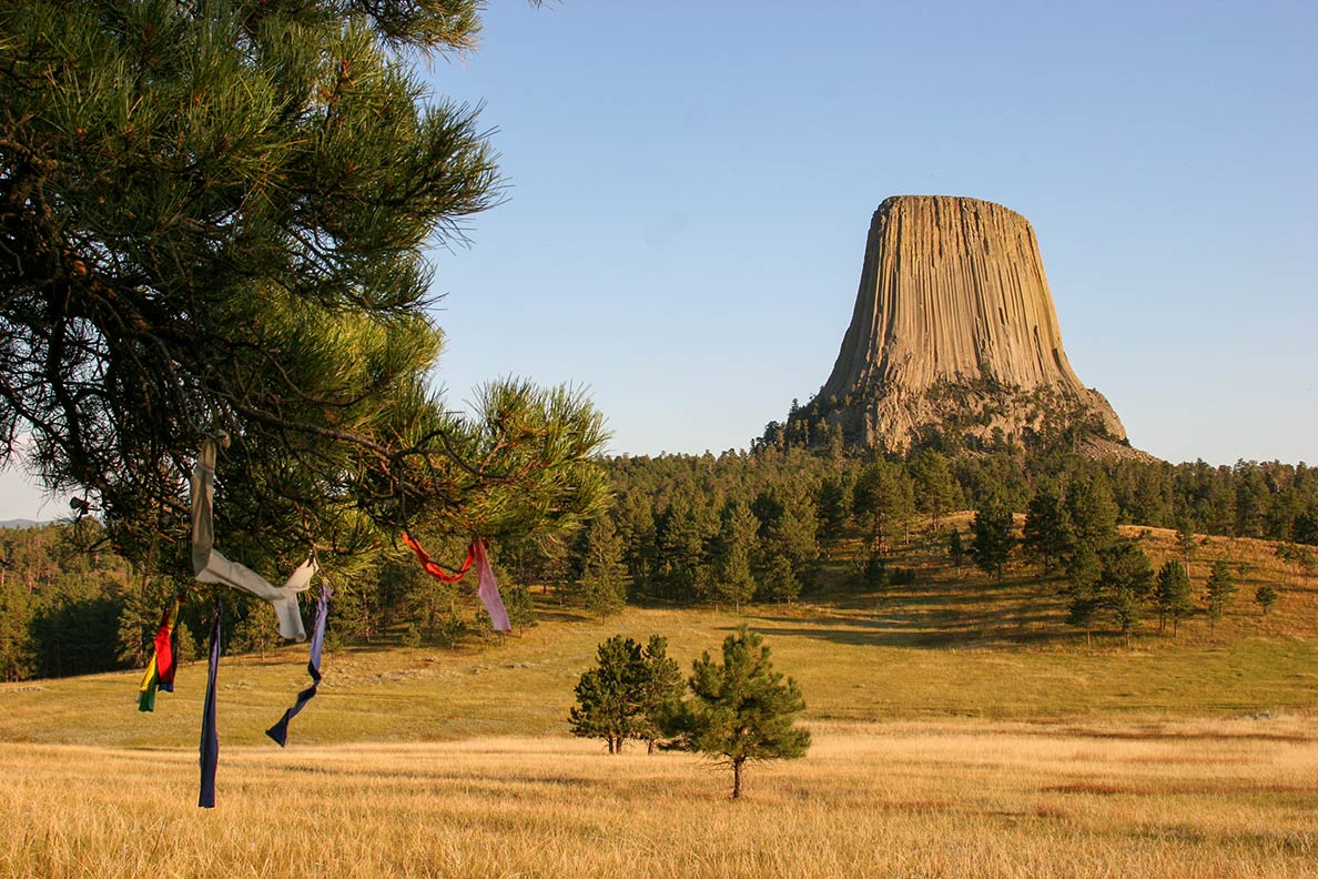
Devils Tower in
Devils Tower is an awesome butte in the Bear Lodge Ranger District of the Black Hills. The first United States national monument is located in the northeastern corner of Wyoming.
Image: Kimon Berlin

Highlights of Wyoming's landscape are the dramatic peaks and steep valleys of the Rocky Mountains, and its subranges like the crescent-shaped Bighorn Mountain Range or the Teton Range, the youngest mountain range in the Rockies.


Highest Mountain Peak
The state's highest mountain summit at 4,209 m (13,809 ft) is Gannett Peak in the Wind River Range within Bridger Wilderness.


World Heritage Site
And there is Yellowstone National Park (www.nps.gov/yell) in the northwest corner of Wyoming, so awe-inspiring to humans that it became the first National Park in the US in 1872, in 1978 Yellowstone became a UNESCO World Heritage Site official website

The Yellowstone Caldera is the largest volcanic system in North America and home to a supervolcano. Yellowstone is also known for its wildlife and geothermal activity.
Within the Upper Geyser Basin sits Old Faithful, the cone geyser erupts in intervals from 60-110 minutes, the colorful Grand Prismatic Spring nearby is the largest hot spring in the United States.

 
Population

Wyoming State Capitol in Cheyenne
Rendered image of Wyoming's State Capitol in Cheyenne.
Image: Google

Wyoming's population rank is 50th, with about 578,000 inhabitants (2018 est.) [3], making it the least populated state in the US. Wyoming is made up of 23 counties. Capital and largest city is Cheyenne; the largest urban area is Cheyenne Metro Area (pop. 2017 98,136) [4]. Other major cities are Casper, Laramie, and Gillette.


Race and Ethnic groups
The population of Wyoming is composed of White alone 83.7%, Hispanic or Latino 10.1%, Native American 2.7%, African American 1.3%, and Asian 1.1%. [5]


The busiest airport is Jackson Hole Airport (IATA code: JAC), which serves Jackson (WY) and Grand Teton National Park. The second-largest airport is Casper/Natrona County International Airport (IATA code: CPR).

 
Cities and Towns in Wyoming

Downtown Cheyenne, Wyoming's capital city
Downtown Cheyenne, Wyoming's capital.
Image: Vasiliymeshko


The map shows the location of following cities and towns in Wyoming:

Capital and largest city: Cheyenne (62,000)
Largest cities in Wyoming state with a population of more than 20,000:
Casper, (60,000), Laramie (32,000), Gillette (32,000), Rock Springs (24,000)

Population figures est. 2014

Other cities and towns in Wyoming:

Afton, Alpine, Big Piney, Buffalo, Cody, Douglas, Evanston, Farson, Fort Laramie, Green River, Greybull, Jackson, Kemmerer, Lander, Lovell, Lusk, Medicine Bow, Moorcroft, Newcastle, Pinedale, Powell, Rawlins, Riverton, Saratoga, Sheridan, Shoshoni, Sundance, Thermopolis, Torrington, Wheatland, Worland, Wright


Weather Conditions Cheyenne:

CHEYENNE WEATHER


Advertisements:


Maps of the 50 U.S. States
Alabama | Alaska | Arizona | Arkansas | California | Colorado | Connecticut | Delaware | Florida | Georgia | Hawaii | Idaho | Illinois | Indiana | Iowa | Kansas | Kentucky | Louisiana | Maine | Maryland | Massachusetts | Michigan | Minnesota | Mississippi | Missouri | Montana | Nebraska | Nevada | New Hampshire | New Jersey | New Mexico | New York | North Carolina | North DakotaOhio | Oklahoma | Oregon | Pennsylvania | Rhode Island | South Carolina | South Dakota | Tennessee | Texas | Utah | Vermont | Virginia | Washington | West Virginia | Wisconsin | Wyoming

20 Most Populous U.S. Cities (in 2018):
1. New York City 2. Los Angeles 3. Chicago 4. Houston 5. Phoenix 6. Philadelphia 7. San Antonio 8. San Diego 9. Dallas 10. San Jose 11. Austin 12. Jacksonville 13. Fort Worth 14. Columbus 15. San Francisco 16. Charlotte 17. Indianapolis 18. Seattle, 19. Denver, 20. Washington D.C.

Other Major U.S. Cities:
Albany, Anchorage, Annapolis, Atlanta, Atlantic City, Augusta, Baltimore, Baton Rouge, Bismarck, Boise, Boston, Carson City, Charleston, WV, Cheyenne, Cincinnati, Cleveland, Columbia, Concord, Des Moines, Detroit, Dover, DE, El Paso, Frankfort, Harrisburg, Hartford, Helena, Honolulu, Jackson, Jefferson City, Juneau, Kansas City, Lansing, Las Vegas, Lincoln, Little Rock, Long Beach, Madison, Memphis, Miami, Milwaukee, Minneapolis, Montgomery, Montpelier, Nashville, New Orleans, Norfolk, Oklahoma City, Olympia, Orlando, Pierre, Pittsburgh, Portland, Providence, Richmond, VA, Raleigh, Sacramento, St. Louis, St. Paul, Salem (OR), Salt Lake City, Santa Fe, Springfield, Tallahassee, Tampa, Topeka, Trenton, Tucson