Advertising

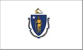
Massachusetts state flag detail
Home Earth Continents The Americas USA Country Profile US State Capitals Massachusetts Map

US States Maps Index
World Maps Index

Map of Massachusetts (MA)


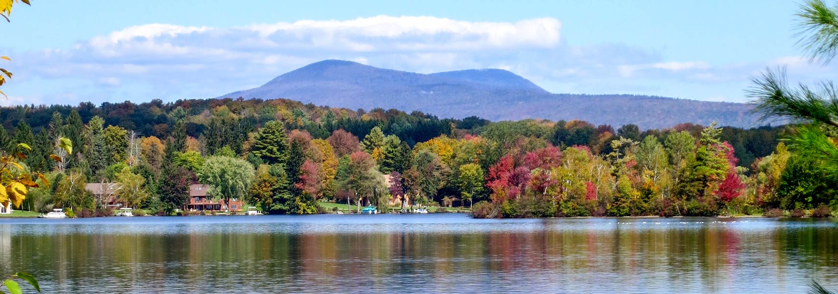
Saddle Ball Mountain and Pontoosuc Lake, Massachusetts
Saddle Ball Mountain, the 2nd highest peak in Massachusetts seen from Pontoosuc Lake, the peak on the right is Mt. Greylock, the highest summit in the state.
Image: Ericshawwhite
 
Massachusetts Flag
Massachusetts State Flag


About Massachusetts


Location map of Massachusetts state USA
Where in the United States is Massachusetts? Location map of the State of Massachusetts in the US.
 
Massachusetts, officially the Commonwealth of Massachusetts, is a state in the northeastern United States; it is one of the six New England states.

Massachusetts borders Vermont and New Hampshire in the north, Rhode Island and Connecticut in the south, and New York in the west. The state is bounded in the east by the Atlantic Ocean.

Massachusetts' nickname is "The Bay State," or also "The Spirit of America" currently used on the state's license plates.

The name Massachusetts is derived from the word of the Massachusetts language (an Algonquian language) and means "at the big hill" or "at the small, big hill."


Short History
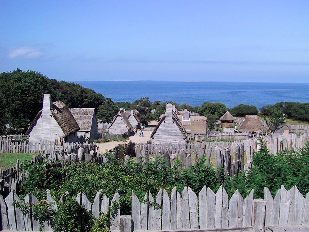
Plimoth Plantation, living history museum in Plymouth, Massachusetts
The Plimoth Plantation official website is a living history museum in Plymouth, Massachusetts. The museum attempts to replicate the original settlement of the Plymouth Colony established in the 17th century by English colonists who later became known as the Pilgrims.
Image: Nancy


Settled by the Mayflower Pilgrims in 1620.
The area of Massachusetts was part of the original territory of the United States.

In the mid 18th century, the Massachusetts Bay Colony became a center of resistance to the British and a driving force of the movement for independence from Great Britain.

Boston, one of the oldest cities in the country, is known as "the birthplace of the American Revolution."

Massachusetts was admitted to the Union on 6th February 1788 as the 6th state.


Massachusetts State Map
Reference Map of Massachusetts
General Map of Massachusetts, United States.

The detailed map shows the US state of Massachusetts with boundaries, the location of the state capital Boston, major cities and populated places, rivers and lakes, interstate highways, principal highways, railroads and major airports.

You are free to use the above map for educational and similar purposes; if you publish it online or in print, you need to credit Nations Online Project as the source.


More about Massachusetts State


Massachusetts Topographic Map Topographic Regions Map of Massachusetts. Click on the map to enlarge.


Geography of Massachusetts

Area
The state occupies an area of 27,336 km² (10,555 sq mi), compared it is somewhat smaller than Belgium (30,528 km²).

Massachusetts extends from the Berkshire Mountains (part of the Appalachians) in the west to the Atlantic Coastal Plain in the east. The coast is shaped by several large bays, like Massachusetts Bay, Buzzards Bay, and Cape Cod Bay.

Two large islands belong to Massachusetts, Martha's Vineyard, the 260 km² (100 sq mi) wide island is known for being an affluent summer colony (a quiet and genteel bastion of old money).

Another summer colony is Nantucket; the island is a popular tourist destination and an architectural example of a late 18th- and early 19th-century New England seaport town with exorbitant home prices.


Landscape after an ice storm near Boxborough, Massachusetts
Landscape after an ice storm near Boxborough, Massachusetts.
Image: liz west


Highest point
The highest point in the state is Mount Greylock in the Taconic Mountains at 1063.4 m (3,489 ft).


Largest lake
The Quabbin Reservoir in the center of the state is the largest lake in Massachusetts; it is the primary fresh water supply for Boston. Three branches of the Swift River feed the reservoir.

 
Population


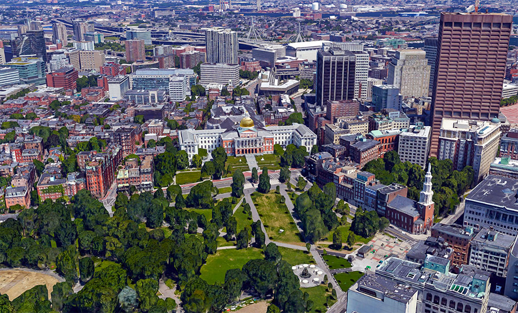
Massachusetts State House in Boston
Rendered image of Downtown Boston and Massachusetts State House. The building with its gilded dome (in 23k gold) is located at Beacon Hill. It is the state capitol and seat of government for the Commonwealth of Massachusetts.
Image: Google


Massachusetts has a population of 6.98 million people (est. 2021) [1]. Its primate city, state capital, largest and most populous urban area, and major port is Boston (pop. 675,000).

The largest metropolitan area is Greater Boston, with an estimated population of 4.7 million people, more than two-thirds of the total population of Massachusetts.

Massachusetts' population is composed of White 71%, Hispanic or Latino 12.4%, African American 9%, and Asian 7.2%. [2]


The main airport in the state is Boston's Gen. Edward Lawrence Logan International Airport (IATA code: BOS).

Other airports with more than 50,000 passengers per year are:

Nantucket Memorial Airport (IATA code: ACK)
Worcester Regional Airport (IATA code: ORH)
Martha's Vineyard Airport (IATA code: MVY)

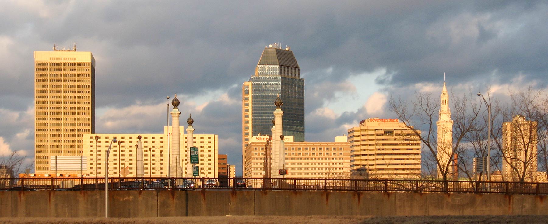
Downtown Springfield, Massachusetts, seen from across the Connecticut River.
Downtown Springfield, MA, seen from across the Connecticut River.
Image: Expos1225

 
Cities and Towns in Massachusetts
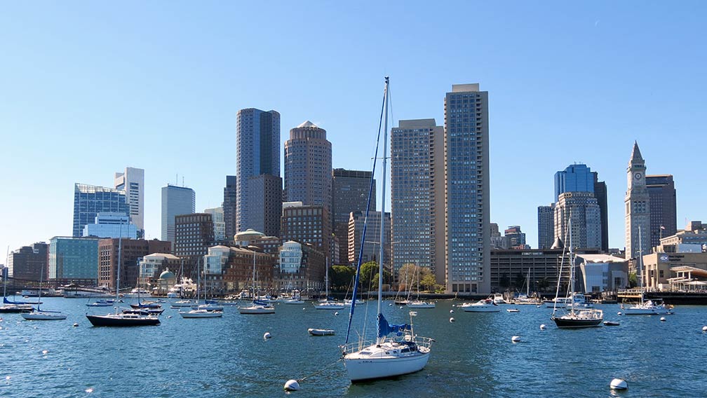


Boston Massachusetts seen from the Harbour
Boston seen from the harbor. Massachusetts' primate city is the state's capital and largest city.
Image: Bob Linsdell


The largest cities in Massachusetts with a population of more than 100,000:
Boston (675,000), Worcester (206,000), Springfield (156,000), Lowell (116,000), and Cambridge (118,000)


Other cities and towns in Massachusetts

Amherst, Athol, Auburn, Barnstable, Brockton, Brookline, Chicopee, Easthampton, Fall River, Falmouth, Fitchburg, Framingham, Franklin, Gloucester, Goshen, Greenfield, Haverhill, Holyoke, Hyannis, Lawrence, Lynn, Malden, Marlborough, New Bedford, Newton, North Adams, Northampton, Pittsfield, Plymouth, Provincetown, Quincy, Salem, Scituate, Stockbridge, Taunton, Ware, Wareham, Westfield, and Woburn.

 

Weather Conditions Boston:

BOSTON WEATHER


Advertisements:


Maps of the 50 U.S. States
Alabama | Alaska | Arizona | Arkansas | California | Colorado | Connecticut | Delaware | Florida | Georgia | Hawaii | Idaho | Illinois | Indiana | Iowa | Kansas | Kentucky | Louisiana | Maine | Maryland | Massachusetts | Michigan | Minnesota | Mississippi | Missouri | Montana | Nebraska | Nevada | New Hampshire | New Jersey | New Mexico | New York | North Carolina | North DakotaOhio | Oklahoma | Oregon | Pennsylvania | Rhode Island | South Carolina | South Dakota | Tennessee | Texas | Utah | Vermont | Virginia | Washington | West Virginia | Wisconsin | Wyoming

20 Most Populous U.S. Cities (in 2018):
1. New York City 2. Los Angeles 3. Chicago 4. Houston 5. Phoenix 6. Philadelphia 7. San Antonio 8. San Diego 9. Dallas 10. San Jose 11. Austin 12. Jacksonville 13. Fort Worth 14. Columbus 15. San Francisco 16. Charlotte 17. Indianapolis 18. Seattle, 19. Denver, 20. Washington D.C.

Other Major U.S. Cities:
Albany, Anchorage, Annapolis, Atlanta, Atlantic City, Augusta, Baltimore, Baton Rouge, Bismarck, Boise, Boston, Carson City, Charleston, WV, Cheyenne, Cincinnati, Cleveland, Columbia, Concord, Des Moines, Detroit, Dover, DE, El Paso, Frankfort, Harrisburg, Hartford, Helena, Honolulu, Jackson, Jefferson City, Juneau, Kansas City, Lansing, Las Vegas, Lincoln, Little Rock, Long Beach, Madison, Memphis, Miami, Milwaukee, Minneapolis, Montgomery, Montpelier, Nashville, New Orleans, Norfolk, Oklahoma City, Olympia, Orlando, Pierre, Pittsburgh, Portland, Providence, Richmond, VA, Raleigh, Sacramento, St. Louis, St. Paul, Salem (OR), Salt Lake City, Santa Fe, Springfield, Tallahassee, Tampa, Topeka, Trenton, Tucson