About Salem
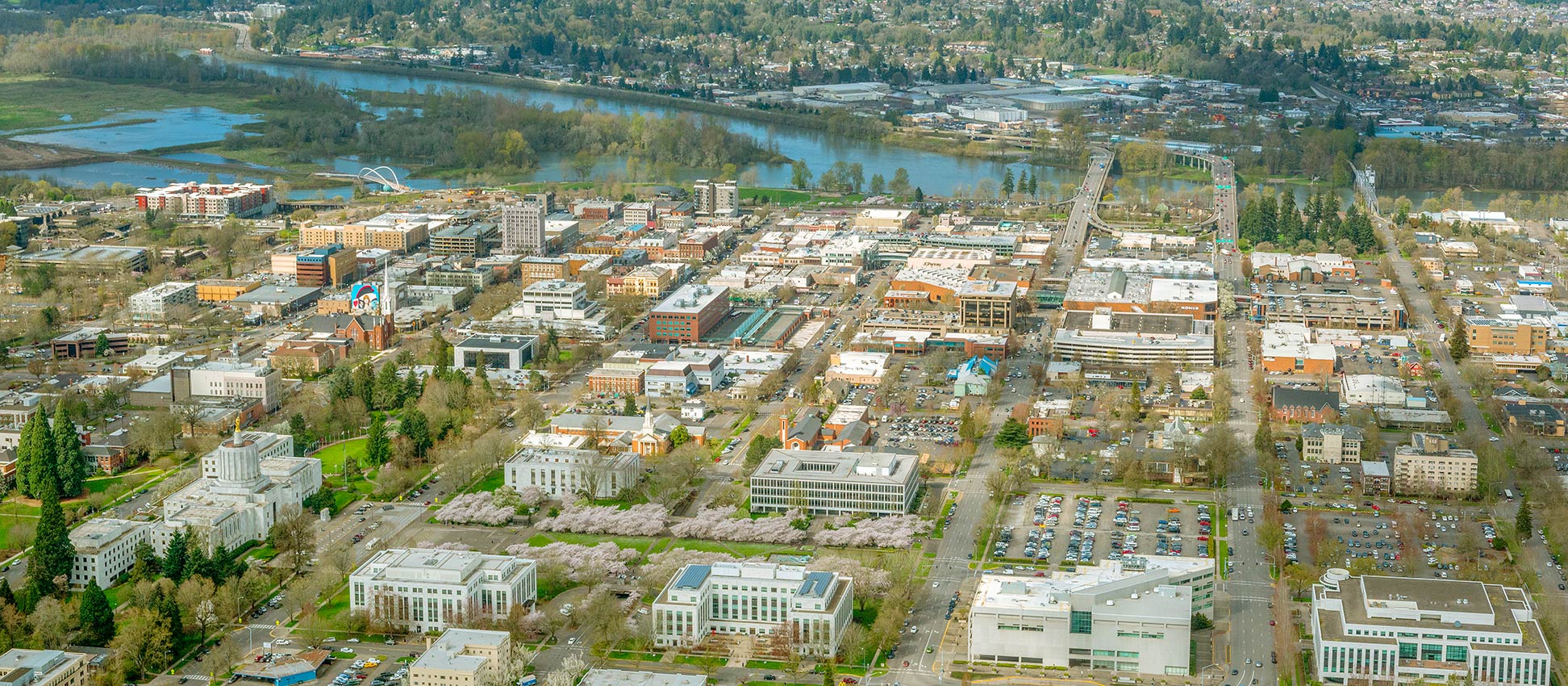
The satellite view shows Salem, second largest city and capital of
Oregon; a state situated north of California with a coastline at the Pacific Ocean in the Western
 United States
. The city is also the county seat of Marion County and is located along the Willamette River, in the north-western part of the state about 48 mi (77 km) east of Oregon's coast, and 47 mi by road south of
Portland, the largest city in Oregon.
Salem came into existence at the beginning of the 19th century. The first permanent settlement around the 1840s was a Methodist mission.
The missionaries established the Oregon Institute in 1842; it was the forerunner of the Willamette University.
In 1851 Salem became the territorial capital of Oregon Territory. The town was incorporated in 1857. Oregon was admitted as the 33rd state to the Union on 14th February 1859 and Salem became the state capital.
Today Salem is a middle-sized city with a population of
170,000 inhabitants (in 2018), about 400,000 people live in its metropolitan area.
The city is home to
Willamette University (
www.willamette.edu), the oldest university in the Western United States.
The city is a hub for local farming produce and a major agricultural food processing center. Major employers
in the city are the state government, Salem-Keizer School District, Salem Health (hospital), and the Chemeketa Community College.
Salem points of interest:
Historical places:
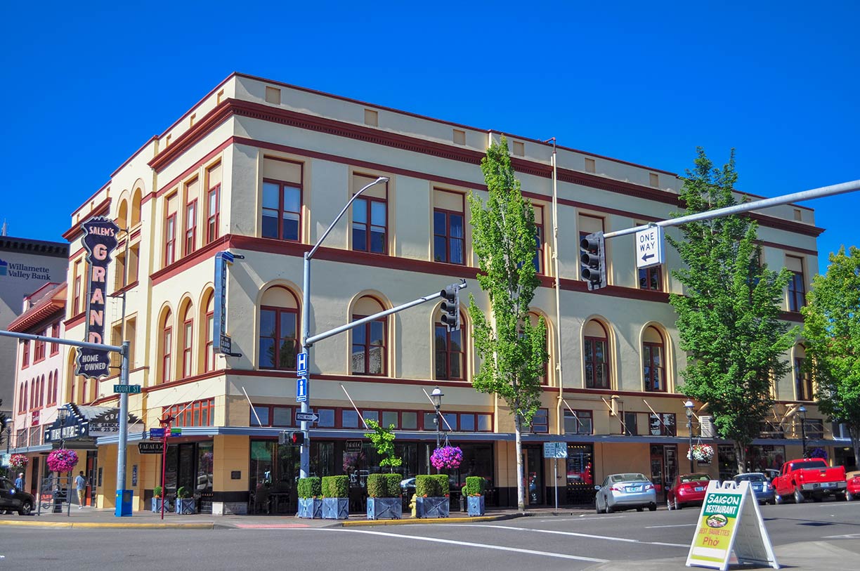 The Grand Theater is part of a complex of historic buildings in Salem; it was built as a lodge hall and opera house by the Oddfellows (Independent Order of Odd Fellows) in 1900.
Image: Joe Mabel
The
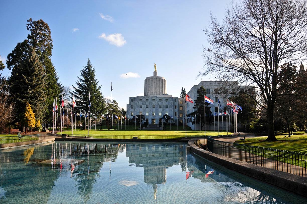
Oregon State Capitol is the seat of the government of Oregon, besides other offices, it houses the bicameral Oregon Legislative Assembly. The current statehouse, a Modernist Art Deco style building, was completed in 1938.
Willamette Heritage Center (
www.willametteheritage.org) 5-acres of Historic Places with a research library and archives of Marion County history. The permanent exhibits comprise 14 historic buildings, including the Thomas Kay Woolen Mill (Mission Mill) in downtown Salem.
Museums:
Hallie Ford Museum of Art (
willamette.edu/arts/hfma/) the museum is affiliated with the Willamette University; the museum’s collections reflect the culture of the Pacific Northwest and explores the history of art around the world.
Oregon Electric Railway Museum (
oregontrolley.com) is a streetcar and trolley museum in Salem, owned and operated by the Oregon Electric Railway Historical Society.
Antique Powerland (
antiquepowerland.com), now known as the Powerland Heritage Park, is an open-air museum for farm machinery like old steam-powered tractors, trucks, trains, and construction equipment; the museum is open from April thru September, located in Brooks, near Salem.
A. C. Gilbert's Discovery Village (
acgilbert.org) is an interactive hands-on children's museum, named in honor of American inventor Alfred Carlton Gilbert (Erector Set) and displays several of his inventions.
Performing Arts:
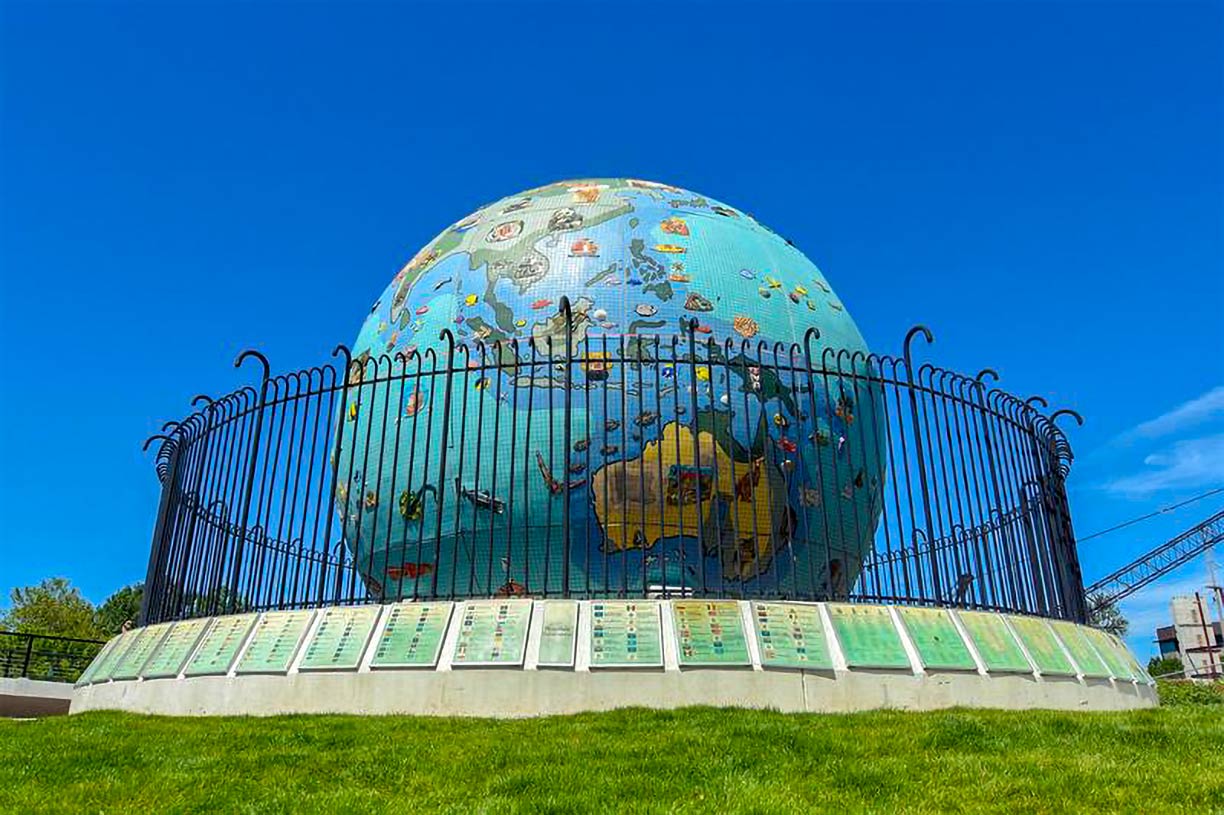 Eco Earth Globe at Riverfront City Park in Downtown Salem.
Image: City of Salem
(
elsinoretheatre.com), the 1,290-seat theater shows local and national acts, Classic Cinema movies, and theatrical performances.
Reed Opera House (
reedoperahouse.com), the recently renovated historic building is Salem's performing arts center and a shopping mall with stores and shops, restaurants, bars and bakeries.
Parks:
Oregon Garden (
www.oregongarden.org) is an 80-acre botanical garden which includes more than twenty specialty gardens, the Gordon House (designed by Frank Lloyd Wright), and the Teufel Amphitheater. Oregon Garden is located in Silverton, about 14 mi (22.5 km) northeast of Salem.
Cascades Gateway Park, an urban park with a lake (Lake Wirth), several ball fields, an 18 holes disc golf course, trails, and fishing and picnic facilities.
Minto-Brown Island Park is the largest park in Salem; it spreads out over 1,200 acres of open and wooded areas.
Riverfront City Park, is a park at the Willamette River in Downtown, with a carousel, two "Oregon Trail" wagons, and the Eco-Earth Globe, an outdoor sculpture; the park is the site for outdoor concerts and community events.
Vineyards:
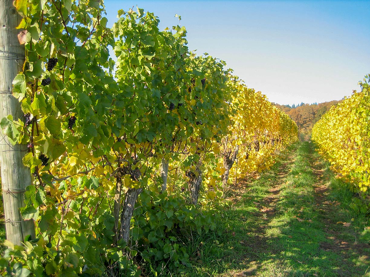 View of a vineyard in Oregon's Willamette Valley wine region of Eola-Amity Hills.
Image: Allie Towers Rice
(
www.wvv.com) a consumer-owned winery located in Turner, it is the leading producer of Pinot noir in Oregon.
Cristom Vineyards (
www.cristomvineyards.com) winery in the Eola-Amity Hills wine region.
Bethel Heights Vineyard (
www.bethelheights.com), the vineyard was one of the earliest plantings in the Eola-Amity Hills region in the Willamette Valley.
Sports:
McCulloch Stadium is a 2,500-seat outdoor stadium and home to Willamette University's football and track and field teams.
Just zoom in (+) to see Oregon State Capitol. The Art Deco building houses the general state authorities like the state legislature and the offices of the governor, secretary of state, and the treasurer of the U.S. state of Oregon.
The page shows a city map of Salem with expressways, main roads, and streets, and the location of
Salem Municipal Airport (
IATA code: SLE) in the south.
To find a location use the form below.

