Advertising

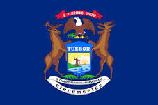
Michigan Flag detail
Home Earth Continents The Americas USA Country Profile US State Capitals Michigan Map

US States Maps Index
World Maps Index

Map of Michigan (MI)


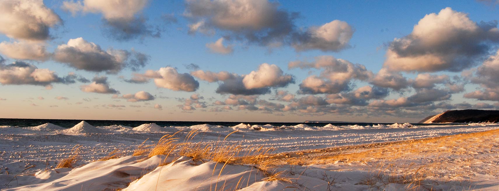
Winter on Lake Michigan, Sleeping Bear Dunes National Lakeshore
Winter on Lake Michigan - View of Sleeping Bear Dunes National Lakeshore. The park in Northern Michigan features forests, beaches, dune formations and ancient glacial phenomena.
Image: Sleeping Bear Dunes National Lakeshore


Michigan Flag
Michigan State Flag
 

About Michigan


Location map of Michigan state USA
Where in the United States is Michigan? Location map of the State of Michigan in the US.
 
Michigan is one of the East North Central states in the US. The state's name is the French version of the Ojibwa word mishigamaa (ᒥᓯᑲᒥ), meaning "large water" or "large lake."

Michigan consists of two peninsulas and has shorelines at four of the five Great Lakes: Lake Superior, Lake Michigan, Lake Huron, and Lake Erie. The Great Lakes are a group of five large, interconnected lakes in the east-central part of North America; it is the largest freshwater area in the world.

Michigan borders the Canadian province of Ontario, the US states of Ohio, Indiana, and Wisconsin, and it shares a water boundary with Illinois and Minnesota.

Michigan is known as the "The Great Lakes State", the Wolverine State, and also as the Mitten State. Michigan's alpha city, Detroit, is known as the cradle of the American auto industry and for being a center for contemporary music, such as Detroit sound, Motown, Detroit hip-hop, garage rock or proto-punk, and Detroit Techno.

 
Michigan State Map
Reference Map of Michigan
General Map of Michigan, United States.

The detailed map shows the US state of Michigan with boundaries, the location of the state capital Lansing, major cities and populated places, rivers and lakes, interstate highways, principal highways, railroads and major airports.

You are free to use the above map for educational and similar purposes; if you publish it online or in print, you need to credit Nations Online Project as the source.


More about Michigan State


Short History
Michigan Topographic Regions Map
Topographic Map of Michigan.

From 1660 until the end of French rule, Michigan was part of the Royal Province of New France.

French-Canadian fur traders and Jesuit missionaries were the first European to explore and settle in the region in the 17th century. In 1691, the French established Fort St. Joseph, a trading post on the St. Joseph River, and in 1701 they founded Fort Pontchartrain du Détroit (Fort Detroit). The town soon became an important fur trade and shipping center.
In 1760, French Montreal fell to British forces ending the French and Indian War (1754–1763), and the region of today Michigan, became part of the British Province of Quebec.

The population of Michigan Territory (effectively consisting of Detroit and the surrounding area) grew slowly until the opening of the Erie Canal in 1825, connecting the Great Lakes and the Hudson River with New York City and the Atlantic Ocean.
The new route brought a massive inflow of people. By the 1830s, Michigan had 80,000 residents, more than enough to apply and qualify for statehood. On 26 January 1837, President Andrew Jackson signed a bill that officially granted Michigan its sovereignty. Michigan joined the Union as the 26th state.

 
Area

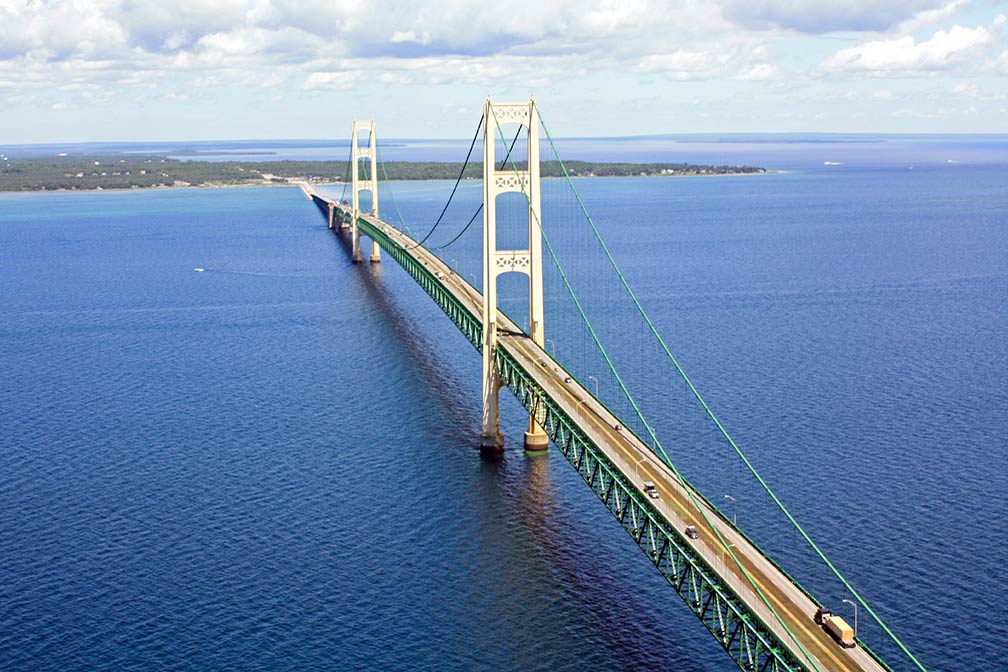
Mackinac suspension bridge connecting  Michigan's two peninsulas
Mackinac suspension bridge (aka "Big Mac") is spanning the Straits of Mackinac, it connects Michigan's Upper and Lower Peninsulas.
Image: Justin Billau

Michigan is an unusual shaped state, for it is situated on two separate peninsulas.

The state covers an area of 250,485 km² (96,713 sq mi), [1] making it slightly larger than the United Kingdom. It is the largest of the East North Central states, but it would fit almost seven times into Alaska.


More about Michigan
The Wolverine State (its nickname) is divided into the Upper and Lower Peninsulas, which were physically separated from one another until the construction of the Mackinac Bridge in 1957, which provided easy access from one part to the other.


Upper Peninsula

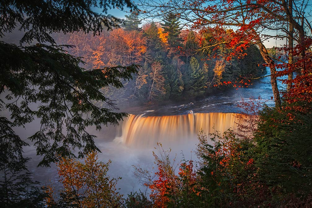
Tahquamenon River Falls,  Upper Peninsula of Michigan
Time-lapse photo of the Upper Falls of Tahquamenon River in Tahquamenon Falls State Park on the Upper Peninsula of Michigan. The 145 km long (90 mi) river empties into Lake Superior.
Image: Dennis Buchner
 
The Upper Peninsula features low rolling hills and occasional swamps in the east and higher hills with rugged terrain in the west.
The eastern section of the Upper Peninsula is part of the Great Lakes Plain, while the western section from Lake Superior into the Porcupine Mountains lies within the Superior Upland.


Lower Peninsula
The Lower Peninsula, also part of the Great Lakes Plains, is bordered on the west by Lake Michigan, on the east by Lake Huron and Lake Erie, and on the south by Indiana and Ohio. The terrain is made up of law rolling hills in the southernmost part and flatlands interspersed with hills in the northernmost section.
 
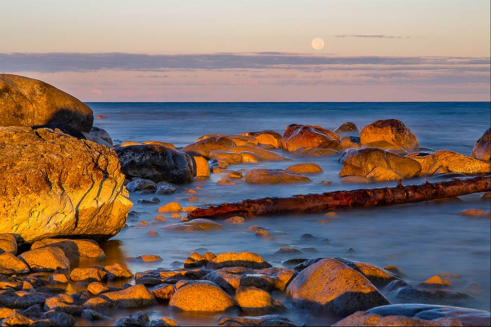
Harvest Moon over Lake Michigan
Harvest Moon over Lake Michigan. The third largest of the Great Lakes (by water surface) is the only Great Lake located entirely in the United States.
Image: Kenneth Snyder
 
The Lower Peninsula includes four major landforms.

The hilly moraines region covers the bottom half of the peninsula; it is composed of moraines, rocks and sediment carried and deposited by a glacier forming low ridges.

The Beaches and Dunes section of the Lower Peninsula comprises of low forest-covered areas alternating with high bare dunes.

The High Plains and Moraines section, located north of Muskegon-Saginaw Bay, contains higher ridges. The Eastern Lower Plains Lowlands, extending from the Saginaw Bay area to the tip of the Lower Peninsula, encompasses the most industrialized section of the state, including Detroit.

 
Population

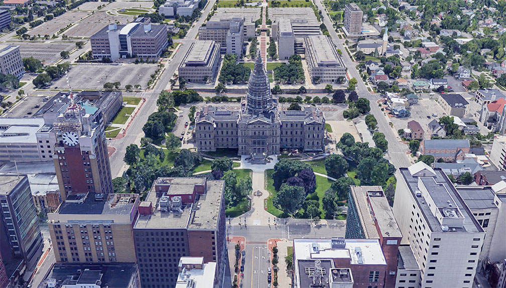
US Michigan State Capitol in Lansing
Rendered image of Michigan State Capitol in Lansing. The Neoclassical revival building houses the legislative branch of the government of Michigan.
Image: Google
 
Michigan is the 10th most populous US state with a population of 9.98 million (est. 2019) [2].

The state's capital is Lansing, the largest city is Detroit, and the largest metropolitan area is Metro Detroit (the second-largest US metropolitan area).

Other major cities (with a population of more than 100,000) are Grand Rapids, Warren, Sterling Heights, Lansing, Ann Arbor, and Flint.


Race and Ethnic groups
The population of Michigan is composed of White alone 74.9%, African American 14.1%, Hispanic or Latino 5.2%, Asian 3.4%, and Native American 0.7%.[3]


Airports
The largest airports in the state of Michigan are:


Cities and Towns in Michigan

The map shows the location of following cities and towns in Michigan.


Major cities:
Detroit, a major industrial city and a Great Lakes shipping center; Grand Rapids (Michigan's second largest city), Warren, Sterling Heights, Lansing, Ann Arbor, Flint, Dearborn, and Livonia.


Skyline of Detroit, Michigan
Skyline of Detroit at the riverbank of Detroit River, with Renaissance Center to the right, seen from south. Michigan's primate city is the state's largest urban center, its metropolitan area, known as Metro Detroit, is home to 4.3 million people, almost half of Michigan's entire population.
Image: Crisco 1492

Other Michigan cities and towns:

Adrian, Alma, Alpena, Battle Creek, Bay City, Benton Harbor, Big Rapids, Burton, Cadillac, Cheboygan, Clare, Coldwater, Copper Harbor, Crystal Falls, East Lansing, Escanaba, Frankfort, Gaylord, Gladstone, Grand Haven, Grayling, Hancock, Harrisville, Holland, Houghton, Iron Mountain, Ironwood, Ishpeming, Jackson, Kalamazoo, Kentwood, L'Anse, Ludington, Mackinaw City, Manistee, Manistique, Marquette, Menominee, Midland, Monroe, Mount Pleasant, Munising, Muskegon, Negaunee, Newberry, Niles, Norton Shores, Ontonagon, Owosso, Petoskey, Pontiac, Port Austin, Port Huron, Portage, Reed City, Rogers City, Saginaw, Sault Ste. Marie, Saint Ignace, Saint Johns, Saint Joseph, Standish, Tawas City, Taylor, Three Rivers, Traverse City, Troy, and Wyoming.

Weather Conditions Detroit:

DETROIT WEATHER


Advertisements:


Maps of the 50 U.S. States
Alabama | Alaska | Arizona | Arkansas | California | Colorado | Connecticut | Delaware | Florida | Georgia | Hawaii | Idaho | Illinois | Indiana | Iowa | Kansas | Kentucky | Louisiana | Maine | Maryland | Massachusetts | Michigan | Minnesota | Mississippi | Missouri | Montana | Nebraska | Nevada | New Hampshire | New Jersey | New Mexico | New York | North Carolina | North DakotaOhio | Oklahoma | Oregon | Pennsylvania | Rhode Island | South Carolina | South Dakota | Tennessee | Texas | Utah | Vermont | Virginia | Washington | West Virginia | Wisconsin | Wyoming

20 Most Populous U.S. Cities (in 2018):
1. New York City 2. Los Angeles 3. Chicago 4. Houston 5. Phoenix 6. Philadelphia 7. San Antonio 8. San Diego 9. Dallas 10. San Jose 11. Austin 12. Jacksonville 13. Fort Worth 14. Columbus 15. San Francisco 16. Charlotte 17. Indianapolis 18. Seattle, 19. Denver, 20. Washington D.C.

Other Major U.S. Cities:
Albany, Anchorage, Annapolis, Atlanta, Atlantic City, Augusta, Baltimore, Baton Rouge, Bismarck, Boise, Boston, Carson City, Charleston, WV, Cheyenne, Cincinnati, Cleveland, Columbia, Concord, Des Moines, Detroit, Dover, DE, El Paso, Frankfort, Harrisburg, Hartford, Helena, Honolulu, Jackson, Jefferson City, Juneau, Kansas City, Lansing, Las Vegas, Lincoln, Little Rock, Long Beach, Madison, Memphis, Miami, Milwaukee, Minneapolis, Montgomery, Montpelier, Nashville, New Orleans, Norfolk, Oklahoma City, Olympia, Orlando, Pierre, Pittsburgh, Portland, Providence, Richmond, VA, Raleigh, Sacramento, St. Louis, St. Paul, Salem (OR), Salt Lake City, Santa Fe, Springfield, Tallahassee, Tampa, Topeka, Trenton, Tucson