Advertising

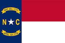
North Carolina Flag detail
Home Earth Continents The Americas USA Country Profile US State Capitals North Carolina Map

US States Maps Index
World Maps Index

Map of North Carolina (NC)


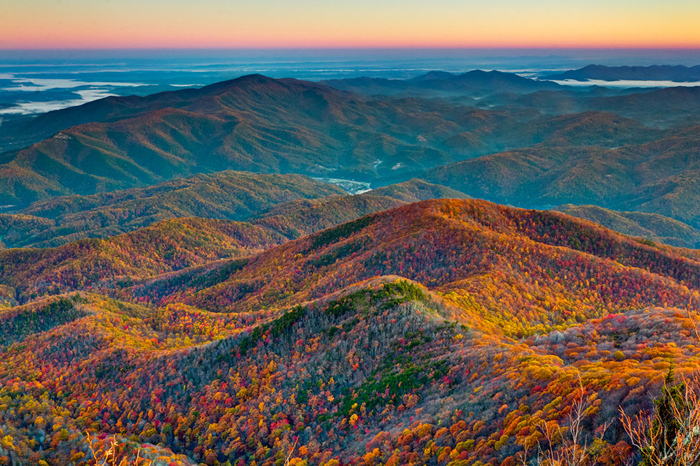
Blue Ridge Mountains from Courthouse Valley Overlook
Sunrise over the Blue Ridge Mountains. View from the Courthouse Valley Overlook on the Blue Ridge Parkway in western North Carolina.
Image: Ken Lane

 
North Carolina Flag
North Carolina State Flag


About North Carolina


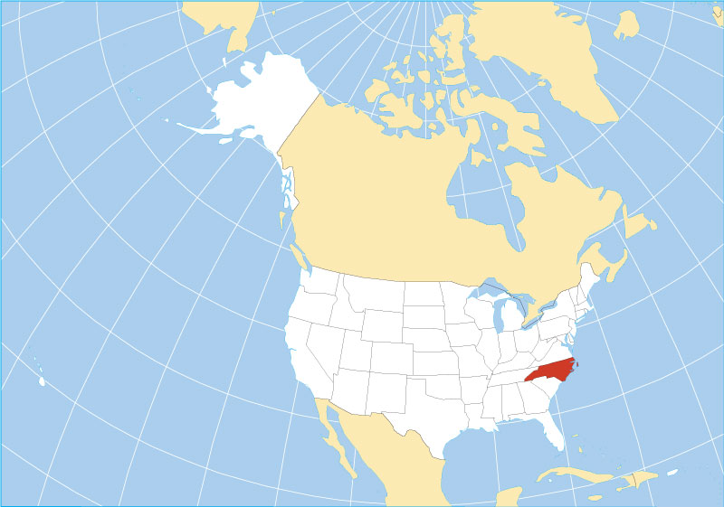
Location map of North Carolina state USA
Where in the United States is North Carolina? Location map of the State of North Carolina in the US.
 
The US state of North Carolina is located in the center of the eastern United States and has a coastline on the Atlantic Ocean to the east.

The state borders Virginia in the north, South Carolina in the south, Georgia in the southwest and Tennessee in the west. The state's nickname is "Tar Heel State."


Short History
First settled by the English in the late 1600s. In 1584 Queen Elizabeth I issued a charter to Sir Walter Raleigh to establish a colony in America.

The region of what is now North Carolina was part of the original territory of the United States.

Both North Carolina and South Carolina were included in the charter that established Carolina in 1663. The two areas separated in 1712, a separation that was finalized when the Carolina Colony was dissolved in 1729. On 21 November 1789, North Carolina ratified the Constitution; it was the 12th of the original 13 states to join the Union.


North Carolina State Map
Reference Map of North Carolina
General Map of North Carolina, United States.

The detailed map shows the US state of North Carolina with boundaries, the location of the state capital Raleigh, major cities and populated places, rivers and lakes, interstate highways, principal highways, railroads and major airports.

You are free to use the above map for educational and similar purposes; if you publish it online or in print, you need to credit Nations Online Project as the source.

 
More about North Carolina


Geography

North Carolina Topographic Regions Map Topographic Regions Map of North Carolina. (click map to enlarge)


Area
With an area of 139,390 km² (53,819 sq mi), [1] the state is about twice the size of Ireland. Compared with other US states, North Carolina would fit into Texas five times.

North Carolina is divided into 100 counties.

Climate
Most of the state features a humid subtropical climate.


North Carolina's Landscape
The geography of North Carolina consists of four different regions (from east to west)

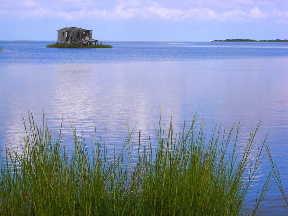
Abandoned hunting lodge near Bodie Island of the Outer Banks, North Carolina Roanoke Sound; an abandoned hunting lodge near Bodie Island of the Outer Banks.
Image: Eric Wettstein
The sandy islands of the Outer Banks, a 300 km long string of barrier islands and spits off the coast of North Carolina, separating the Atlantic Ocean from the brackish inlets and sounds of the coastal region.

North Carolina has its share of the Atlantic Coastal Plain; the Tidewater region covers roughly 40% of the state's area.

The Piedmont Plateau, a hilly region between the Atlantic Coastal Plain and the Appalachian Mountains, is marked by the escarpment of the Atlantic Seaboard fall line in the east, which separates the Coastal Plains from the Piedmont.

To the west of the Piedmont rise the densely forested mountain chains of the Blue Ridge Mountains and the Great Smoky Mountains, subranges of the larger Appalachians.

The highest elevation in the state is Mount Mitchell at 2,037 m (6,684 ft). The highest mountain in the Eastern United States is located in the Black Mountains, a subrange of the Blue Ridge Mountains.


World Heritage Site


Forest canopy, Newfound Gap mountain pass in the Great Smoky Mountains National Park
The Great Smoky Mountains in Haywood County; view from Mt Cammerer. The Great Smoky Mountains National Park is a UNESCO World Heritage Site.
Image: Michael Hicks


North Carolina shares one UNESCO World Heritage Site with Tennessee.

The Great Smoky Mountains National Park UNESCO official website is a major North American refuge of temperate zone flora and fauna that survived the Pleistocene glaciations.

The park covers an area of over more than 200,000 ha, centered on the ridgeline of the Great Smoky Mountains, a subrange of the Appalachian mountain chain.

The park is home to the largest remains of an Arctic-Tertiary Geoflora that once covered the entire Northern Hemisphere. The park's landscape gives a sense of what the late Pleistocene (Ice Age) flora looked like before recent human impacts.

The main park entrance in North Carolina is at Cherokee and in Tennessee at Gatlinburg.


Population


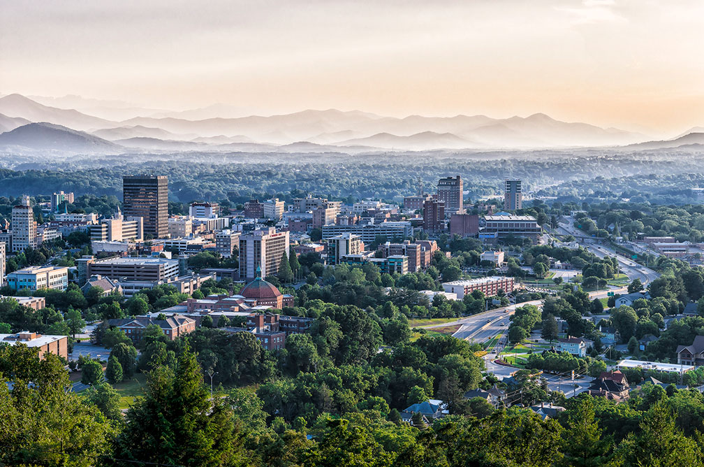
View of the City of the city of Asheville in North Carolina
The city of Asheville in North Carolina with the Blue Ridge Mountains in the background. Asheville is home to the United States National Climatic Data Center (NCDC), the world's largest active archive of weather data.
Image: Ken Lane

North Carolina is one of the ten most populous states in the country. It has a population of 10.5 million people (est. in 2019); [2] the capital is Raleigh, the largest city is Charlotte, the largest urban area in the state is Charlotte metropolitan area (Metrolina).


Race and Ethnic Groups
North Carolina's population is composed of White 62.8%, African American 22.2, Hispanic or Latino 9.6%, Asian 3.2%, and Native Americans 1.6%. [3]


Cities and Towns in North Carolina

The map shows the location of the following cities and towns in North Carolina.


Largest cities in North Carolina with a population of more than 100,000.

Charlotte (872,000), Raleigh (469,000), Greensboro (295,000), Durham (274,000), Winston-Salem (246,000), Fayetteville (209,000), Cary (168,000), Wilmington (122,000), High Point (112,000)
Figures from 2018


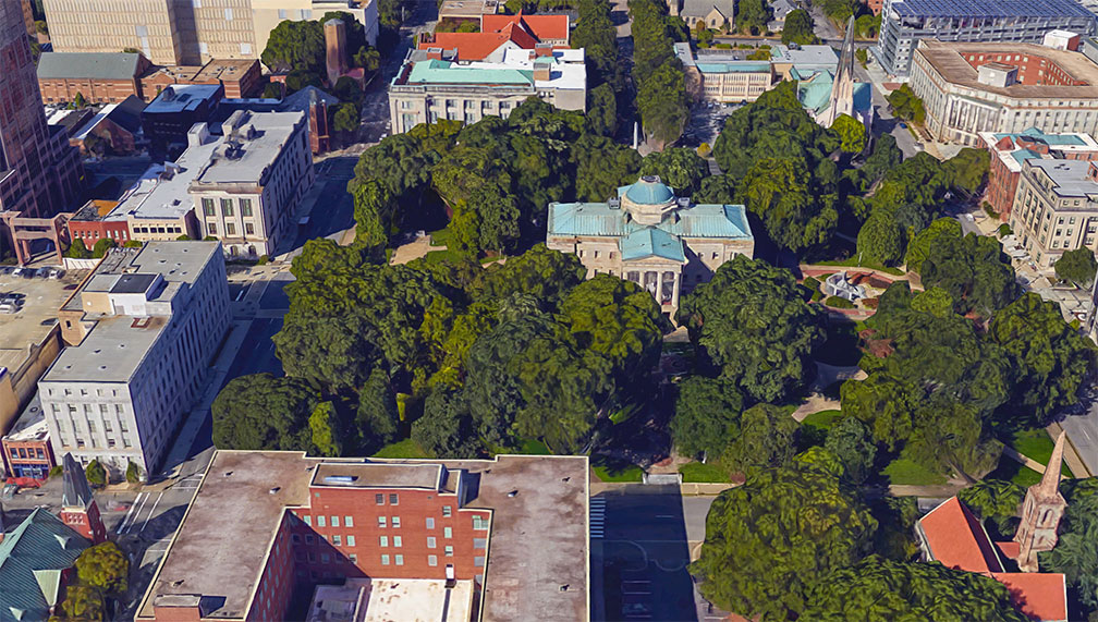
North Carolina's State Capitol in Raleigh Rendered image of North Carolina's State Capitol in Raleigh. The state is part of the Bible Belt; this can be seen by the fact that there is a church on each corner of Capitol Square.
Image: Google
Other cities and towns in North Carolina:

Albemarle, Asheboro, Asheville, Atlantic, Boone, Burlington, Chapel Hill, Clinton, Concord, Dunn, Edenton, Elizabeth City, Forest City, Franklin, Gastonia, Goldsboro, Greenville, Henderson, Hendersonville, Hickory, Jacksonville, Kannapolis, Kinston, Laurinburg, Lenoir, Lexington, Lumberton, Manteo, Monroe, Morehead City, Mount Airy, Murphy, Nags Head, New Bern, Oxford, Reidsville, Roanoke Rapids, Rockingham, Rocky Mount, Roxboro, Salisbury, Sanford, Shelby, Smithfield, Southern Pines, Statesville, Tarboro, Washington, Waynesville, Whiteville, Williamston, and Wilson.


Airports in North Carolina
By far the largest airport in the state is Charlotte/Douglas International Airport (IATA code: CLT). The second-most busiest airport is Raleigh–Durham International Airport (IATA code: RDU). Other airports, Piedmont Triad International Airport (IATA code: GSO)


Downtown Charlotte
Downtown Charlotte, the largest city in North Carolina. The Charlotte metropolitan area, also known as Metrolina, is an urban area in North and South Carolina.
Image: Harshil Shah
 

Weather Conditions Raleigh:

RALEIGH WEATHER


Advertisements:


Maps of the 50 U.S. States
Alabama | Alaska | Arizona | Arkansas | California | Colorado | Connecticut | Delaware | Florida | Georgia | Hawaii | Idaho | Illinois | Indiana | Iowa | Kansas | Kentucky | Louisiana | Maine | Maryland | Massachusetts | Michigan | Minnesota | Mississippi | Missouri | Montana | Nebraska | Nevada | New Hampshire | New Jersey | New Mexico | New York | North Carolina | North DakotaOhio | Oklahoma | Oregon | Pennsylvania | Rhode Island | South Carolina | South Dakota | Tennessee | Texas | Utah | Vermont | Virginia | Washington | West Virginia | Wisconsin | Wyoming

20 Most Populous U.S. Cities (in 2018):
1. New York City 2. Los Angeles 3. Chicago 4. Houston 5. Phoenix 6. Philadelphia 7. San Antonio 8. San Diego 9. Dallas 10. San Jose 11. Austin 12. Jacksonville 13. Fort Worth 14. Columbus 15. San Francisco 16. Charlotte 17. Indianapolis 18. Seattle, 19. Denver, 20. Washington D.C.

Other Major U.S. Cities:
Albany, Anchorage, Annapolis, Atlanta, Atlantic City, Augusta, Baltimore, Baton Rouge, Bismarck, Boise, Boston, Carson City, Charleston, WV, Cheyenne, Cincinnati, Cleveland, Columbia, Concord, Des Moines, Detroit, Dover, DE, El Paso, Frankfort, Harrisburg, Hartford, Helena, Honolulu, Jackson, Jefferson City, Juneau, Kansas City, Lansing, Las Vegas, Lincoln, Little Rock, Long Beach, Madison, Memphis, Miami, Milwaukee, Minneapolis, Montgomery, Montpelier, Nashville, New Orleans, Norfolk, Oklahoma City, Olympia, Orlando, Pierre, Pittsburgh, Portland, Providence, Richmond, VA, Raleigh, Sacramento, St. Louis, St. Paul, Salem (OR), Salt Lake City, Santa Fe, Springfield, Tallahassee, Tampa, Topeka, Trenton, Tucson