Advertising

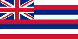
Hawaii state flag detail
Home Earth Continents The Americas USA Country Profile US State Capitals Hawaii Map

US States Maps Index
World Maps Index

Map of Hawaii (HI)


Mauna Kea Observatories on Hawaii island.
The Mauna Kea Observatories on the summit of Mauna Kea, a dormant volcano on Hawaii island. The 4,200-meter high mountain is home to the world's largest observatory for optical, infrared, and submillimeter astronomy. [1]
Image: Gord McKenna

Flag of Hawaii
Hawaii State Flag
 

About Hawaii


Location map of Hawaii state USA
Where in the United States is Hawaii? Location map of Hawaii island group in the US.

 
The US state of Hawaii is an island group located in the central Pacific Ocean, southwest of the continental United States, about 4,400 km (2,800 mi) south of Alaska, and 4,200 km (2,600 mi) north of Tahiti (French Polynesia).


Short history
The Hawaiian Islands were first settled as early as 400 C.E., when Polynesians from the Marquesas Islands, 3550 km (2200 mi) away, traveled to Hawaii's Big Island in canoes. [2]
The islands were later 'discovered' by Captain James Cook in 1778, who named the archipelago the Sandwich Islands.

Hawaii Islands Topographic Map Satellite Image map of Hawaii's main islands: Hawaii, Kahoolawe, Maui, Lanai, Molokai, Oahu, Kauai, and Niihau.
Image: NASA
 
One hundred plus years later, in 1893, a Hawaii-based secret society called the Hawaiian League, a group of planters and businessmen (mainly white men of North American origin) led a coup against Queen Liliuokalani, at that time monarch of the Kingdom of Hawaii, and established an oligarchical government.

The anti-monarchist and pro-American group sought annexation by the United States, but then-incumbent President Grover Cleveland rejected their requests. In 1898, however, President McKinley and the American public were more favorably disposed toward acquiring the islands.[3]

Sixty years later, Hawaii was admitted as the 50th state, admission to the Union on the 21st August 1959.
 
Hawaii State Map
Reference Map of Hawaii
General Map of Hawaii, United States.

The detailed map below shows the US state of Hawaii with its islands, the state capital Honolulu, major cities and populated places, volcanoes, rivers, and roads.

You are free to use this map for educational purposes (fair use); please refer to the Nations Online Project.

   
More about Hawaii State


Some Geography

Area
The Aloha State (its official nickname) consists of hundreds of islands spread over a distance of more than 2,400 km (1,500 mi). The total area of the islands is 28,313 km² (10,932 sq mi), [4] compared it is slightly smaller than Belgium (30,528 km²) or twice the size of the Bahamas. Compared with other US states, Hawaii is somewhat larger than New Jersey, but it would fit into Texas 25 times.
 

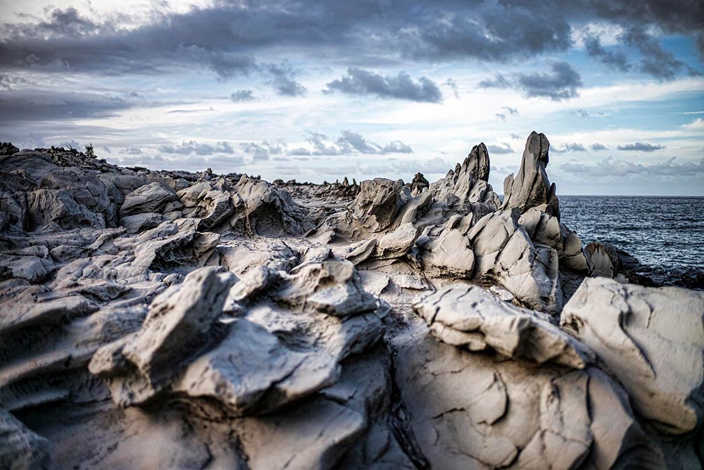
Dragon's Teeth  rock formation on Maui Island
Dragon's Teeth at Makaluapuna Point, Maui. The rock formation was formed from one of Maui's lava flows and pounding ocean waves, the natural monument is a sacred place to Native Hawaiians.
Image: Christopher Michel

 
On the map above, you see the eight largest islands, the "main islands" located at the southeastern end of the archipelago. In order from the northwest to southeast, they are Niihau (Ni'ihau, The Forbidden Isle), Kauai (Kaua'i, The Garden Isle), Oahu (O'ahu, The Gathering Place), Molokai (Moloka'i, The Friendly Isle), Lanai (Lānaʻi, The Pineapple Isle), Kahoolawe (Kaho'olawe, The Target Isle), Maui (The Valley Isle), and Hawaii (Hawai'i, The Big Island).


Main Geographical Features of Hawaii
The geographical features of Hawaii are just stunning. The islands rise from the floor of the abyssal Northeast Pacific Basin that has an average depth of 5,000 m. The Hawaiian Islands are the exposed peaks of the Hawaiian-Emperor seamount chain. The massive submarine mountain range was formed by volcanic activity over several hotspots in the earth's mantle and extends for about 6,200 km (3,900 mi) from the Aleutian Trench in the far northwest Pacific to the island of Hawaii.


Highest point
Hawaii's tallest mountain is Mauna Kea, a sleeping volcano that rises 4,205 m (13,796 ft) from sea level, but measured from its base on the ocean floor to its peak, its height is 10,203 m (33,476 ft), making it the highest mountain on Earth. [5]

 
World Heritage Sites


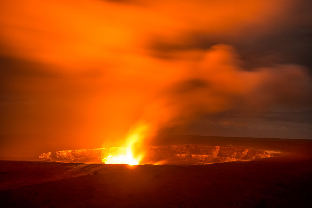
Halemaumau Crater within Kīlauea volcanoe, Hawaii
Halemaumau Crater, the pit crater within the much larger summit caldera of Kīlauea in Hawaii Volcanoes National Park.
Image: Howard Ignatius 
Hawaii has not one but two outstanding UNESCO World Heritage Sites.

The Hawaiʻi Volcanoes National Park official website is an American National Park's featuring two main attractions, two active superlative volcanoes on the island of Hawaii, Kīlauea and Mauna Loa.


Mauna Loa is the world's largest shield volcano, and Kīlauea is one of the world's most active volcanoes.

The site serves as an excellent example of island-building through volcanic processes. Volcanic eruptions have created a constantly changing landscape, and the lava flows reveal extraordinary geological formations.

Rare birds and endemic species can be found there, as well as forests of giant ferns.

 
Hawaiian Archipelago Papahānaumokuākea


Papahānaumokuākea island map
Map of Papahanaumokuakea, the main Hawaiian Archipelago to the right.
 
Papahānaumokuākea official website is a vast and isolated cluster of small, low lying islands and atolls, with their surrounding ocean, the protected area begins roughly 250 km to the northwest of the main Hawaiian Archipelago.


The Marine National Monument is one of the world's largest protected areas with a length of over some 1930 km.


The archipelago has deep cosmological and traditional significance for living Native Hawaiian culture. It is considered as an embodiment of the Hawaiian concept of kinship between man and nature.

 
Population

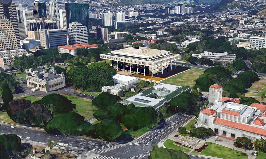
View of Hawaii State Capitol in Honolulu, Hawaii
Rendered image of Hawaii State Capitol in Honolulu (in the center). Hawaii's statehouse was completed in March 1969. The Hawaiian international architecture style building houses the bicameral Hawaii State Legislature. The small building to the left is the Iolani Palace, the former royal residence of the rulers of the Kingdom of Hawaii. The building to the right is the Honolulu City Hall.
Image: Google

 
Hawaii has a population of 1.41 million people (in 2019). [6] The capital, principal port, and largest city is Honolulu.
Hawaii's largest urban area is the Island of Oahu, the third largest of the Hawaiian Islands is home to about two-thirds of Hawaii's entire population.
Official languages are English and Hawaiian.


Race and Ethnic groups
The population of Hawaii is composed of Asian 37.6%, Caucasian 21.8%, Hispanic or Latino 10.7%, Native Hawaiian 10.2%, African American 2.2%, and Native American 0.4%. [7]


By far the busiest airport in the state is Honolulu's Daniel K. Inouye International Airport (IATA code: HNL). Other major airports are Maui's Kahului Airport (IATA code: OGG), Kona International Airport at Keahole (IATA code: KOA), and Kauai's Lihue Airport (IATA code: LIH).

Cities, Towns, and Villages in Hawaii

The map above shows the location of following cities and towns in Hawaii.

View of Waikiki and Honolulu, Hawaii
View of Waikiki and Honolulu.
Image: Edmund Garman
 
Largest cities: Honolulu (capital city; pop. est. 360,000 in 2018), East Honolulu (area directly east of the center of Honolulu; pop. 50,000), Pearl City (along the north shore of Pearl Harbor; pop. 47,700), Hilo (second-largest city (pop. 43,300)


Other cities and towns:
Captain Cook, Haleiwa, Hana, Hanalei, Hawi, Honokaa, Honolulu (most populous city, principal port and capital of Hawaii), Kahului, Kailua, Kailua, Kalaupapa, Kaneohe, Kapaa, Kaunakakai, Kekaha, Lahaina, Laie, Lanai City, Lihue, Maunaloa, Mountain View, Pahala, Pahoa, Pearl City, Puuwai, Wahiawa, Waialua, Wailuku, and Waimea.


Weather Conditions Honolulu:

HONOLULU WEATHER


Advertisements:


Maps of the 50 U.S. States
Alabama | Alaska | Arizona | Arkansas | California | Colorado | Connecticut | Delaware | Florida | Georgia | Hawaii | Idaho | Illinois | Indiana | Iowa | Kansas | Kentucky | Louisiana | Maine | Maryland | Massachusetts | Michigan | Minnesota | Mississippi | Missouri | Montana | Nebraska | Nevada | New Hampshire | New Jersey | New Mexico | New York | North Carolina | North DakotaOhio | Oklahoma | Oregon | Pennsylvania | Rhode Island | South Carolina | South Dakota | Tennessee | Texas | Utah | Vermont | Virginia | Washington | West Virginia | Wisconsin | Wyoming

20 Most Populous U.S. Cities (in 2018):
1. New York City 2. Los Angeles 3. Chicago 4. Houston 5. Phoenix 6. Philadelphia 7. San Antonio 8. San Diego 9. Dallas 10. San Jose 11. Austin 12. Jacksonville 13. Fort Worth 14. Columbus 15. San Francisco 16. Charlotte 17. Indianapolis 18. Seattle, 19. Denver, 20. Washington D.C.

Other Major U.S. Cities:
Albany, Anchorage, Annapolis, Atlanta, Atlantic City, Augusta, Baltimore, Baton Rouge, Bismarck, Boise, Boston, Carson City, Charleston, WV, Cheyenne, Cincinnati, Cleveland, Columbia, Concord, Des Moines, Detroit, Dover, DE, El Paso, Frankfort, Harrisburg, Hartford, Helena, Honolulu, Jackson, Jefferson City, Juneau, Kansas City, Lansing, Las Vegas, Lincoln, Little Rock, Long Beach, Madison, Memphis, Miami, Milwaukee, Minneapolis, Montgomery, Montpelier, Nashville, New Orleans, Norfolk, Oklahoma City, Olympia, Orlando, Pierre, Pittsburgh, Portland, Providence, Richmond, VA, Raleigh, Sacramento, St. Louis, St. Paul, Salem (OR), Salt Lake City, Santa Fe, Springfield, Tallahassee, Tampa, Topeka, Trenton, Tucson