Advertising

Countries Index
Countries A to Z
Sovereign States
Dependent Areas
Countries by Area
Country Population
Island Countries
Countries of the Islamic World
Third World
First, Second, Third World Countries
Human Development by Country
Countries by Corruption
Countries and Press Freedom
Country Flags
Currencies
Home  Earth Continents Countries in Australia/Oceania Capital Cities of Australia/Oceania
Cities and Capitals around the World

Earth Continents Countries in Australia/Oceania Capital Cities of Australia/Oceania
Cities and Capitals around the World Capital Cities of Australia/Oceania

Government buildings (from l to r) in Suva, Fiji; Canberra, Australia; Port Moresby, Papua New Guinea; Apia, Samoa; and Wellington in New Zealand.
Images: Qiliho (Suva), Thennicke (Canberra); Steve Shattuck (Port Moresby), Michael Coghlan (Apia), Donaldytong (Wellington)
Capitals of Oceania
List of the Capital Cities of Oceania.
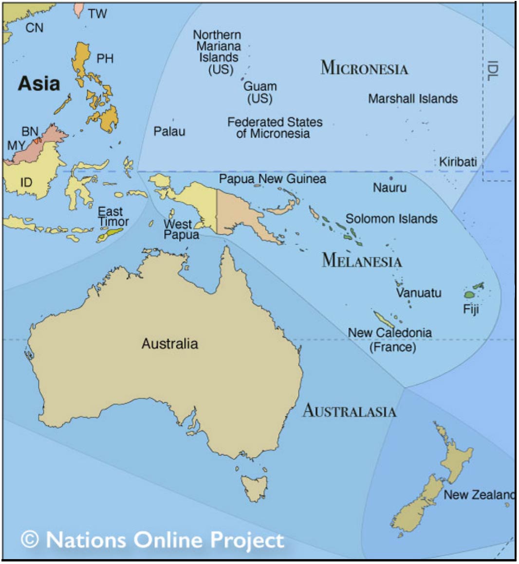
Section of a map of the regions of Oceania: Micronesia, Melanesia, Polynesia, and Australasia.
The island world of Oceania is divided into:
Australia, a country and Earth's smallest continent.
Zealandia, a microcontinent that includes the island country of New Zealand.
New Guinea, the second largest island on the planet (after Greenland),
The Pacific Islands, thousands of islands in the Pacific Ocean divided into Melanesia, Micronesia, and Polynesia.
Australasia
Australasia (south of Asia) is the region encompassing Australia, New Zealand, New Guinea and the surrounding islands of Melanesia.
In this area, there are the most unknown capitals of the world, or do you know Apia or Melekeok, or Palikir?
On this page, you will find the capitals of Australia/Oceania with the latest population figures of the cities.
Have a look at the cities and islands from space; for each capital, there is a searchable map and satellite view; additionally, you will find links to the official city site (if available) and more information about a city. Many nations of the South and Central Pacific are developing countries with a less developed internet infrastructure; therefore, there are fewer capitals of Oceania/Australia online.
The country links lead you to the respective country profile page.
keywords: Capital, Capital City, Capitals of Australasia, Melanesia, Polynesia, Micronesia
Population Source: National Statistics Bureaus and the World Urbanization Prospects: The 2018 Revision (Population of Capital Cities in 2018).
Capital City
Satellite View and Map
City Population
Country
Capital Cities and States of Australia/Oceania |
|||
| Adamstown | 50 | Pitcairn | |
| Alofi | 600 | Niue | |
| Apia |  Apia Map |
37,400 | Samoa |
| Avarua | 5,000 | Cook Islands | |
| Canberra | Canberra Map |
427,000 | Australia |
| Hagåtña (Agana) | Hagåtña Map |
1,100 | Guam |
| Funafuti (Fongafale) | Funafuti Map |
6,400 | Tuvalu |
| Honiara | Honiara Map |
84,500 | Solomon Islands |
| Majuro | Majuro Map |
31,000 | Marshall Islands |
| Ngerulmud | 270 | Palau | |
| Nouméa | Nouméa Map |
94,300 | New Caledonia |
| Nuku'alofa | Nuku'alofa Map |
23,000 | Tonga |
| Pago Pago | Pago Pago |
15,000 | American Samoa |
| Palikir | Palikir Map |
6,000 | Micronesia |
| Papeete | Papeete Map |
27,000 | French Polynesia (Tahiti) |
| Port Moresby | Port Moresby Map |
367,000 | Papua New Guinea |
| Port Vila | Port Vila Map |
51,000 | Vanuatu |
| Saipan (island) | Saipan |
52,200 | Northern Mariana Islands |
| Suva | Suva Map |
94,000 | Fiji |
| (South) Tarawa** (Bairiki) | 3,200 | Kiribati (Kiribas) | |
| Wellington (Te Whanganui-a-Tara) | Wellington Map |
210,400 | New Zealand |
**Figures are for Urban Agglomeration population |
|||
More about Australia/Oceania
Countries
of Australia/OceaniaMaps
Map
of Australia/OceaniaReference Map of the Australia/Oceania region.
Administrative Map of AustraliaMap showing continental Australia with state borders and capital cities.
Australia
MapPolitical Map of Australia.
Detailed Australia
MapMap showing mainland Australia with international borders, state boundaries, the national capital Canberra, state capitals, major cities and towns, main roads, railroads and international airports.
 Topographic Map of Australia
Topographic map of continental Australia showing the general topographic regions.
Languages
Languages of Australia/OceaniaFlags
Flags of Australia/OceaniaRelated Pages
Other capital cities
Capital Cities of Africa Capital Cities of Asia Capital Cities of the Americas Capital Cities of Europe Capital Cities of the World by States World
Continents World
Population Population by Country First,
Second and Third WorldAdvertisements: