Advertising

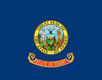
Idaho Flag detail
Home Earth Continents The Americas USA Country Profile US State Capitals Idaho Map

US States Maps Index
World Maps Index

Map of Idaho (ID)


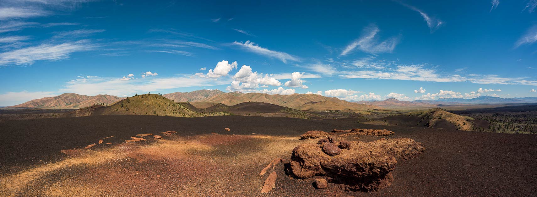
Landscape Craters of the Moon National Monument, Idaho
Craters of the Moon National Monument, the alien landscape is situated in the Snake River Plain, about 145 km (90 mi) northeast of Twin Falls.
Image: NikonFDSLR


Idaho Flag
Idaho State Flag
 

About Idaho


Location map of Idaho state USA
Where in the United States is Idaho? Location map of the State of Idaho in the US.
 
Idaho is a landlocked mountainous state in the Pacific Northwest region of the United States.

At 45th parallel north, it shares a 72 km (44.7 mi) long border with the Canadian province of British Columbia. The ridges of the Bitterroot Range define its border with Montana.

Idaho also borders the U.S. states of Wyoming in the southeast, Nevada, and Utah in the south, and Washington and Oregon in the west.


Idaho State Map
Reference Map of Idaho
General Map of Idaho, United States.

The detailed map shows the US state of Idaho with boundaries, the location of the state capital Boise, major cities and populated places, rivers and lakes, interstate highways, principal highways, and railroads.

You are free to use this map for educational purposes (fair use); please refer to the Nations Online Project.
 
Some history

Idaho was part of Oregon Country and the original home of the Shoshone and the Nez Perce peoples. Because of its remote location, it was one of the last of the lower 48 states to be visited by Europeans. French-Canadian trappers were the first Europeans in the region. The Lewis and Clark expedition crossed Idaho two times, once in 1805 on the way to the Pacific Ocean, and in 1806 on the way back. The Oregon Trail, which ended at Fort Vancouver in Washington, crossed Idaho Territory. Thousands of fortune seekers passed through Idaho during the California Gold Rush; only a few settled in the area.
The United States acquired the region through a treaty with Great Britain in 1846.
Idaho Territory was organized from parts of Dakota, Nebraska, and Washington territories and included parts of present-day Montana and Wyoming. The territory existed from 4 March 1863 to 3 July 1890, when Idaho Territory joined the Union and became the 43rd state. The territorial capital was first Lewiston and was then moved to Boise in 1865.
When Idaho became a territory, there were four counties Boise, Idaho, Nez Perce, and Shoshone.


More about Idaho


Some Geography

Area
Topographic Regions of Idaho Map Topographic Regions Map of Idaho. (Click the map to enlarge)

Idaho covers an area of 216,632 km² (83,570 sq mi) [1] the "Gem State" (its nickname) is somewhat smaller than the island of Great Britain (229,848 km²) or about half the size of Iraq (438,317 km²). Idaho is about the size of Utah but would fit into Texas more than three times.


Idaho is divided into 44 counties.


Some Idaho Geography
Rivers, mountains, and farmland dominate Idaho's landscape, which includes a portion of the Rocky Mountains.


Mountains
The Bitterroot Range is a subrange of the Rockies; it runs along the Idaho-Montana border.

The Salmon River Mountains and the Smokey Mountains are both parts of the Rocky Mountains; they cover most of the central region of the state.


Highest point
Idaho's highest point is Borah Peak at 3,859 m (12,662 ft), located in the Lost River Range, another subrange of the Rockies.

Canyon
The deepest gorge in North America is located along the border of eastern Oregon, eastern Washington, and western Idaho. The canyon is part of the Hells Canyon National Recreation Area USDA official website and is North America's deepest river gorge at 2,436 m (7,993 ft). The canyon was created by the Snake River, which flows more than 1.600 m (1 mi) below the canyon's west rim, and 2,300 m (7,400 ft) below the peaks of Idaho's Seven Devils Mountains range to the east.


Plains

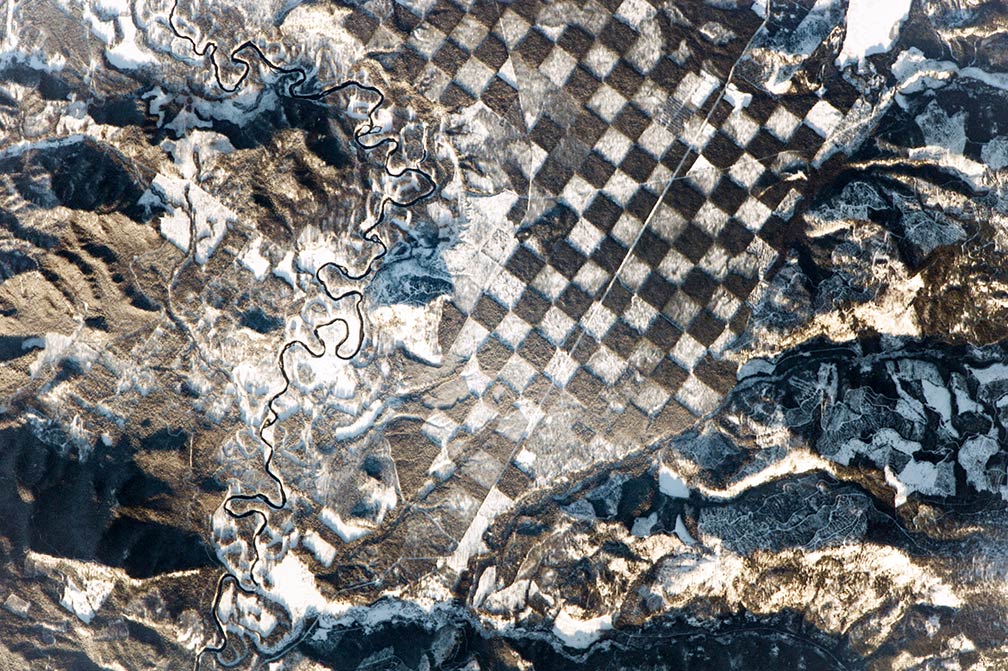
Checkerboard pattern alongside the Priest River in northern Idaho
Checkerboard pattern alongside the Priest River in northern Idaho. The squares in this landscape checkerboard appear to be the result of forest management.
Image: NASA

 
In the southern part of the state, the Snake River Plain dominates the landscape, the flat, arc-shaped depression covers about a quarter of Idaho, on its course through the plain, the Snake River has created many canyons and gorges.

Within the Snake River Plain is the Craters of the Moon National Monument, a vast flood basalt area with scattered islands of cinder cones and sagebrush, midway between Boise and the Yellowstone National Park. The three major lava fields are the result of volcanic eruptions between 15,000 and 2,000 years ago.


Towhee River Wilderness
The wilderness area is located on the high basalt plateaus (Towhee Plateau) of Towhee County in southwestern Idaho near the Oregon border. It protects the upper Towhee River, its tributaries, and the surrounding desert canyon landscape. [2]


World Heritage Site
Famous Yellowstone National Park UNESCO official website is mostly in Wyoming, but the park also spreads into parts of Montana (3%) and Idaho (1%). The park is since 1978 a UNESCO World Heritage Site.


Population


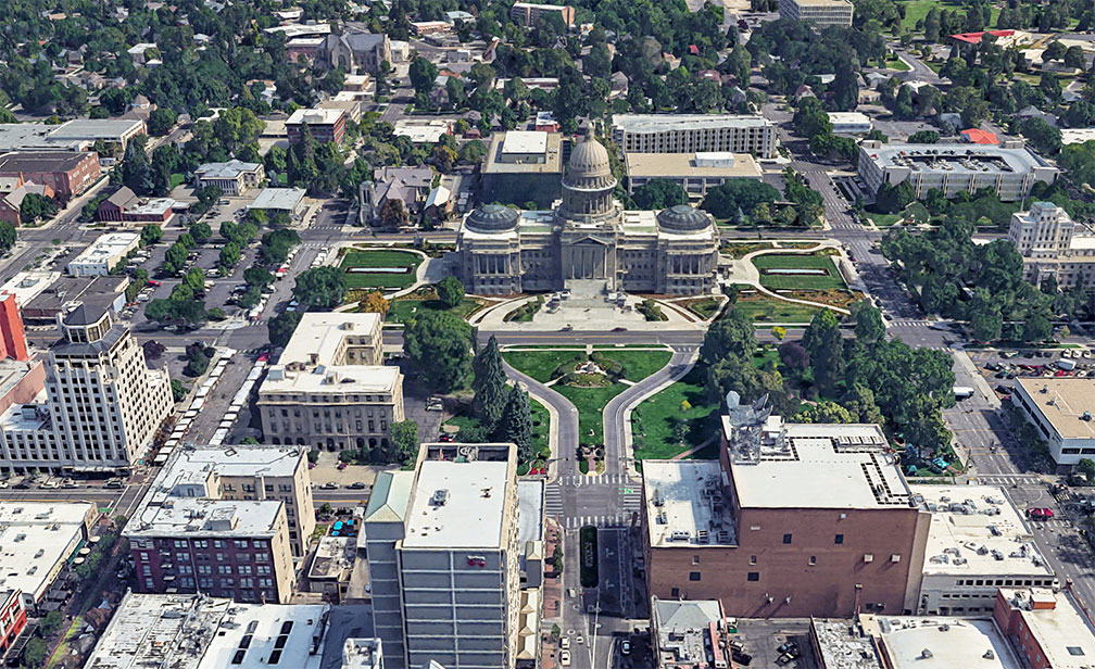
Idaho State Capitol in Boise
Rendered image of Idaho State Capitol building in Boise, the neoclassical 1914 statehouse, is home to the government of the state of Idaho.
Image: Google
Idaho has a population of 1.78 million people (est. 2019) [3]; Idaho was the nation’s fastest-growing state in 2016. [4]

The largest city and the state's capital is Boise; the largest metro is the Boise metropolitan area (Boise City–Nampa, Idaho Metropolitan Statistical Area), also known as the 'Treasure Valley.'

Other major cities are Meridian, Napa, Idaho Falls, Pocatello, and Caldwell.


Race and Ethnic groups
Idaho's population is composed of 81.7% Caucasians, 12.7% Hispanics or Latinos, 1.6% Asians, 1.7% Native Americans, and 0.9% African Americans. [5]


The busiest airport in the state is Boise Airport (Boise Air Terminal; IATA code: BOI)

 
Cities and Towns in Idaho
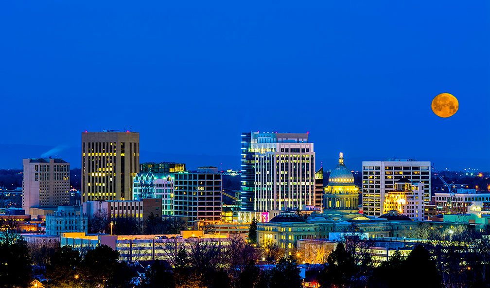
Blue night sky over Boise Idaho
Blue night sky over Boise Idaho. Boise is the capital and most populous city of Idaho and the county seat of Ada County.
Image: Charles Knowles


The map shows the location of following cities and towns in Idaho:

Largest city is Boise (pop. 223,000; metro 665,000 in 2017),

Cities with a population of more than 50,000: Napa, Meridian, Idaho Falls, and Pocatello.

Other Idaho cities and towns:
American Falls, Arco, Blackfoot, Bonners Ferry, Burley, Caldwell, Cascade, Challis, Chubbuck, Coeur d'Alene, Downey, Dubois, Gooding, Grangeville, Hailey, Idaho City, Kellogg, Ketchum, Lewiston, Malad City, Mc Call, Montpelier, Moscow, Mountain Home, New Meadows, Orofino, Payette, Rexburg, Rupert, Salmon, Sandpoint, Shoshone, Soda Springs, St. Anthony, St. Maries, Sun Valley, Twin Falls, Wallace, and Weiser.

Lake Pend Oreille in Northern Idaho.
Lake Pend Oreille in the northern Idaho Panhandle is the state's largest lake.
Image: Stan Petersen
 

Weather Conditions Boise:

BOISE WEATHER


Advertisements:


Maps of the 50 U.S. States
Alabama | Alaska | Arizona | Arkansas | California | Colorado | Connecticut | Delaware | Florida | Georgia | Hawaii | Idaho | Illinois | Indiana | Iowa | Kansas | Kentucky | Louisiana | Maine | Maryland | Massachusetts | Michigan | Minnesota | Mississippi | Missouri | Montana | Nebraska | Nevada | New Hampshire | New Jersey | New Mexico | New York | North Carolina | North DakotaOhio | Oklahoma | Oregon | Pennsylvania | Rhode Island | South Carolina | South Dakota | Tennessee | Texas | Utah | Vermont | Virginia | Washington | West Virginia | Wisconsin | Wyoming

20 Most Populous U.S. Cities (in 2018):
1. New York City 2. Los Angeles 3. Chicago 4. Houston 5. Phoenix 6. Philadelphia 7. San Antonio 8. San Diego 9. Dallas 10. San Jose 11. Austin 12. Jacksonville 13. Fort Worth 14. Columbus 15. San Francisco 16. Charlotte 17. Indianapolis 18. Seattle, 19. Denver, 20. Washington D.C.

Other Major U.S. Cities:
Albany, Anchorage, Annapolis, Atlanta, Atlantic City, Augusta, Baltimore, Baton Rouge, Bismarck, Boise, Boston, Carson City, Charleston, WV, Cheyenne, Cincinnati, Cleveland, Columbia, Concord, Des Moines, Detroit, Dover, DE, El Paso, Frankfort, Harrisburg, Hartford, Helena, Honolulu, Jackson, Jefferson City, Juneau, Kansas City, Lansing, Las Vegas, Lincoln, Little Rock, Long Beach, Madison, Memphis, Miami, Milwaukee, Minneapolis, Montgomery, Montpelier, Nashville, New Orleans, Norfolk, Oklahoma City, Olympia, Orlando, Pierre, Pittsburgh, Portland, Providence, Richmond, VA, Raleigh, Sacramento, St. Louis, St. Paul, Salem (OR), Salt Lake City, Santa Fe, Springfield, Tallahassee, Tampa, Topeka, Trenton, Tucson