Advertising

Wisconsin Flag detail
Home Earth Continents The Americas USA Country Profile US State Capitals Wisconsin Map

US States Maps Index
World Maps Index

Map of Wisconsin (WI)


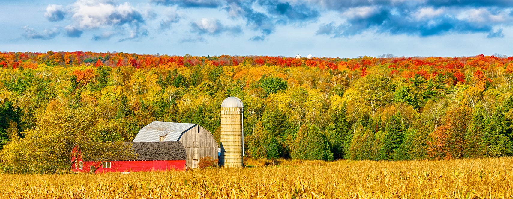
A farm building in Door County, Wisconsin
Fall Colors in Door County. Classic scene from northern Wisconsin. A farm nestled in fall colors, surrounded by cornfields on an October day.
Image: Elvis Kennedy


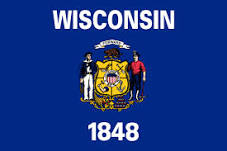
Wisconsin Flag
Wisconsin State Flag


About Wisconsin


Location map of Wisconsin state USA
Where in the United States is Wisconsin? Location map of Wisconsin in the US.
 
Wisconsin is one of the East North Central states situated in the north-central part of the US mainland. The state borders Lake Superior and Michigan to the north, Lake Michigan to the east, and Illinois to the south. The Mississippi River forms sections of its state borders with and Iowa and Minnesota to the west.


Short History
The area of Wisconsin was part of the original territory of the United States, being part of lands ceded by four states to the United States and designated in 1787 as the ‘‘Territory Northwest of the River Ohio.’’ Wisconsin Territory was organized on 3rd July 1836, from part of Michigan Territory; it included all of present-day Wisconsin, Iowa, and Minnesota, eastern North Dakota and South Dakota, and a small portion of northeastern Nebraska.
Wisconsin was admitted to the Union on 29th May 1848, as the 30th state, with generally the same boundary as the present state.

 
Wisconsin State Map
Reference Map of Wisconsin
General Map of Wisconsin, United States.

The detailed map shows the US state of Wisconsin with boundaries, the location of the state capital Madison, major cities and populated places, rivers and lakes, interstate highways, principal highways, and railroads.

You are free to use this map for educational purposes (fair use); please refer to the Nations Online Project.

 
More about Wisconsin State


Some Geography

Area
Wisconsin Topographic Regions Map
Topographic Regions Map of Wisconsin. (Click on the map to enlarge)
 
In area Wisconsin ranks 23rd in the US, with a total area of 169,634 km² (65,496 sq mi) [1], the state is somewhat smaller than half the size of Germany. Compared with other US states, Wisconsin would fit into Texas slightly more than four times.
17% of the state territory is water areas, and 46% is covered by forest. Wisconsin is subdivided into 72 counties.


Nicknames
The nickname of Wisconsin is Badger State or America's Dairyland.


Geographical Regions
Wisconsin's landscape has five major geographic regions.

1. There is the Lake Superior Lowland "up north," the forested coastal plain along the shore of Lake Superior.

2. The plain is bounded by the Northern Highland, an ancient mountain range, flattened out by erosion and glaciation. Timms Hill in Price County is the highest point in Wisconsin, at an elevation of 595 m (1,951 ft).

3. South of the upland is the v-shaped belt of the flat Central Plain covered by hardwood forest, and some areas are used for agriculture. To the east of the plain is the Green Bay and Fox River lowland, worn by glaciers in the last ice age. Situated between the lowland and the Eastern Ridges and Lowland is Lake Winnebago, the largest lake entirely in Wisconsin.

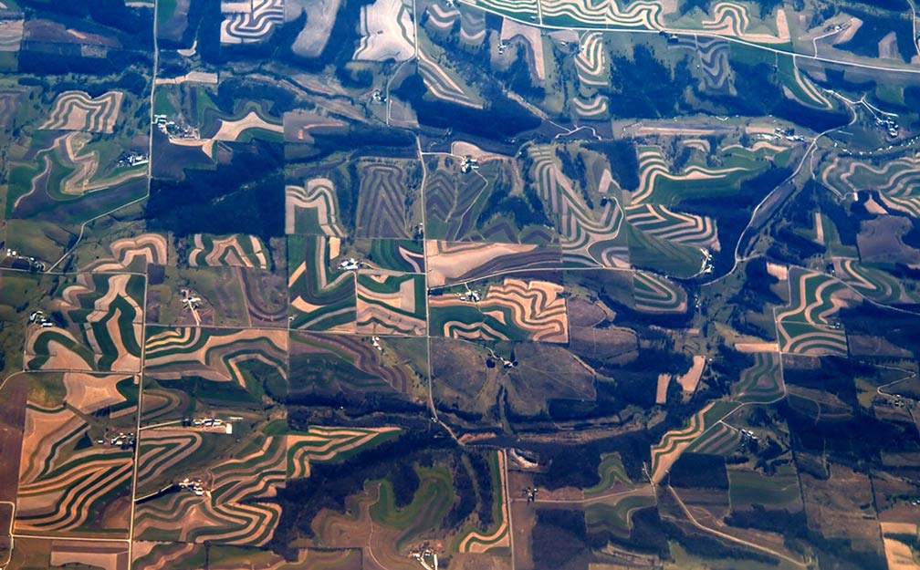
Aerial image of Wisconsin topography
Aerial image of Wisconsin topography. Farmers in the rolling hillside need to follow the contours of their land, so farming in straight rows is both not possible and not suitable for the soil.
Image: Šarūnas Burdulis

 
4. To the southwest of the plain is the Western Upland, a rugged, hilly region, dissected by rivers and streams.

5. The Eastern Ridges and Lowlands is a geographical region in the southeast of Wisconsin along Lake Michigan. The area includes the Lake Michigan lowland and two cuestas, the Niagara cuesta and the Black River Magnesian cuesta. Cuestas are ridges with a gentle slope on one side, and a steep slope or scarp on the other.

The arched Niagara cuesta stretches along the shores of Lake Michigan, and further west is the Black River Magnesian cuesta or escarpment; in between those ridges expands the Green Bay-Lake Winnebago-Rock River lowland.


Islands
Some islands in the Great Lakes belong to Wisconsin; there is the Apostle Islands group in Lake Superior and Washington Island in Lake Michigan.


Population

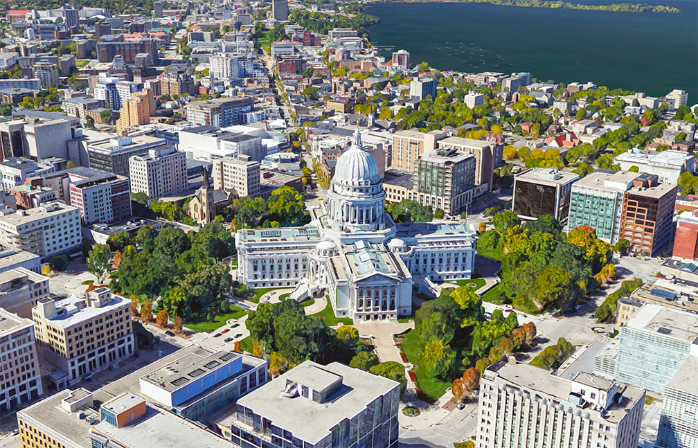
Wisconsin State Capitol, in Madison houses the state's government.
Rendered image of Wisconsin State Capitol, in Madison. The Beaux-Arts style building houses both chambers of Wisconsin's legislature, the Wisconsin Supreme Court, and the Office of the Governor.
Image: Google 
Wisconsin has a population of about 5.8 million people (2019 est.). [2] The capital city is Madison; the largest city is Milwaukee, the largest urban area is Greater Milwaukee (Metro Milwaukee; pop. 1.6 million).

Other major cities are Green Bay, Kenosha, Racine, and Appleton.


Race and Ethnic groups
The population of Wisconsin is composed of White alone 81.1%, Hispanic or Latino 6.9%, African American 6.7%, Asian 3.0%, and Native American 1.2%. [3]


The largest airports in the state are General Mitchell International Airport, (IATA code: MKE), and Madisons Dane County Regional Airport (Truax Field; IATA code: MSN)


Cities and Towns in Wisconsin

The map shows the location of following cities and towns in Wisconsin:


Milwaukee Art Museum, Wisconsin
Milwaukee Art Museum, Wisconsin.
Image: ThreeIfByBike


Capital city: Madison (258,000)

Largest cities in Wisconsin state with a population of more than 70,000:
Milwaukee, (592,000), Green Bay (104,800), Kenosha (100,000), Racine (77,400), Appleton (74,500), and Waukesha (72,500)

Population figures est. 2018


Other cities and towns in Wisconsin:
Antigo, Ashland, Bayfield, Beaver Dam, Beloit, Black River Falls, Brule, Chippewa Falls, Crandon, De Pere, Dodgeville, Eagle River, Eau Claire, Fond du Lac, Fort Atkinson, Hayward, Hurley, Janesville, Kaukauna, Kewaunee, La Crosse, Manitowoc, Marinette, Marshfield, Menomonee Falls, Menomonie, Merrill, Monroe, Oconto, Ojibwa, Oshkosh, Osseo, Park Falls, Pembine, Platteville, Plymouth, Portage, Prairie du Chien, Rhinelander, Rice Lake, Richland Center, Shawano, Sheboygan, Sparta, Spooner, St Croix Falls, Stevens Point, Sturgeon Bay, Superior, Tomah, Tomahawk, Two Rivers, Viroqua, Watertown, Waupun, Wausau, Wauwatosa, West Allis, West Bend, Wisconsin Dells, and Wisconsin Rapids.

Weather Conditions Milwaukee

MILWAUKEE WEATHER


Advertisements:


Maps of the 50 U.S. States
Alabama | Alaska | Arizona | Arkansas | California | Colorado | Connecticut | Delaware | Florida | Georgia | Hawaii | Idaho | Illinois | Indiana | Iowa | Kansas | Kentucky | Louisiana | Maine | Maryland | Massachusetts | Michigan | Minnesota | Mississippi | Missouri | Montana | Nebraska | Nevada | New Hampshire | New Jersey | New Mexico | New York | North Carolina | North DakotaOhio | Oklahoma | Oregon | Pennsylvania | Rhode Island | South Carolina | South Dakota | Tennessee | Texas | Utah | Vermont | Virginia | Washington | West Virginia | Wisconsin | Wyoming

20 Most Populous U.S. Cities (in 2018):
1. New York City 2. Los Angeles 3. Chicago 4. Houston 5. Phoenix 6. Philadelphia 7. San Antonio 8. San Diego 9. Dallas 10. San Jose 11. Austin 12. Jacksonville 13. Fort Worth 14. Columbus 15. San Francisco 16. Charlotte 17. Indianapolis 18. Seattle, 19. Denver, 20. Washington D.C.

Other Major U.S. Cities:
Albany, Anchorage, Annapolis, Atlanta, Atlantic City, Augusta, Baltimore, Baton Rouge, Bismarck, Boise, Boston, Carson City, Charleston, WV, Cheyenne, Cincinnati, Cleveland, Columbia, Concord, Des Moines, Detroit, Dover, DE, El Paso, Frankfort, Harrisburg, Hartford, Helena, Honolulu, Jackson, Jefferson City, Juneau, Kansas City, Lansing, Las Vegas, Lincoln, Little Rock, Long Beach, Madison, Memphis, Miami, Milwaukee, Minneapolis, Montgomery, Montpelier, Nashville, New Orleans, Norfolk, Oklahoma City, Olympia, Orlando, Pierre, Pittsburgh, Portland, Providence, Richmond, VA, Raleigh, Sacramento, St. Louis, St. Paul, Salem (OR), Salt Lake City, Santa Fe, Springfield, Tallahassee, Tampa, Topeka, Trenton, Tucson