Advertising

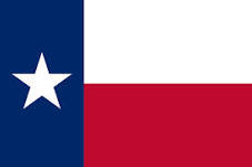
US Texas Flag detail
Home Earth Continents The Americas USA Country Profile US State Capitals Texas Map

US States Maps Index
World Maps Index

Map of Texas (TX)


Stargazing at Big Bend Ranch State Park, Texas
Gazing at the stars in Big Bend Ranch State Park, Texas, with the Milky Way and the halo of the moon setting on the horizon. Big Bend Ranch State Park is located in the darkest area of the state and is the largest state park in Texas.
Image: Alex Draco


Texas Flag
Texas State Flag
 

About Texas


Location map of Texas in the United States (USA)
Where in the United States is Texas? Location map of the State of Texas in the US.
 
Texas is one of the 50 US states, located in the south-central part of the country; it features a 560 km (350 mi) long coastline on the Gulf of Mexico in the southeast, and a 3,169 km (1,969 mi) long border with Mexico.

The Rio Grande, Texas' longest river, forms the border to the Mexican states of Chihuahua, Coahuila, Nuevo León, and Tamaulipas in the southwest.

The Lone Star State (its nickname) borders the US state of New Mexico in the west; the Red River of the South defines its border with the US state of Oklahoma.
Texas has a short border with Arkansas in the east; the Sabine River creates a natural boundary to Louisiana in the east. Other major rivers are the Brazos River, the Canadian River, the Colorado River, and the Pecos River.

Texas is known for being the largest US state (until Alaska was integrated in 1959), Bluebonnets (flowers), Texas longhorns (cattles), cowboy myth (stories about boys herding cows), tornadoes (whirlwinds), the state where Kennedy was killed, and as the state with a connection to space (Houston, we have a problem).


Texas State Map
Reference Map of Texas, USA
General Map of Texas, United States.

The detailed map shows the US state of Texas with boundaries, the location of the state capital Austin, major cities and populated places, rivers and lakes, mountains, interstate highways, principal highways, railroads and airports.

You are free to use the above map for educational and similar purposes; if you publish it online or in print, you need to credit Nations Online Project as the source.

 
More about Texas State


Some History
Texas Topographic Regions Map
Topographic Regions Map of Texas (click map to enlarge)

 
Texas was originally part of Mexico. It achieved independence as the Republic of Texas (Lone Star Republic) in 1836.

The United States acquired the area through annexation, and Texas was admitted to the Union on 29th December 1845, as the 28th state.
Texas formally relinquished its sovereignty to the United States on 14th February 1846.


Area
With an area of 696,241 km² (268,581 sq mi) [1], Texas is the largest state in the contiguous United States. It is about twice the size of Germany or somewhat larger than Afghanistan. Compared with another US state, Texas would fit two and a half times into Alaska.

Texas is divided into 254 counties.


Geography of Texas
The geography of Texas tends to be flat, except for the mountains west of the Pecos River.

 
Geographical Regions of Texas


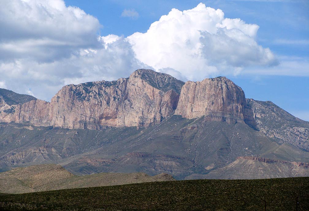
Guadalupe Peak in Guadalupe Mountains National Park, Texas
Guadalupe Peak in the Guadalupe Mountains National Park in Texas; it is the highest summit in Texas at 2,667 m (8,751 ft).
Image: Zereshk
 
Texas has four major geographical regions.

1. Texas' Gulf Coastal Plains along the Gulf of Mexico is a vast region in the Southern United States. The coastal area features barrier islands, brackish water inlets, and bays.
These coastal plains are further subdivided into the Coastal Prairies, the small remainder of native grassland. Today, less than 1% remains as a refuge for rare and endangered species. [2] The Piney Woods in southeast Texas is a critically endangered ecoregion with only remnants of coniferous forests.
Also part of the coastal plains is the Rio Grande Plain and the Lower Rio Grande Valley in the west and south. Another temperate grassland ecoregions of the coastal plain are the Texas Blackland Prairies and the Blackland Belt, a temperate tallgrass prairie.
The Post Oak Belt is a transition zone between the Piney Woods and the Blackland Prairie.

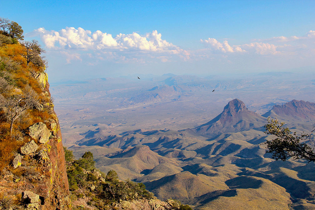
Chihuahuan Desert from South Rim Trail in Chisos Mountains of Big Bend National Park
Chihuahuan Desert from South Rim Trail in Chisos Mountains of Big Bend National Park.
Image: daveynin
 
2. Interior Lowlands (aka the North Central Plains), the southwestern extension of the interior lowlands into Texas's northeast. The region is subdivided into the Rolling Plains, rangeland devoted to wheat growing and cattle ranching. The mostly treeless Grand Prairie with an agricultural economy and a primarily rural population, with no large cities, except Fort Worth. [3]. The Eastern and Western Cross Timbers (aka Ecoregion 29), strips of land, partly forested, partly used for fruit and vegetable crops.

3. The Great Plains of Texas east of the Rocky Mountains features the High Plains in the north of the state, a vast, flat, high plain, also known as the Llano Estacado. The Caprock Escarpment is the dividing fault line between the High Plains and the lower West Texas Rolling Plains. The Edwards Plateau, the lower extension of the Great Plains supports three industries: cattle, goat, and sheep raising, its southeastern border is the Balcones Escarpment.

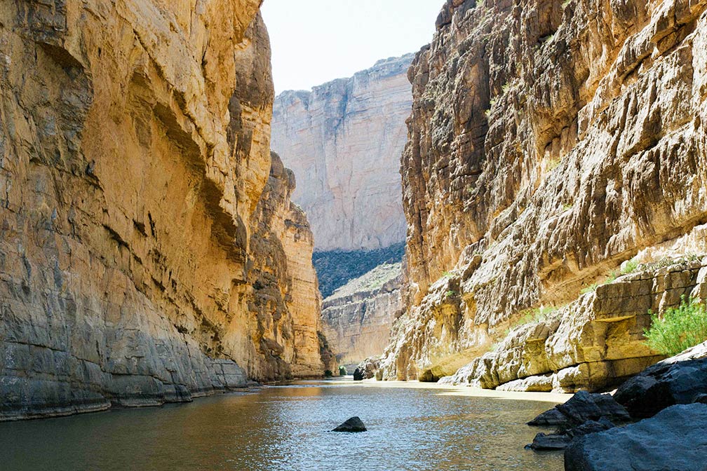
The Rio Grande River in Santa Elena Canyon in Big Bend National Park, Texas
Santa Elena Canyon in Big Bend National Park. The Rio Grande marks the US Mexican border.
Image: Kyle Glenn

 
4. The Basin and Range Province in West Texas. Within the province are the Guadalupe Mountains, with the state's highest peak, the Guadalupe Peak, at 2,667 m (8,749 ft). The Davis Mountains (or Limpia Mts) are a mountain range of volcanic origin in West Texas. The Chihuahuan Desert, a desert ecoregion of eastern Mexico and Texas, covers much of West Texas and parts of the middle and lower Rio Grande Valley.

Climate
The climate of Texas is quite varied, ranging from subtropical along the southern gulf coast to continental in the northern part, to semiarid in the mountains and arid in the deserts in the far west. The northern portion of Texas lies in the Tornado Alley, which extends from central Texas northward to Illinois and Indiana.

 
World Heritage Site


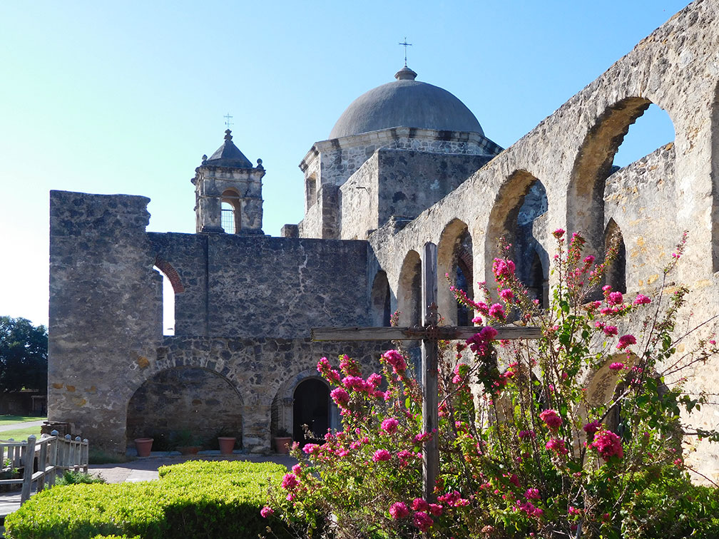
Mission San Jose a former frontier mission in San Antonio, Texas
Mission San José in San Antonio, Texas. One of the four Franciscan missions in San Antonio, designated a World Heritage Site in 2015.
Image: Steven B Yount
 
Since 2015, Texas has a UNESCO World Heritage Site.

The San Antonio Missions official website is a group of former frontier missions and a ranch situated along a stretch of the San Antonio River basin in southern Texas.

The facilities were built in the 18th century in the former Spanish Province of Texas by Franciscan missionaries. The site illustrates Spain’s efforts to colonize, evangelize, and eventually expand the northern frontier of New Spain.

The property showcases architectural and archaeological structures, farmlands, residencies, churches, and granaries, as well as water distribution systems.
 
Population


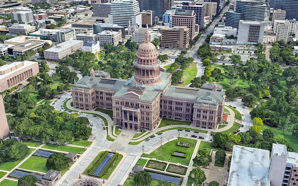
Texas State Capitol in Austin, Texas
Rendered image of Texas State Capitol in Downtown Austin. The Italian Renaissance Revival building houses the offices and chambers of the Texas Legislature and the Office of the Governor.
Image: Google
 
A population of 29 million (2020 est.) [3], makes Texas the second most populous state in the US (after California). Capital city is Austin; the largest city, and a primary port is Houston, the second-largest city in Texas is San Antonio. The state's largest metropolitan area is DallasFort Worth.

Other major cities are Fort Worth, El Paso, Arlington, and Corpus Christi.


Race and Ethnic Groups
Texas' population is composed of White 41.5%, Hispanic or Latino 39.6%, African American 12.8%, Asian 5.2%, and Native Americans 1.0%. [4]


Airports
The two largest airports in the state are Dallas/Fort Worth International Airport (IATA code: DFW) and Houston's George Bush Intercontinental Airport (IATA code: IAH).

Other major airports are William P. Hobby Airport (Houston; IATA code: HOU), Austin-Bergstrom International Airport (IATA code: AUS), San Antonio International Airport (IATA code: SAT), Dallas Love Field (IATA code: DAL), and El Paso International Airport (IATA code: ELP).


Cities and Towns in Texas


The map shows the location of following cities and towns in Texas:
(major cities with a population of more than 150,000 in bold)
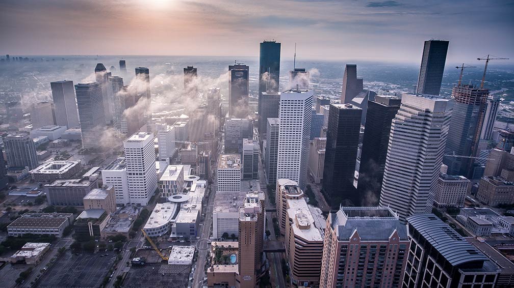

Central Business District, Downtown Houston, Texas
Downtown Houston, the state's largest city and a primary port.
Image: Vlad Busuioc

Abilene, Albany, Alice, Alpine, Amarillo, Andrews, Angleton, Anson, Arlington, Aspermont, Athens, Austin, Ballinger, Bay City, Baytown, Beaumont, Beeville, Big Spring, Bonham, Borger, Bowie, Brady, Brownfield, Brownsville, Brownwood, Bryan, Buffalo, Burnet, Canadian, Canyon, Carrizo Springs, Carthage, Cedar Park, Channing, Childress, Cisco, Clarendon, Clarksville, Cleburne, Coleman, College Station, Colorado City, Columbus, Conroe, Corpus Christi, Corsicana, Cotulla, Crockett, Crystal City, Cuero, Dalhart, Dallas, Del Rio, Denton, Dumas, Eagle Pass, Eden, EdnaVictoria, El Paso, Ennis, Fairfield, Falfurrias, Floydada, Fort Stockton, Fort Worth, Fredericksburg, Freeport, Gainesville, Galveston, Garland, George West, Georgetown, Gladewater, Goldthwaite, Goliad, Gonzales, Graham, Guthrie, Hallettsville, Hamilton, Harlingen, Henderson, Hereford, Hillsboro, Hondo, Houston, Huntsville, Irving, Jacksonville, Jasper, Johnson City, Junction, Kermit, Kerrville, Kilgore, Killeen, Kingsville, La Grange, Lake Jackson, Lamesa, Lampasas, Laredo, Levelland, Littlefield, Livingston, Longview, Lubbock, Lufkin, Luling, Madisonville, Marfa, Marlin, Marshall, Mason, McAllen, McCamey, McKinney, Mexia, Midland, Mission, Monahans, Mount Pleasant, Muleshoe, Nacogdoches, Nederland, New Braunfels, Odessa, Orange, Ozona, Paducah, Palacios, Palestine, Pampa, Paris, Pasadena, Pecos, Perryton, Pharr, Plainview, Plano, Port Arthur, Port Isabel, Port Lavaca, Post, Presidio, Robstown, Rocksprings, Rosenberg, Rusk, San Marcos, San Angelo, San Antonio, San Augustine, Sanderson, Seguin, Seminole, Seymour, Shamrock, Sherman, Sinton, Snyder, Socorro, Sonora, Stamford, Stephenville, Stratford, Sweetwater, Tahoka, Temple, Texarkana, Texas City, The Woodlands, Tyler, Uvalde, Van Horn, Vega, Vernon, Waco, Wharton, Wichita Falls, and Woodville.


Weather Conditions Austin:

AUSTIN WEATHER


Advertisements:


Maps of the 50 U.S. States
Alabama | Alaska | Arizona | Arkansas | California | Colorado | Connecticut | Delaware | Florida | Georgia | Hawaii | Idaho | Illinois | Indiana | Iowa | Kansas | Kentucky | Louisiana | Maine | Maryland | Massachusetts | Michigan | Minnesota | Mississippi | Missouri | Montana | Nebraska | Nevada | New Hampshire | New Jersey | New Mexico | New York | North Carolina | North DakotaOhio | Oklahoma | Oregon | Pennsylvania | Rhode Island | South Carolina | South Dakota | Tennessee | Texas | Utah | Vermont | Virginia | Washington | West Virginia | Wisconsin | Wyoming

20 Most Populous U.S. Cities (in 2018):
1. New York City 2. Los Angeles 3. Chicago 4. Houston 5. Phoenix 6. Philadelphia 7. San Antonio 8. San Diego 9. Dallas 10. San Jose 11. Austin 12. Jacksonville 13. Fort Worth 14. Columbus 15. San Francisco 16. Charlotte 17. Indianapolis 18. Seattle, 19. Denver, 20. Washington D.C.

Other Major U.S. Cities:
Albany, Anchorage, Annapolis, Atlanta, Atlantic City, Augusta, Baltimore, Baton Rouge, Bismarck, Boise, Boston, Carson City, Charleston, WV, Cheyenne, Cincinnati, Cleveland, Columbia, Concord, Des Moines, Detroit, Dover, DE, El Paso, Frankfort, Harrisburg, Hartford, Helena, Honolulu, Jackson, Jefferson City, Juneau, Kansas City, Lansing, Las Vegas, Lincoln, Little Rock, Long Beach, Madison, Memphis, Miami, Milwaukee, Minneapolis, Montgomery, Montpelier, Nashville, New Orleans, Norfolk, Oklahoma City, Olympia, Orlando, Pierre, Pittsburgh, Portland, Providence, Richmond, VA, Raleigh, Sacramento, St. Louis, St. Paul, Salem (OR), Salt Lake City, Santa Fe, Springfield, Tallahassee, Tampa, Topeka, Trenton, Tucson