One Planet
Nations Online

All Countries in the World
 

___ Searchable Map and Satellite View of United States (USA)

 
Mammoth Mountain with Ritter mountain range
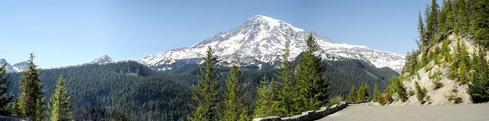
Panorama of the south face of Mount Rainier, also known as Mount Tacoma. The highest mountain of the Cascade Range in Washington state is considered to be one of the most dangerous volcanoes in the world.
 
 
Statue of Liberty
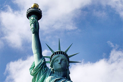
Head and arm with torch of the Statue of Liberty, one of the most recognizable landmarks in the world.
 

About the United States

Founded: 4th July 1776

Area: 9,63 million km² (3rd largest country in the world)

Population: 322 million (in 2016; 3rd most populous country in the world)

Administrative divisions: 50 states, 3,144 counties (including 137 county equivalents)

Spoken languages: English, Spanish, some survivals of Native American languages

Capital city: Washington D.C.
Largest city: New York City

Mainland border countries: Canada and Mexico

Main coastlines: Pacific Ocean, Atlantic Ocean, Gulf of Mexico
Longest river: Missouri River
Highest peak: Denali (6140 m (20,146 ft);  formerly Mount McKinley, Alaska)

Satellite view is showing the central part of North America with USA and its international borders.

Zoom in to see the boundaries of the U.S. States, the states' capitals, major cities, expressways, main roads and streets.

By click on the Map button it shows the United States with state capitals, cities, expressways, main roads and street maps.

To view just the map, click on the "Map" button.


To find a location type: street or place, city, optional: state, country.

Local Time Washington D.C.:
Monday-March-18 2024  03:16  
Standard time zone Eastern (EST): UTC/GMT -5 hours
Daylight Saving Time (EDT) in use from the second Sunday in March, ends on the first Sunday in November; time zone offset: UTC/GMT -4 hours.
For the diverse time zones in the U.S. see Time Zone Map of the United States
 
φ Latitude, λ Longitude (of Map center; move the map to see coordinates):
,
 
Sorry! Google's pricing policy has made it impossible for us to continue showing Google Maps. We apologize for any inconvenience.

Google Map: Searchable map/satellite view of the United States of America.
 
Bookmark/share this page
Instagram


More about the USA:

Landmarks:
profile Statue of Liberty

profile The White House

Cities:
profile Most populated cities in the U.S.
profile State Capitals in the U.S.

States:
profile Profiles of the 50 U.S. States
profile Maps of the 50 U.S. States
profile Flags of the 50 U.S. States
profile 50 U.S. States by Area
profile Population of the 50 U.S. States

Country:
 US Time Zone Map
profile Reference Map of the USA

profile United States Country Profile

Continent:
Political Map of North America

Physical Map of North America
 
Weather Washington D.C.


Weather New York City

Explore more:


Related Consumer Information:


Most Populous U.S. Cities:
1. New York City | 2. Los Angeles | 3. Chicago | 4. Houston | 5. Philadelphia
6. Phoenix | 7. San Antonio | 8. San Diego | 9. Dallas | 10. San Jose
11. Austin | 12. Jacksonville | 13. San Francisco | 14. Indianapolis | 15. Columbus

Other Major U.S. Cities:
Albany | Anchorage | Annapolis | Atlanta | Atlantic City | Augusta | Baltimore | Baton Rouge | Bismarck
Boise | Boston | Carson City | Charleston, WV | Charlotte | Cheyenne | Cincinnati | Cleveland | Columbia
Concord | Denver | Des Moines | Detroit | Dover, DE | El Paso | Fort Worth | Frankfort | Harrisburg | Hartford
Helena | Honolulu | Jackson | Jefferson City | Juneau | Kansas City | Lansing | Las Vegas | Lincoln | Little Rock
Long Beach | Madison | Memphis | Miami | Milwaukee | Minneapolis | Montgomery | Montpelier | Nashville
New Orleans | Norfolk | Oklahoma City | Olympia | Orlando | Pierre | Pittsburgh | Portland | Providence
Richmond, VA | Raleigh | Sacramento | St. Louis | St. Paul | Salem (OR) | Salt Lake City | Santa Fe | Seattle
Springfield | Tallahassee | Tampa | Topeka | Trenton | Tucson | Washington D.C.
 

Map Help [ show ]
 
up