Advertising

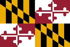
Maryland flag detail
Home Earth Continents The Americas USA Country Profile US State Capitals Maryland Map

US States Maps Index
World Maps Index

Map of Maryland (MD)


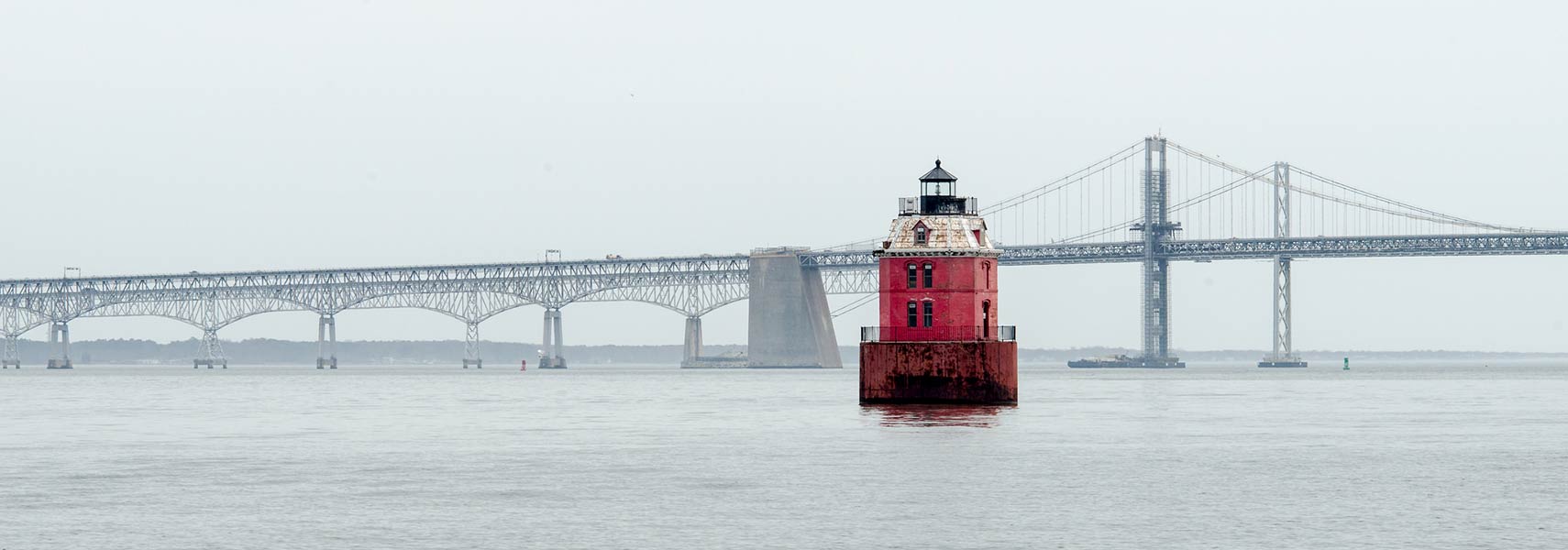
Chesapeake Bay Bridge over the Chesapeake Bay with Sandy Point Shoal Lighthouse
Chesapeake Bay Bridge over the Chesapeake Bay with Sandy Point Shoal Lighthouse. Chesapeake Bay Bridge near Annapolis connects Anne Arundel County with Kent Island and further with Queen Anne's County on the Delmarva Peninsula.
Image: Marc Palumbo

 
Maryland Flag
Maryland State Flag
 

About Maryland


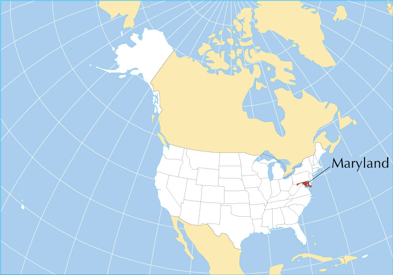
Location map of Maryland state USA
Where in the United States is Maryland? Location map of Maryland in the US. (Click on the map to enlarge)

 
Maryland, one of the 50 US states, is located in the Mid-Atlantic region in the northeast of the United States. The state is bounded to the north by the Mason-Dixon line that forms the border with Pennsylvania. The Potomac River creates most of its border with West Virginia and Virginia in the west; in the east, it borders Delaware and the Atlantic Ocean on the Delmarva peninsula. Maryland surrounds a good portion of Washington D.C. in the west.

Many-branched Chesapeake Bay, the greatest arm of the sea in the contiguous US, is reaching deep inland from the Atlantic Ocean and defines the center of Maryland and its serrated coastline.

The area of Maryland was part of the original territory of the United States. It was chartered as a colony in 1632.

Maryland ratified the US Constitution on 28 April 1788; it was the seventh of the original 13 states to join the Union.

 
Maryland State Map
Reference Map of Maryland
General Map of Maryland, United States.

The detailed map shows the US state of Maryland with boundaries, the location of the state capital Annapolis, major cities and populated places, rivers and lakes, interstate highways, principal highways, and railroads.

You are free to use this map for educational purposes (fair use); please refer to the Nations Online Project.
   
More about Maryland State


Some Geography

Area
Maryland Topographic Regions Map Topographic Regions Map of Maryland. (click map to enlarge)

 
With an area of 32,131 km² (12,406 sq mi), Maryland is ranked 42nd of the 50 US states, compared, it is about the size of Belgium.

Compared with other US states, Maryland is one and a half times larger than New Jersey, but it would fit into Texas 22 times.

The state is made up of twenty-three counties plus Baltimore City, which is considered to be on par with a county.


Maryland geography
Maryland's landscape offers three principal regions and six physiographic provinces (natural sites).

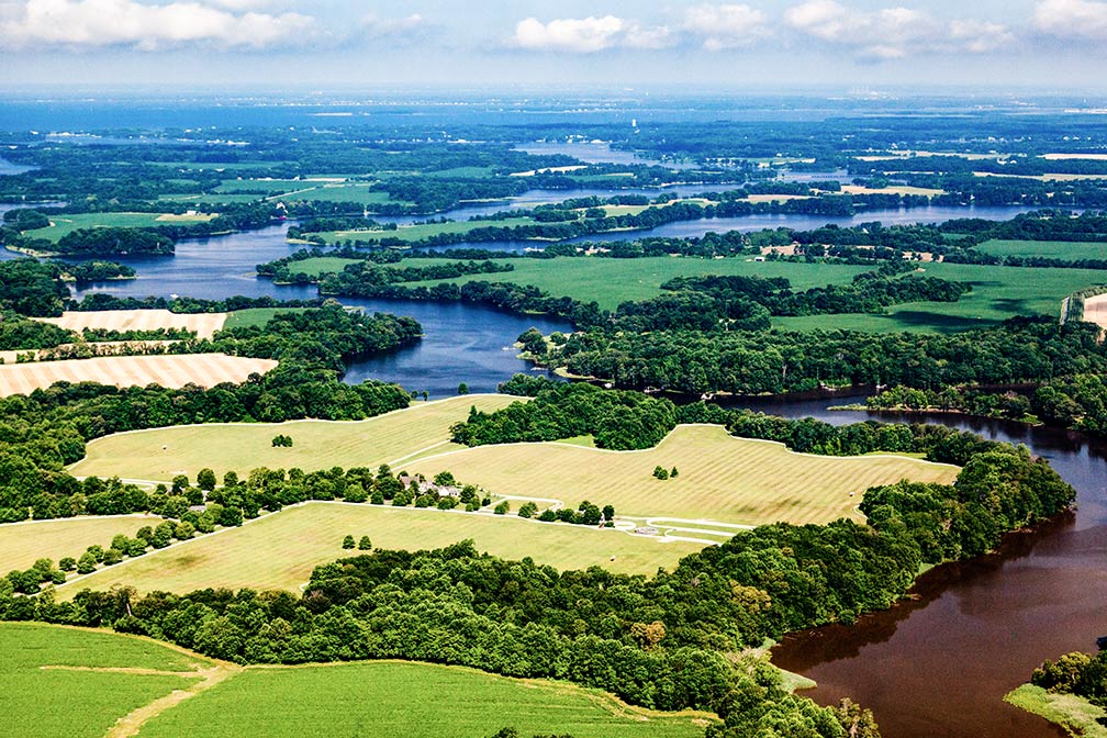
Skipton Creek in Talbot County, Maryland
Skipton Creek, a tributary of the Wye River, in Talbot County, Maryland.
Image: Will Parson/Chesapeake Bay Program

 
1. The state has its share of the Appalachian Mountains in the west, in the state's 'panhandle.' The Appalachian region is further divided into several physiographic provinces; the Appalachian Plateaus Province (or Allegheny Mountains) in the far west borders the Ridge and Valley Province in the east, and the Great Valley Section in the areas around Hagerstown. Further to the east lies the more separate Blue Ridge Province, which borders the Piedmont Plateau.


2. The Piedmont Plateau with its Lowland Section and its Upland Section with sprawling Baltimore at its edge.


3. The Atlantic Coastal Plain is separated from the upland bedrock of the Piedmont Plateau by the Atlantic Seaboard Fall Line in the west.

Maryland's portion of the plain surrounds the Chesapeake Bay; west of the bay lies the Western Shore Lowlands Region in the north, and the Western Shore Uplands Region in the south. East of the bay is the Eastern Shore covering the west side of the Delmarva Peninsula, which Maryland shares with Delaware and Virginia. Finally, in the far southeast is the Atlantic Continental Shelf Province along Assateague Island.

 
Rivers

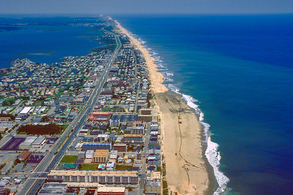
Aerial view of Fenwick Island and Ocean City in Maryland
Aerial view of Fenwick Island. Maryland's Ocean City is at the bottom of the image.
Image: Tex Jobe, U.S. Army Corps of Engineers

 
Major rivers are the Patapsco, the Patuxent, the Susquehanna, and the Potomac River, all of them empty into the Chesapeake Bay.


Lakes
Maryland's largest lake is the Deep Creek Lake with a 111 km (69 mi) long shoreline.
Prettyboy Reservoir is a 206.5 km² (79.7 sq mi) barrier lake created to supply the Metropolitan Baltimore municipal water system; the lake is fed by the Gunpowder Falls. The water from Prettyboy Reservoir is transferred to the Loch Raven Reservoir. The water is then supplied through a tunnel from Loch Raven to the Montebello filtration plants in Baltimore.
The Liberty Reservoir is a reservoir northwest of Baltimore fed by the Patapsco River.

By the way, all of Maryland's lakes today are human-made.

 
Islands

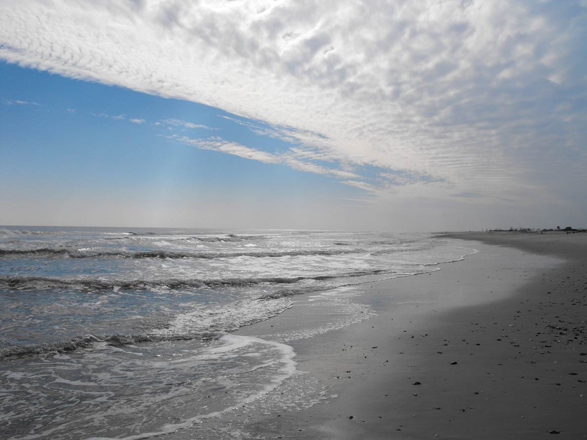
Wild Beach at Chincoteague National Wildlife Refuge / Assateague Island National Seashore in Maryland
Wild Beach at Chincoteague National Wildlife Refuge, southern Assateague Island National Seashore.
Image: Emma Kerr/USFWS


Maryland has 281 named islands, including river islands, islands in the Chesapeake, and other bays.

Assateague Island is an elongated barrier island off the east coast of the Delmarva Peninsula in the Atlantic Ocean.

Fenwick Island is a barrier spit along the Atlantic Ocean; the barrier island is shared by Delaware and Maryland.

Islands located in the Chesapeake Bay: Kent Island in Maryland's Eastern Shore region is the largest island in the Chesapeake Bay.
Eastern Neck Island is home to the Eastern Neck National Wildlife Refuge, a sanctuary for migratory birds.
The uninhabited Pooles Island is home to the oldest lighthouse still standing in Maryland.

Other islands in the Chesapeake Bay are rural Tilghman Island, Hart-Miller Island, a state-owned, public recreation area. Gibson island, a gated community with expensive real estate. In the south of the bay are the isolated Hoopers Islands, the Bloodsworth Island, a former shore bombardment and bombing range, the once settled and now abandoned Holland Island, and the car-free Smith Island on the border of Maryland and Virginia.


Highest point
The highest point in the state is Hoye Crest at 1,024 m (3,360 ft) a.s.l., on Backbone Mountain in Garrett County on the Maryland-West Virginia border in the far west.

 
Population


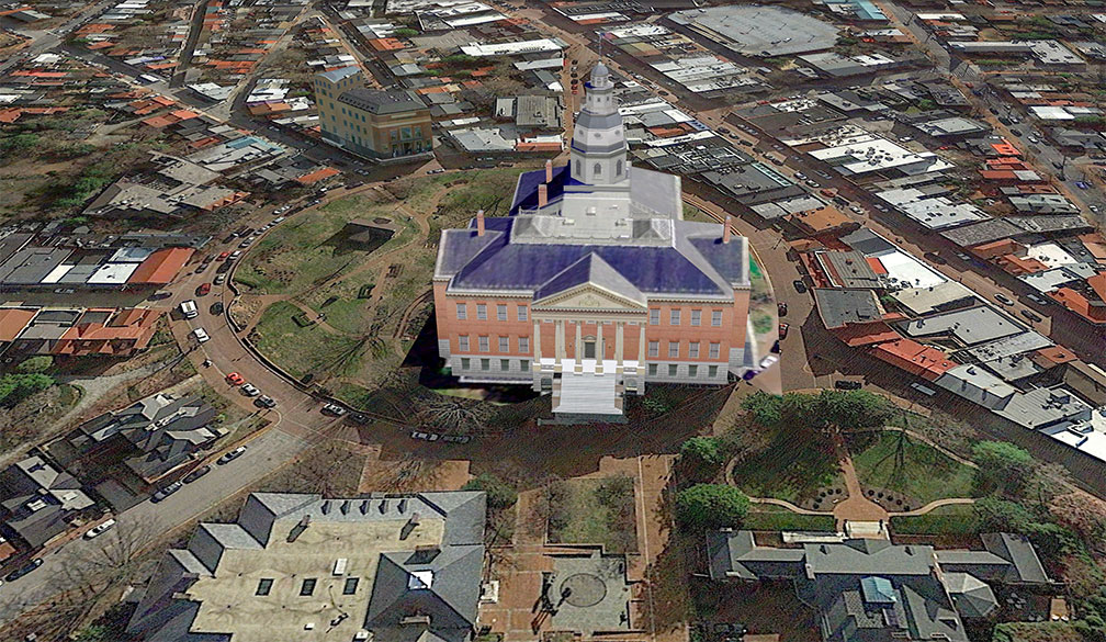
Maryland State House in Annapolis
Rendered image of Maryland State House in Annapolis. The Georgian style building houses the Maryland General Assembly, and offices of the Governor. The capitol is the oldest U.S. state capitol in continuous legislative use, dating to 1772.
Image: Google Earth

 
Maryland has a population of 6 million people (in 2019). [1]

Major cities in the state are Baltimore, which is by far the largest city with a population of 602,000 citizens; 2.8 million people live in the Baltimore-Columbia-Towson urban area.

All other cities like Frederick, Gaithersburg, Rockville, and Bowie, have a population of under 70,000 people, including Annapolis, the state's capital.

Besides those cities, there are urbanized census-designated places (CDP) like
Columbia (pop. 106,700), Germantown (pop. 90,800), Silver Spring (pop. 81,800), Waldorf (pop. 78,600), and Glen Burnie (pop. 66,000).
Source: USCB


Race and Ethnic groups
The population of Maryland is composed of White alone 50.5%, African American 30.9%, Hispanic or Latino 10.4%, Asian 6.7%, and Native American 0.6%. [2]

The main airport in the state is Baltimore/Washington International Thurgood Marshall Airport (IATA code: BWI).


Cities and Towns in Maryland


Downtown Baltimore
Old meets New. Downtown Baltimore, Maryland's largest city.
Image: urbanfeel

 
The map above shows the location of following cities and towns in Maryland:

The largest city is Baltimore (602,000)
Second largest city is Frederick (72,100), Gaithersburg (68,300), Rockville (68,200), Bowie (58,700)
Annapolis (capital city, 39,100)
Population figures in 2018

Other cities and towns in Maryland:
Aberdeen, Bethesda, Cambridge, Chestertown, Columbia, Cumberland, Dundalk, Easton, Frostburg, Hagerstown, Lexington Park, Ocean City, Pocomoke City, Salisbury, Silver Spring, St. Charles, Towson, and Westminster.


Weather Conditions Washington D.C.

WASHINGTON D.C. WEATHER


Advertisements:


Maps of the 50 U.S. States
Alabama | Alaska | Arizona | Arkansas | California | Colorado | Connecticut | Delaware | Florida | Georgia | Hawaii | Idaho | Illinois | Indiana | Iowa | Kansas | Kentucky | Louisiana | Maine | Maryland | Massachusetts | Michigan | Minnesota | Mississippi | Missouri | Montana | Nebraska | Nevada | New Hampshire | New Jersey | New Mexico | New York | North Carolina | North DakotaOhio | Oklahoma | Oregon | Pennsylvania | Rhode Island | South Carolina | South Dakota | Tennessee | Texas | Utah | Vermont | Virginia | Washington | West Virginia | Wisconsin | Wyoming

20 Most Populous U.S. Cities (in 2018):
1. New York City 2. Los Angeles 3. Chicago 4. Houston 5. Phoenix 6. Philadelphia 7. San Antonio 8. San Diego 9. Dallas 10. San Jose 11. Austin 12. Jacksonville 13. Fort Worth 14. Columbus 15. San Francisco 16. Charlotte 17. Indianapolis 18. Seattle, 19. Denver, 20. Washington D.C.

Other Major U.S. Cities:
Albany, Anchorage, Annapolis, Atlanta, Atlantic City, Augusta, Baltimore, Baton Rouge, Bismarck, Boise, Boston, Carson City, Charleston, WV, Cheyenne, Cincinnati, Cleveland, Columbia, Concord, Des Moines, Detroit, Dover, DE, El Paso, Frankfort, Harrisburg, Hartford, Helena, Honolulu, Jackson, Jefferson City, Juneau, Kansas City, Lansing, Las Vegas, Lincoln, Little Rock, Long Beach, Madison, Memphis, Miami, Milwaukee, Minneapolis, Montgomery, Montpelier, Nashville, New Orleans, Norfolk, Oklahoma City, Olympia, Orlando, Pierre, Pittsburgh, Portland, Providence, Richmond, VA, Raleigh, Sacramento, St. Louis, St. Paul, Salem (OR), Salt Lake City, Santa Fe, Springfield, Tallahassee, Tampa, Topeka, Trenton, Tucson