Advertising

Kansas Flag detail
Home Earth Continents The Americas USA Country Profile US State Capitals Kansas Map

US States Maps Index
World Maps Index

Map of Kansas (KS)


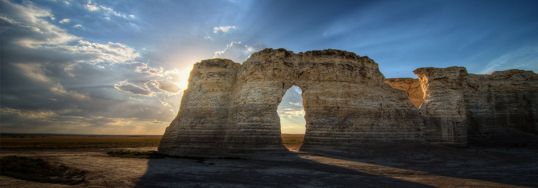
Monument Rocks in Gove County, Kansas
Monument Rocks in Gove County of Kansas. The US Department of the Interior chose the 80 million years old chalk pyramids landmark as the first National Natural Landmark (in 1968).
Image: Lane Pearman

 
Kansas Flag
Kansas State Flag


About Kansas


Location map of Kansas state USA
Where in the United States is Kansas? Location map of Kansas in the US.
 
Kansas is a landlocked state in the Midwest of the USA, located on the eastern edge of the Great Plains, more or less in the center of the nation.

The state borders Nebraska to the north, Missouri to the east, Oklahoma to the south, and Colorado to the west.


Before the arrival of the Europeans, the Great Plains were home to the Siouan-speaking Native American nomadic tribes, the Kaws, Quapaws, Omahas, Osages, and Poncas.

The United States acquired the territory of present-day Kansas from France in 1803 as part of the Louisiana Purchase. Kansas was admitted to the Union on 29th January 1861, as the 34th state.


Kansas State Map
Reference Map of Kansas
General Map of Kansas, United States.

The detailed map shows the US state of Kansas with boundaries, the location of the state capital Topeka, major cities and populated places, rivers and lakes, interstate highways, principal highways, and railroads.

You are free to use this map for educational purposes (fair use); please refer to the Nations Online Project.

 
More about Kansas State


Some Geography

Area
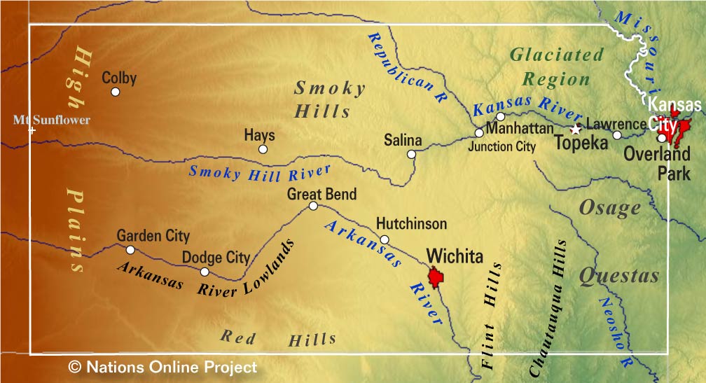
Kansas Topographic Regions Map Topographic Regions Map of Kansas showing the location of the High Plains, the Arkansas River Lowlands, the Smoky Hills, the Flint Hills, the Chautauqua Hills, the Osage Cuestas, and the Glaciated Region of Kansas. (click on the map to enlarge)
 
Most of the state is situated in the Great Plains of North America, a broad expanse of flat land covered by prairie, steppe, and grassland that extends from the valleys of the Mackenzie River in Canada to southern Texas.

Kansas covers an area of 213,099 km², [1] which is about the size of Great Britain (the island) squeezed into an almost rectangular shape. Compared with other US states, Kansas is more than nine times larger than New Jersey, but it would fit into Texas more than three times.


Major physiographic regions
Kansas landscape is mostly flat with hills and forests in the east.
A tiny portion of the Springfield Plateau of the Ozarks reaches into the southeastern corner of the state.

The upland of the Ozark Plateau merges with the rolling hills of the Cherokee Lowlands to the northwest. In the northwest of the lowlands are the Osage Cuestas, also known as Osage Prairie, a region of east-southeast facing escarpments that can range from 50 to 200 feet high.
 
Smoky Hills Wind Farm in Kansas
Smoky Hills Wind Farm in the central Great Plains of Kansas.
Image: brent flanders

 
Within the Osage Prairie are the Chautauqua Hills, sandstone-covered ridges and rolling hills that are usually densely covered with oaks and other trees.

Further west are the Flint Hills (also known as Osage Hills), a range of hills with the densest cover of intact tallgrass prairie in North America.

The Red Hills, an upland also known as Gypsum Hills, covers the central southern portion of Kansas and northern Oklahoma.

The north-central part of Kansas is dominated by the Smoky Hills, a dissected upland area with outcropping rocks.

In the western third of Kansas the High Plains dominate the landscape. The High Plains are an upland subregion of the Great Plains. From the east to the west, the land rises in elevations from around 350 m (1,160 ft) to 1,200 m (4,000 ft). Mount Sunflower, the state's highest point, is located in that upland close to the Colorado state border.

 
Population


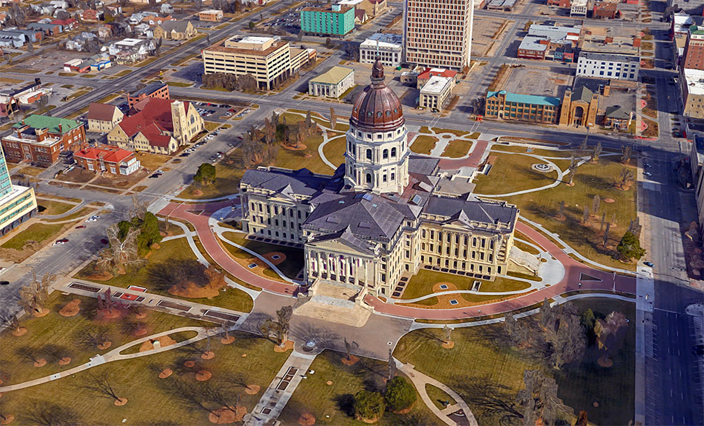
Kansas Statehouse in Topeka, Kansas
Rendered image of the Kansas State Capitol, also known as the Kansas Statehouse. The French Renaissance building is the seat of Kansas' executive and legislative branches of government.
Image: Google

 
Kansas has a population of 2.91 million people (est. 2019) [2], the state capital is Topeka, the largest city is Wichita.

Other major cities are Overland Park (part of the Kansas City metropolitan area), Olathe, Topeka, and Lawrence.

The region's largest urban conglomerate is Kansas City metropolitan area, a two-state metropolitan area that extends across the border between the US states of Missouri and Kansas.


Race and Ethnic groups
The population of Kansas is composed of Caucasians (white) 75.7%, 12.1% Hispanics or Latinos, 6.1% African Americans, 3.1% Asians, and 1.2% Native Americans. [3]


The busiest airport in the state is Wichita Dwight D. Eisenhower National Airport (IATA code: ICT).


Cities and Towns in Kansas

The map shows the location of following cities and towns in Kansas:

The largest city is Wichita (390,000)
The second-largest largest city is Overland Park (192,500),
other major cities with more than 50,000 citizens are
Kansas City (Kansas) 153,000), Olathe (part of Kansas City metro, 135,500), Topeka (capital city, 126,000), Lawrence (95,500)
Shawnee (part of Kansas City metro, 65,200), Manhattan (55,000), and Lenexa (part of Kansas City metro, 53,000)
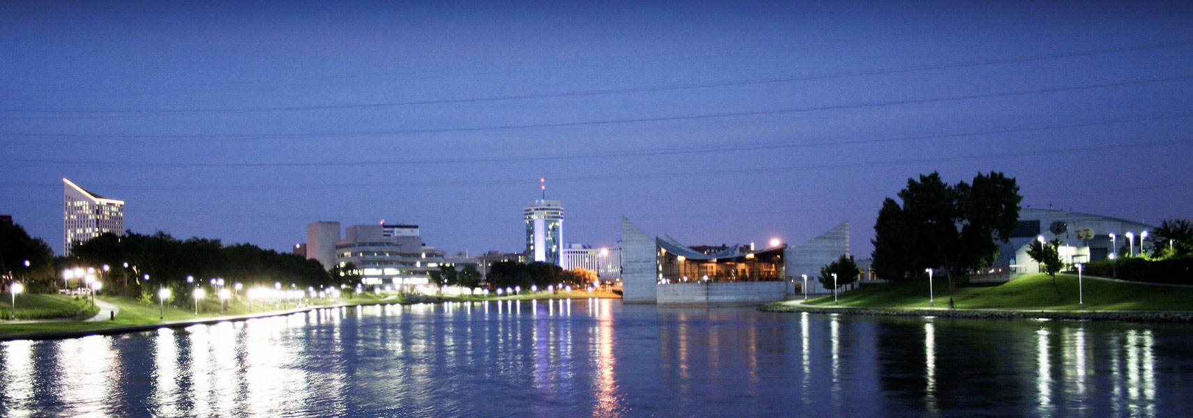


Wichita at night with Exploration Place the Arkansas River View of Wichita at night with Exploration Place, the science museum, next to the Arkansas River. Garvey Center in the center and the building of the Federal Public Defender on the left.
Image: Andrea Allen

Other cities and towns in Kansas:
Abilene, Arkansas City, Ashland, Atchison, Atwood, Belleville, Beloit, Chanute, Cherryvale, Cimmaron, Clay Center, Coffeyville, Colby, Concordia, Council Grove, Derby, Dodge City, El Dorado, Elkhart, Emporia, Fort Scott, Fredonia, Garden City, Garnett, Goodland, Great Bend, Greensburg, HaysIola, Hiawatha, Hill City, Holton, Hugoton, Hutchinson, Independence, Jetmore, Junction City, Kingman, Kinsley, Larned, Lawrence, Leavenworth, Lebanon, Liberal, Lyons, Manhattan, Marion, Marysville, Mc Pherson, Meade, Medicine Lodge, Neodesha, Ness City, Newton, Norton, Oakley, Oberlin, Osborne, Ottawa, Paola, Parsons, Phillipsburg, Pittsburg, Pratt, Russell, Salina, Scott City, Sharon Springs, St. Francis, St. John, Stockton, Sublette, Syracuse, Topeka, Tribune, Ulysses, WaKeeney, Wellington, Winfield, and Yates Center.
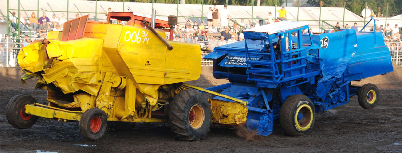
Combine Demo Derby in Abilene, Kansas
Pimp my combine harvester. Badass farmers at Combine Demolition Derby in Abilene, Kansas.
Image: Russell Feldhausen

 

Weather Conditions Topeka:

TOPEKA WEATHER


Advertisements:


Maps of the 50 U.S. States
Alabama | Alaska | Arizona | Arkansas | California | Colorado | Connecticut | Delaware | Florida | Georgia | Hawaii | Idaho | Illinois | Indiana | Iowa | Kansas | Kentucky | Louisiana | Maine | Maryland | Massachusetts | Michigan | Minnesota | Mississippi | Missouri | Montana | Nebraska | Nevada | New Hampshire | New Jersey | New Mexico | New York | North Carolina | North DakotaOhio | Oklahoma | Oregon | Pennsylvania | Rhode Island | South Carolina | South Dakota | Tennessee | Texas | Utah | Vermont | Virginia | Washington | West Virginia | Wisconsin | Wyoming

20 Most Populous U.S. Cities (in 2018):
1. New York City 2. Los Angeles 3. Chicago 4. Houston 5. Phoenix 6. Philadelphia 7. San Antonio 8. San Diego 9. Dallas 10. San Jose 11. Austin 12. Jacksonville 13. Fort Worth 14. Columbus 15. San Francisco 16. Charlotte 17. Indianapolis 18. Seattle, 19. Denver, 20. Washington D.C.

Other Major U.S. Cities:
Albany, Anchorage, Annapolis, Atlanta, Atlantic City, Augusta, Baltimore, Baton Rouge, Bismarck, Boise, Boston, Carson City, Charleston, WV, Cheyenne, Cincinnati, Cleveland, Columbia, Concord, Des Moines, Detroit, Dover, DE, El Paso, Frankfort, Harrisburg, Hartford, Helena, Honolulu, Jackson, Jefferson City, Juneau, Kansas City, Lansing, Las Vegas, Lincoln, Little Rock, Long Beach, Madison, Memphis, Miami, Milwaukee, Minneapolis, Montgomery, Montpelier, Nashville, New Orleans, Norfolk, Oklahoma City, Olympia, Orlando, Pierre, Pittsburgh, Portland, Providence, Richmond, VA, Raleigh, Sacramento, St. Louis, St. Paul, Salem (OR), Salt Lake City, Santa Fe, Springfield, Tallahassee, Tampa, Topeka, Trenton, Tucson