Nations Online
All Countries in the World
Nations Online All Countries in the World | |
Home  |
___ Searchable Map and Satellite View of Cleveland, Ohio (with 45-degree image coverage) |
 Skyline of Downtown Cleveland, Ohio. Image: Joanne |
About Cleveland |
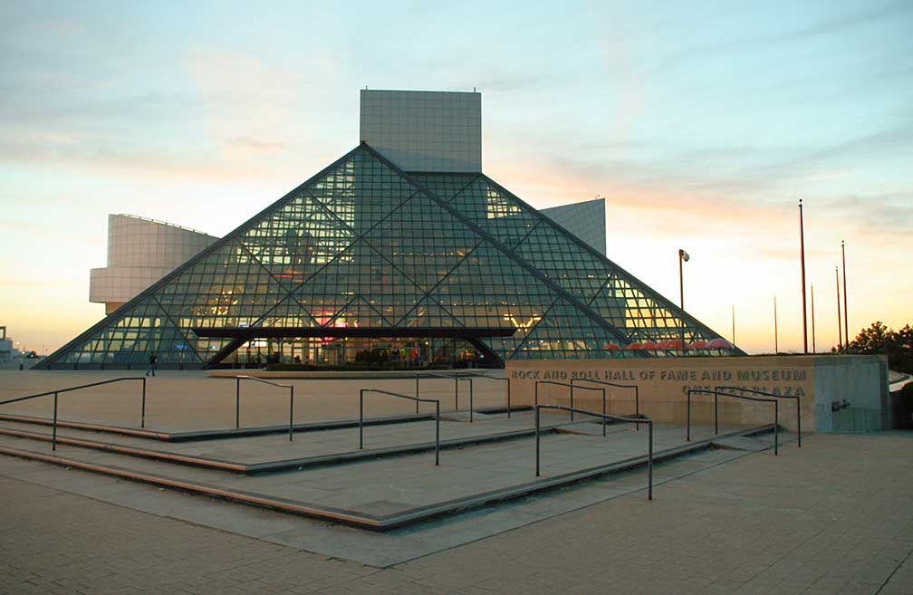
 The satellite view shows Cleveland, second largest city in Ohio (after Columbus), and a major Saint Lawrence Seaway port in the The satellite view shows Cleveland, second largest city in Ohio (after Columbus), and a major Saint Lawrence Seaway port in the Cleveland was laid out in 1796 by Moses Cleaveland for the Connecticut Land Company. The city expanded rapidly after the completion of the Ohio and Erie Canal, which linked Lake Erie to the Ohio River. The canal was an important transportation route until the arrival of the railroad in 1851. Today the city has a population of 388,000 residents (2015 est.), about 2 million people live in Greater metropolitan area (Cleveland-Elyria-Mentor). Cleveland Points of Interest: The city is home to the Rock and Roll Hall of Fame, a museum dedicated to archiving the history of rock music. Other museums are the Great Lakes Science Center, a museum and educational facility. Cleveland Museum of Art, and the Cleveland Museum of Natural History. Churches: Cathedral of St. John the Evangelist (historic Roman Catholic church consecrated in 1852), Old Stone Church (historic Presbyterian church) Kids: Children's Museum of Cleveland (helping children develop), Memphis Kiddie Park (kids amusement park from the 50s) Theater: Cleveland Theater District (Playhouse Square), is the largest performing arts center in the United States outside of New York, the venue includes the State Theatre, with more than 3000 seats, home of the Cleveland Ballet and Cleveland Opera and the Ohio Theatre, home of the Great Lakes Shakespeare Festival. Parks: Cleveland Metroparks Zoo (from African Elephant Crossing to Wolf Wilderness, has also a new 4-D Theater), Cleveland Botanical Garden (urban escape), Wade Park District (park with Cleveland Museum of Art, Cleveland Botanical Gardens, the Cleveland Institute of Art, the Cleveland Museum of Natural History, and the Crawford Auto-Aviation Museum), Willard Park (park where Claes Oldenburg left a stamp) Shopping: Cleveland Arcade (Victorian style arcade, one of the earliest indoor shopping malls in the United States), West Side Market (Cleveland's oldest indoor/outdoor market space) Stadiums: Progressive Field (baseball park, home field of the Cleveland Indians), FirstEnergy Stadium (formerly Cleveland Browns Stadium, home of the Cleveland Browns). The Map shows a city map of Cleveland with expressways, main roads, and streets, and the location of Burke Lakefront Airport (IATA code: BKL); zoom out to find the location of Cleveland Hopkins International Airport (IATA code: CLE), the city's primary airport located 12 mi (20 km) by road, southwest of the central business district. Just zoom in to see the high-rise buildings around The Mall in Cleveland's Central Business District. To find a location use the form below. To view just the map, click on the "Map" button. |
|
| To find a location type: street or place, city, optional: state, country. |
Local Time Cleveland:
Friday-July-10 2026 22:28
Standard time zone Eastern (EST): UTC/GMT -5 hoursDaylight Saving Time (EDT) in use from the second Sunday in March, ends on the first Sunday in November; time zone offset: UTC/GMT -4 hours |
One World - Nations Online .:. let's care for this planet Promote that every nation assumes responsibility for our world. Nations Online Project is made to improve cross-cultural understanding and global awareness. More signal - less NOISE |
| Site Map
| Information Sources | Disclaimer | Copyright © 1998-2024:: nationsonline.org |