One Planet Nations Online All Countries in the World |
![]() |
![]() ![]() ![]() |
![]() Biloxi Bay Bridge (with U.S. Route 90) over Biloxi Bay between the cites of Biloxi and Ocean Springs. The bridge was destroyed by Hurricane Katrina in 2005. The new constructed bridge is designed to withstand hurricane-force winds and waves. Image: Jared |
___ Reference Maps of Mississippi (MS) |
About Mississippi![]() Time Zone Central:
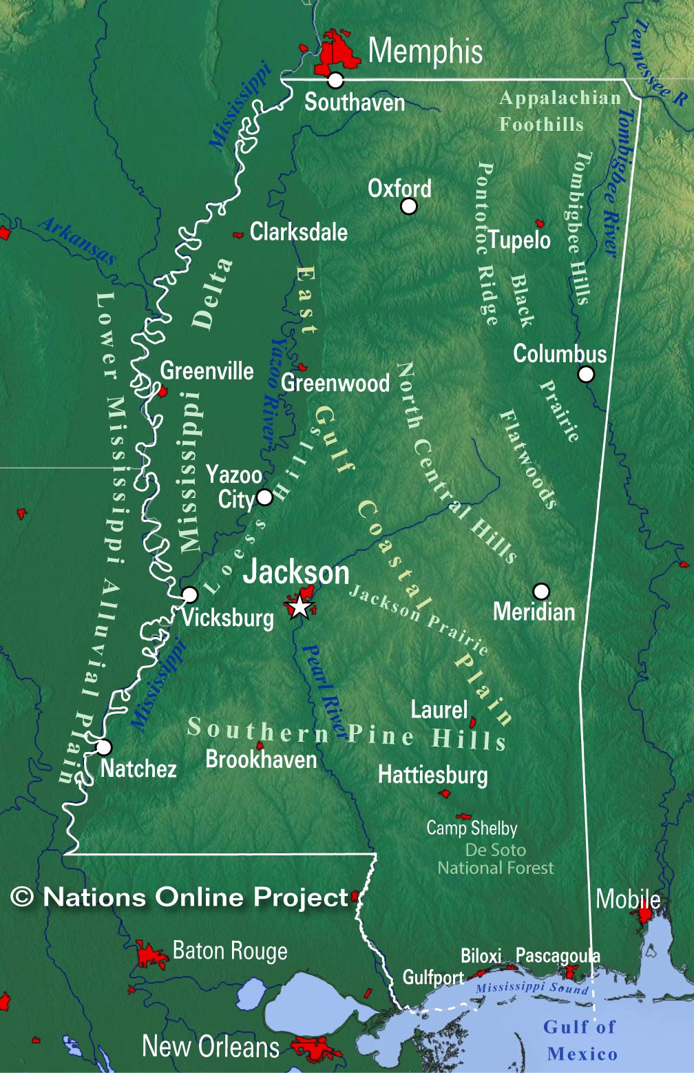
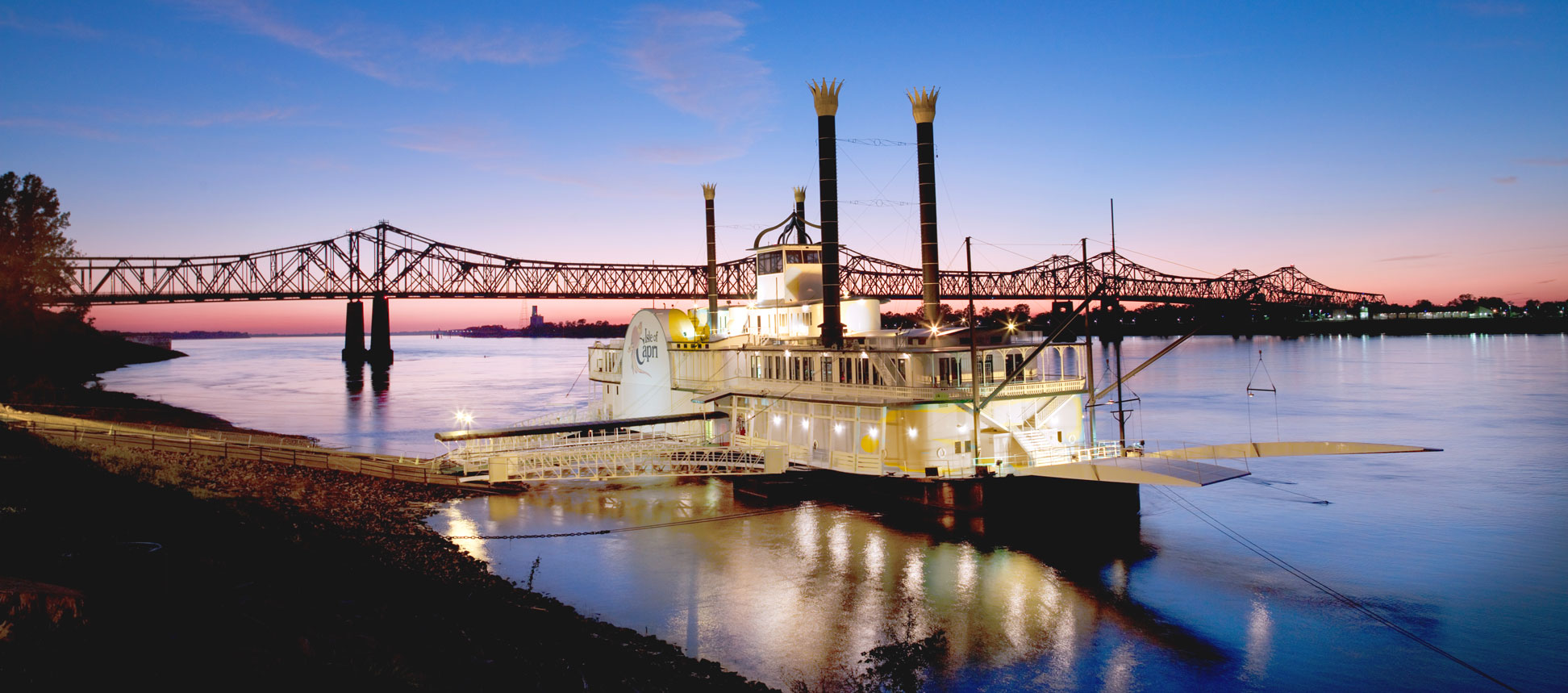
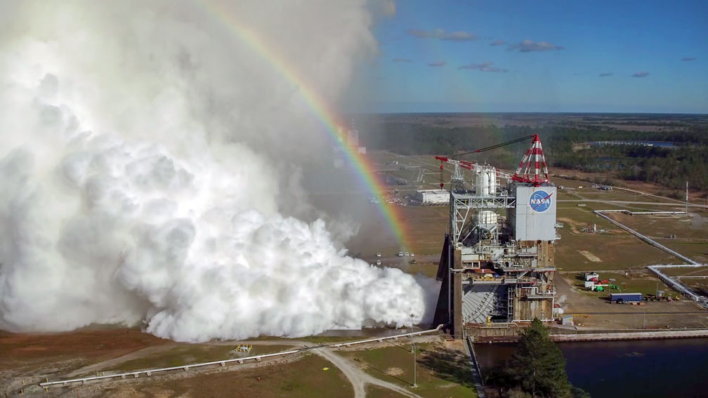
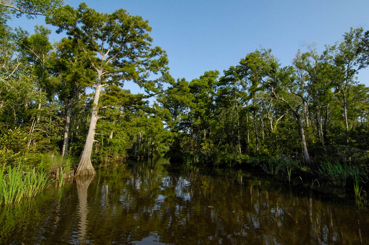
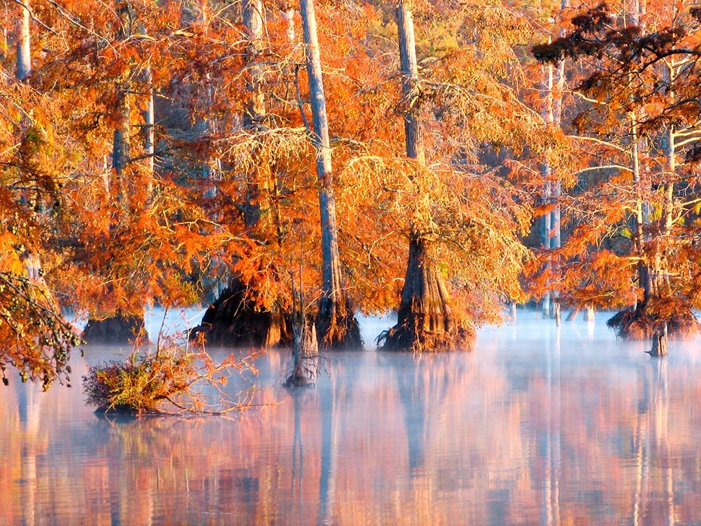
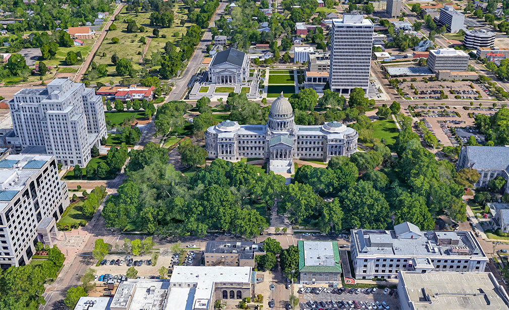
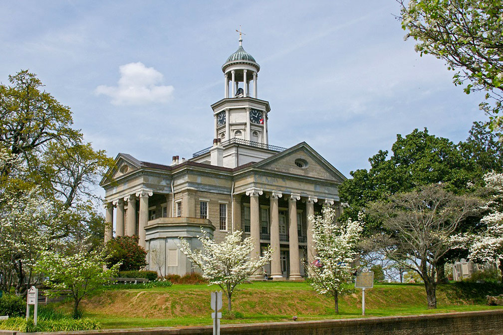
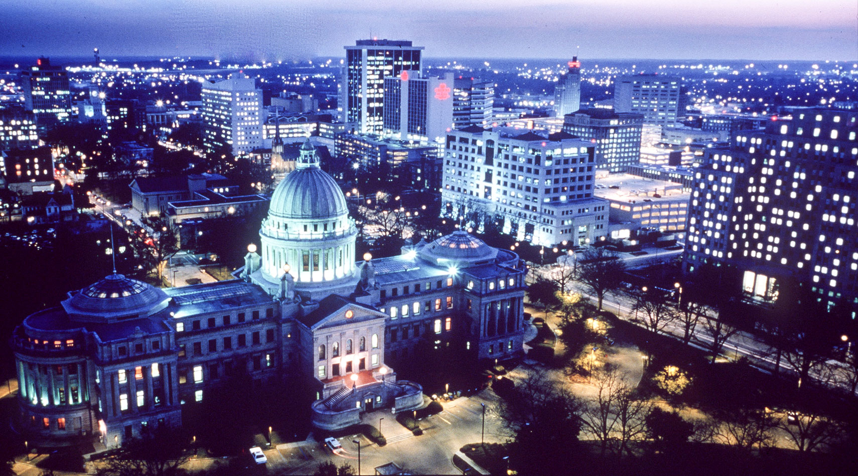
UTC −7/DST−6 Clock shows DST ![]() Where in the United States is Mississippi? Location map of Mississippi in the US. Mississippi is bordered to the north by the state of Tennessee, the Tennessee River defines a short section of the Mississippi/Alabama border at its north eastern corner, the remaining part of the state border is more or less a straight line. The line essentially cuts in half what was formerly the entire Mississippi Territory. The lower Mississippi River forms the border with Arkansas and most of the border with Louisiana in west, the Pearl River forms the southern section of the Mississippi/Louisiana border. Short history Inhabited by local natives for thousands of years, Mississippi became a French colony in the first half of the 18th century, it was ceded to Britain in 1763. Mississippi Territory was organized on 7 April 1798, from territory ceded by Georgia and South Carolina, it was later twice expanded to include disputed territory claimed by both the U.S. and Spain. The United States claimed the territory south of the 31st parallel as part of the Louisiana Purchase in 1803. All of the area of Mississippi except the part south of the 31st parallel was included in the original territory of the United States. On the 10th December 1817, the western half of the territory was admitted to the Union as the State of Mississippi (as the 20th state) and the eastern half became the Alabama Territory until its admittance to the Union as the State of Alabama on 14 December 1819. Area The state covers an area of 125,438 km² (48,432 sq mi) [1] making Mississippi about half the size of the United Kingdom. Compared with other US states, Mississippi is five and a half times larger as New Jersey, but it would fit into Texas five and a half times as well. The state lies entirely in the Central Lowland of the US, its flat landscape is crisscrossed by many rivers. Mississippi is located within two major regions in the United States: the Gulf Coastal Plain, the generally flat, broad, coastal region along the Gulf of Mexico, and the Mississippi Alluvial Plain, in the western portion of the state, known as the Mississippi Delta, and sometimes called the Yazoo-Mississippi Delta. In south east Mississippi has a 120 km (75 mi) long coastline at the Gulf of Mexico. The coastline features a number of large bays, including the Bay of Saint Louis, Biloxi Bay, and Pascagoula Bay. The urban metropolitan area along the coast is Gulfport–Biloxi–Pascagoula, a combined statistical area with an estimated population of 400,000. The Mississippi District of the Gulf Islands National Seashore features natural beaches, some historic sites, wildlife sanctuaries, the Mississippi Sound and the Gulf Islands, which are only accessible by boat. Mississippi main geographic regions ![]() Coniferous trees at Bluff Lake at the Noxubee National Wildlife Refuge, the woodland refuge in in Noxubee County offers native wildlife and migratory birds, fishing, hiking, and hunting. Image: Roger Smith 1. The Mississippi Delta in the eastern part of the state is not a delta but in reality a two hundred miles long alluvial plain created by regular flooding by the Mississippi and the Yazoo river. Before colonization the Delta was covered in hardwood forest, but European settlers developed it into one of the richest cotton-growing areas in the nation. 2. The Loess Bluffs or Loess Hills, in the eastern rim of the Delta are a narrow strip of hills and sharp bluffs along the lower Mississippi Valley, formed by windswept sand and clay deposits in the last ice age. 3. The North Central Hills (also known as the Red Clay Hills), the region is situated in central north of the state, the area got its name from the red color of its soil and the clay deposits there. The red clay soil supports only small farms. ![]() Stennis Space Center in Hancock County, Mississippi where NASA tests a new Space Launch System, NASA's new heavy-lift rocket, the Orion spacecraft. Image: NASA 5. To the south of the Appalachian Foothills are four distinctive landforms, the Tombigbee Hills, along the border with Alabama, the Pontotoc Ridge, a highland area along the Central Hills, the Black Prairie, a region with fertile black soil excellent for agriculture, and the Flatwoods, a low-lying narrow region with heavy clay soils. 6. Most of southern Mississippi lies in the gently rolling Southern Pine Hills (Piney Woods). Rivers ![]() The Old Warren County Courthouse in Vicksburg, Mississippi is now a Civil War Museum. Image: OzarksRazorback Largest Lakes Pickwick Lake, a reservoir at the Tennessee River, the lake is in three states Alabama, Mississippi, and Tennessee. The lake is the north end of the Tennessee-Tombigbee Waterway, which provides a water transportation route to the Gulf of Mexico. Grenada Lake, the reservoir at the Yalobusha River was constructed to help control flooding along the Yazoo River Basin. Sardis Lake, is a 400 km² reservoir at the Little Tallahatchie River Climate Mississippi's climate is subtropical humid, with long summers and short, mild winters. Highest point Highest elevation in the state is Woodall Mountain, a hill of 246 m (800 ft) in Tishomingo County in the northeast part of the state. Population ![]() Rendered image of the Mississippi State Capitol in Jackson. The Beaux Arts style building houses the Mississippi Legislature. Image: Google Busiest airports in the state are Jackson–Evers International Airport (IATA code: JAN) and Gulfport–Biloxi International Airport (IATA code: GPT). Cities and Towns in Mississippi The map shows the location of following cities and towns in Mississippi: Capital and largest city is Jackson (173,000) Gulfport (70,000), Southaven (50,000), Hattiesburg (47,000), Biloxi (45,000) Population figures in 2014 Other cities and towns in Mississippi: Aberdeen, Batesville, Belzoni, Brookhaven, Canton, Clarksdale, Cleveland, Collins, Columbia, Columbus, Corinth, Forest, Greenville, Greenwood, Grenada, Hazlehurst, Holly Springs, Indianola, Kosciusko, Laurel, Louisville, Magee, McComb, Meridian, Monticello, Natchez, New Albany, Oxford, Pascagoula, Philadelphia, Picayune, Senatobia, Starkville, Tupelo, Vicksburg, Water Valley, Waynesboro, and Yazoo City. ![]() Jackson Skyline with "New" Mississippi State Capitol in foreground. The building houses the Mississippi Legislature. Image: Visit Mississippi A detailed map showing the US state of Mississippi with boundaries, the location of the state capital Jackson, major cities and populated places, rivers and lakes, interstate highways, principal highways, and railroads. ![]() |
|
|
![]() Reference Map of Mississippi. Map is based on a state map of The National Atlas of the USA. |
More about Mississippi and the United States: Cities -- Information about, and searchable maps of: ![]() U.S. States: ![]() ![]() ![]() ![]() ![]() ![]() Country: ![]() Reference Map of Mainland USA. ![]() ![]() ![]() ![]() ![]() Continent: ![]() ![]() |
Jackson Weather Conditions JACKSON WEATHER |
Explore more:
Related Consumer Information:
|
One World - Nations Online .:. let's care for this planet Promote that every nation assumes responsibility for our world. Nations Online Project is made to improve cross-cultural understanding and global awareness. More signal - less NOISE |
Site Map
| Information Sources | Disclaimer | Contact: ">[email protected] | Copyright © 1998-2019 :: nationsonline.org![]() ![]() ![]() ![]() ![]() ![]() ![]() ![]() ![]() |