Nations Online
All Countries in the World
|
One Planet Nations Online All Countries in the World | |
Home  |
___ Searchable Map and Satellite View of the City of Jacksonville, Florida
|
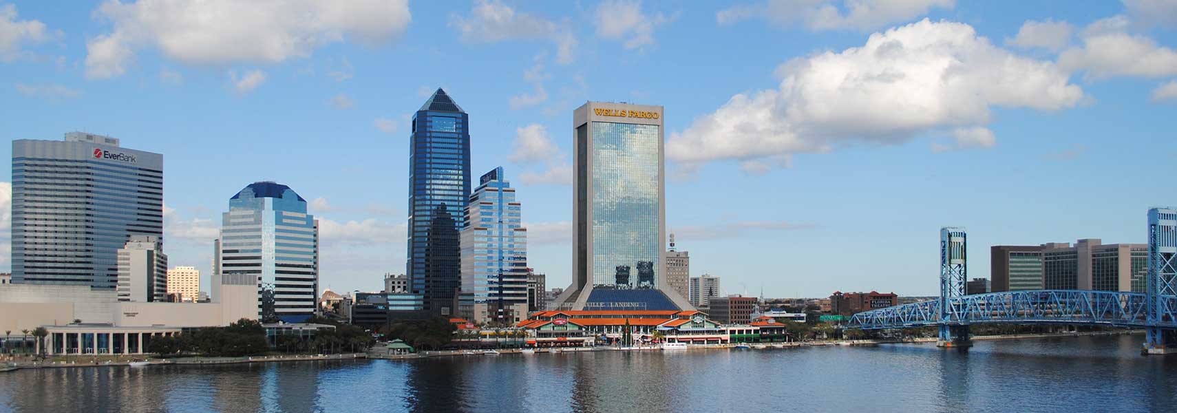
 Northbank skyline with EverBank Center, Jacksonville Landing in front of SunTrust Tower and Bank of America Tower, Wells Fargo Center and Main Street Bridge in Jacksonville, Florida. Image: Excel23 |
About Jacksonville |
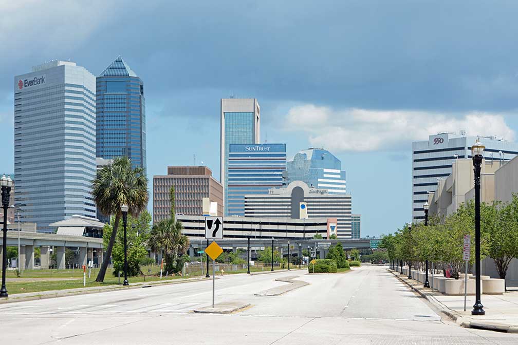
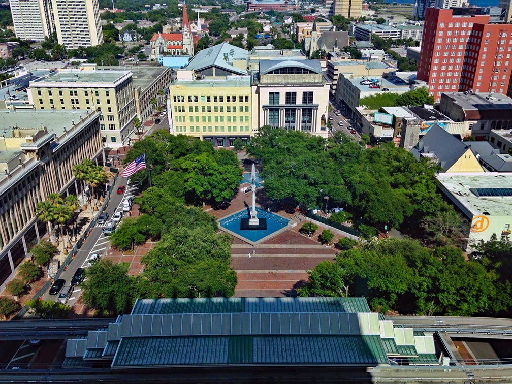
 The satellite view shows Jacksonville, most populous city in the State of Florida in the The satellite view shows Jacksonville, most populous city in the State of Florida in the  Downtown Jacksonville with EverBank Center, Wells Fargo Center, SunTrust Tower, Omni Jacksonville Hotel, Bank of America Tower, and 550 Water Street. Image: Bubba73 Today Jacksonville is preferred called JAX. The 12th most populous city in the United States is seat of Duval County, it has a population of about 880,600 inhabitants (in 2016), 1.44 million people live in Jacksonville's metropolitan area. The city's economy is based on industry, banking, insurance, logistics, healthcare and tourism. The deep-water Port of Jacksonville (JAXPORT) with its three separate cargo facilities is the second largest handler of vehicles in the United States. The third largest military presence in the US contributes also a great deal to the city's economic activity. Jacksonville points of interest:  Hemming Park in Downtown Jacksonville with St. James Building (Jacksonville's City Hall) to the left. The oldest 'park' in the city is today more a brick-paved square located in the heart of the city's government center. Image: Mathew105601 Museums: Cummer Museum of Art and Gardens (art museum with a collection of European and American paintings and a 20th century garden design), Museum Of Contemporary Art - MOCA (the museum houses one of the largest collections of modern and contemporary art in the Southeast), Alexander Brest Museum and Gallery (glass, porcelains, ivory, Cloisonnés), Museum of Science & History (specialized in science and local history exhibits), Jacksonville Fire Museum (all you want to know about the Jacksonville Fire and Rescue Department) Theater: Theatre Jacksonville (one of the oldest continually producing community theaters in the United States founded in 1919), Ritz Theatre (African-American oriented theater in the LaVilla neighborhood) Shopping: Jacksonville Landing (complex for shopping, dining, clubbing, it also has a historic museum) Churches: Basilica of the Immaculate Conception (historic Catholic church, rebuilt after the Great Fire of 1901), Riverside Baptist Church (historic Baptist church from 1926) Parks: Jacksonville has the largest urban park system in the US. Confederate Park (public park on the southern bounds of the historic neighborhood of Springfield), Jacksonville Zoo and Gardens (zoo and park at the mouth of the Trout River), Hanna Park (public beach and city park), Metropolitan Park (urban waterfront park), Just zoom in (+) to see Jacksonville Landing, the business, cultural and entertainment center in downtown Jacksonville. The page shows a city map of Jacksonville with expressways, main roads and streets. Zoom out to see the location of Jacksonville International Airport (IATA code: JAX), about 9 mi (14 km) north of the city. To find a location use the form below. To view just the map, click on the "Map" button. |
|
| To find a location type: street or place, city, optional: state, country. |
Local Time Jacksonville:
Saturday-April-20 2024 12:14
Standard time zone Eastern (EST): UTC/GMT -5 hoursDaylight Saving Time (EDT) in use from the second Sunday in March, ends on the first Sunday in November; time zone offset: UTC/GMT -4 hours |
One World - Nations Online .:. let's care for this planet Promote that every nation assumes responsibility for our world. Nations Online Project is made to improve cross-cultural understanding and global awareness. More signal - less NOISE |
| Site Map
| Information Sources | Disclaimer | Copyright © 1998-2023 :: nationsonline.org |