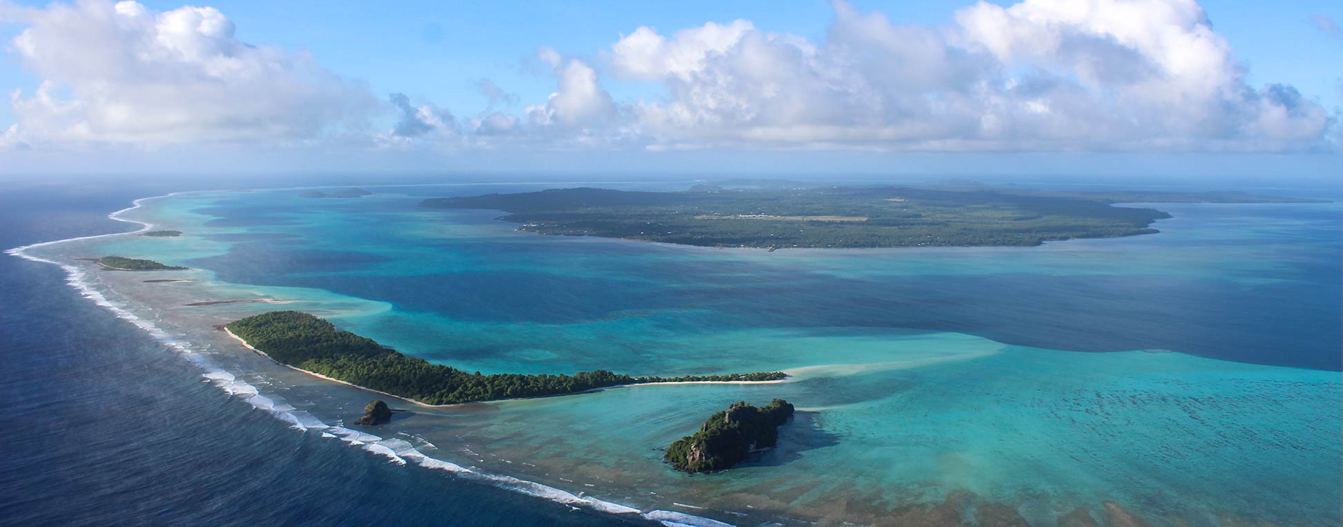
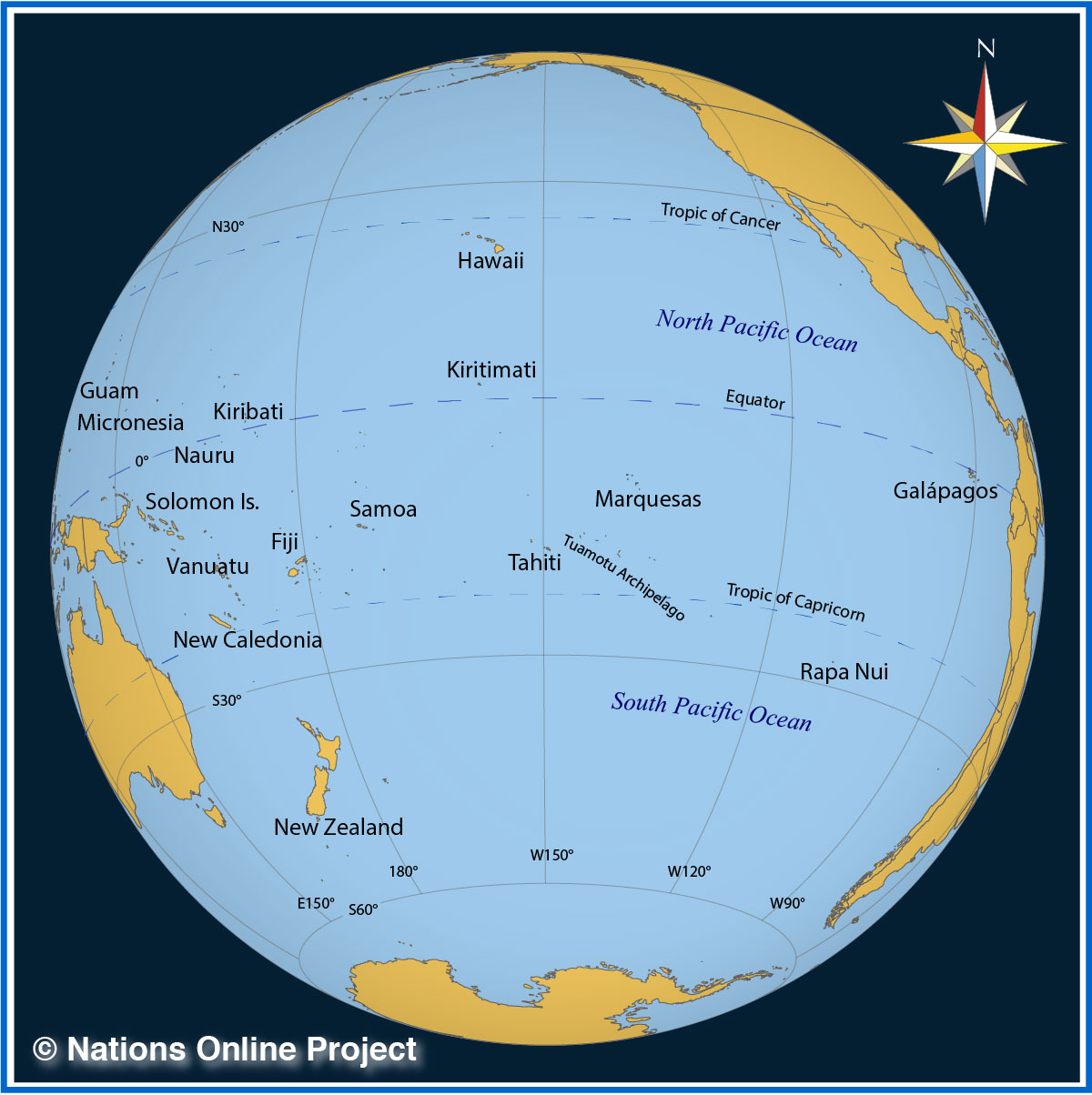
 Oceania, the ocean continent. The vast expanse of water between Asia and the Americas, with an area of 100 million square kilometers, is home to countless archipelagos and more than 10,000 islands. Due to rising sea levels and coastal erosion, many low-lying reef islands are threatened to be submerged.
Some Facts about Australia and Oceania
Oceania
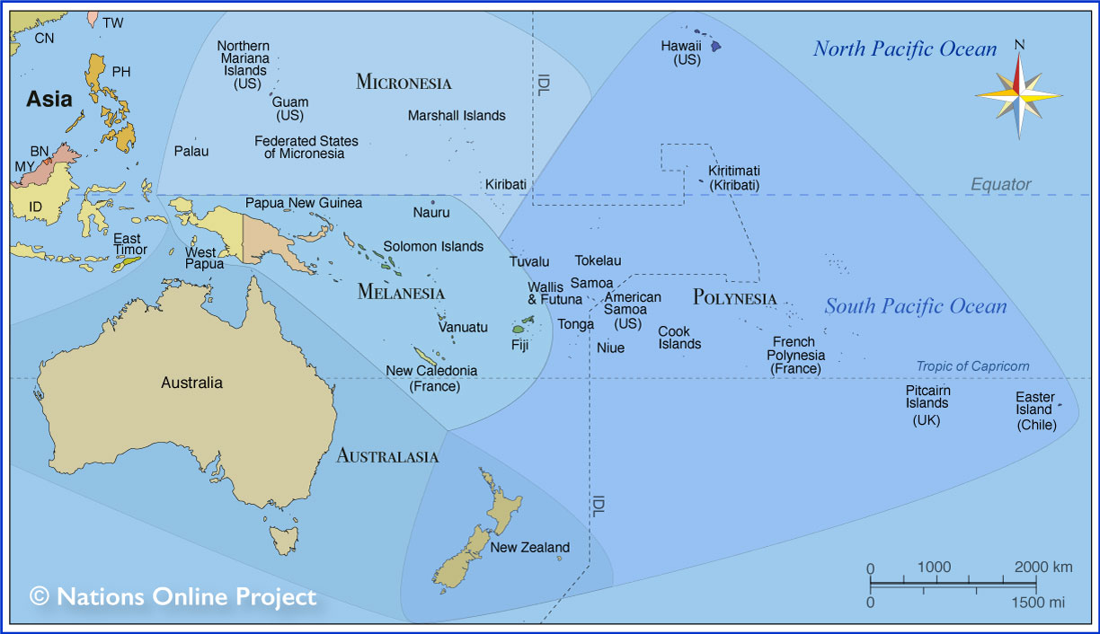
There are a variety of definitions of Oceania. The most plausible is to refer to the vast regions, island territories and adjacent seas in the Pacific Ocean, east of Maritime Southeast Asia and Australia and west of South America. (see the map below).
How many countries are there in Oceania?
In the vast area of Oceania, there are 14 independent countries and several dependent territories (see the
list below).
Australasia
The region consisting of Australia, New Zealand, New Guinea, and neighboring islands in the Pacific Ocean is sometimes referred to as Australasia.
Area
Oceania covers an area of approximately 100 million square kilometers; this is about one-fifth of Earth's surface area.
The water continent includes more than 10,000 islands. With a total
land area (excluding Australia but including Papua New Guinea and New Zealand) of approximately 822,800 km² (317,700 sq mi), it is slightly larger than
Turkey or somewhat smaller than half of
Alaska.
By far the largest country in Oceania in terms of area is Australia with 7,692,024 km², followed by
Papua New Guinea with 462,840 km² and
New Zealand with 270,467 km².
The smallest independent country in Oceania is the island nation of
Nauru, which covers an area of 21 km² (8 sq mi).
Australia
Australia is the smallest of the seven continents on Earth.
The first people to discover and settle Australia about 50,000 years ago were the ancestors of the Aboriginal Australians. The ancestors of today's indigenous Australians migrated by sea from Southeast Asia during the Pleistocene.
The discovery by the Europeans was a long time coming. It was not until 1606 that Dutch and Spanish explorers landed on the continent. In 1770 James Cook, a colorful figure in British colonial history, was on a quest to find the predicted Great South Land. He came across a vast stretch of unknown land when he arrived on the east coast of Australia, and in the usual blunt British fashion, he claimed the territory for the British Crown.
Between 1788 and 1868, the British used the continent as a penal colony.
Australia became independent from the United Kingdom in several steps, and it was not until the 3rd of March 1986 that Australia gained full independence from Great Britain.
Area of Australia
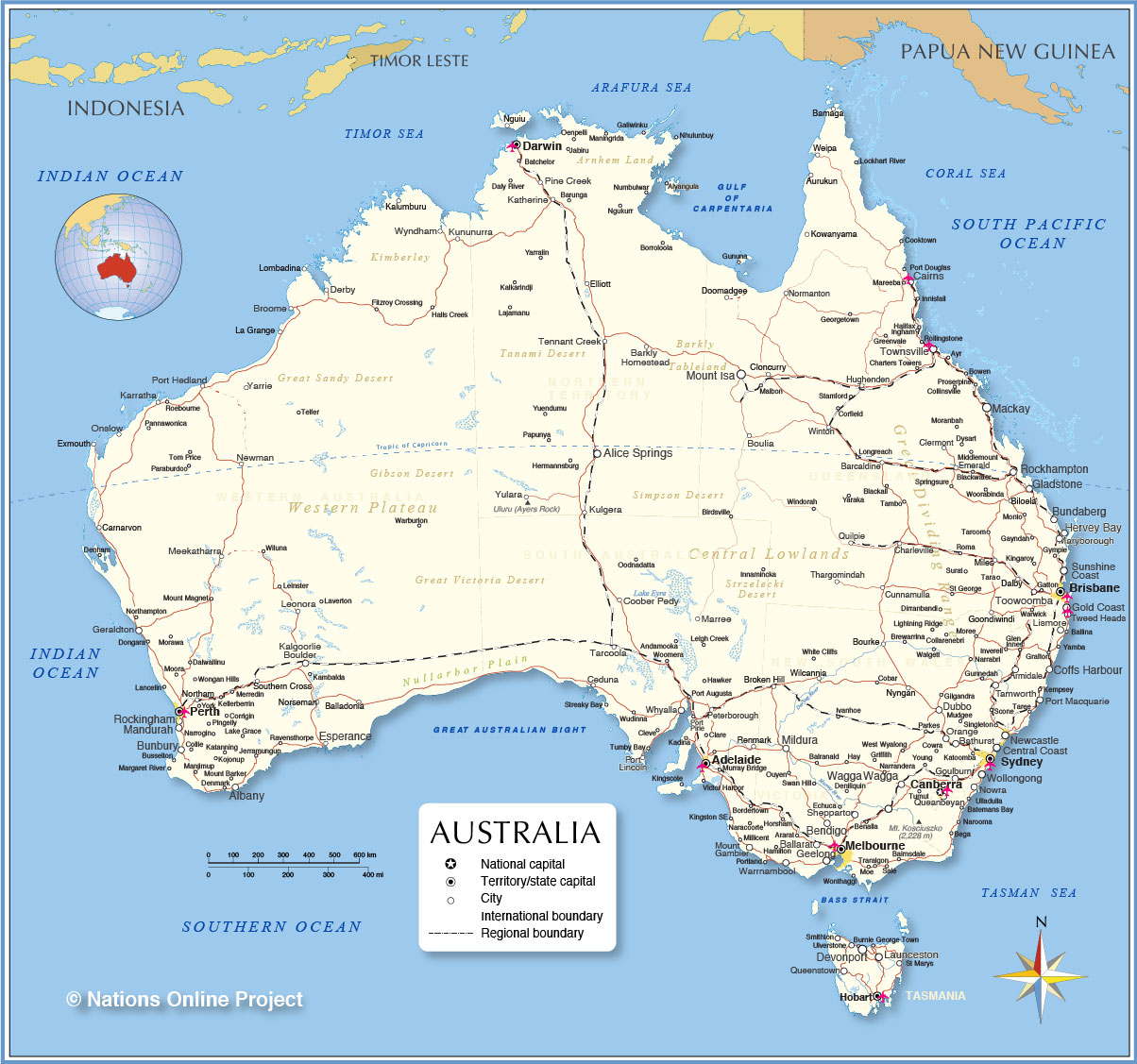
Including the adjacent island of Tasmania, Australia covers an
area of 7,692,024 km² (2,969,907 sq mi), which corresponds to about 5.6% of Earth's landmass. In comparison, Australia is slightly smaller than the contiguous United States. One country,
Australia, occupies the continent.
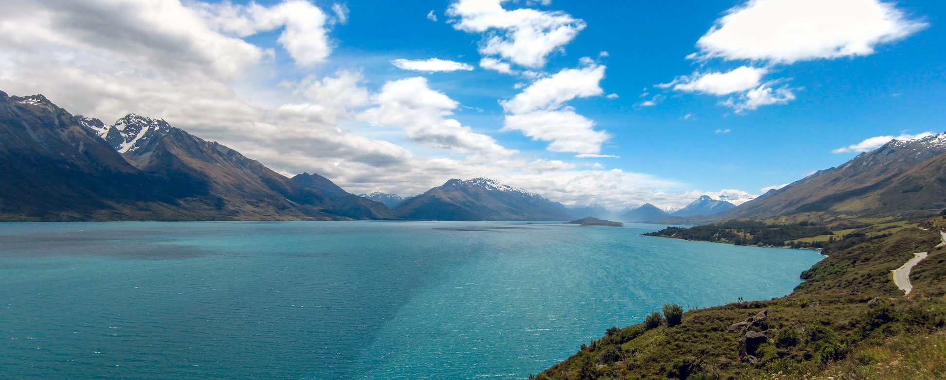
Northwest end of Lake Wakatipu, a long, narrow, roughly north-south lake in the South Island of New Zealand. The Humboldt mountain range on the left.
Image: Avenue
More about Oceania
Oceania's major Regions and Subregions
The island world of Oceania is divided into:
- Australia, a country and Earth's smallest continent.
- Zealandia, a microcontinent that includes the island country of New Zealand.
- New Guinea, the second largest island on the planet (after Greenland)
- The Pacific Islands, thousands of islands in the Pacific Ocean divided into Melanesia, Micronesia, and Polynesia.
Population
An estimated 43.5 million people live in Oceania/Australia, about 0.54 % of the
world's
population (7.8 billion).
The most populous countries in Oceania are Australia,
with 25.9 million people;
Papua New Guinea, with 9 million; and New Zealand, with 4.9 million residents (in 2022).
(Source: UN World Population Prospects)
Largest Metropolitan Areas
The largest cities in Oceania by population are
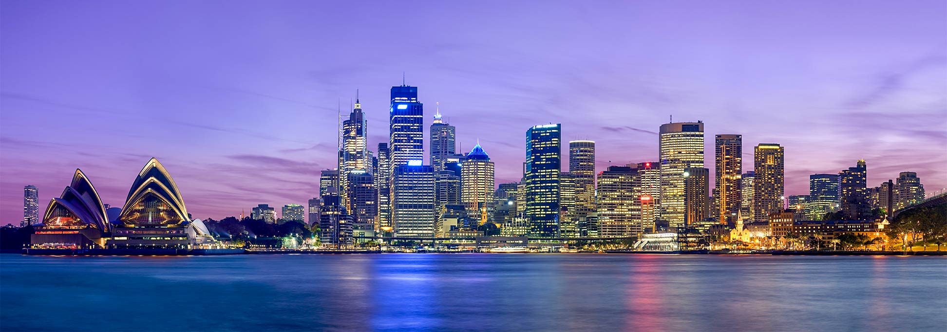
Sydney (pop. 5.2 million),
Melbourne (pop. 4.9 million),
Brisbane (pop. 2.5 million),
Perth (pop. 2.1 million), and
Auckland (pop. 1.4 million); except Auckland, all cities are located in Australia.
Major Physiographic Features of Oceania
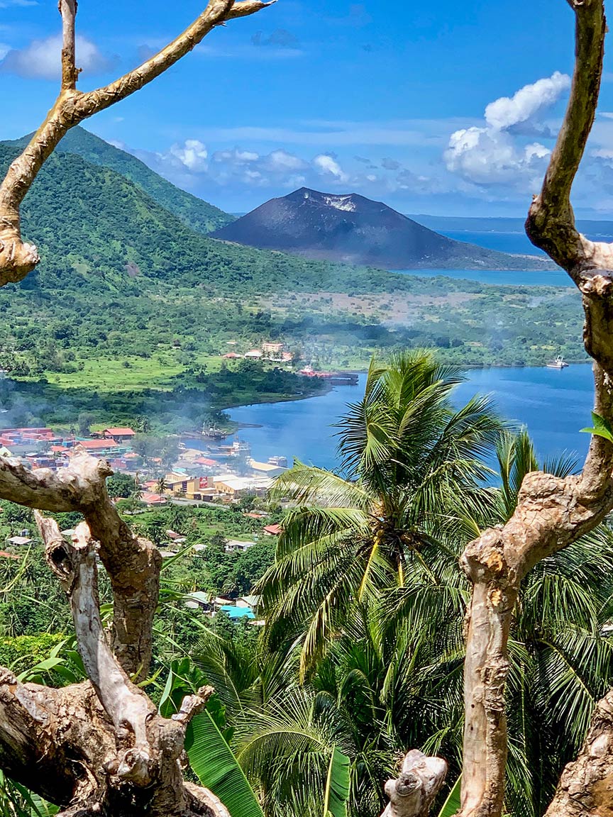 Rabaul township with Rabaul volcano (in the background) on the tip of the Gazelle Peninsula on the island of East New Britain, Papua New Guinea.
Image: JulesR
Major physiographic regions of Australia/Oceania include:
The southwestern part of the Pacific Ring of Fire, the Great Barrier Reef, Australia's Outback, the Great Dividing Range in Australia, the North Island Volcanic Plateau and the Southern Alps in New Zealand, the rain forest covered New Guinea Highlands and the coral islands of Micronesia and Polynesia.
Mountains
Highest Point
Puncak Jaya or Carstensz Pyramid in the Papua Province of Indonesia on the island of
New Guinea is at 4,884 m (16,024 ft), the highest peak in Oceania.
Mauna Kea on the island of Hawaii is at 4,207.3 m (13,803 ft) above sea level Oceania's second-highest peak. Mauna Kea is also the highest mountain on Earth. Measured from its base on the ocean floor to its summit, it rises over 10,210 m (33,500 ft).
Mount Kosciuszko in New South Wales is the highest mountain in Australia at 2,228 m (7,310 ft).
The
Great Dividing Range, also known as the Eastern Highlands, is a 3,500 km long mountain range along the eastern coast of Australia. The highest peak is Mount Kosciuszko at 2,228 m (7,310 ft).
Puncak Jaya (4,884 m) is the highest mountain in the
Maoke Mountains (formerly known as the Snow Mountains), part of the
New Guinea Highlands (Central Cordillera) on New Guinea. Puncak Jaya, with a prominence of 4,884 m, is also the highest mountain peak of an island on Earth.
Largest Lake:
Theoretically, the largest lake in Oceania/Australia is
Lake Eyre (officially Kati Thanda–Lake Eyre) in South Australia, a seasonal lake with a surface area between 8,000 and 9500 km².
Longest River:
The longest single river in Oceania is the
Murray at 2,508 km.
[3] For a long distance, the river forms the border between the Australian states of Victoria and New South Wales.
Deserts
About 35% of the Australian continent is arid and inhospitable. Most of the country's interior, known as the
Outback, receives so little rain that it is practically a desert.
There are several named deserts in Australia; the largest by area is the
Great Victoria Desert in Western Australia and South Australia. Other deserts are the Great Sandy Desert, the Tanami Desert, the Simpson and the Gibson deserts, and the Strzelecki Desert.
Languages of Oceania
Many different languages were spoken in Oceania before the arrival of the Europeans. The major languages spoken in Oceania today are based on English, some French-based creole, some Japanese, Aboriginal and Torres Strait Islander languages, Melanesian Pidgin, Hawaiian, Polynesian languages, Tahitian, and Maori.
 Languages of Oceania
 Tourists on camels - the popular sunset camel ride at Cable Beach, 7 km (4 mi) west of Broome in Western Australia.
Keywords: countries of Oceania, the population of Oceania, destination Oceania,
travel Oceania, capitals Oceania, Australia, Zealandia, Melanesia, Micronesia, Polynesia

