Advertising

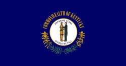
Kentucky Flag detail
Home Earth Continents The Americas USA Country Profile US State Capitals Kentucky Map

US States Maps Index
World Maps Index

Map of Kentucky (KY)


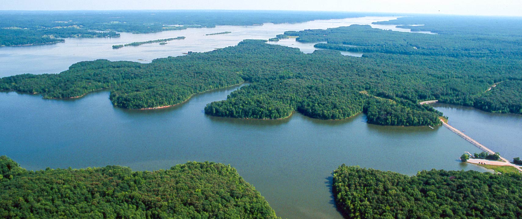
Aerial photography of the Land Between the Lakes in Kentucky
Land Between the Lakes, the national recreation area between Lake Barkley and Kentucky Lake in the southwest of Kentucky.
Image: Land Between the Lakes KY/TN

Kentucky Flag
Kentucky State Flag
 

About Kentucky


Location map of Kentucky state USA
Where in the United States is Kentucky? Location map of Kentucky in the US.
 
Kentucky, officially the Commonwealth of Kentucky, is one of the 50 US states located in the east south-central region along the west side of the Appalachian Mountains, an area known as the Upland South.

Kentucky borders Virginia to the southeast, and Tennessee to the south. The Ohio River forms a natural border with Illinois, Indiana, and Ohio. The Big Sandy and the Tug Fork Rivers define the state line with West Virginia in the east; the Mississippi River creates the border to Missouri in the southwest.

For at least 5,000 years, the region was inhabited by Native American people. About 4,000 years ago, these natives shifted from a hunter-gatherer society to an agricultural-based economy by cultivating numerous species of wild plants. Native groups known to have lived in Kentucky were Cherokee, Chickasaw, Delaware (Lenape), and Shawnee.

 
Kentucky State Map
Reference Map of Kentucky
General Map of Kentucky, United States.

The detailed map shows the US state of Kentucky with boundaries, the location of the state capital Frankfort, major cities and populated places, rivers and lakes, interstate highways, principal highways, railroads and airports.

You are free to use the above map for educational and similar purposes; if you publish it online or in print, you need to credit Nations Online Project as the source.

 
More about Kentucky State


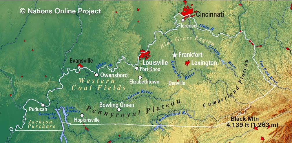
Kentucky Topographic Regions Map Topographic Map of Kentucky shows Kentucky's five major regions: the Cumberland Plateau, the Bluegrass region, the Pennyroyal Plateau (or Mississippian Plateau), the Western Coal Fields, and the Jackson Purchase. (Click the map to enlarge)
 
The region was explored by Daniel Boone, a frontiersman and one of the first folk heroes of the United States.

European settlement began in the mid 18th century.
First settlements west of the Appalachian Mountains were founded by settlers migrating primarily from Virginia, North Carolina, and Pennsylvania.

The region of what is today Kentucky (then part of Virginia), was ceded by the French to the British in 1763 and then to the US in 1783 by the Treaty of Paris (which ended the American Revolution).

Kentucky was admitted to the Union together with Vermont to the existing 13 states on 1st June 1792 as the 15th state.

 
Area


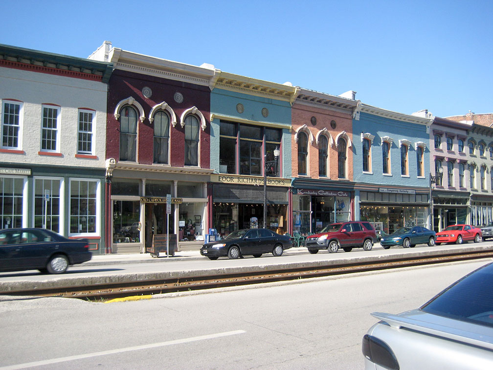
A street in Downtown Frankfort, Kentucky
Downtown Frankfort, since 1792 the capital of the Commonwealth of Kentucky. The city is also the seat of Franklin County.
Image: kartografia

 
The Commonwealth of Kentucky occupies an area of 104,659 km² (40,409 sq mi), [1] making it slightly larger than Iceland (103,000 km²) or somewhat smaller than Guatemala (108,889 km²).
Compared with other US states, Kentucky would fit into Texas almost seven times but is nearly five times the size of New Jersey.


Kentucky Geography

Kentucky's five major regions are:
I. The Cumberland Plateau in the southeast is a deeply dissected high plain; it is the southern section of the Appalachian Mountains, also known as the Appalachian Plateau.


II. The Bluegrass region in the northeastern part of the state is centered around Lexington, a farmland savanna of extensive grasslands, oak trees, country roads, and world-renowned horse farms.


III. The landscape of the Pennyroyal Plateau (aka Mississippi Plateau) offers rolling hills, caves, and karst topography.


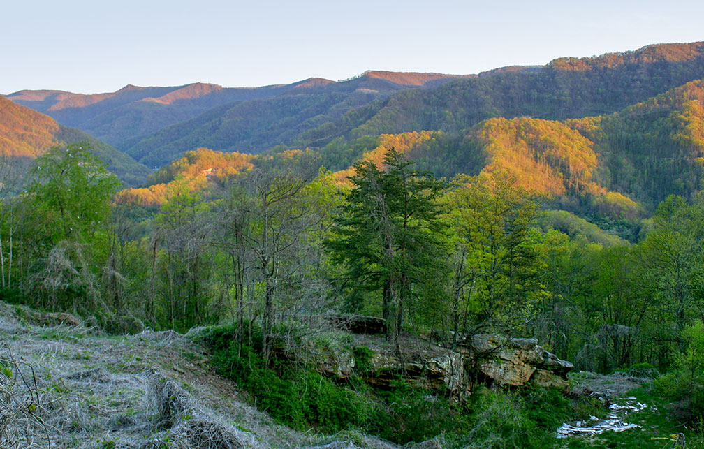
Kentucky side of Black Mountain
Kentucky's highest point, the Black Mountain, offers a rare view of the Appalachian coalfields with no visible mountaintop removal mining.
Image: Matt Wasson
 
IV. The rugged terrain of the Western Coal Fields is the region of coal mining in Kentucky since 1750. In 2010 there were still more than 400 operating coal mines in the state.


V. The Jackson Purchase in the southwestern corner of Kentucky near Missouri was land purchased from the Chickasaw Indians in 1818.


Rivers and Lakes
Major rivers are the Cumberland River, the Kentucky River, the Licking River, and the Green River.

Major lakes in the state are Lake Barkley, Lake Cumberland, and the Kentucky Lake freshwater reservoir, a major navigable dammed lake along the Tennessee River in Kentucky and Tennessee.

 
More Kentucky Facts:


Highest Elevation Point
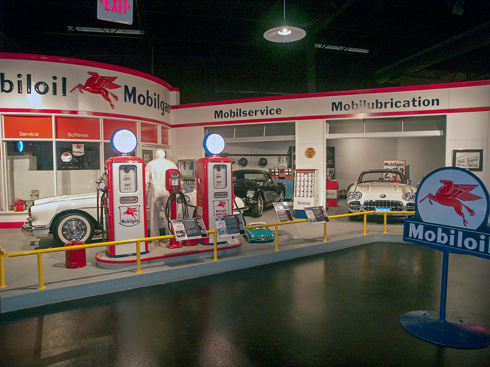
National Corvette Museum in Bowling Green, Kentucky
Inside the National Corvette Museum in Bowling Green. The Museum showcases the Chevrolet Corvette, the American dream car that has been in production since 1953. The design work for the car "Project Opel" began as a secret project in late 1951.
Image: David Ellis 

The state's highest elevation point is on Black Mountain at 1,263 m (4,145 ft), located in Harlan County near the Virginia border.

Nickname
The state's nickname is Bluegrass State, the nickname is based on Kentucky bluegrass.

Horses
The state is home to the Kentucky Derby, a horse race, and "The Greatest Two Minutes in Sports." The Kentucky Derby is usually held on the first Saturday in May.

Thoroughbred horses and beef cattle are Kentucky's most important livestock products.


Whiskey
Bourbon whiskey is a type of American whiskey, a white oak barrels-aged brandy made mainly from corn. Although Bourbon can be produced anywhere in the United States, it has strong ties to the American South, and especially Kentucky.
According to the Kentucky Distillers’ Association, Kentucky produces 95% of the world's supply of bourbon whiskey. [3]


World Heritage Site


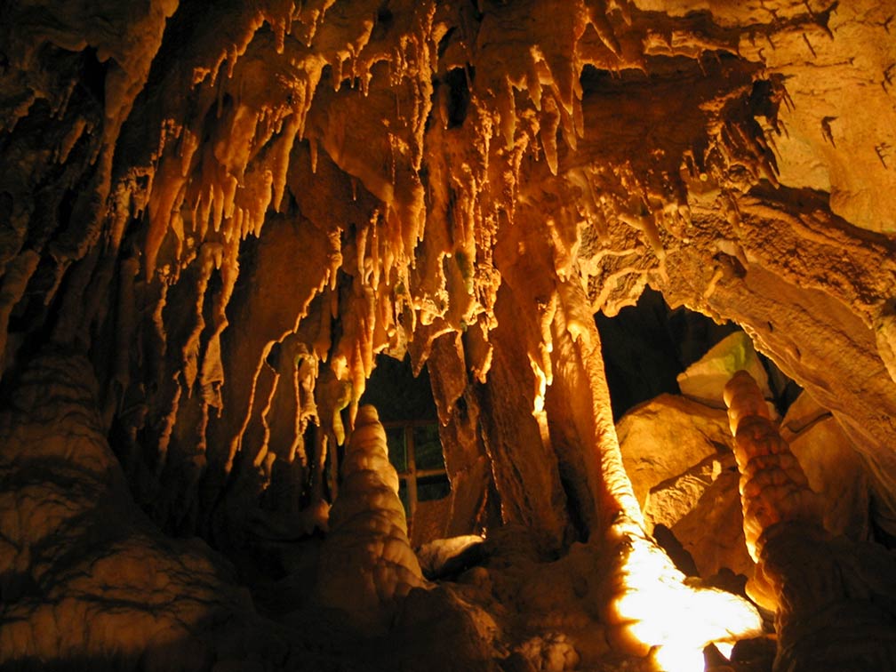
Within Mammoth Cave in Kentucky
Stalactites and stalagmites in Mammoth Cave in the Mammoth Cave National Park of Kentucky. It is the world's longest known cave system with chambers and subterranean passageways, more than 600 km (400 mi) are explored [2]. The Mammoth Cave National Park is a UNESCO World Heritage Site.
Image: jshyun 
Kentucky has one amazing UNESCO World Heritage Site.
The Mammoth Cave National Park preserves a part of the Green River valley and hilly country of south-central Kentucky and the Mammoth Cave -- the longest known cave system in the world.

The cave system is a network of natural caves, vertical shafts, and extremely large horizontal underground passageways with an unbelievable length of more than 650 km (405 mi).

The limestone cave system is an unrivaled example of a number of stages of Earth's evolutionary history with almost every type of cave formation known, and it contains the most abundant known cave-dwelling wildlife.


The Mammoth Cave National Park is since 1981 a UNESCO World Heritage Site.

Mammoth Cave National Park - U.S. National Park Service (https://www.nps.gov/maca/)

 
Population


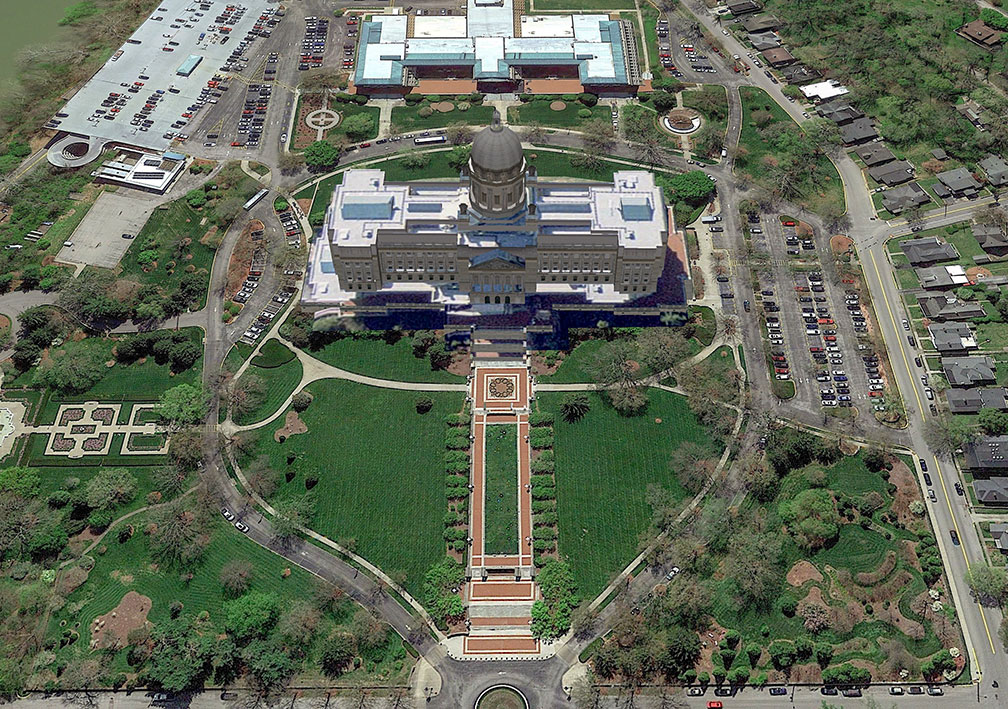
Kentucky State Capitol in Frankfort, Kentucky
Rendered image of Kentucky State Capitol in Frankfort. The Beaux-Arts style building houses the three branches (executive, legislative, judicial) of the state government of the Commonwealth of Kentucky.
Image: Google Earth
 
Kentucky has a population of 4.46 million people (2019 est.), [4] the capital is Frankfort, the largest city is Louisville, the largest urban area is the Louisville metropolitan area.


Race and Ethnic groups
The population of Kentucky is composed of White alone 84.3%, African American 8.4%, Hispanic or Latino 3.8%, Asian 1.6%, and Native American 0.3%. [5]


The busiest airports in the state are Cincinnati/Northern Kentucky International Airport (IATA code: CVG), and Louisville International Airport (Standiford Field; IATA code: SDF).


Cities and Towns in Kentucky

The map shows the location of following cities and towns in Kentucky:

Major cities are Louisville, Lexington, Bowling Green, Covington, Hopkinsville, Paducah, and Frankfort (state capital).

Other cities and towns in Kentucky

Ashland, Bardstown, Berea, Campbellsville, Corbin, Covington, Cynthiana, Danville, Elizabethtown, Florence, Fulton, Glasgow, Harlan, Harrodsburg, Hazard, Henderson, Hopkinsville, Independence, Jackson, Jenkins, La Grange, Lebanon, Leitchfield, London, Madisonville, Marion, Mayfield, Maysville, Middlesboro, Morehead, Mount Sterling, Mount Vernon, Owensboro, Paintsville, Paris, Pikeville, Pleasure Ridge Park, Princeton, Radcliff, Richmond, Russellville, Scottsville, and Somerset.
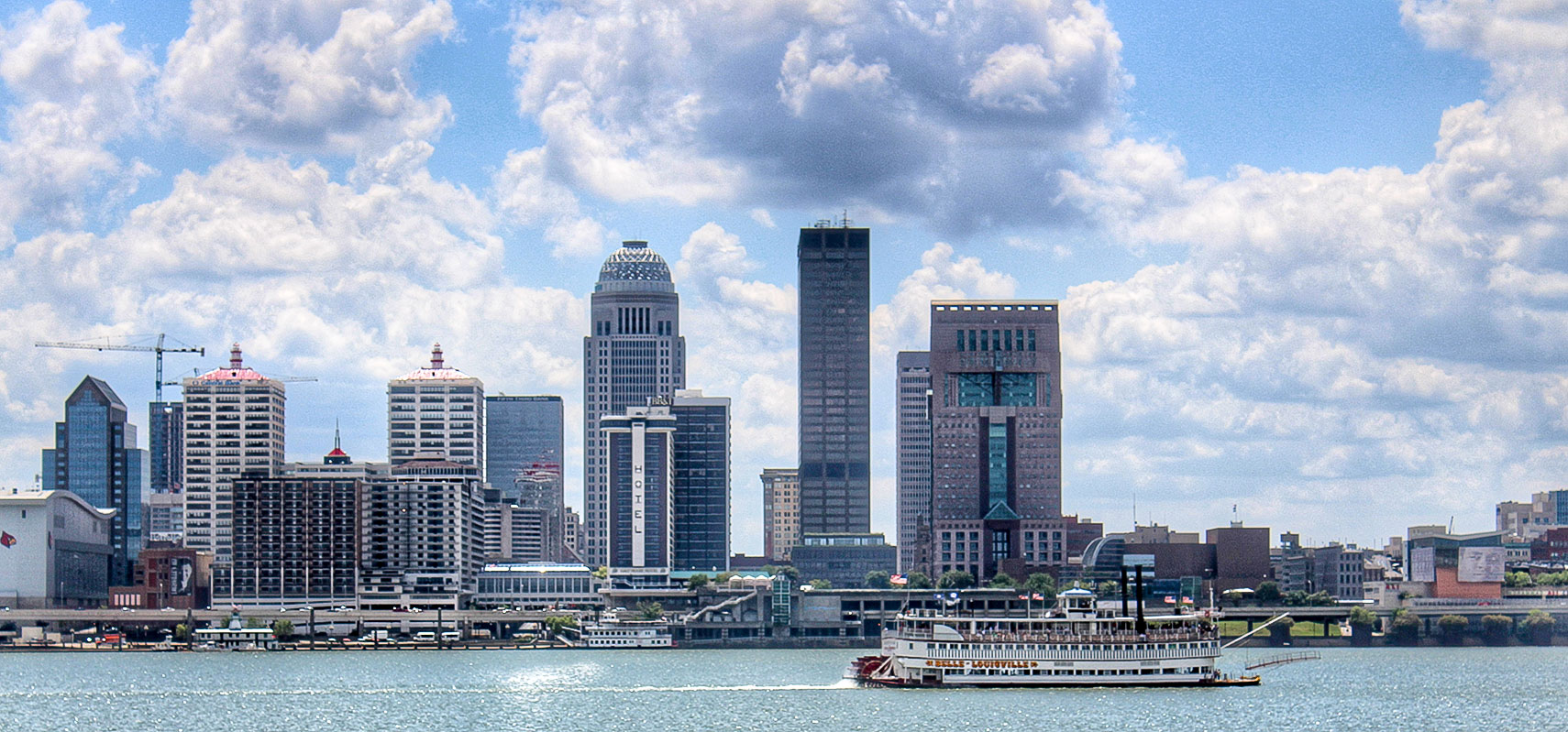
Downtown Louisville at Ohio River with the Belle of Louisville
Downtown Louisville at Ohio River with the Belle of Louisville, a paddle steamer owned and operated by the city. Louisville is the largest city in the Commonwealth, founded in 1778.
Image: Jonathan Parrish

Weather Conditions Frankfort:

FRANKFORT WEATHER


Advertisements:


Maps of the 50 U.S. States
Alabama | Alaska | Arizona | Arkansas | California | Colorado | Connecticut | Delaware | Florida | Georgia | Hawaii | Idaho | Illinois | Indiana | Iowa | Kansas | Kentucky | Louisiana | Maine | Maryland | Massachusetts | Michigan | Minnesota | Mississippi | Missouri | Montana | Nebraska | Nevada | New Hampshire | New Jersey | New Mexico | New York | North Carolina | North DakotaOhio | Oklahoma | Oregon | Pennsylvania | Rhode Island | South Carolina | South Dakota | Tennessee | Texas | Utah | Vermont | Virginia | Washington | West Virginia | Wisconsin | Wyoming

20 Most Populous U.S. Cities (in 2018):
1. New York City 2. Los Angeles 3. Chicago 4. Houston 5. Phoenix 6. Philadelphia 7. San Antonio 8. San Diego 9. Dallas 10. San Jose 11. Austin 12. Jacksonville 13. Fort Worth 14. Columbus 15. San Francisco 16. Charlotte 17. Indianapolis 18. Seattle, 19. Denver, 20. Washington D.C.

Other Major U.S. Cities:
Albany, Anchorage, Annapolis, Atlanta, Atlantic City, Augusta, Baltimore, Baton Rouge, Bismarck, Boise, Boston, Carson City, Charleston, WV, Cheyenne, Cincinnati, Cleveland, Columbia, Concord, Des Moines, Detroit, Dover, DE, El Paso, Frankfort, Harrisburg, Hartford, Helena, Honolulu, Jackson, Jefferson City, Juneau, Kansas City, Lansing, Las Vegas, Lincoln, Little Rock, Long Beach, Madison, Memphis, Miami, Milwaukee, Minneapolis, Montgomery, Montpelier, Nashville, New Orleans, Norfolk, Oklahoma City, Olympia, Orlando, Pierre, Pittsburgh, Portland, Providence, Richmond, VA, Raleigh, Sacramento, St. Louis, St. Paul, Salem (OR), Salt Lake City, Santa Fe, Springfield, Tallahassee, Tampa, Topeka, Trenton, Tucson