Population
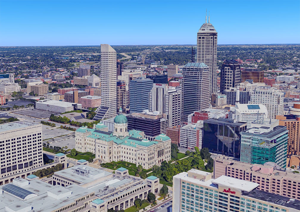
 Rendered image of downtown Indianapolis with Indiana Statehouse in the center. Indiana's primate city is the state capital since 1st January 1825, when the seat of state government was moved from Corydon to Indianapolis.
The Indiana Statehouse houses the executive, legislative, and judicial branches of the state government.
Image: Google
For its size, Indiana has a massive
population, 6.73 million people (2019 est, US rank 17)
[2] live in "
The Hoosier State" (Indiana's nickname).
Located in the center of the state is
Indianapolis, the capital and largest city with a population of 876,000 people.
Other major cities are Fort Wayne (270,400), Evansville (118,000), South Bend (102,000), Carmel (101,000), and Fishers (95,300).
Race and Ethnic groups
The population of Indiana is composed of White alone 78.9%, African American 9.8%, Hispanic or Latino 7.1%, Asian 2.5%, and Native American 0.4%.
[3]
The busiest
airport in the state is
Indianapolis International Airport (
IATA code: IND).
Cities and Towns in Indiana
The map above shows the location of following cities and towns in Indiana:
Major cities are:
Indianapolis, Fort Wayne, South Bend, Evansville, Carmel, Fishers, and Bloomington.
Other cities and towns in Indiana:
Anderson, Angola, Auburn, Bedford, Columbus, Crawfordsville, Decatur, Elkhart, Elwood, Frankfort, Frankfort, Franklin, Gary, Goshen, Greencastle, Greensburg, Greenwood, Hammond, Huntington, Jasper, Jeffersonville, Kokomo, La Porte, Lafayette, Lawrence, Linton, Logansport, Madison, Marion, Martinsville, Michigan City, Muncie, New Albany, Noblesville, Peru, Plymouth, Portage, Princeton, Richmond, Rochester, Seymour, Shelbyville, Shoals, Terre Haute, Vincennes, Wabash, Warsaw, Washington, and West Lafayette.
 Panorama of Downtown Indianapolis, view from the Perry K. Steam Plant looking northeast. Victory Field on the left, the Indiana Convention Center in the foreground and to the right. The dark shiny high-rise building behind Victory Field is the JW Marriott hotel.
Image: Momoneymoproblemz


 Topographic Map of Indiana showing Indiana's three major physiographic regions: the Great Lakes Plains, the Tipton Till Plain, and the Southern Hills and Lowlands region.

