Advertising

North Dakota Flag detail
Home Earth Continents The Americas USA Country Profile US State Capitals North Dakota Map

US States Maps Index
World Maps Index

Map of North Dakota (ND)


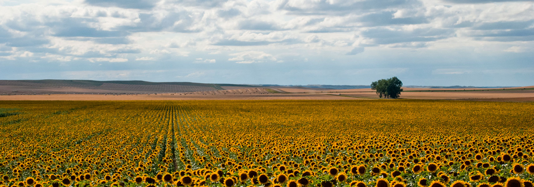
Sunflower field in North Dakota
Sunflower field in North Dakota, the state is among the top producers of sunflowers in the US.
Image: Thomas Huston

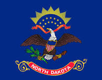
North Dakota Flag
North Dakota State Flag


About North Dakota


Location map of North Dakota state USA
Where in the United States is North Dakota? Location map of the State of North Dakota in the US.
 
North Dakota is a landlocked state in the Great Plains of the north-central US, south of Canada.

The state borders South Dakota in the south, Montana in the west, and the Canadian provinces of Saskatchewan and Manitoba in the north. The winding Red River of the North shapes its border with Minnesota in the east.


The territory of today's North Dakota was acquired partly by the Louisiana Purchase in 1803, and partly from Great Britain by a treaty in 1818. North Dakota became the 39th (or 40th) US state on 2 November 1889; it was admitted to the Union along with South Dakota.


North Dakota State Map
Reference Map of North Dakota
General Map of North Dakota, United States.

The detailed map shows the US state of North Dakota with boundaries, the location of the state capital Bismarck, major cities and populated places, rivers and lakes, interstate highways, principal highways, and railroads.


You are free to use this map for educational purposes (fair use); please refer to the Nations Online Project.
 
More about North Dakota State


Some Geography

Area
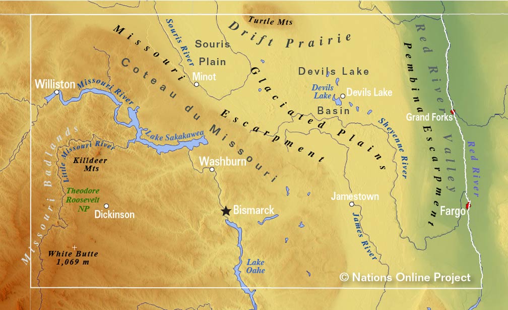
North Dakota's Topographic Regions Map
Topographic Regions Map of North Dakota showing the state's major physiographic regions: the Missouri Badlands, the Missouri Plateau (Coteau de Missouri), the Missouri Escarpment, the Glaciated Plains, the Pembina Escarpment, and the Red River Valley. (click map to enlarge)

 
North Dakota covers a total area of 183,107 km² (70,698 sq mi), [1] making it somewhat smaller than half the size of Germany.
Compared with other US states, North Dakota is eight times as big as New Jersey, but it would fit into Texas nearly four times.

The landscape of the state varies from region to region. In the east, there is, along its border with Minnesota, the flat Red River Valley, it is the lake bed of the ancient Lake Agassiz, a remnant of the last glacial period (ice age).

Further west lies the Drift Prairie. The area is several hundred feet higher than the Red River Valley; its landscape with gently rolling hills and shallow lakes covers most of the eastern half of the state.

The Laurentian Divide, also known as the Northern Divide, cuts from northwest to southeast diagonal through North Dakota. This continental divide separates the river systems that flow northwards to the Arctic Ocean and Hudson Bay from those rivers that flow southwards into the Gulf of Mexico.

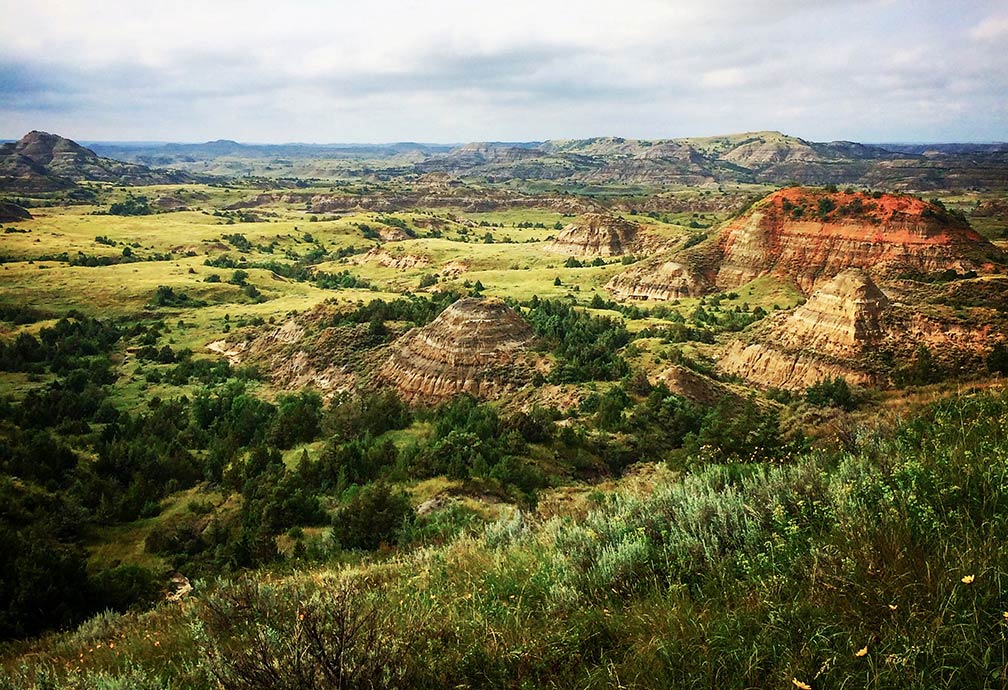
Theodore Roosevelt National Park, North Dakota
View of Theodore Roosevelt National Park south unit in western North Dakota. The park is now threatened by a proposed oil refinery nearby. [2]
Image: Aaronyoung777

 
The Missouri Escarpment defines the edge of the Missouri Plateau in the center of North Dakota. The plateau (Coteau du Missouri) is a vast upland expanse of the Great Plains that occupies the southwestern third of the state. Within the plateau are North Dakota's Badlands, the hilly, treeless landscape along the Little Missouri River offers buttes, pyramids, domes, and cones.


Rivers
Major rivers are the Red River of the North, which defines North Dakota's border with Minnesota. The Sheyenne River is one of the major tributaries of the Red River of the North. The Missouri, the longest river in North America with a length of 3,767 km (2,341 mi), flows east and south through North Dakota. The river was one of the principal transportation routes for the westward expansion of the United States during the 19th century. The Garrison Dam is a dam on the Missouri River in central North Dakota, which forms the Lake Sakakawea reservoir.
 
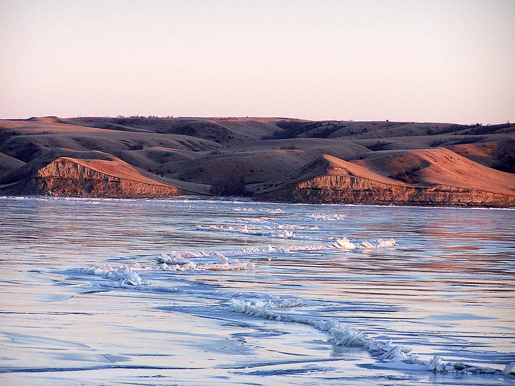
Lake Sakakawea in January, North Dakota
Frozen Lake Sakakawea in North Dakota in January. The reservoir is created by an earth-fill embankment dam on the Missouri River; it is the third-largest human-made lake in the US.
Image: ND Parks and Recreation Department
 
Tributaries of the Missouri in North Dakota are the Yellowstone River, the 1,110 km (690 mi) long stream is the principal tributary of the upper Missouri River. The Little Missouri of North Dakota is a 900 km (560 mi) long river in the northern Great Plains.

The James River (aka Dakota River) is a 1,140 km (710 mi) long river that provides the main drainage of the flat lowland area of the Dakotas between the two plateau regions known as the Coteau du Missouri and the Coteau des Prairies.
The Souris River (aka Mouse River in the US) drains a portion of the Drift Prairie, also known as the Souris Plain.


Highest point
North Dakota's highest point is White Butte at 1069 m (3,508 ft) located in the Badlands in the south western corner of the state.

North Dakota's geographical highlights are Lake Sakakawea, a reservoir within the Lake Sakakawea State Park in the Missouri River basin. The Theodore Roosevelt National Park, three geographically separated areas of badlands (https://www.nps.gov/thro/index.htm).

 
Population


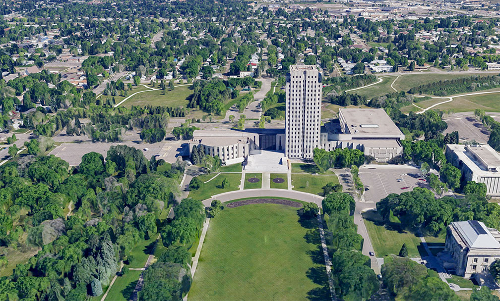
North Dakota State Capitol complex in the city of Bismarck
Rendered image of the North Dakota State Capitol in Bismarck, the state's capital. The 21 story tower and the surrounding office buildings house the state's legislative and judicial branches, as well as numerous government agencies.
Image: Google
 
North Dakota has a population of 762,000 people (est. in 2019). [3] It is among the least densely populated US states (rank 47). The state's capital is Bismarck; the largest city is Fargo. The largest urban area is Fargo-Moorhead, which includes Fargo, North Dakota, Moorhead, Minnesota, and surrounding communities (pop. 234,000).

North Dakota declared English the official state language in 1987.

Race and Ethnic groups
North Dakota's population is composed of White American 84.0%, Native American 5.5%, Hispanic or Latino 3.9%, African American 3.4%, and Asian 1.8%. [4]

The largest airports in the state are Fargo's Hector International Airport (IATA code: FAR), Bismarck Municipal Airport (IATA code: BIS), and Minot International Airport (IATA code: MOT).


Cities and Towns in North Dakota

The map shows the location of following cities and towns in North Dakota.
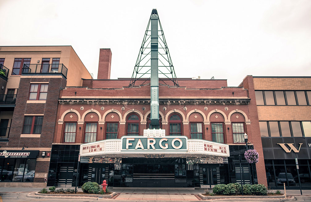
Fargo Theatre, art deco movie theater in Fargo, North Dakota
The iconic Fargo Theatre, an art deco movie theater in downtown Fargo, the most populous city in North Dakota.
Image: katie wheeler
 
Largest cities in North Dakota with a population of more than 20,000 are
Fargo (124,000), Bismarck (73,000), Grand Forks (57,000), Minot (47,300), West Fargo (part of Fargo–Moorhead Metropolitan Area, 36,500), Williston (27,000), Dickinson (22,700)
Population figures in 2018

Other cities and towns in North Dakota

Ashley, Beach, Belfield, Beulah, Bottineau, Bowman, Cando, Carrington, Carson, Cavalier, Cooperstown, Crosby, Devils Lake, Edgeley, Ellendale, Fort Yates, Garrison, Grafton, Harvey, Hettinger, Hillsboro, Jamestown, Kenmare, Lakota, Langdon, Linton, Lisbon, Mandan, McClusky, Mohall, Mott, Napoleon, New Town, Oakes, Pembina, Portal, Rocklake, Rugby, Stanley, Towner, Valley City, Wahpeton, Washburn, and Watford City.

Weather Conditions Bismarck:

BISMARCK WEATHER


Advertisements:


Maps of the 50 U.S. States
Alabama | Alaska | Arizona | Arkansas | California | Colorado | Connecticut | Delaware | Florida | Georgia | Hawaii | Idaho | Illinois | Indiana | Iowa | Kansas | Kentucky | Louisiana | Maine | Maryland | Massachusetts | Michigan | Minnesota | Mississippi | Missouri | Montana | Nebraska | Nevada | New Hampshire | New Jersey | New Mexico | New York | North Carolina | North Dakota | Ohio | Oklahoma | Oregon | Pennsylvania | Rhode Island | South Carolina | South Dakota | Tennessee | Texas | Utah | Vermont | Virginia | Washington | West Virginia | Wisconsin | Wyoming

20 Most Populous U.S. Cities (in 2018):
1. New York City 2. Los Angeles 3. Chicago 4. Houston 5. Phoenix 6. Philadelphia 7. San Antonio 8. San Diego 9. Dallas 10. San Jose 11. Austin 12. Jacksonville 13. Fort Worth 14. Columbus 15. San Francisco 16. Charlotte 17. Indianapolis 18. Seattle, 19. Denver, 20. Washington D.C.

Other Major U.S. Cities:
Albany, Anchorage, Annapolis, Atlanta, Atlantic City, Augusta, Baltimore, Baton Rouge, Bismarck, Boise, Boston, Carson City, Charleston, WV, Cheyenne, Cincinnati, Cleveland, Columbia, Concord, Des Moines, Detroit, Dover, DE, El Paso, Frankfort, Harrisburg, Hartford, Helena, Honolulu, Jackson, Jefferson City, Juneau, Kansas City, Lansing, Las Vegas, Lincoln, Little Rock, Long Beach, Madison, Memphis, Miami, Milwaukee, Minneapolis, Montgomery, Montpelier, Nashville, New Orleans, Norfolk, Oklahoma City, Olympia, Orlando, Pierre, Pittsburgh, Portland, Providence, Richmond, VA, Raleigh, Sacramento, St. Louis, St. Paul, Salem (OR), Salt Lake City, Santa Fe, Springfield, Tallahassee, Tampa, Topeka, Trenton, Tucson