Nations Online
All Countries in the World
|
One Planet Nations Online All Countries in the World | |
Home  |
___ Searchable Map and Satellite View of Seattle, Washington State (45-degree view available) |
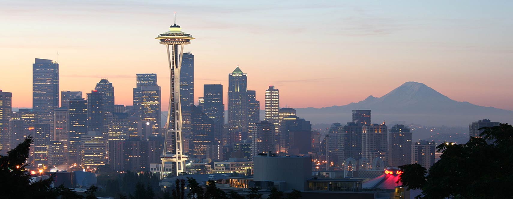
 Downtown Seattle as seen from Queen Anne Hill, the Central Business District with Space Needle in center and Mount Rainier (Mount Tacoma) in background. The Space Needle, Seattle's famous landmark was built for the 1962 World's Fair. Image: Rattlhed |
About Seattle |
 Satellite view showing the city of Seattle, Washington State in the
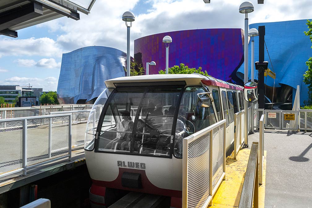
  Seattle Center Monorail station. The 1.4-mile (2.3 km) elevated monorail line in Seattle operates along Fifth Avenue between Seattle Center in Lower Queen Anne and Westlake Center in Downtown. The Monorail opened on 24 March 1962 for the Century 21 Exposition (World's Fair). The city is home to the University of Washington, one of the oldest universities on the West Coast. Seattle Art Museum SAM, operates three major facilities in the city. The page shows a city map of Seattle with expressways, main roads and streets, zoom out to find Seattle-Tacoma International Airport (IATA code: SEA) south of Central District, in a distance of 22 km (14 mi) by road. To find a location use the form below. To view just the map, click on the "Map" button. |
|
| To find a location type: street or place, city, optional: state, country. |
Local Time Seattle:
Wednsday-April-17 03:00
Standard time zone Pacific Standard Time (PST): UTC/GMT -8 hoursPacific Daylight Time (PDT) in use from the second Sunday in March, ends on the first Sunday in November; time zone offset: UTC/GMT -7 hours |
|
φ Latitude, λ Longitude (of Map center; move the map to see coordinates): , |
||||||
| Sorry! Google's pricing policy has made it impossible for us to continue showing Google Maps. We apologize for any inconvenience. Google Map: Searchable Map of the City of Seattle, Washington State, USA. City Coordinates: 47°36′35″N 122°19′59″W |
Bookmark/share this page
|
|||||
| More about the State of Washington and the USA: Other Cities in Washington State: Washington State: U.S. States: Country: Reference Map of Mainland USA. Continent: |
Current Weather Conditions Seattle External Links: Seattle (official website) Newspapers: The Seattle Times Local news. Wikipedia: Seattle, Washington State |
Explore more:
Related Consumer Information:
|
||||
One World - Nations Online .:. let's care for this planet Promote that every nation assumes responsibility for our world. Nations Online Project is made to improve cross-cultural understanding and global awareness. More signal - less NOISE |
| Site Map
| Information Sources | Disclaimer | Copyright © 1998-2023 :: nationsonline.org |