Advertising

Maine Flag detail
Home Earth Continents The Americas USA Country Profile US State Capitals Maine Map

US States Maps Index
World Maps Index

Map of Maine (ME)


View from Cadillac Mountain on Mount Desert Island in Maine
View from Cadillac Mountain on Mount Desert Island within Acadia National Park, in direction of Bar Harbor and the islands in the Frenchman Bay.
Image: Ken Lane

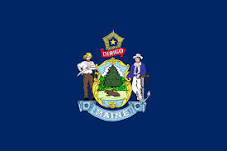
Maine Flag
Maine State Flag


About Maine


Location map of Maine state USA
Where in the United States is Maine? Location map of the State of Maine in the US.
 
Maine is the easternmost US state, situated in the northeastern part of the country, bordering Canada. It is also the northernmost of the six New England states.


Maine borders the Canadian provinces of Québec to the northwest and New Brunswick to the north and northeast. The state borders the Atlantic Ocean (Gulf of Maine) to the southeast and the US state of New Hampshire in the southwest. The state's nickname is "The Pine Tree State;"the destination-marketing organization for the United States promotes Maine as "Vacationland."


Short history

The region was visited by John Cabot (an Italian navigator under the commission of Henry VII of England) in 1498 and colonized by England in the 17th and 18th centuries.

Maine was originally part of Massachusetts. The district was included in the Charter of New England [1] in 1620 and the Charter of Massachusetts Bay in 1629, which became the Constitution of the Massachusetts Bay Colony, the predecessor to the Commonwealth of Massachusetts.

In 1819, Massachusetts agreed to allow its district of Maine to petition for statehood. Maine was admitted to the Union as a separate state on 15th March 1820 as the 23rd state. [2]

Maine State Map
Reference Map of the US State of Maine
General Map of Maine, United States.

The detailed map shows the US state of Maine with boundaries, the location of the state capital Augusta, major cities and populated places, rivers and lakes, interstate highways, principal highways, and railroads.

You are free to use this map for educational purposes (fair use); please refer to the Nations Online Project. 
More about Maine State


Some Geography

Area
Maine Topographic Regions Map Topographic Regions Map of Maine. (Click on the map to enlarge)
Maine occupies an area of 91,646 km² (35,385 sq mi) [2], compared it is about the size of Portugal. Compared in scale with other US states, it is the largest of the six New England states, but it would fit more than seven times into Texas.


Maine Sights
Maine's landscape offers some unique geographical features: the state is number one in forestry in the US, about 83% of its territory is forested.

West Quoddy Head is the easternmost point on the U.S. mainland.
The northern section of the Appalachian Mountains, the eroded remains of an ancient mountain range of once alpine proportions, runs along the northwestern border of the state.

The highest elevation in the state is Mount Katahdin 1606 m (5,270 ft), located in Baxter State Park, almost in the center of Maine, it is the northern terminus of the Appalachian Trail, the 3,500 km (2,200 mi) long marked hiking trail in the Eastern US.

In the disputed maritime border area is Old Sow whirlpool, the largest tidal whirlpool in the Western Hemisphere.

Coastal Maine


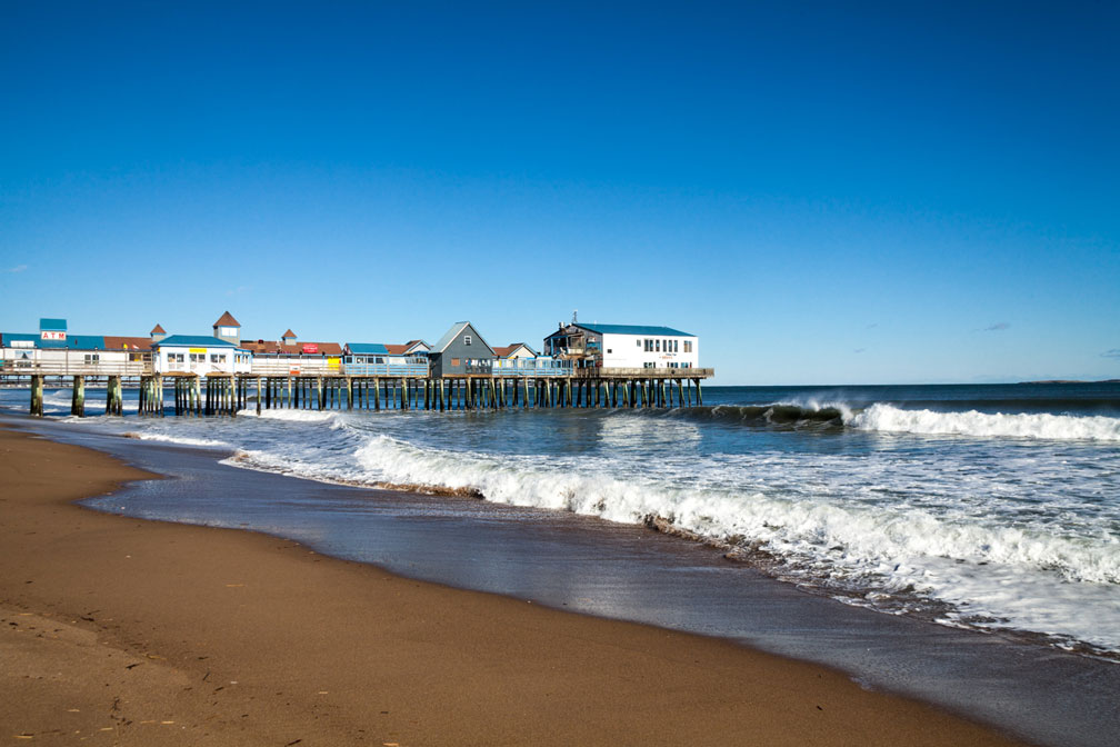
Wooden pier at Old Orchard Beach, Maine
The pier at Old Orchard Beach, a popular summer beach destination in York County, about 20 km south west of Portland, Maine.
Image: Paul VanDerWerf
 
Coastal Maine, with its charming maritime towns, seaside drives, peninsulas, lighthouses, lakes, and mountains, is a popular tourist destination.

Old Orchard Beach is a popular summer beach destination with the usual clam shacks and T-shirt shops.


Maine Islands
Machias Seal Island and North Rock are two of Maine's 3,166 coastal islands, the sovereignty of both islands is disputed between Canada and the US, the area is referred to colloquially as the "Grey Zone."

Mount Desert Island is Maine's largest coastal island and home to the first national park east of the Mississippi, the Acadia National Park.

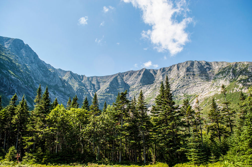
Mount Katahdin in Baxter State Park of Maine
Mount Katahdin, a cluster of mountains within Baxter State Park, a large wilderness area in Northeast Piscataquis county of Maine.
Image: James
 
The Acadia National Park official website protects more than half of the island. The park also includes Isle au Haut, parts of Baker Island, all of Bar Island, three of the four Porcupine Islands, and a portion of the Schoodic Peninsula on the mainland.

Other popular islands worthwhile a visit are Chebeague Island, the largest of the Casco Bay Islands, and Squirrel Island, which is Maine's oldest summer colony. There is genteel North Haven, and neighboring Vinalhaven, Maine's largest offshore island has one of the world's largest lobster fishing fleets.

Lakes
Maine is a lake-rich region, hundreds of lakes and ponds are decoratively distributed throughout the state, the largest are Moosehead Lake, Sebago Lake, and Chesuncook Lake.


Population


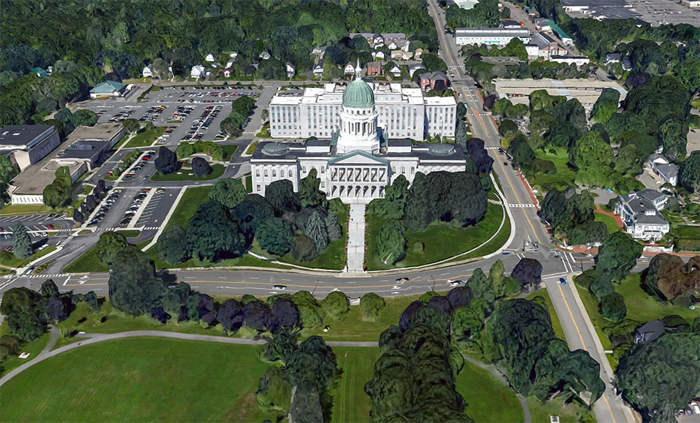
Maine State House in Augusta, capital city of Maine
Rendered image of Maine State House in Augusta, the state capital of Maine since 1832. The Greek Revival building is home to the bicameral state legislature.
Image: Google
 
Maine has a population of about 1.34 million people (est. 2019); [3] it is the most sparsely populated state east of the Mississippi.

The state's capital is Augusta, the largest city, Maine's largest port, and economic capital is Portland (Maine). The largest metropolitan area is Greater Portland (Portland-South Portland-Biddeford).

Race and Ethnic groups
Maine is a state with a predominantly white population (93%). The rest of the population is made up of 1.8% Hispanics or Latinos, 1.7% Black or African Americans, 1.3% Asians, and 0.7% Native Americans. [4]


The busiest airports in the state are Portland International Jetport (IATA code: PWM), and Bangor International Airport (IATA code: BGR).


Cities and Towns in Maine

The map shows the location of following cities and towns in Maine:

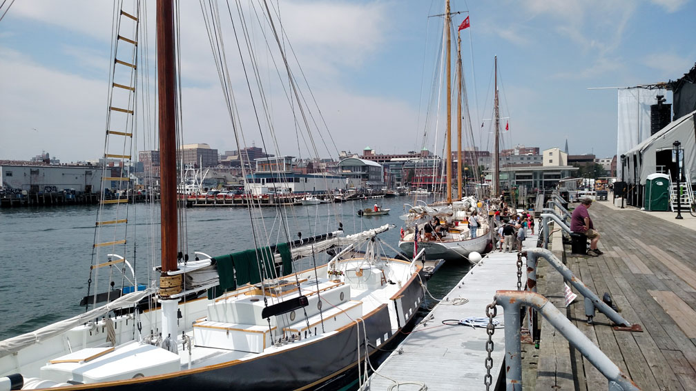
Sailboat charters docked at the pier of Portland, Maine
Sailboat charters docked at the pier of Portland, Maine.
Image: Bd2media
Largest cities in Maine with a population of more than 20,000
 
Portland (66,200), Lewiston (36,600), Bangor (33,000), South Portland (25,000; adjoining Portland), Auburn (23,000; Auburn and Lewiston are known as the Twin Cities), Sanford (21,000), Biddeford (21,000)

Other cities and towns in Maine:
Ashland, Augusta, Bar Harbor, Bath, Belfast, Brunswick, Bucksport, Calais, Camden, Caribou, Dexter, Dover-Foxcroft, Eastport, Ellsworth, Farmington, Fort Fairfield, Fort Kent, Greenville, Houlton, Jackman, Kittery, Lincoln, Machias, Macwahoc, Madawaska, Mars Hill, Millinocket, Newport, Norway, Orono, Presque Isle, Rockland, Rumford, Saco, Skowhegan, Topsfield, Van Buren, Vanceboro, Waterville, and Westbrook.


Weather Conditions Augusta:

AUGUSTA WEATHER


Advertisements:


Maps of the 50 U.S. States
Alabama | Alaska | Arizona | Arkansas | California | Colorado | Connecticut | Delaware | Florida | Georgia | Hawaii | Idaho | Illinois | Indiana | Iowa | Kansas | Kentucky | Louisiana | Maine | Maryland | Massachusetts | Michigan | Minnesota | Mississippi | Missouri | Montana | Nebraska | Nevada | New Hampshire | New Jersey | New Mexico | New York | North Carolina | North DakotaOhio | Oklahoma | Oregon | Pennsylvania | Rhode Island | South Carolina | South Dakota | Tennessee | Texas | Utah | Vermont | Virginia | Washington | West Virginia | Wisconsin | Wyoming

20 Most Populous U.S. Cities (in 2018):
1. New York City 2. Los Angeles 3. Chicago 4. Houston 5. Phoenix 6. Philadelphia 7. San Antonio 8. San Diego 9. Dallas 10. San Jose 11. Austin 12. Jacksonville 13. Fort Worth 14. Columbus 15. San Francisco 16. Charlotte 17. Indianapolis 18. Seattle, 19. Denver, 20. Washington D.C.

Other Major U.S. Cities:
Albany, Anchorage, Annapolis, Atlanta, Atlantic City, Augusta, Baltimore, Baton Rouge, Bismarck, Boise, Boston, Carson City, Charleston, WV, Cheyenne, Cincinnati, Cleveland, Columbia, Concord, Des Moines, Detroit, Dover, DE, El Paso, Frankfort, Harrisburg, Hartford, Helena, Honolulu, Jackson, Jefferson City, Juneau, Kansas City, Lansing, Las Vegas, Lincoln, Little Rock, Long Beach, Madison, Memphis, Miami, Milwaukee, Minneapolis, Montgomery, Montpelier, Nashville, New Orleans, Norfolk, Oklahoma City, Olympia, Orlando, Pierre, Pittsburgh, Portland, Providence, Richmond, VA, Raleigh, Sacramento, St. Louis, St. Paul, Salem (OR), Salt Lake City, Santa Fe, Springfield, Tallahassee, Tampa, Topeka, Trenton, Tucson