Nations Online
All Countries in the World
Nations Online All Countries in the World | |
Home  |
___ Satellite View and Map of the City of Charlotte Amalie, US Virgin Islands |
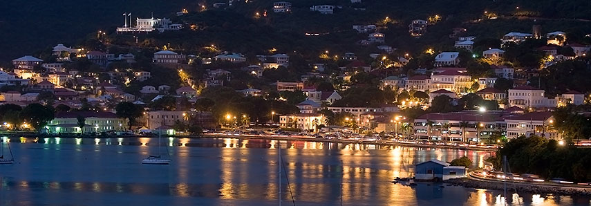 Saint Thomas Harbor in Charlotte Amalie at night. Image: Calyponte |
About Charlotte AmalieSatellite view is showing Charlotte Amalie, the territorial capital and and largest city of the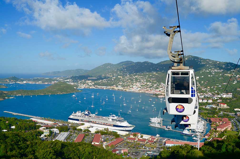 Charlotte Amalie, St. Thomas, US Virgin Islands, view from Lookout Point on Skyline Drive. Photo by Matt Wade The town is located on the island of Saint Thomas, the gateway island of the U.S. Virgin Islands. Havensight, the deep-water harbor, is a major port of call (a premier stop) for cruise ships. It is one of the busiest cruise ports in the Caribbean with 2 million passengers per year. Since the end of the Second World War, tourism has been by far the most important economic sector in the Virgin Islands. Charlotte Amalie Points of interest: The city is known for its Danish colonial architecture and its mixture of American- and Afro-Caribbean culture, tourist attractions are Blackbeard's Castle (a tower and vantage point), Fort Christian (a 17th-century Danish-built fort), Coral World Ocean Park (marine park), the Legislature Building, the 99 steps stairway, the Emancipation Garden, the Market Square, the Seven Arches Museum, St. Thomas Synagogue (a historic synagogue) and the Weibel Museum (300 years of Jewish history), the Frederick Lutheran Church (historic church, it was the official church of the Danish West Indies). The Map shows a city map of Charlotte Amalie with main roads and streets. Zoom out to see the location of the Virgin Islands in the Caribbean. To find a location use the form below. To view just the map, click on the "Map" button. |
|
| To find a location type: street or place, city, optional: state, country. | Local Time Charlotte Amalie:
Monday-June-15 18:28
UTC/GMT -4 hours |
One World - Nations Online .:. let's care for this planet Promote that every nation assumes responsibility for our world. Nations Online Project is made to improve cross-cultural understanding and global awareness. More signal - less NOISE |
| Site Map
| Information Sources | Disclaimer | Copyright © 1998-2024:: nationsonline.org |

