Nations Online
All Countries in the World
Nations Online All Countries in the World | |
Home  |
___ Satellite View and Map of the City of Castries, Saint Lucia |
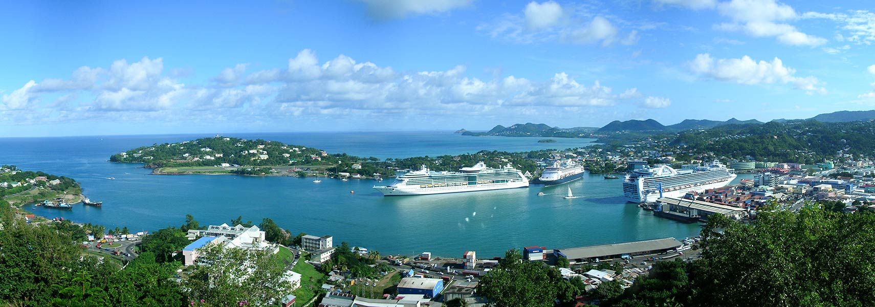 Panorama of Castries, a port, largest city and capital of Saint Lucia, the island is a regular cruise ship stop. Image: Matt H. Wade |
About Castries Satellite view is showing Castries, chief town, sea port, and the national capital of Satellite view is showing Castries, chief town, sea port, and the national capital of The town was founded by the French, they named it after Marquis de Castries, a French marshal who commanded the expeditionary force sent to St Lucia in 1756. Today Castries has a population of 4,100 people living in the town and 22,000 in its urban area. Official language is English. Some Points of interest: Immaculate Conception Church (since 1999 a Minor Basilica), and the Central Library (completed in 1924), at Derek Walcott Square (formerly Columbus Square, a public square and park), Marigot Bay (laid-back), Vigie Beach (protected white sand beach), Pigeon Island national park (historic site with numerous forts), Morne Fortune (hill and vantage point), Castries Market (largest open-air market), Pointe Seraphine (Duty Free), Maria Islands Nature Reserve (by appointment only), La Toc Battery Fort (old British fort), National Library, the Pitons (Gros Piton and Petit Piton are a UNESCO World Heritage Site The map shows a city map of Castries with expressways, main roads and streets, the location of Castries’ George F. L. Charles Airport, formerly Vigie Airport (IATA code: SLU) north of the city. Zoom out to find the location of Hewanorra International Airport (IATA code: UVF), Saint Lucia’s international gateway, 56 km (35 mi) from Castries by road (via Micoud Highway) situated in the southeastern corner of the island. To find a location use the form below. To view just the map, click on the "Map" button. |
|
| To find a location type: street or place, city, optional: state, country. | Local Time Saint Lucia:
Friday-July-17 11:18
UTC/GMT - 4 hours |
One World - Nations Online .:. let's care for this planet Promote that every nation assumes responsibility for our world. Nations Online Project is made to improve cross-cultural understanding and global awareness. More signal - less NOISE |
| Site Map
| Information Sources | Disclaimer | Copyright © 1998-2024:: nationsonline.org |


