Nations Online
All Countries in the World
Nations Online All Countries in the World | |
Home  |
___ Satellite View and Map of Aruba |
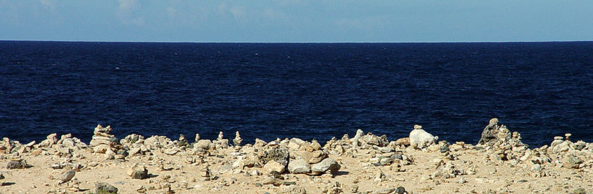 Aruba Wishing Stones. Image: Serge Melki |
About Aruba Satellite view is showing the Caribbean island in the South Caribbean Sea, north of Venezuela. Aruba is known together with Bonaire and Curaçao as the ABC islands. Satellite view is showing the Caribbean island in the South Caribbean Sea, north of Venezuela. Aruba is known together with Bonaire and Curaçao as the ABC islands. Formerly part of the Netherlands Antilles, today Aruba is one of the four constituent countries that form the Kingdom of the Netherlands. Aruba is a flat, riverless island renowned for its white sand beaches and a landscape overgrown with cacti. It was 'discovered' by the Spanish and claimed for the Spanish Crown in 1499, Aruba was acquired by the Dutch in 1636. With an area of 180 km² , the island is the size of Liechtenstein, or slightly larger than Washington, DC. Aruba today has a population of 106,000 inhabitants (in 2015). Capital and largest city is Oranjestad. Spoken languages are Dutch and Papiamento. The map shows Aruba with cities, towns, main roads and streets, and the location of Queen Beatrix International Airport (IATA Code: AUA). Zoom out to see the location of Aruba within the Caribbean. To find a location use the form below. To view just the map, click on the "Map" button. |
||
| To find a location type: street or place, city, optional: state, country. | Local Time Aruba:
Wednsday-July-15 02:27
UTC/GMT -4 hours |
|
|
φ Latitude, λ Longitude (of Map center; move the map to see coordinates): , |
||||||
| Google Maps:Searchable Map of Aruba. |
Bookmark/share this page |
|||||
| More about Aruba: Cities: Island: Country: Continent: External Link: Wikipedia: Aruba Wikipedia: Oranjestad | Weather Conditions Aruba: Weather station at Queen Beatrix International Airport
| Related Consumer Information:
|
||||
Searchable Maps of Greater Antilles: Cuba, Haiti, Dominican Republic, Jamaica, Puerto Rico Searchable Maps of Lesser Antilles: Anguilla (UK), Antigua and Barbuda, Aruba (NL), Bahamas, Barbados, Bermuda, Curaçao (NL), Dominica, Grenada, Guadeloupe (FR) Martinique (FR), Montserrat (UK), Netherlands Antilles, Saint Kitts and Nevis, Saint Lucia, Saint Martin (Sint Maarten), Saint Vincent and the Grenadines, Trinidad and Tobago, Virgin Islands Maps of Caribbean Islands (Greater Antilles) Cuba Map, Dominican Republic Map, Haiti Map, Jamaica Map, Puerto Rico Map Countries and Territories of the Americas |
||||||
Map Help [ show ] |
||||||
One World - Nations Online .:. let's care for this planet Promote that every nation assumes responsibility for our world. Nations Online Project is made to improve cross-cultural understanding and global awareness. More signal - less NOISE |
| Site Map
| Information Sources | Disclaimer | Copyright © 1998-2024:: nationsonline.org |

