Nations Online
All Countries in the World
Nations Online All Countries in the World | |
Home  |
___ Satellite View and Map of Martinique |
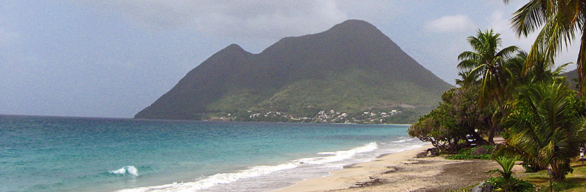 Le Morne Larcher hill seen from the town of Le Diamant. Image: Monster1000 |
About Martinique Map is showing Martinique, the Caribbean island in the Lesser Antilles group bordering the Caribbean Sea and the North Atlantic Ocean, between Map is showing Martinique, the Caribbean island in the Lesser Antilles group bordering the Caribbean Sea and the North Atlantic Ocean, between Martinique is the 3rd largest island in the Lesser Antilles after Trinidad and Guadeloupe. With an area of 1,100 km² (436 sq mi) it is slightly smaller than the Faroe Islands, or slightly more than six times the size of Washington, DC. Martinique has a population of 381,000 people (in 2014). Most of Martinique's population are descendants from African slaves brought to work on sugar plantations during the colonial era. Capital city is Fort-de-France. Spoken languages are French (official) and French Patois. The island has been a high-end vacation hotspot for many years. The map shows Martinique with cities, towns, expressways, main roads and streets, and the location of Martinique's only airport Aimé Césaire International Airport/Lamentin Airport (IATA code: FDF). Zoom out to see the location of Martinique within the Caribbean. To find a location use the form below. |
|
| To find a location type: street or place, city, optional: state, country. |
Martinique actual time:
Fri-July-17 07:35
Time zone: Atlantic Standard Time (AST) :: GMT (UTC): - 4h |
|
φ Latitude, λ Longitude (of Map center; move the map to see coordinates): , |
||||||
| Google Maps: Searchable Map of Martinique. |
Bookmark/share this page |
|||||
| More about Martinique: Cities: Island: Continent: | Current Weather Conditions Martinique
| Related Consumer Information:
| ||||
Searchable Maps of Greater Antilles: Cuba, Haiti, Dominican Republic, Jamaica, Puerto Rico Searchable Maps of Lesser Antilles: Anguilla (UK), Antigua and Barbuda, Aruba (NL), Bahamas, Barbados, Bermuda, Curaçao (NL), Dominica, Grenada, Guadeloupe (FR), Montserrat (UK), Netherlands Antilles, Saint Kitts and Nevis, Saint Lucia, Saint Martin (Sint Maarten), Saint Vincent and the Grenadines, Trinidad and Tobago, Virgin Islands Maps of Caribbean Islands (Greater Antilles) Cuba Map, Dominican Republic Map, Haiti Map, Jamaica Map, Puerto Rico Map Countries and Territories of the Americas |
||||||
Map Help [ show ] |
||||||
One World - Nations Online .:. let's care for this planet Promote that every nation assumes responsibility for our world. Nations Online Project is made to improve cross-cultural understanding and global awareness. More signal - less NOISE |
| Site Map
| Information Sources | Disclaimer | Copyright © 1998-2024:: nationsonline.org |