Nations Online
All Countries in the World
|
One Planet Nations Online All Countries in the World | |
Home  |
___ Satellite View and Map of the City of Santo Domingo, Dominican Republic |
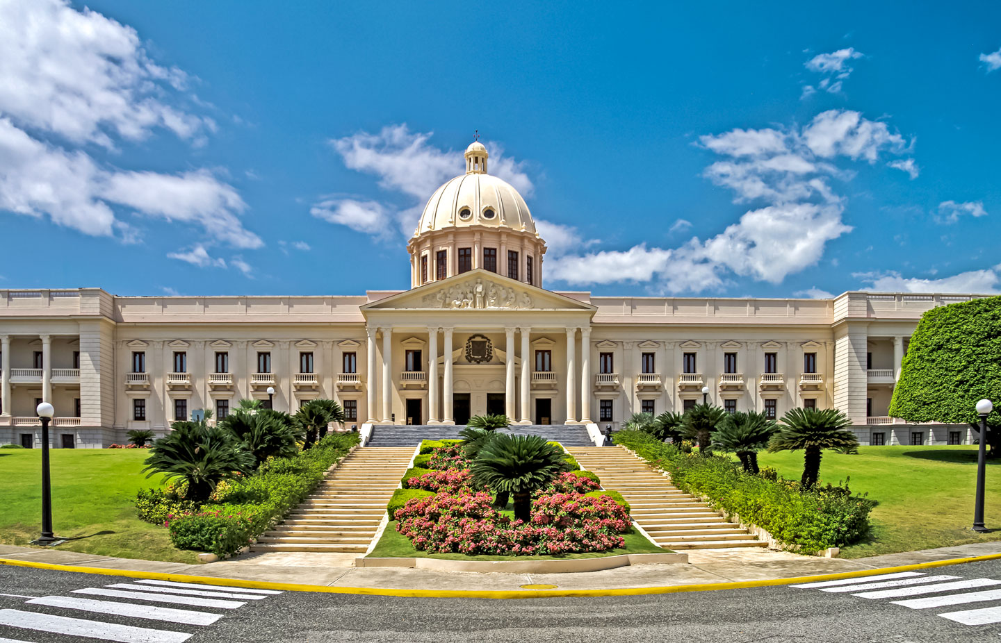
 The National Palace in Santo Domingo, the building houses the offices of the Presidency and Vice Presidency of the Dominican Republic. The National Palace in Santo Domingo, the building houses the offices of the Presidency and Vice Presidency of the Dominican Republic.Image: Jean-Marc Astesana |
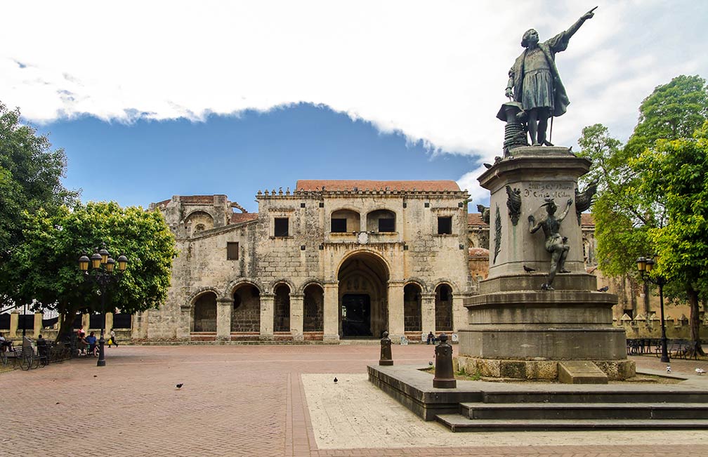
About Santo Domingo Satellite view is showing Santo Domingo, chief port, largest city and capital of the Satellite view is showing Santo Domingo, chief port, largest city and capital of the Santo Domingo is situated on the south coast of the island at the estuary of the Ozama River. It is the oldest continuously inhabited settlement in the Western Hemisphere established by Europeans, founded between 1496 and 1498 by Bartholomew Columbus, the younger brother of Christopher Columbus. It was the first seat of the Spanish colonial rule, from here the Spanish started to colonize the New World. Santo Domingo, the City of « firsts », the site of the first European style institutions in the Americas: first cathedral (1521), first university (1538), castle, monastery (1508), and fortress (1505) in the New World. The Colonial City of Santo Domingo Today the city has a population of about 1 million inhabitants, 3.7 million people are living in the metropolitan area, making Santo Domingo the most populous city in the Caribbean. It is the political, commercial, cultural, financial, and industrial center of the Dominican Republic. Spoken language is Spanish.  Parque (Cristóbal) Colón with a late-19th statue of Christopher Columbus, the park is the central square of Ciudad Colonial historic district of Santo Domingo. Image: Jean-Marc Astesana Santo Domingo's nightlife takes place at Zona Colonia, Ocean boardwalk Malecon and Avenida Venezuela. Just zoom in to see the National Palace, not far to the right at Ozama River is the Zona Colonial , the old town of Santo Domingo. The map shows a city map of Santo Domingo with expressways, main roads and streets, and the location of the domestic airport La Isabela International Airport (IATA code: JBQ), zoom out to find the location of Las Américas International Airport (IATA code: SDQ), 34.5 km (21 mi) by road (via Route 3) east of the city. To find a location use the form below. |
|
| To find a location type: street or place, city, optional: state, country. |
Local Time Dominican Republic:
Wednsday-April-24 03:40
UTC/GMT -4 hours |
|
φ Latitude, λ Longitude (of Map center; move the map to see coordinates): , |
||||||
| Google Earth: Searchable map/satellite view of Santo Domingo de Guzmán, Dominican Republic. City Coordinates: 18°30′0″N 69°59′0″W |
Bookmark/share this page
|
|||||
| More about the Dominican Republic: Country: Political Map of the Dominican Republic. Continent: External Links: Santo Domingo Website of the national district government (in Spanish) Wikipedia: Santo Domingo | Weather Conditions Santo Domingo: Weather station at Las Américas International Airport | Related Consumer Information:
|
||||
Other Cities (Islands) in the Caribbean: Basse-Terre (Guadeloupe), Basseterre (Saint Kitts and Nevis), Bridgetown (Barbados), Castries (Saint Lucia), Charlotte Amalie (US Virgin Islands), Fort-de-France (Martinique), Hamilton (Bermuda), Havana (Cuba), Kingston (Jamaica), Kingstown (Saint Vincent and the Grenadines), Nassau (Bahamas), Oranjestad (Aruba), Port-au-Prince (Haiti), Port-of-Spain (Trinidad and Tobago), Roseau (Dominica), Saint George's (Grenada), Saint John's (Antigua and Barbuda), Saint Martin (Sint Maarten), San Juan (Puerto Rico), Santo Domingo (Dominican Republic), The Valley (Anguilla), Willemstad (Curaçao) |
||||||
Map Help [ show ]  |
||||||
One World - Nations Online .:. let's care for this planet Promote that every nation assumes responsibility for our world. Nations Online Project is made to improve cross-cultural understanding and global awareness. More signal - less NOISE |
| Site Map
| Information Sources | Disclaimer | Copyright © 1998-2023 :: nationsonline.org |