More about India
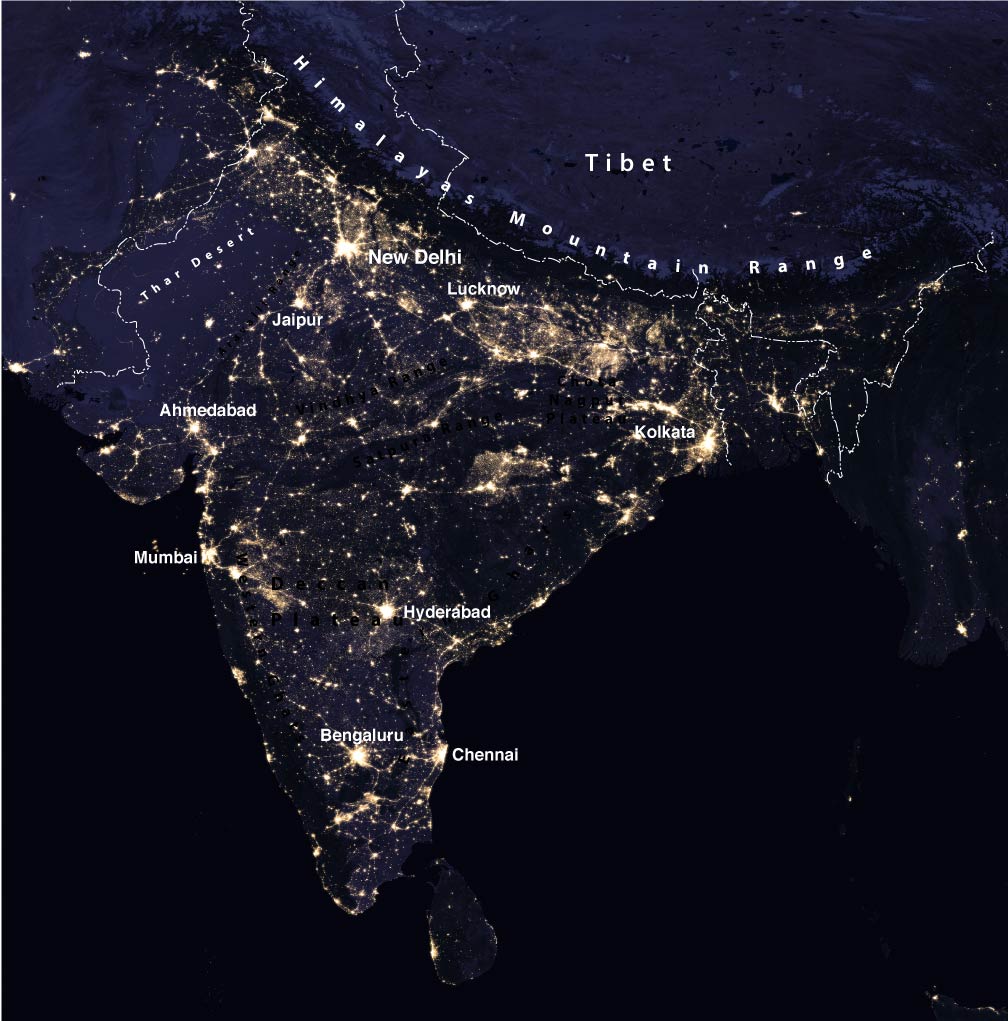 The satellite image shows India at night with the lights of urban agglomerations and cities. The map shows the names of the largest cities.
Image: NASA
India's 10 largest cities are
Mumbai (Maharashtra),
Delhi (Delhi), Bengaluru (Karnataka),
Hyderabad (Telangana), Ahmedabad (Gujarat),
Chennai (Tamil Nadu),
Kolkata (West Bengal), Surat (Gujarat), Pune (Maharashtra), and Jaipur (Rajasthan).
Administrative Divisions
Since June 2014, India is a union of now 29 states (with Telangana as the youngest state), and seven union territories.
India's largest states with an area of more than 300,000 km² are
Rajasthan,
Madhya Pradesh, and
Maharashtra.
The states with the largest population are
Uttar Pradesh (pop. 199 million), Maharashtra (pop. 112 million),
Bihar (104 million) and
West Bengal (91 million).
States and Union Territories of India
As mentioned above, India is a union of 29 states and seven so-called union territories. The states have their own elected governments, while the union territories are ruled directly by the central government of India.
Andhra Pradesh, the state along India's southeastern coast has a population of 49,4 million people. The state's capital is
Amaravati (de facto, a planned city on the southern banks of the Krishna river),
Hyderabad (de jure, until the proposed new capital will be built). The largest city and the economic capital of Andhra Pradesh is the port city of Visakhapatnam.
Andhra Pradesh Tourism
Arunachal
Pradesh, the ‘land of dawn-lit mountains’ is the remote Indian state in the far north-eastern corner of the country. It is the largest of the 'Seven Sister States' and one of India's several disputed territories. It is administered by India but claimed by China. The state has a population of 1.3 million people, the capital and largest city is
Itanagar. There are several distinct languages spoken in Arunachal: Nishi (19%), Adi (Tani; 17.5%), Bengali (9%), Nepali (8.5%), and Hindi (7%).
Assam, the second largest of the 'Seven Sister States' in north-eastern India is known for its rich biodiversity, wildlife sanctuaries, Assam tea, and Assam silk. The state shares a border with
Bhutan. Assam's economy is mainly based on agriculture, oil and some tourism. The state has a population of 31 million people; capital is
Dispur, a suburb of the state's largest city Guwahati.
About 50% of Assam's population are Assamese people, the indigenous people of the state speaking the Assamese language (49%). Other languages are Bengali (28%), Hindi (6%), and Bodo (5%). The main religions are Hinduism (61.5%) and Islam (34%).
Assam Department of Tourism  Bihar
Bihar is situated in the northeast of the country on the Indus-Ganga Plain, south of
Nepal. It covers an area of 94,163 km², this is roughly the size of
Hungary or about the size of the US state of
Indiana. The state's territory is bisected from west to east by the Ganges River.
Bihar is India's third most populous state with more than 110 million people (est. in 2019).
The capital and largest city is
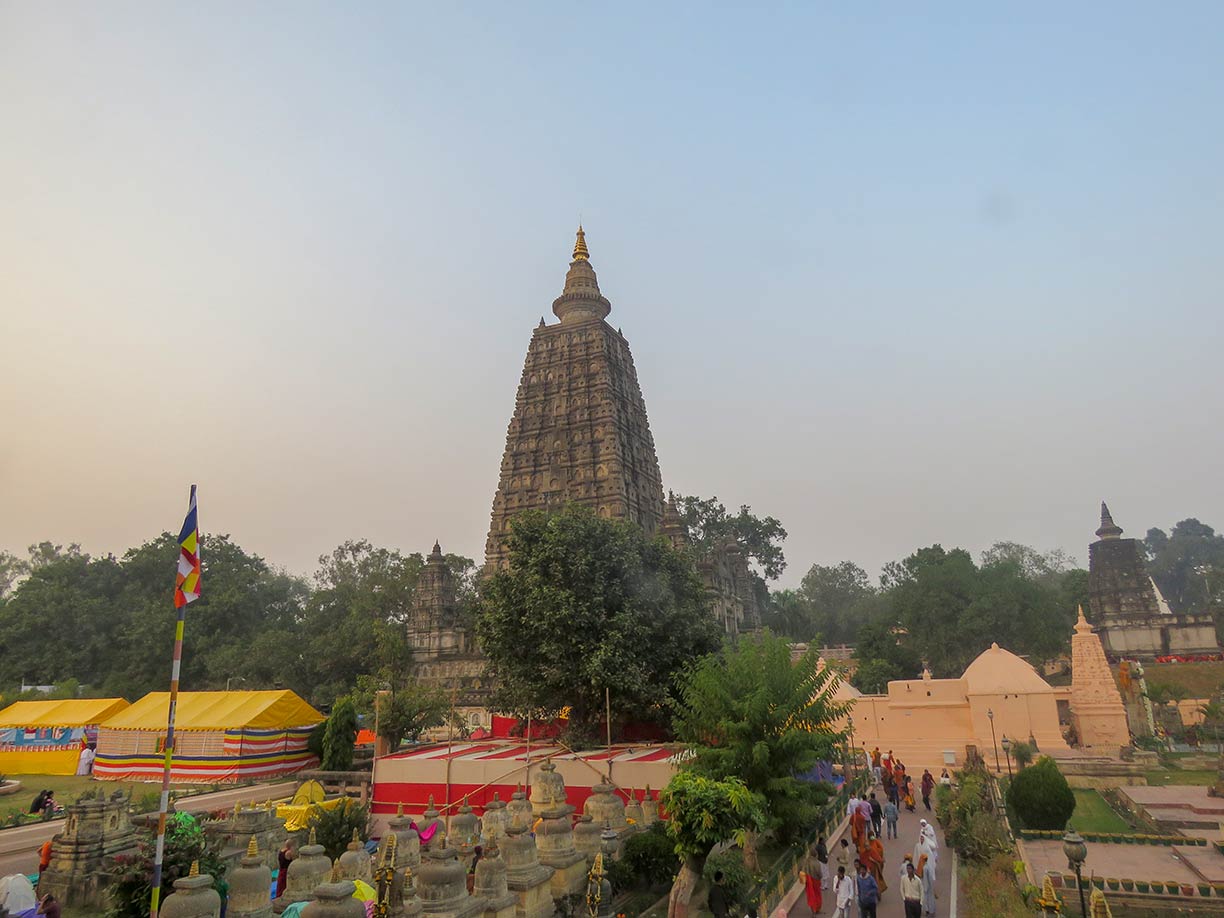
Patna. Gaya, Bihar's second largest city, is of ancient historical and mythological significance. Nearby Bodh Gaya is the place where Gautama Buddha achieved enlightenment, it is an important center for religious tourism. The
Mahabodhi Temple Complex at Bodh Gaya is a UNESCO World Heritage Site since 2002.
Bihar's official languages are Hindi and Urdu; other spoken languages are Bhojpuri, Maithili, and Magahi. Hinduism (more than 80 %) is the main religion in the state.
Bihar Tourism  Chhattisgarh
 is a landlocked state located in the central-east of the country with an area of 136,034 km², and a population of 28 million people (in 2017). The state was created on 1 November 2000. Sixteen Chhattisgarhi-speaking districts (Dakshina Kosala region) of Madhya Pradesh became the new state. Capital and largest city is
Raipur; other major cities are Bhilai, Bilaspur, and Rajnandgaon, official languages are Chhattisgarhi and Hindi. Hinduism (more than 90 %) is the main religion in Chhattisgarh.
Chhattisgarh Tourism Board  Goa
Goa is the smallest of the 29 states of India with an area of approximately 3,760 km² and a population of 1.45 million people. Goa is located in central-west of the nation, it has a coastline at the Arabian Sea. The Terekhol River separates Goa from Maharashtra, and it shares a border with Karnataka to the east and south. Capital is
Panaji; the largest city is Vasco da Gama; Mormugao in South Goa district is one of India's major ports.
Konkani is the official language in the state. The former overseas territory of Portuguese India is famous for its beaches and places of worship. The
Churches and Convents of Goa 
, a Portuguese legacy, are a UNESCO World Heritage Site.
Goa Tourism  Gujarat
, India's westernmost state borders Pakistan in the northwest. The state covers an area of 196,024 km². Its location at the Arabian Sea has made Gujarat an important maritime state. The port of Kandla, south of the city of Gandhidham is one of India's major ports built in the 1950s, as the chief seaport serving western India.
The region of Gujarat was formerly one of the main centers of the Indus Valley Civilization (3300–1300 BCE), known as one of four early cradles of civilizations of the Old World (Eurasia). Today more than 60 million people live in Gujarat state. Capital city is
Gandhinagar; the largest city is Ahmedabad. The principal language is Gujarati; the main religion is Hinduism (with more than 88 %).
Haryana is a landlocked state in Northern India. Formerly part of East Punjab (until 1 November 1966), the Yamuna river defines its border with Uttar Pradesh. Haryana surrounds the
National Capital Territory of Delhi on three sides. The state covers an area of 44,200 km². Haryana's economy is predominantly based on agriculture and manufacturing industries. 27 million people live in Haryana. Capital city is
Chandigarh, which is also the capital of neighboring Punjab state. Haryana's largest city is Faridabad. Gurugram (Gurgaon), a satellite city of Delhi in the National Capital Region, is a leading financial and industrial hub. Spoken languages are Hindi (87%) and Punjabi (10%). Hinduism (87%) is the main religion followed by Islam (7%).
Himachal Pradesh is a mountainous landlocked state in North India; its landscape is dominated by the Great Himalaya and the Pir Panjal mountain ranges in the north; it shares a border with the
Tibet Autonomous Region of China in the east. The state covers an area of 55,673 km². Himachal Pradesh is a multireligious and multilingual state with a population of 6.8 million people. Capital city is
Shimla, one of India’s largest and most famous hill stations. Some of the most commonly spoken languages in Himachal are Hindi and Pahari, a Northern Indo-Aryan language with many dialects. Hinduism (96%) is the main religion.
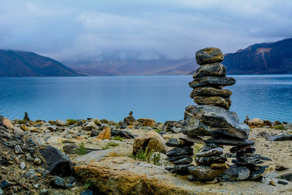 Pangong lake near the town of Leh, Ladakh, Jammu and Kashmir and China (Tibet).
Image: Aaron Thomas
(J&K) is the northernmost Indian state, located in the
Kashmir region and the Himalayan mountains. The size of the Indian controlled area is about 98,340 km², with a population of approximately 14 million people (est. 2017). The former Princely State of Jammu and Kashmir was run by Maharajas of the Dogra dynasty (supervised by the British). The territory was partitioned between India and Pakistan in August 1947. The Aksai Chin, a disputed border area in the east, is claimed by India as a part of the Ladakh region, but the area is under Chinese control since 1962.
There are three administrative divisions within Jammu and Kashmir:
The
Jammu division in the southwest, with Jammu city, the winter capital of the state.
The
Kashmir Valley division (Vale of Kashmir), a valley in the northwest of J&K surrounded by the Great Himalaya and the Pir Panjal mountain ranges, within lies
Srinagar, the summer capital of J&K.
The sparsely populated
Ladakh in the eastern half of Jammu and Kashmir is among the highest regions of the world; its culture and its history is closely related to that of Tibet. Most of the population of Ladakh is living in small villages in the valleys at elevations between about 2,750 and 4,550 m. Largest towns are Leh and Kargil.
Jharkhand came into existence when it was formed from the southern half of Bihar in November 2000, the city of
Ranchi became its capital. The state covers an area of 79,714 km², most of its territory is situated on the Chota Nagpur Plateau, a hilly, highly dissected region with an average elevation of about 700 m. Jharkhand has a population of estimated 36 million people. Largest cities are Jamshedpur, Dhanbad, and Ranchi. The official language is Hindi; other languages are Santali, Bengali, and Urdu. The main religions are Hinduism (68%) and Islam (14.5%).
Karnataka is located in the southwestern region of India with a coastline at the Arabian Sea. Formerly known as the State of Mysore (with Mysore as its capital), it was renamed Karnataka in 1973. The state covers an area of 191,976 km².
Karnataka features three distinct geographical regions: the coastal area of
Karavali (also known as Kanara or Coastal Karnataka), the coastal plain west of the Western Ghats mountain range is the southern portion of India's Konkan coast.
The
Malenadu (or Malnad) region comprises the slopes of the Western Ghats south of Goa; it is known for its lush vegetation and many waterfalls generated by high annual rainfall. To the east of Malenadu is the
Bayalu Seeme region, a large area east of the Western Ghats on the Deccan Plateau. The
Western Ghats 
are a UNESCO World Heritage Site
Karnataka has a population of about 68 million people (est. 2019), capital and largest city is
Bengaluru (Bangalore, pop. 9 million), other major cities are Mysore (Mysuru), Hubli (Hubballi), and Mangalore; New Mangalore Port is the only port in the state, it is one of India's major ports.
Karnataka's official language is Kannada (65%), other languages are Kodava, Konkani and Tulu. Main religion is Hinduism (84%) and Islam (13%).
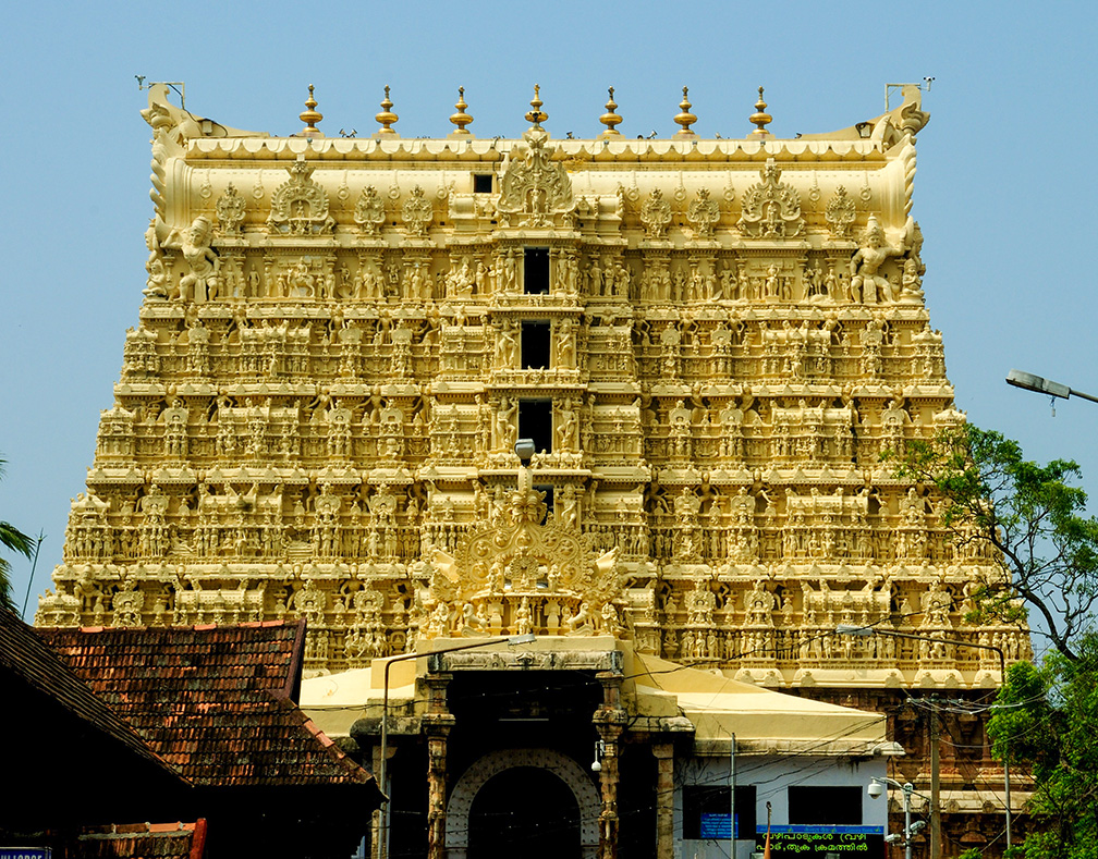 Padmanabhaswamy Temple, a Vedic temple dedicated to Lord Vishnu in Thiruvananthapuram, Kerala's capital city.
Image: -Reji
, the Indian state between the Western Ghats and the Lakshadweep Sea (Arabian Sea) on the country's tropical Malabar Coast was formed in 1956 by merging the British districts of Malabar and Calicut, the South Kanara district, and the princely states of Travancore and Cochin (Thiru-Kochi).
Kerala's landscape features three distinct areas: the mountainous terrain of Kerala's eastern highlands, a portion of the southern Western Ghats, known as the Cardamom Hills; the name comes from the cardamom spice grown at the altitude of the mountains' cool climate, which also supports pepper and coffee. Anamudi at 2,695 m (8,842 ft), the highest peak in the Western Ghats and Southern India rises in Kerala. The central mid-lands of the state are known for its rolling hills, and in the west are the lowlands with its comparatively flat coastal plains.
Since centuries Kerala is associated with spice production and trade, known as the Spice Garden of India, it was an important commercial center at the spice trade routes. Spice trade brought, along with colonialism, early capitalism to India's Malabar Coast.
Kerala covers an area of 38,863 km²; it has a population of about 37 million people (in 2018); capital and largest city is
Thiruvananthapuram (Trivandrum), second city and a major port is Kochi (Cochin), the city of Thrissur is the state's cultural capital.
Almost the entire population of Kerala speaks Malayalam, one of the Dravidian languages (97%), Tamil is spoken by 2%. Main religions are Hinduism (55%), Islam (27%), and Christianity (18%).
Kerala Government Website, Kerala Tourism
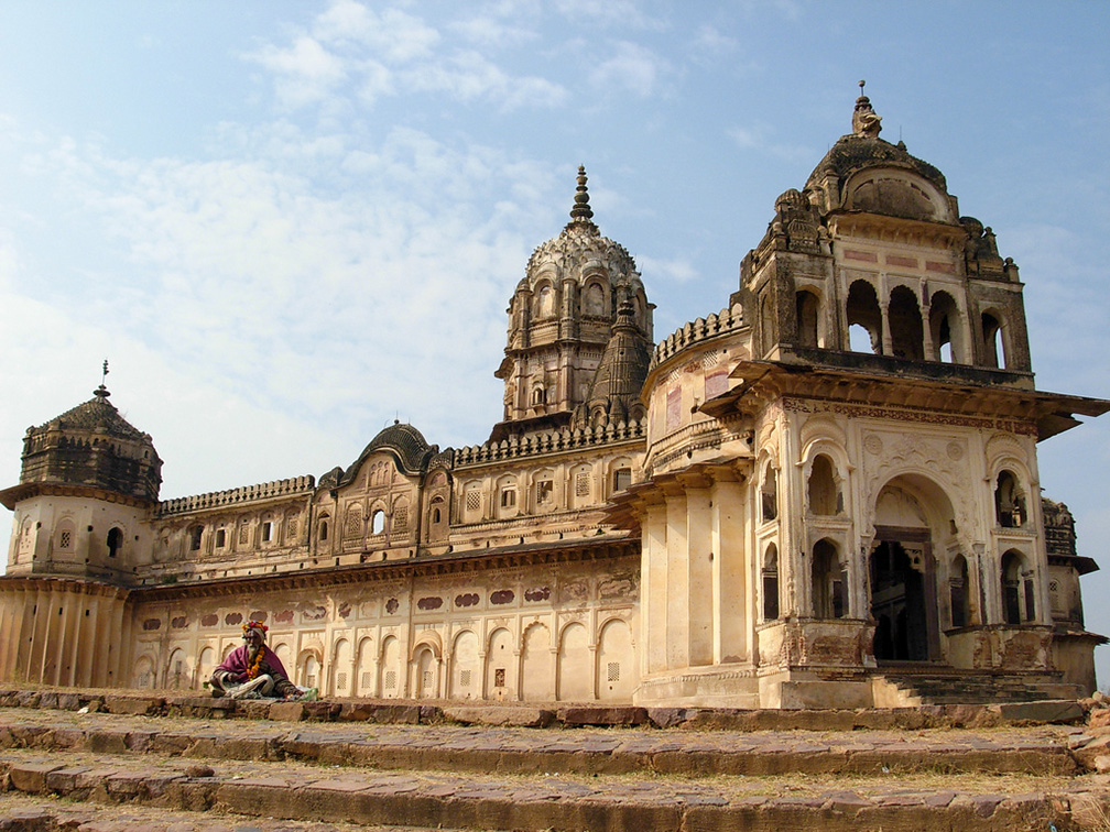 Temple of Lakshmi, the Hindu goddess of wealth, fortune and prosperity, the temple is located in Orchha, in Tikamgarh district of Madhya Pradesh.
Image: Vishaka Jayakumar
 is a large landlocked state in central India. The country's "Central Province" is bisected from east to west by its longest river, the Narmada. The river follows the valleys between the highlands and mountain ridges of the Vindhya range in the north, and the hills of the Satpura range in the south.
Madhya Pradesh occupies an area of 308,252 km², making it somewhat bigger than
Italy.
The state's populace of 80 million people (est. 2018) is primarily concentrated in the south. A number of ethnic groups, tribal communities, and various castes compose the population of Madhya Pradesh.
Capital city is
Bhopal, known as the 'City of Lakes,' but also as the site of one of the worst industrial accidents in history. Madhya Pradesh largest city is Indore; other major cities are Gwalior, Jabalpur, and the ancient city of Ujjain.
The state's official language is Hindi; spoken regional languages are Malwi, Bundeli, Bagheli, and Nimadi. The main religion is Hinduism (91%), about 7% of the state's population are Muslim.
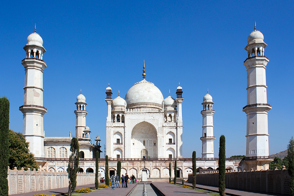 No, this is not Taj Mahal, this is Bibi Ka Maqbara, another mausoleum, it is the tomb of Rabia-ul-Daurani alias Dilras Banu Begum, wife of the Mughal Emperor Aurangzeb (1658-1707 A.D.) in Aurangabad, the "City of Gates" in Maharashtra.
Image: Arian Zwegers
, India's most industrialized state is situated in west-central India and has a coastline at the Arabian Sea in west. Large parts of the state occupy the Deccan plateau, one of the main geographical features of India. To the west of the plateau is a section of the Western Ghats (or Sahyadri Mountain Range), a chain of mountains and hills following the coastline, separated from the sea by the Konkan belt, a rugged coastal area section of India's western coast.
Maharashtra covers an area of 307,713 km², this about the size of Italy. The state is divided into six administrative divisions: Amravati, Aurangabad, Konkan, Nagpur, Nashik, and Pune. An estimated population of 124 million people (in 2018) makes Maharashtra the second-most populous state in India.
Capital city is
Mumbai (formerly known as Bombay), it is India's largest port and a mega-city with a population of 18 million people in its metropolitan area. Other major urban areas in Maharashtra are Pune, its cultural capital, Nagpur, Maharashtra's Winter capital, the ancient city of Nasik, the coastal Vasai-Virar, part of Mumbai Metropolitan Region, and the medieval city and tourism hub of Aurangabad.
The official language of Maharashtra is Marathi, spoken predominantly by the Marathi people. Main religions in the state are Hinduism (80%), Islam (11.5%), and Buddhism (5.8%).
Manipur, the "place of gems," a landlocked mountainous state in northeastern India borders Myanmar's Chin State in the southeast and the Sagaing Division in the east. Like the other Seven Sister States in the easternmost region of India, Manipur is largely isolated from the rest of the country.
The state covers an area of 22,327 km²; making it roughly half the size of
Denmark or about the size of the US state of
New Jersey. The scenic beauty of the landscape of the former kingdom is found in the Imphal valley and its surrounding forested hills and mountains.
Manipur has an estimated population of 3 million people (in 2017). Hindu Meitei people are the majority ethnic group of Manipur, primarily found in the central plain region of the state. One-third of the state's inhabitants are Tibeto-Burman people of the Kuki and Naga hill tribes. The relationship between the tribal people in the hills and the Meiteis in the Imphal valley has long been full of tensions.
The state's capital
Imphal sits in the center of Manipur connected to the rest of the world by a spiderweb of roads, passing through Naga inhabited hills. The roads were all closed from November 2016 to March 2017 by the Naga people who wanted to put pressure on Imphal and the federal government to add emphasis to their rejection to plans of the government to create seven new districts in the state. The Nagas accused the authorities that the new districts trespass ancestral land and it is done to weaken their vote in the upcoming state assembly elections.
Unrests in the state are making Manipur one of India's "politically sensitive areas." Separatist movements have been active in the state since 1964. Several groups have used economic blockade or even violence toward achieving their goal of a sovereign Manipur, one of the demands of the tribal people was the division of the present state into two or three Indian states along ethnic lines or the integration into an independent Nagaland.
Meghalaya, the 'home of the clouds', is a state in the northeastern part of India. It is situated on a mountainous plateau, bordering
Bangladesh in the south. Meghalaya was formerly part of Assam; it was separated in 1972 to become an autonomous state.
Meghalaya covers an area of 22,429 km², its landscape features valleys, deep gorges, and highland plateaus, with many rivers running through the area. The Khasi Hills are the highest elevations in the state, and Shillong Peak is its highest point, overlooking the capital Shillong. Meghalaya is known as home to two of the rainiest places on the planet, the towns of Cherrapunji and Mawsynram. Nohkalikai Falls near Cherrapunji, close to the border with Bangladesh in the southeast is one of India's tallest waterfalls. The state, predominantly inhabited by Khasis, Jaintias, and Garo tribal communities, has a population of about 3.2 million people. The capital and largest city is
Shillong, a hill station at an elevation of 1,495 m (4,900 ft.) with a population of about 150,000 people (in 2017). Soken languages are Khasi (47%), Garo (31%), and English (official). Major religions are Christianity (74%), Hinduism (11%), and Islam (4%).
Mizoram, the 'land of the hill people,' is a landlocked state in Northeast India, it borders Bangladesh's Chittagong Hill Tracts in the west and Myanmar's Chin State in the east. Mizoram was formerly the Lushai Hills District of Assam; it became a Union Territory in 1972 and an autonomous state in 1987. The state covers an area of 21,087 km², compared, this is about half the size of
Denmark, or somewhat smaller than the US state of
New Jersey. Mizoram offers a landscape with an assortment of hills and mountains, rocky cliffs, deep valleys, lakes, and rivers. Verdant forests dominated by bamboo groves cover its terrain. The highest point is Phawngpui, the Blue Mountain at 2,157 m (7,077 ft).
Mizoram is home of the Mizos, tribal people with several sub-tribes known as Luseis, Lais, Maras, and Kukis. About 1.1 million people
live in Mizoram. The capital and largest city is
Aizawl; official languages are Mizo and English. Animism was the traditional religion of the Mizos, but since the 19th century, American Baptist missionaries have propagated their Christian belief along with formal education which eventually resulted in the Mizos becoming one of the most literate communities in the country.
Mizoram Government,
Mizoram Department of Tourism
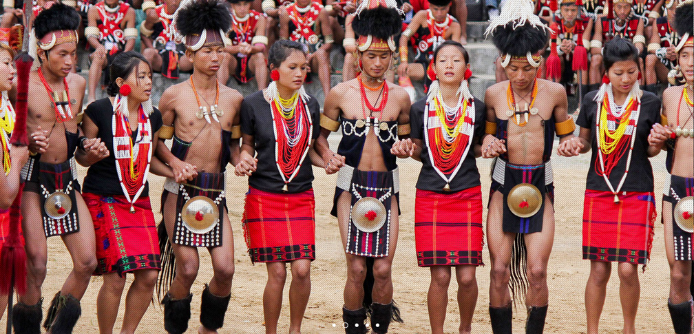 A group of Chang Naga people in traditional colorful costumes perform dance at Horbill festival.
Image: Nagaland Tourism
is a rural, remote territory and one of the Seven Sisters States in the northeastern part of India. It borders an extent of the Naga Self-Administered Zone in the Sagaing Region of Myanmar. Nagaland gained statehood in 1963.
The state covers an area of 16,579 km². The mountainous landscape of Nagaland is known as the Naga Hills. The hills rise from the Brahmaputra Valley in Assam to about 2,000 m (6,500 ft.), the highest peak is Mount Saramati at 3,840 m on the India-Myanmar border.
Nagaland is home to diverse indigenous tribes, sixteen major and several minor ethnic groups, all called Nagas. The tribal communities are distinct in character from each other in terms of customs, language, and costumes. About 2.2 million people live in Nagaland; capital town is Kohima, the largest city is Dimapur there is the only airport in Nagaland. Spoken languages are a number of dialects, all belonging to the Sino-Tibetan language family. The traditional Naga religion is animistic, but like many other Seven Sister States, main religion is Christianity due to large-scale proselytization since the 19th century by Baptist missionaries in Northeast India and neighboring regions of Myanmar.
Nagaland official State Portal,
Nagaland Department of Tourism
Odisha is situated in the tropical zone of central-east India. It has a coastline at the Bay of Bengal in the east. Until 2011 the state was known as Orissa. Odisha covers an area of 155,707 km², compared it is about half the size of
Poland, or slightly larger than the US state of
Georgia.
Odisha has a variety of geographical regions: the
Northern Plateau, a series of forested highlands with steep ridges which alternate with valleys. The mountainous region of the
Eastern Ghats runs parallel to the coastal plains. The two broad plateaus of the
Central Table Land are age-old eroded mountains with elevations between 500 m to 1,000 m. The
Coastal Plains (Utkal Plains), also known as the "Gift of Six Rivers," the plains are formed by alluvial deposits of six major rivers, the Subarnarekha, the Budhabalanga, the Baitarani, the Brahmani, the Mahanadi, and the Rushikulya. Within the plains lies
Chilika Lake, a large brackish water lagoon at the mouth of the Daya River.
About one-third of the state is forested, and it has an abundance of natural resources such as iron, coal, zinc, and forest products.
Odisha has a population of 42 million people; the majority are Hindus. Tribal people constitute over 20 percent of the population. Capital and largest city is
Bhubaneswar. Oriya (Odia) is the local language with a number of dialects. The main religion is Hinduism with more than 94%.
Government of Odisha,
Odisha Department of Tourism
Punjab, the "land of five rivers" is a state in the northwestern part of India in a plain to the southwest of the Himalayas; it shares a border with Pakistan's Punjab province in the west. The Indian State of Punjab was created in 1947 when the partition of India split the former Raj province of Punjab between India and Pakistan.
The India's Punjab covers an area of 50,362 km², compared it is about the size of
Slovakia or twice the size of the US state of
Vermont. The state is situated on a flat alluvial plain, bordered by some hills in the northeast. Only three of the original five rivers flow in today's Indian Punjab, the Sutlej, the Ravi, and the Beas rivers; they are all tributaries of the Indus. The rivers are the source for an extensive irrigation canal system in the state. While the region near the foothills of Himalayas receives sufficient rainfall, the southwestern part of the state is semiarid and merges into the Great Indian Desert, the Thar Desert.
Punjab India has a population of about 30 million people (in 2017). The capital city is
Chandigarh (which is also the capital of Haryana), largest city is Ludhiana, India's largest city north of Delhi. Other major cities are Amritsar (Rāmdāspur), famous for its Golden Temple. The ancient city of Jalandhar, well-known for its sports industry, and Patiala, a major education center in the state. Spoken languages are Punjabi (92%) and Hindi (8%). The main religions are Sikhism (58%) and Hinduism (38%).
Government of Punjab,
Punjab Tourism Department
Rajasthan was until 1949 known as Rajputana, a landlocked state in north-western India; it borders Pakistan in the west. It is India's largest state with an area of 342,239 km², compared it is somewhat smaller than
Germany, or slightly smaller than the US state of
Montana.
The landscape of Rajasthan has two major geographical features, the hilly region of the
Aravalli Range, the "line of peaks" runs northwest to southeast through the state, the Aravalli hills are the eroded remains of ancient mountains, dating back to times when the Indian subcontinent still was an island.
To the northeast of the Aravalli spreads the inhospitable
Thar Desert, also known as the Great Indian Desert or the Rajasthan Desert. The arid region covers an area the size of the UK; it is home to the largest (but declining) camel population in India. The desert extends into Pakistan, Gujarat, Punjab, and Haryana. Rajasthan's desert is inhospitable but not uninhabitable, in fact, it is one of the most heavily populated desert areas in the world, its inhabitants engage in farming and animal husbandry, it is also the biggest wool-producing area in India.
Rajasthan’s historical forts, palaces, art and culture making it a major tourist destination in India.
Rajasthan has a population of 76 million people (est. 2017), capital and largest city is
Jaipur, other major cities are Jodhpur, Kota, Bikaner, Ajmer, and Udaipur. Spoken languages are Hindi and Rajasthani.
Government of Rajasthan,
Rajasthan Department of Tourism
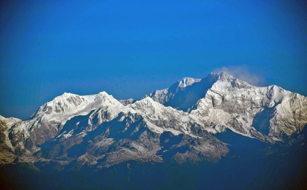 Kangchenjunga seen from Tiger Hill, Darjeeling. The third highest mountain in the world at 8,586 m, is situated on the border between Nepal and Sikkim.
Image: DC Assam
, (
Dejong in Tibetan, the rice country) is a small state on the southern slopes of the Himalayas in northeastern India. It borders Nepal in the west, the
Tibet Autonomous Region in the north and the northeast,
Bhutan in the southeast, and West Bengal in the south.
The former Buddhist kingdom became a princely state of British India in 1890. After India's independence in 1947, Sikkim continued its protectorate status with India. In 1975, the Indian military deposed the Sikkimese monarchy and annexed the kingdom. A referendum was delivered some days later.
Sikkim covers an area of 7,096 km²; it is India's second smallest state after Goa. Its landscape is mountainous with the Sivalik Hills of the outer Himalayas in the south and the Great Himalaya range in the north. The highest mountains in Sikkim are the Chomo Yummo (6,829 m) on the Tibet-Sikkim border, Kangchengyao (6,889 m), Kirat Chuli (7,362 m), the Jongsong Peak (7,462 m) on the China–India–Nepal tripoint, and Kangchenjunga (8,586 m) India’s highest mountain, located on the Sikkim-Nepal border.
Sikkim is India's least populous state with a population of 650,000 (est. 2018), capital and largest city is
Gangtok, formerly the seat of the Sikkimese Chogyal, the monarchs of the former kingdom. Today Sikkim's population is multiethnic and multilingual with 11 official languages. Main languages are Nepali (63%), Sikkimese (Bhutia), (7.6%) Hindi (6.6%), Lepcha (6.5%), and Limbu (6.3%). Major religions are Hinduism (57.8%), Buddhism (27.3%), and Christianity (9.9%).
Sikkim State Portal,
Official Sikkim Tourism portal
Tamil Nadu is the state at the southeastern tip of the Indian subcontinent. It features a coastline known as the Coromandel Coast along the Bay of Bengal in the east, the Palk Strait and Palk Bay in the southeast, the Gulf of Mannar and the Laccadive Sea in the south.
Tamil Nadu covers an area of 130,060 km²; making it slightly smaller than
Greece, or somewhat larger than the US state of
Mississippi.
Its terrain is mostly flat, along its northern border rises the southern section of the Eastern Ghats. The separate portions of the mountain range are known as the Servarayan Hills, and the Javadi Hills.
The Western Ghats define Tamil Nadu's western border with Kerala, within are the Palani Hills, an eastward extension of the mountain range. In the west tower the Nilgiri Mountains, with several peaks above 2,000 m (6,600 ft).
Major rivers in the state are the Kaveri (Cauvery), the Palar, and the Ponnaiyar rivers.
Tamil Nadu is home of the Tamil people, descendants of the more than 3,000 years old early Indian civilization of the Dravidians, one of the last surviving classical cultures.
Today Tamil Nadu has a population of 78 million people (est. 2017); the capital and largest city is
Chennai (formerly known as Madras); other major cities are Coimbatore, Madurai, Tiruchirappalli (Trichinopoly), and Tiruppur.
Spoken languages are Tamil (90%) and some English. The main religions are Hinduism (87%), Christianity (6%), and Islam (6%).
Tamil Nadu Government,
Tamil Nadu Tourism
Telangana is home to the Telugu-speaking people. It became the 29th state of India on the 2nd June 2014 by separating ten districts from Andhra Pradesh. Telangana covers a part of the eastern Deccan Plateau; the tableland is also known as the Telangana Plateau. The plateau lies at an average altitude between 200 m and 600 m. The highest point is Doli Gutta at 965 m (3,166 ft). The state occupies an area of 112,077 km², making it slightly larger than
Bulgaria or somewhat greater than the US state of
Virginia. Two major rivers drain the region, the Godavari and the Krishna River.
The economy of Telangana is largely based on agriculture. Rice is the main food crop. Industrial manufacturing and services are established mostly around
Hyderabad, the capital and primate city of Telangana. Other major cities are Hyderabad's twin city Secunderabad, Warangal, Nizamabad, Khammam, and Karimnagar.
Telangana has a population of 38 million people (est. 2017), the official language is Telugu, spoken by about 77% of the people; the other language is Urdu (12%). Main religions are Hinduism 85%, and Islam 13%.
Telangana State Portal,
Telangana Department of Tourism
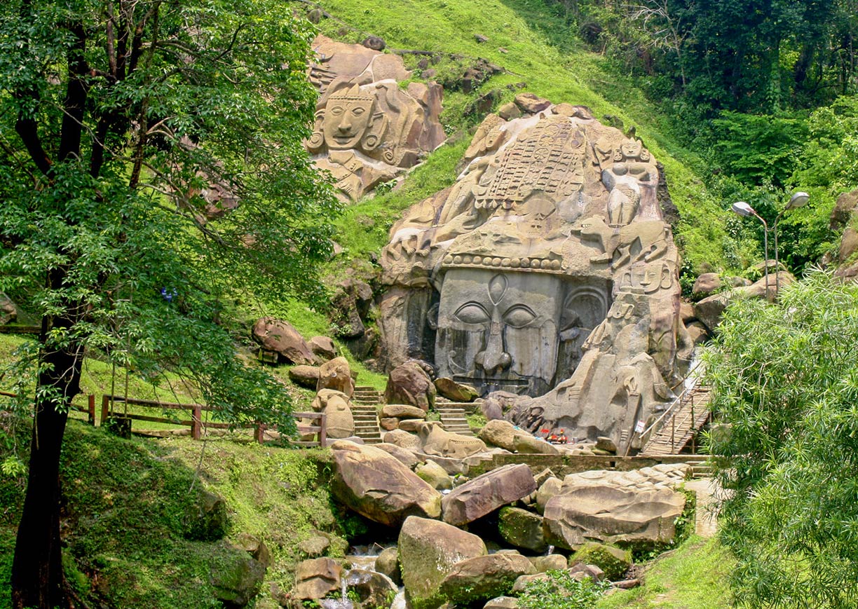 Unakoti is an ancient Shaivite place of worship with huge rock reliefs celebrating Shiva.
Image: Atudu
is a small landlocked state in northeast India; it borders
Bangladesh on three sides. After independence in 1947, the former kingdom acceded to India and achieved full status as a state in 1972. India's third-smallest state covers an area of 10,491 km²; compared it is about four times the size of
Luxembourg or roughly half the size of the US state of
New Jersey.
The terrain of Tripura features a plain in the west. The rest of the state is covered by five hill ranges, separated by valleys, extending in a north-south direction. Tripura's undulating landscape is mostly forested; several rivers originate in its hills from where they flow into Bangladesh. Agriculture and related activities are the backbone of the state's economy; rice is the main crop, rubber and tea are important cash crops. The National Highway 8 connects Tripura with the rest of the country.
Tripura has a population of about 4 million people; capital and largest city is Agartala. Other urban centers are the ancient city of Dharmanagar in the northeast, Udaipur, the former state capital, and Kailashahar, the ancient capital of the Tripuri kingdom.
Spoken languages are Bengali (67%), Kokborok (Tripuri, 25%), Mizo, and English. Major religions are Hinduism (83%), Islam (9%), and Christianity (4%).
Tripura State Portal,
Tripura Tourism Department
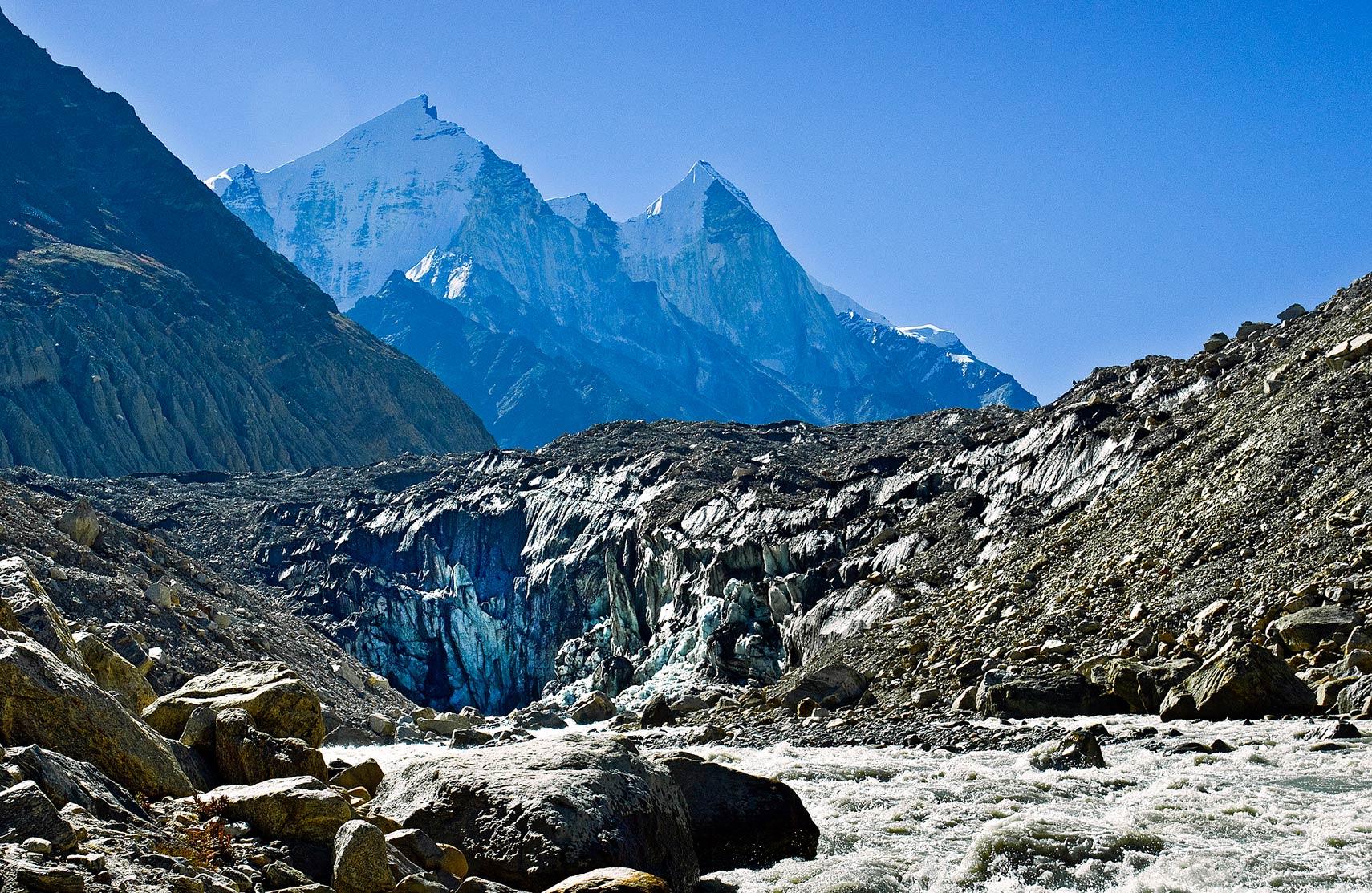 Gomukh, the mouth of the Gangotri glacier is the source of the Ganges River. The Bhagirathi peaks rise in background.
Image: Pranab basak
, until 2006 known as Uttaranchal, lies in the Himalayas in northern India, it borders the
Tibet Autonomous Region of
China to the northeast and
Nepal in the southeast.
Uttaranchal was created in 2000 from the northern quarter of Uttar Pradesh; it covers an area of 53,483 km², compared it is about half the size of
Bulgaria, or about twice the size of the US sate of
Massachusetts.
The landscape of Uttarakhand is dominated to the north by the Himalaya Mountain Range.
Nanda Devi (7,816 m) is the highest mountain in India which is located entirely within the country. The mountain, part of the Garhwal Himalayas, rises in the Chamoli district of Uttarakhand.
Two of the most important rivers in Hinduism originate in the glaciers of Uttarakhand, the Gangotri Glacier is one of the primary sources of the Ganges, and the Champasar Glacier near the pilgrim town of Yamunotri in the Garhwal Himalayas is the source of the Yamuna River.
Uttarakhand is home to four of the most revered Hindu sites in India (Chota Char Dham): the holy town of Badrinath, the Kedarnath Hindu temple in Haridwar District, Gangotri, the pilgrim town on the banks of the river Bhagirathi, and Yamunotri, the source of the Yamuna River and seat of the Goddess Yamuna (Kalindi).
Uttarakhand has a population of 10.3 million people (est. in 2017), the capital and largest city is
Dehradun (Dehra Dun); other major cities are Haridwar, Roorkee, and Haldwani.
The state has the highest Hindi language speaking population (88.26%) in India, followed by Urdu (5.88%), Punjabi (2.92%), Bengali (1.46%) and Nepali (1.46%). The main religions are Hindu 60%, Islam 27%, Christianity 8%, and Sikh 5%.
Uttar Pradesh (UP) is a state in the central-north of India in the Gangetic Plain. It adjoins the Himalaya foothills in the north and shares a border with Nepal in the northeast. The state covers an area of 243,290 km², compared, it is about the same size as the
United Kingdom or roughly the size of
Minnesota. The terrain of Uttar Pradesh features a variety of landscapes. In the north, there are the parallel east-west running belts of the Shivalik Hills and the Terai. The
Shivalik Hills is a mountain range of the outer Himalayas that separates the sparsely populated mountain region from the densely populated plains to the south. The
Terai to the south of the hills is a lowland belt of grasslands, scrub savanna and sal tree forests, interspersed with marshes and swamps.
The largest part of the state is situated on the
Gangetic Plain, a mostly flat area with many rivers and fertile alluvial soils. The principal rivers are the Ghaghara, the Yamuna, and the Ganges rivers.
India's most populous state has an estimated population of 210 million people
(in 2019), compared it would be the 5th most populous country in the world after Indonesia (265 million). Capital and largest city is
Lucknow (pop. 3 million); second largest city is Kanpur, with the most populous metropolis in the state. Other major cities are Ghaziabad, a planned industrial city close to New Delhi; Agra on the banks of the Yamuna river and home to the
Taj Mahal; the religious hub of Varanasi (Benares) on the banks of the Ganga river; the ancient city of Meerut; and Allahabad (Prayagraj), the judicial capital of Uttar Pradesh. Spoken languages are Hindi in its various dialects and Urdu. The main religions are Hinduism (80%) and Islam (19%).
West Bengal, the long stretched state in central-eastern India is wedged between Bangladesh and several Indian states. In 1947, Bengal was partitioned along religious lines; the eastern part went to the Dominion of Pakistan (now Bangladesh), the western part went to India.
In West Bengal's Himalaya region in the north, the state borders Nepal and Bhutan; in the southeast, it is bounded by the Bay of Bengal. West Bengal covers an area of 88,752km², making it somewhat smaller than
Portugal, or slightly smaller than the US state of
Maine.
West Bengal's terrain has two natural geographic areas; in the north, there are the sub-Himalayan and Himalayan areas. Internationally famous is the Darjeeling district, at the border to Sikkim, well known for its tea. In the south of the state, there is the fertile Gangetic Plain of the river Ganges with its tributaries, and distributaries. Major rivers are the Damodar river, the Hooghly river, and the Ajay river. The Ganges flows through the narrow middle portion of the state and then forms a short section of the border with Bangladesh.
West Bengal has a population of about 95 million people.
Kolkata (pop. 5.2 million) is the state capital, a river port and industrial center in eastern India and the second largest city in the country. Other major cities are Asansol, Siliguri, Durgapur, and Bardhaman. Spoken languages are Bengali 85%, and Hindi 7%, Nepali is the official language in three Hill Sub-divisions of the Darjeeling District. Main religions are Hinduism (71%) and Islam (27%).
Government Of West Bengal,
West Bengal Tourism

