Advertising

India Flag detail
Home Earth Continents Asia India Country Profile States and Union Territories of India Google Earth Daman and Diu Map

___ Satellite View and Map of Daman and Diu (दमन और दीव), India


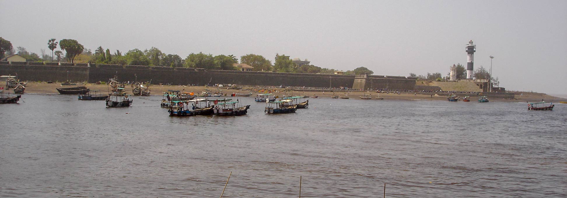
Fortress and Lighthouse of Daman at Daman Ganga River, India
Daman Fort, the Portuguese Fortress at the mouth of the Daman Ganga River with the Lighthouse of Daman, Daman and Diu, India.

About Daman and Diu


Seal of Daman and Diu
Satellite view and a map of Daman and Diu. The Indian Union Territory is located in the west of India and consists of two separate areas.
Daman & Diu was formerly part of Portuguese India (Portugal), along with Goa and the union territories of Dadra & Nagar Haveli.
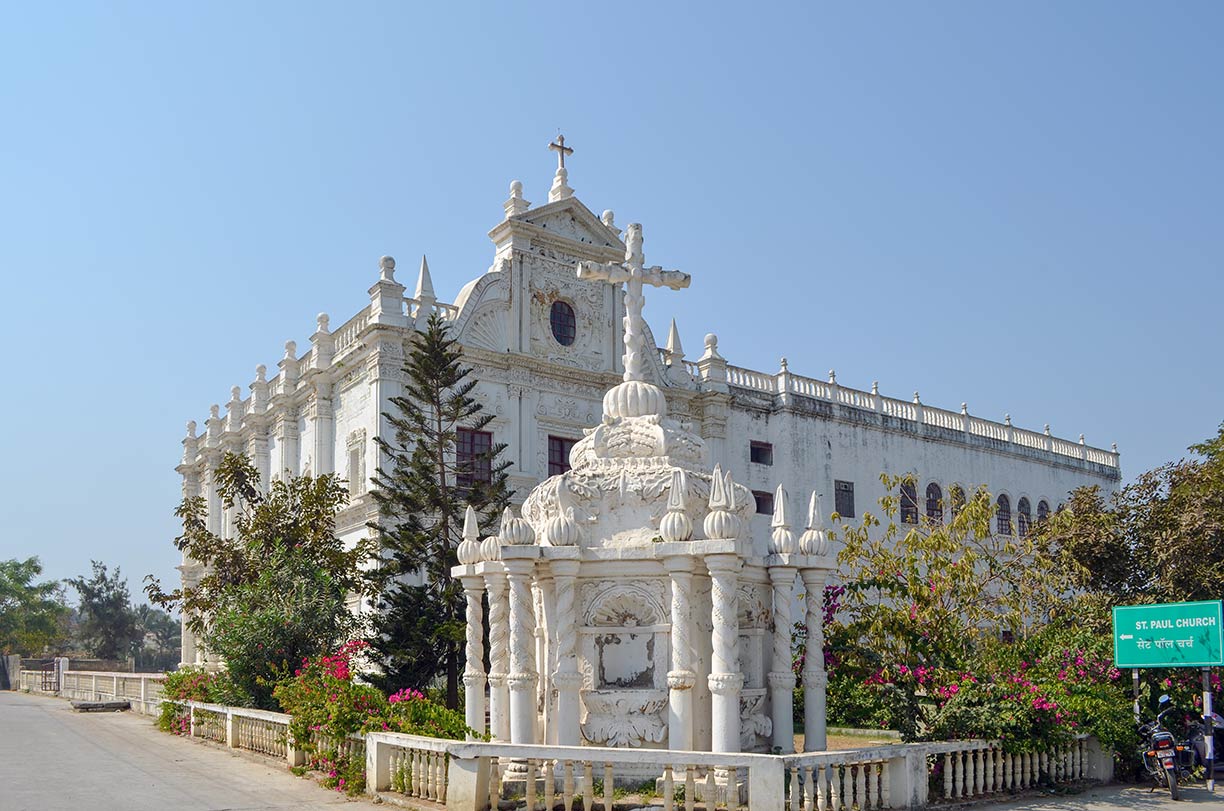

St. Paul Church on Diu Island, Daman and Diu Union Territory
St. Paul Church on Diu Island. The church was built by the Portuguese 400 years ago.
Image: Mohnish1208
Daman lies on India’s west coast at the mouth of the Daman Ganga River, about 170 km by road north of Mumbai. The Daman district is surrounded by the Valsad District of Gujarat.

Diu is situated to the west of Daman, about 200 km across the Gulf of Khambhat (Cambay) on the Kathiawar peninsula of Gujarat. If you take the road to travel from Daman to Diu all along the coast of the Gulf of Khambhat, the route is about 680 km long.

The town and the Fort of Diu are located south of Gir Somnath district of Gujarat on the eastern tip of Diu Island, at the Gulf of Khambhat.


The territory of Daman and Diu has a combined area of 112 km² (43 sq mi), it is the smallest federal division on India's mainland. Compared it is about twice the size of San Marino or about two-thirds the size of Washington D.C.

The UT of Daman and Diu has a population of 160,000 people. Administrative capital is Daman. Official languages are Gujarati, Marathi, and English, a number of elder people still use and understand Portuguese.


The map shows the location of Daman and Diu with both cities, main roads and streets, and the location of Diu Airport (IATA code: DIU).

To find a location use the form below.


Sorry! Google's pricing policy has made it impossible for us to continue showing Google Maps. We apologize for any inconvenience.

Google Map: Searchable map and satellite view of Daman and Diu, India.

φ Latitude, λ Longitude (of Map center; move the map to see coordinates):

,


Bookmark/share this page
  Instagram button
More about India

Landmarks:
Taj Mahal
Satellite view of the famous mausoleum.

Cities:
Information and searchable map/satellite views of
Delhi
Chandigarh
Chennai
Hyderabad
Kolkata
Mumbai

Country:
Searchable map/satellite view of India
Map of India
Administrative Map of India
Political Map of Northern India and the Kashmir region
Searchable location map of India's airports
India Country Profile
India in numbers
India Key Statistical Data.

States and Union Territories of India

Continent:
Map of Southeast Asia
Map of Asia


External Links:
Daman and Diu
U.T. Administration of Daman & Diu.

Wikipedia: Daman and Diu
Wikipedia entry Daman and Diu.
 
Weather Conditions Daman and Diu:

DAMAN WEATHER

Advertisements:


States of India:
Andhra Pradesh, Arunachal Pradesh, Assam, Bihar, Chhattisgarh, Goa, Gujarat, Haryana, Himachal Pradesh, Jammu & Kashmir, Jharkhand, Karnataka, Kerala, Madhya Pradesh, Maharashtra, Manipur, Meghalaya, Mizoram, Nagaland, Odisha, Punjab, Rajasthan, Sikkim, Tamil Nadu, Telangana, Tripura, Uttarakhand, Uttar Pradesh, West Bengal

Google Maps of India's Union Territories:
Andaman and Nicobar Islands, Chandigarh, Dadra & Nagar Haveli, Daman & Diu, Lakshadweep, Puducherry

Major Cities in South-Central Asia:
Almaty, Ashgabat, Astana, Baku, Bishkek, Colombo, Dhaka, Dushanbe, Islamabad, Kabul, Karachi, Kathmandu, Lahore, Lhasa, Male, Samarkand, Tashkent, Tehran, Thimphu 

Map Help [ show ]
up