Advertising

India Flag detail
Home Earth Continents Asia India Country Profile States and Union Territories of India Google Earth Chandigarh Map

___ Satellite View and Map of the City of Chandigarh (चण्डीगढ़), India


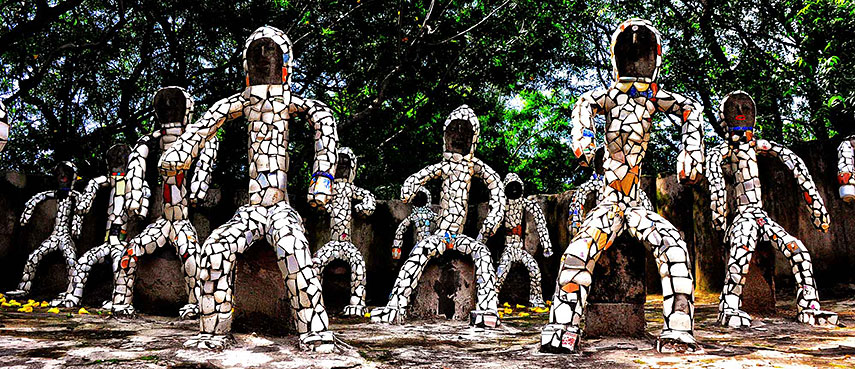
Sculpture garden in Chandigarh
Rock Garden, Chandigarh, a forty-acre sculpture garden with a plethora of statues made of industrial and home waste by Nek Chand Saini, a self-taught Indian artist.
Image: Rod Waddington

About Chandigarh


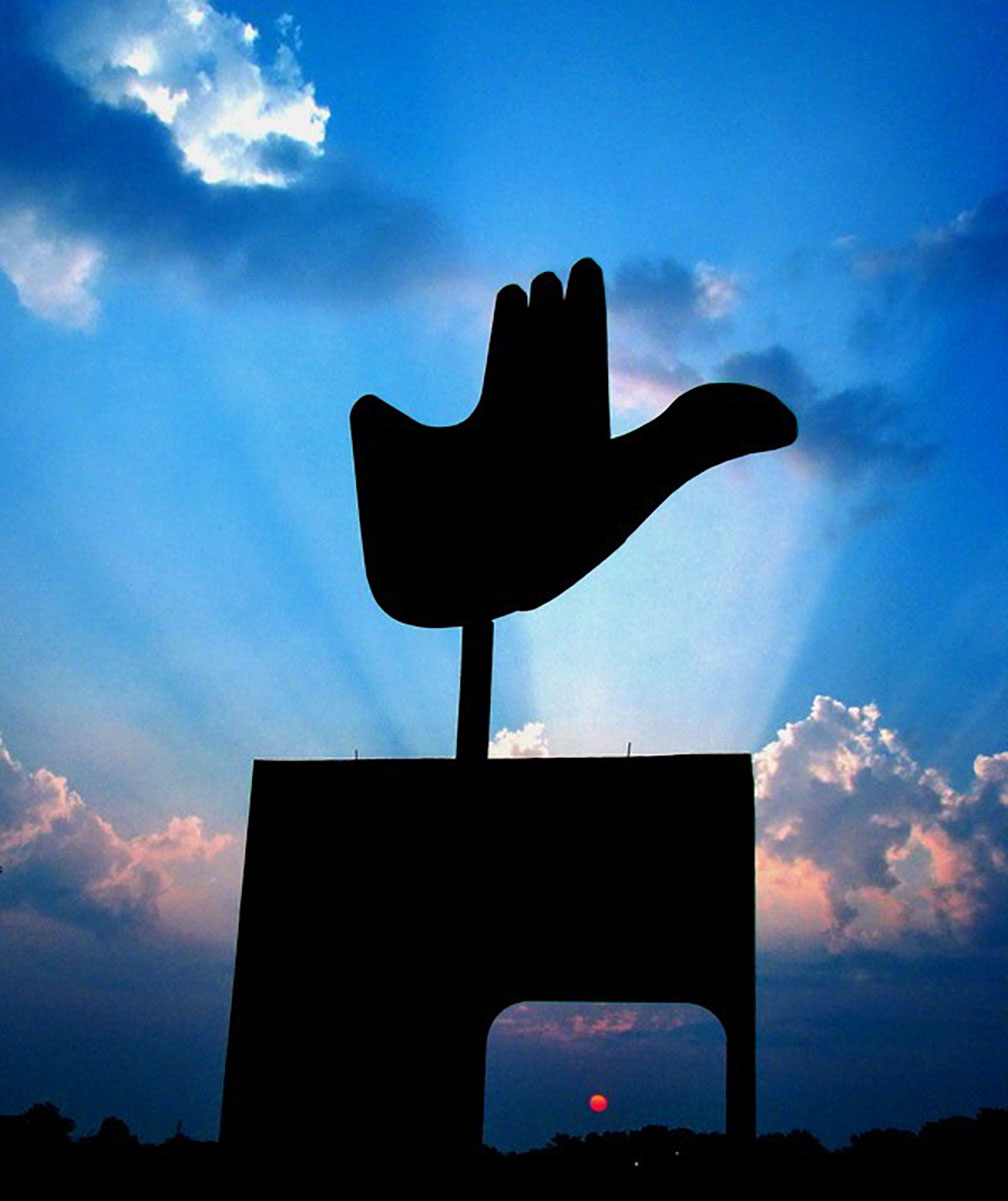
Open hand monument of Chandigarh
The famous open hand monument of Chandigarh. The symbolic structure was designed by Le Corbusier and is located in the Capitol Complex of the city.
Image: Ravjot Singh


Chandigarh Administration Logo
The satellite view and the map show Chandigarh. The city is located in northern India at the foothills of the Himalayas, in the Shivalik hills (Morni Hills).


The Hindi word Chandigarh means "the fort of Chandi," Chandi (aka or Chandika) is the combined form of Kali, Lakshmi, and Saraswati, a fearless and ferocious goddess, the Bengal Goddess of power.


Chandigarh is a planned city, built to replace Lahore (now Pakistan) as the capital of the Indian state of Punjab. The site was designed in 1950 by Le Corbusier, the famous French architect and city planner.


The city is not only the capital of two Indian states, Punjab and Haryana; it is also one of the seven Union Territories of India under the direct administration of the Indian Government.


Chandigarh has a population of about 1 million people. Spoken languages are Hindi, Punjabi, and English.


Some points of interest:
Sukhna Lake (an artificial lake), Rock Garden of Chandigarh (a sculpture garden), Government Museum and Art Gallery (a museum and art gallery), Open Hand Monument (Le Corbusier sculpture), Elante Mall (largest shopping mall in Northern India), Le Corbusier Centre (life and works of Le Corbusier), Rose Garden.

The map shows a city map of Chandigarh with main roads and streets, and the location of Chandigarh International Airport (IATA code: IXC).

To find a location use the form below.
 
Sorry! Google's pricing policy has made it impossible for us to continue showing Google Maps. We apologize for any inconvenience.

Google Map: Searchable map and satellite view of Chandigarh, India.

City Coordinates: 30°45′N 76°47′E

φ Latitude, λ Longitude (of Map center; move the map to see coordinates):

,


Bookmark/share this page
  Instagram button
More about India

Landmarks:
Taj Mahal
Satellite view of the famous mausoleum.

Cities, searchable map/satellite view and of and information about:
Delhi, Chennai (Madras), Hyderabad, Kolkata (Calcutta), Mumbai (Bombay)

Country/States:
Searchable map/satellite view of India
Searchable map with India's major airports
Administrative Map of India
Map of India
Political Map of Northern India and the Kashmir region

India Country Profile
India in numbers
India Key Statistical Data.

States and Union Territories of India

Continent:
Map of Southeast Asia
Map of Asia


External Links:
Chandigarh (official website)
Wikipedia: Chandigarh
 
Current Weather Conditions Chandigarh:

CHANDIGARH WEATHER

Advertisements:


States of India:
Andhra Pradesh, Arunachal Pradesh, Assam, Bihar, Chhattisgarh, Goa, Gujarat, Haryana, Himachal Pradesh, Jammu & Kashmir, Jharkhand, Karnataka, Kerala, Madhya Pradesh, Maharashtra, Manipur, Meghalaya, Mizoram, Nagaland, Odisha, Punjab, Rajasthan, Sikkim, Tamil Nadu, Telangana, Tripura, Uttarakhand, Uttar Pradesh, West Bengal

Google Maps of other India's Union Territories:
Andaman & Nicobar Islands | Chandigarh | Dadra & Nagar Haveli | Daman & Diu | Lakshadweep | Puducherry

Major Cities in South-Central Asia:
Almaty, Ashgabat, Astana, Baku, Bishkek, Colombo, Dhaka, Dushanbe, Islamabad, Kabul, Karachi, Kathmandu, Lahore, Lhasa, Male, Samarkand, Tashkent, Tehran, Thimphu

Map Help [ show ]
up