About Delhi
The satellite view shows Delhi, known locally as Dilli, officially the National Capital Territory (NCT) of Delhi. The Capital Territory consists of twenty-two towns or urban districts.
The national capital is the second-largest metropolis in
 India
India after
Mumbai.
The territory is bordered on three sides by the Indian state of
Haryana and by
Uttar Pradesh in the east.
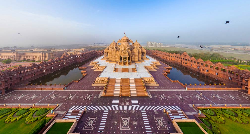
 The Swaminarayan Akshardham, a Hindu temple complex in Noida Mor, New Delhi.
Image: Gursimran Singh
Delhi, officially the National Capital Territory of Delhi or NCT, is a city and a union territory in northern central India that consists of the cities of Old and New Delhi.
Old Delhi (Purani Dilli)
The walled city on the Jumna (Yamuna) River is shaped like a quarter coin, with the Red Fort palace complex at its center. In 1638/39 Shah Jahan (1592–1666), the architect of the
Taj Mahal decided to shift the Mughal capital from Agra to the new location. He built a walled urban center to the north of earlier settlements of Delhi and named it Shahjahanabad, to serve as the capital of the Mughal Empire, a Muslim dynasty and the second largest empire that existed in the Indian subcontinent. In 1803, the British East India Company captured Delhi.
New Delhi
The capital of India is a planned city designed by British architects. The foundation stone of the new government complex was laid in 1911 by George V, Emperor of India and King of the United Kingdom and the British Dominions. The city was built between 1912 and 1929 to replace Calcutta (today
Kolkata) as the capital of British India. Today New Delhi is the seat of the Indian government.
In 2011 the urban agglomeration of Delhi had a population of 16.3 million inhabitants (
Census of India 2011). According to a
UN Study, Delhi's metropolitan area is now considered to extend beyond the NCT boundary to include an estimated population of over 27 million people (in 2017) making it the world's second largest urban area. The area contains the neighboring satellite cities of Bahadurgarh, Gurugram, Faridabad, Noida, and Ghaziabad.
Delhi points of interest
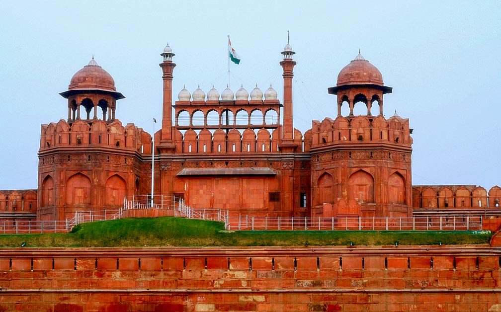
 The Red Fort Complex, the main residence of Mughal emperors until 1857 in Shahjahanabad (Old Delhi).
Image: Saad Akhtar
If you visit Delhi you can cross off three World Heritage Sites from your bucket list:
Humayun’s Tomb, the tomb of the Mughal Emperor Humayun was built in 1570; it was the first garden-tomb on the Indian subcontinent.
Qutb Minar and its Monuments, the Qutub Minar is a 13th-century red sandstone tower with a height of 72.5 m. The minaret is situated a few kilometers south of Delhi.
The
Red Fort Complex is a palace fort of red sandstone. Shah Jahan, India's fifth Mughal Emperor, built the palace in Shahjahanabad (now Old Delhi) when he moved the empire's capital from Agra to Delhi.
Other top sights are: the
Purana Qila, the riverside Mughal style walled stone fortress with the Humayan Gate and a 16th-century mosque, is one of the oldest forts in Delhi.
Jama Masjid, 17th-century Mughal-style red sandstone mosque with 40m high minarets, it is one of the largest mosques in India, it was also built by Mughal emperor Shah Jahan between 1644 and 1656.
India Gate, is an Arc de Triomphe-style war memorial on the eastern edge of the ‘ceremonial axis’ of New Delhi.
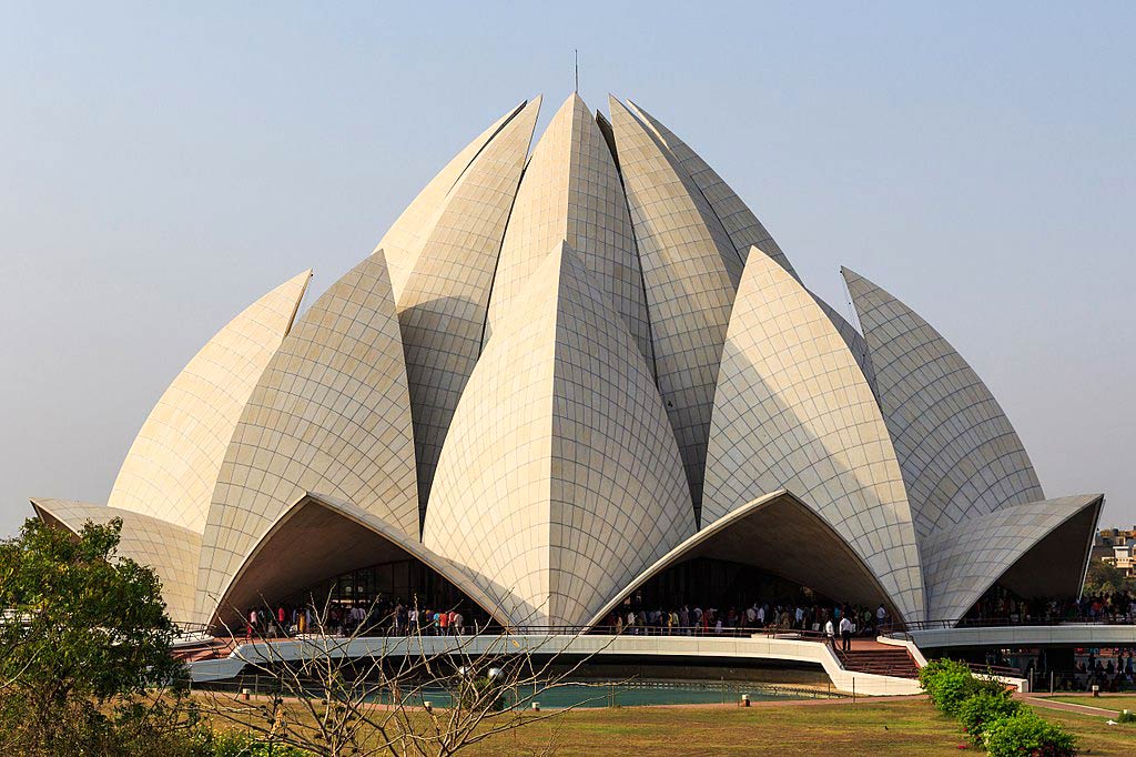
 Lotus Temple, the Bahá'í House of Worship in New Delhi, a Bahá'í House of Worship is a gathering place where people of all religions may worship God without denominational restrictions.
Image: Alexander Savin
The
Lotus Temple in Delhi is a religious site and the Bahá'í Mother Temple on the Indian subcontinent.
Akshardham, the spiritual-cultural complex shows thousand years of traditional Hindu and Indian culture, it features besides a water show and a cultural boat ride, an IMAX film on the early life of Swaminarayan as the teenage yogi.
Gurudwara Bangla Sahib, is a Sikh gurdwara, a prominent place of worship for Sikhs in the city.
Chandni Chowk, is a busy shopping area in the heart of Old Delhi, near the Delhi Junction railway station, a market full of spices, dried fruit, silver jewelry, and traditional Indian sweets.
Parks
Mehrauli Archaeological Park is a park with over 100 historically significant monuments, located adjacent to Qutub Minar World Heritage site.
Lodi Gardens is a city park in New Delhi, a popular recreation place for locals, interspersed with 15th-century architecture.
National Zoological Park, Delhi's zoo near the Old Fort has a motley collection of animals and birds.
Museums
National Museum, established in 1949, it is one of the largest museums in India with several departments. The museum represents almost all disciplines of art.
National Gallery of Modern Art, India's Number One art gallery.
Just zoom in (+) to discover the
Baha'i Lotus Temple (Bahá'í Mashriqu'l-Adhkar), the Bahá'í House of Worship, one of New Delhi's famous landmarks.
The Map shows a city map of Delhi with expressways, main roads and streets, and
Indira Gandhi International Airport (
IATA Code: DEL) located in the southwest.
To find a location use the form below.


