![]() |
Home ![]() ![]() ![]() ![]() |
___ Nepal |
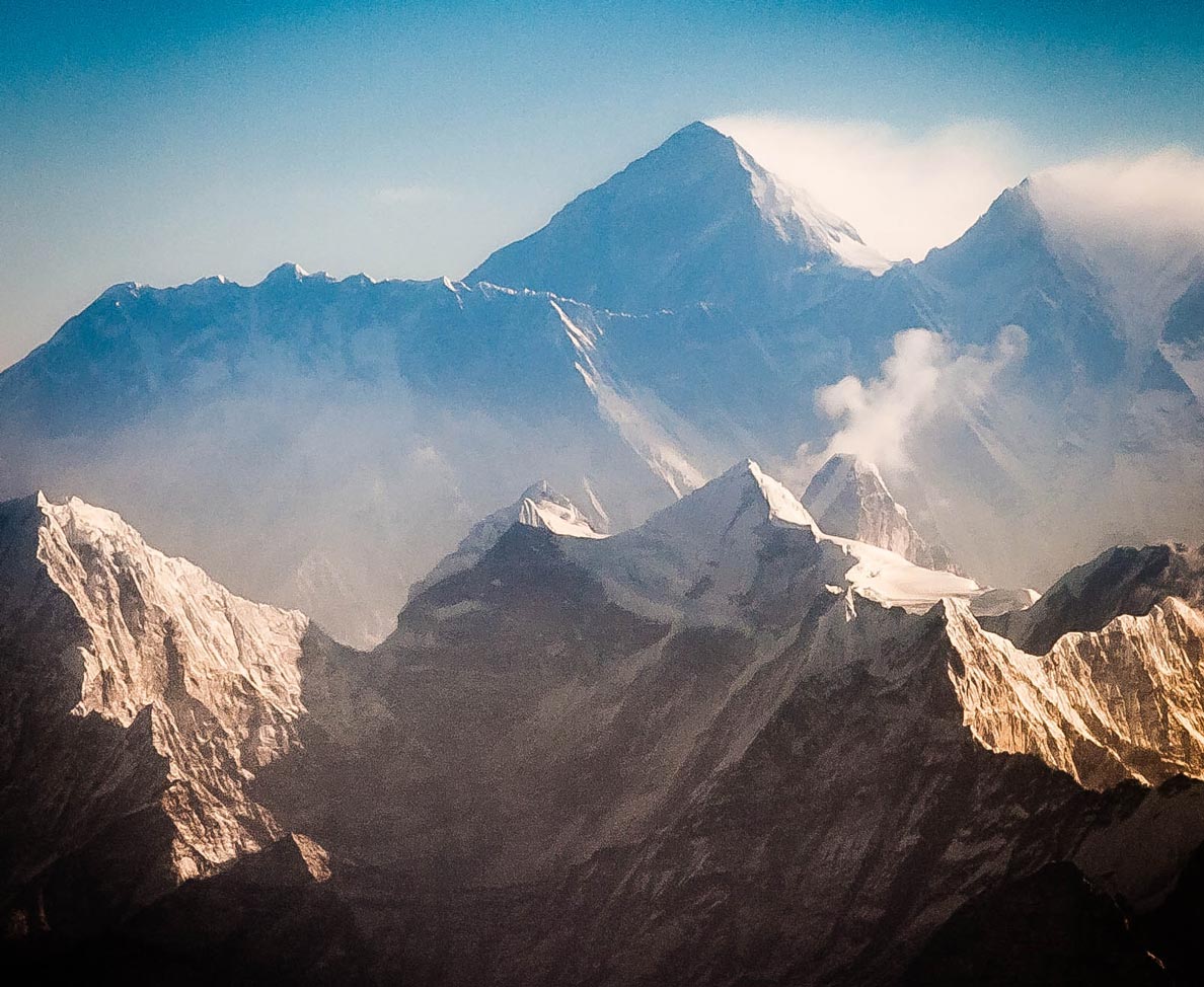
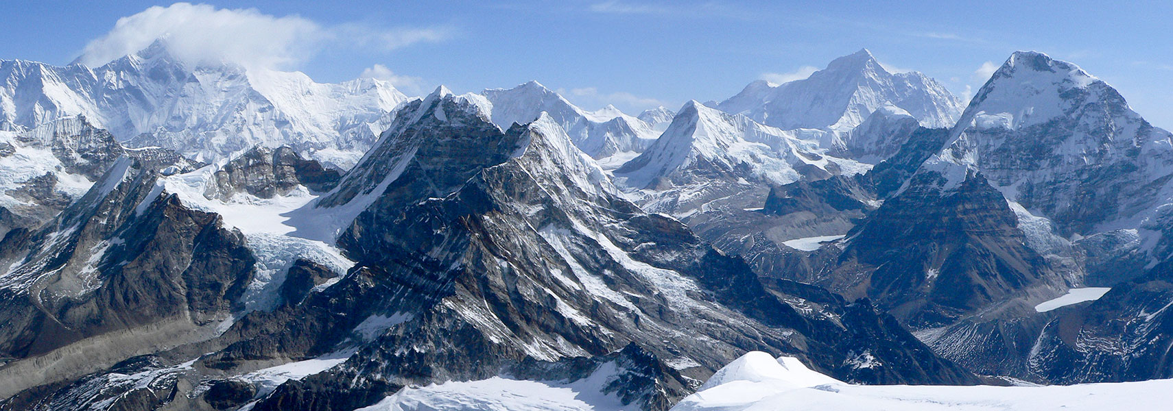
![]() Himalaya mountain range, view from summit of Mera Peak in Nepal's Sagarmatha Zone. Mount Everest, Lhotse and Lhotse Shar (hidden by clouds, left), Peak 41 in center with Baruntse behind; Makalu (8,485 m) and Mount Chamlang (7321 m) to the right. Image: Andrew Grandison |
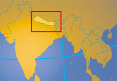
Destination Nepal, a virtual guide to the former Kingdom in the Himalayas between India and China. Officially the Federal Democratic Republic of Nepal, a landlocked country in South Asia bordered by the Indian states of Uttarakhand, Uttar Pradesh, Bihar and Sikkim, and in north by Tibet. The country along the southern slopes of the Himalayan mountain range is host to eight of the 10 highest peaks in the world, including Mount Everest, Lhotse, Makalu, and Kanchenjunga (on the border to Sikkim). With an area of 147,181 km² Nepal is slightly larger than 1.5 times the size of Portugal, or slightly larger than the U.S. state of Arkansas. Nepal has a population 31 million (2016 est.). Largest city and national capital is Kathmandu. Spoken languages: about half of the population speaks the official language Nepali, the rest is using one of the several other Tibeto-Burman languages. ![]() |
Federal Democratic Republic of Nepal | Sanghiya Loktāntrik Ganatantra Nepāl |
Country Profile |
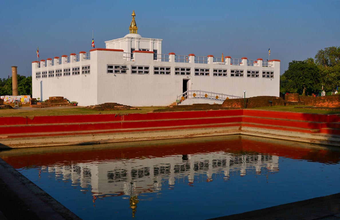
Background: Nepal, the landlocked multiethnic, multilingual, multi-religious country, is situated north of India in the Himalayas, in the region where, about 40 to 50 million years ago, the Indian subcontinent has crashed into Asia. Because of that accident, Nepal has some of the world's highest mountains including Sagarmatha (Mt. Everest, 8848m, which it shares with Tibet (by now a province of China). The highest mountain on Earth is towering above populated valleys and forested plains. Somewhere here in the Kapilavastu district, there is a place called Lumbini where in about 500 B.C.E. Queen Mayadevi is said to have given birth to Siddhartha Gautama, better known as Buddha. Nepal can be divided broadly into three ecological zones: the lowland, the midland and the highland. The altitude of the Himalayan Region (the highland) ranges between 4877 m - 8848 m, It includes 8 of the highest 14 summits in the world, which exceed altitude of 8000 meters including Mount Everest. The mountain region accounts for about 64 percent of total land area, which is formed by the Mahabharat range that soars up to 4877 m and the lower Churia range. The lowland Terai, the flat river plain of the Ganges with a belt of marshy grasslands, savannas, and forests, occupies about 17 percent of the total land area of the country. border countries: China (Tibet Autonomous Region (Xizang), India other countries close to Nepal: Bhutan, Bangladesh |
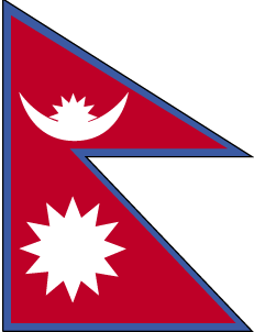
Official Name: Sanghiya Loktāntrik Ganatantra Nepāl Federal Democratic Republic of Nepal short form: Nepal formerly: Kingdom of Nepal (Nepal Adhirajya) ISO Country Code: np Time: Local Time = UTC + 5:45h Actual Time: Sat-Mar-6 01:08 Country Calling Code: +977 Capital City: Kathmandu (pop 1.5 million) Other Cities: Biratnagar, Patan, Pokhara, Birganj, Dharan, Nepalganj. Government: Type: Republic Geography: Location: Southern Asia, between China and India Area: 147,181 km² (56,826 sq.mi.) Terrain: Tarai or flat river plain of the Ganges in south, central hill region, rugged Himalayas in north. Climate: The climate in Nepal varies with elevation, tropical in the lower southern part Tarai, mid-hills alpine and the high mountains polar; elevation ranges from 90 to 8848 meters. People: Nationality: noun: Nepalese (singular and plural), adjective: Nepalese or Nepali. Population: 31 million (2016) Refugee Population: Bhutanese (94 000), Tibetans (20 000 approx.) Ethnic Groups: sixty ethnic groups, major groups are Sherpas, Kirats or Limbus, Rais, Magars, Newars, Tamangs, Gurungs, the Bahuns and Chhetries and the Tharus the inhabitants of the Tarai. Religions: Hinduism (predominant 86%), Buddhism 8%, Tibetan Lamaism (Bon) Languages: Nepali (official and lingua franca of the country), sixty ethnic groups, who speak seventy different dialects and eleven major languages like Tibeto-Burman, Lhotsamkha, Nepalbhasa, Tamang languages. Literacy: 40% Natural resources: Quartz, water, timber, hydropower, scenic beauty, small deposits of lignite, copper, cobalt, iron ore. Agriculture products: Rice, corn, wheat, sugarcane, root crops; milk, water buffalo meat. Industries: Tourism, carpet, textile; small rice, jute, sugar, and oilseed mills; cigarette; cement and brick production. Exports - commodities: clothing, pulses, carpets, textiles, juice, jute goods Exports - partners: India 61.3%, USA 9.4% (2015) Imports - commodities: petroleum products, machinery and equipment, gold, electrical goods, medicine Imports - partners: India 61.5%, China 15.4% (2015) Currency: Nepalese Rupee (NPR) (Source: Nepal Embassy and others) ![]() Nepal key statistical data. |
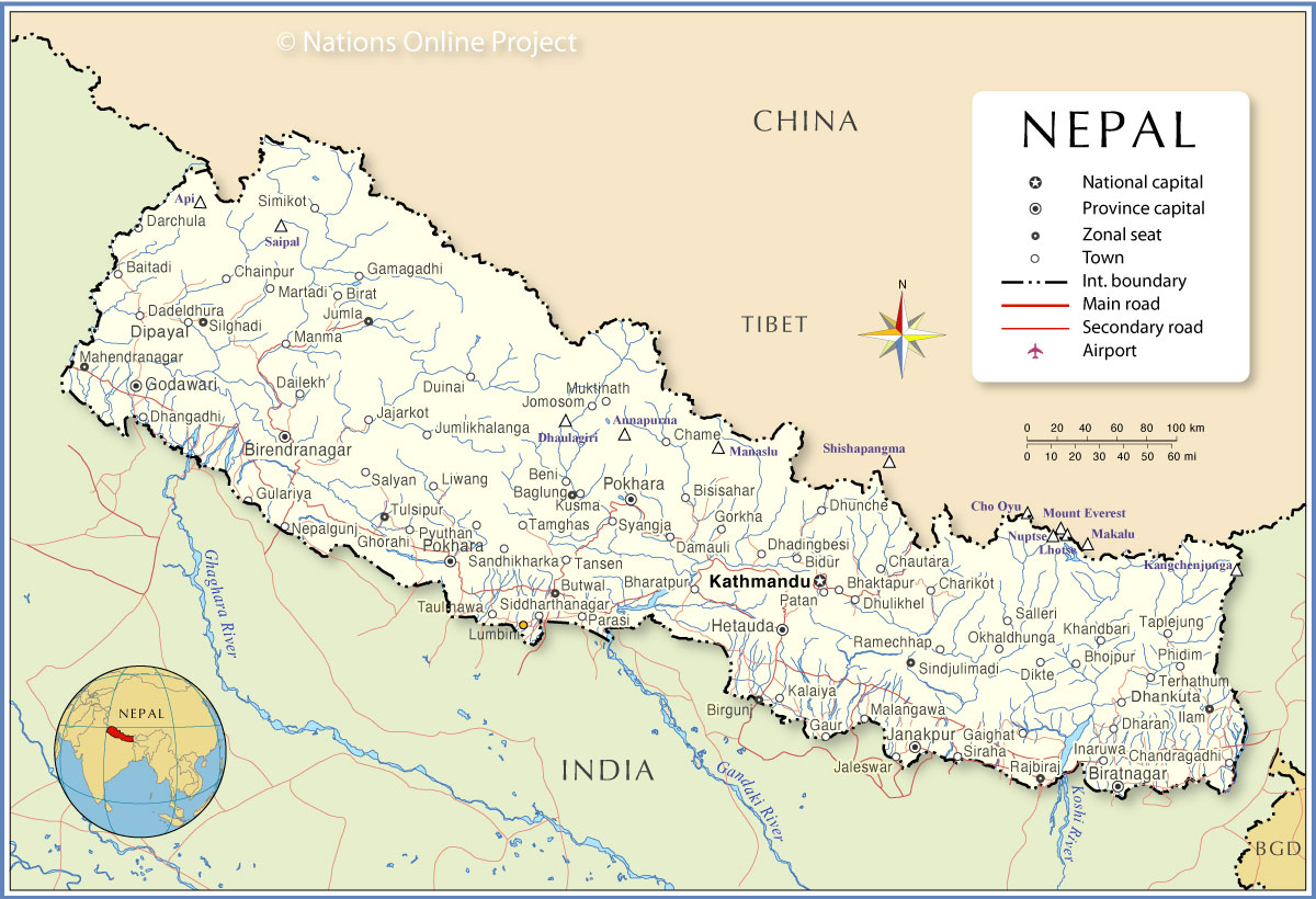
Note: External links will open in a new browser window. Official Sites of NepalOffice of The Prime Minister and Council of MinistersOfficial website of Nepal's Prime Minister and the Council of Ministers. Ministry of Foreign Affairs Responsible for the foreign policy of the kingdom of Nepal. Institute of Foreign Affairs (IFA) IFA was founded in 1993 as an integral part of the Ministry of Foreign Affairs; the dissemination of information on foreign policy related issues is another major responsibility of the Institute. Diplomatic Missions The Permanent Mission of the Kingdom of Nepal to the UN Nepal's representation to the United Nations. Nepal Embassy in the US The site provides also comprehensive information on Nepal. Nepal Embassy in the UK Embassy of Nepal in the United Kingdom. Nepal Missions Nepalese Missions world wide. Foreign Missions in Nepal Address list of foreign Missions in Kathmandu. Statistics Central Bureau of Statistics of Nepal Nepal in figures. Weather Department of Hydrology and Meteorology Weather information for Nepal. Nepal Maps![]() Political Map of Nepal. ![]() Searchable map and satellite view of Nepal. ![]() Searchable map and satellite view of Nepal's capital city. ![]() Satellite view and map of Mt. Everest region. ![]() Map of the Southeast Asia region. ![]() Reference Map of Asia. ![]() A rainy day in Lumbini, the place where, according to Buddhist tradition, in 563 BCE Queen Maya devi gave birth to Siddhartha Gautama, who later became the Gautama Buddha. Image: Bijaya Kumar Shrestha |
![]() |
|
News__Nepal News Online News Info Nepal News from Nepal. Kantipur Online Part of the democratic media of Nepal. The Kathmandu Post News from Nepal as it happens. Nepali Times Weekly updated news. Nepal News Online news. Rastriya Samachar Samiti (RSS) National News Agency. __Magazines Cyber Nepal First Nepal Internet Magazine. Radio Stations Hits FM 100 Kathmandu Radio Station. Radio Nepal National radio station. International News Sources BBC News Country Profile: Nepal With links to Nepal related news and background information. Reuters AlertNet - Nepal peace Reuters news. Yahoo! News Full Coverage-Nepal Press agencies news on Nepal Human Rights Amnesty International: Nepal Amnesty International Reports. Human Rights Watch: Nepal Background Briefings. IRINnews Nepal UN humanitarian news and analysis. Press freedom Reporters sans frontières - Nepal Annual report 2007 about Press freedom in the country. |
Bookmark/share this page ![]() |
![]() |
|
Arts & CultureBuddhism, Nepal, and its Sacred History Sculptures, shrines and stupas. Nepali Calendar (Bikram Sambat) Events and Festivals, Nepal follows a different calendar system, according to this system, 2001-2002 is Bikram Sambat 2058. Nepal National Library Has collections of books, journals and other materials in Nepali, English, Sanskrit and Hindi. Ethnic GroupsNewar peopleWikipedia article about the culture of the Newars one of the ethnic groups of Nepal. Sherwa mi Website on the Sherpas (Sherwa) of Nepal. |
![]() 14th century Boudhanath Stupa, Kathmandu. Image: maqroll |
![]() |
|
Business & EconomyNepal Rastra Bank Central Bank of Nepal Nepal Stock Exchange Federation of Nepalese Chambers of Commerce & Industry Trade Promotion Center Provides trade information for Nepal. __Transportation Airlines Nepal Airlines The flag carrier airline of Nepal serves domestic and international destinations in Asia. Gorkha Airlines Gorkha operates scheduled and charter flights to domestic destinations. Sita Air Domestic cargo flights. Tara Air Newest and biggest airline service provider in the Nepalese mountains. Yeti Airlines Regional airline. |
![]() |
||
![]() Durbar Square in front of the old royal palace in Kathmandu in 2012. Many buildings in the city collapsed or have been damaged by the earthquake on 25 April 2015, which killed thousands of people, flattened villages and reduced numerous heritage sites to ruin. Image: Sundar1 Travel and Tour Consumer Information
Destination Nepal - Country GuidesDiscover Nepal: Kathmandu, Dhulikhel, Chomolungma, Everest,accommodation, attractions, festivals, events, tourist boards, Himalaya, mountaineering, paragliding, rafting, hiking, climbing, trekking, jungle adventure tours and much more. Nepal Tourism Board Information on Nepal. Kathmandu Kathmandu Metropolitan City. ![]() Frontdoor to Nepalese news, information, travel guide, economy, society, politics. Nepal Travel and Tourism information A very comprehensive guide for all things Nepal. visitnepal.com More Nepal travel information. Lonely Planet Nepal The backpackers bible-guide to Nepal. Do's and Don'ts in Nepal Some DOs & DON'Ts. Trekking Nepal Mountaineering Association National alpine association of Nepal. Trekking Agents Associations of Nepal Official list of trekking agencies. |
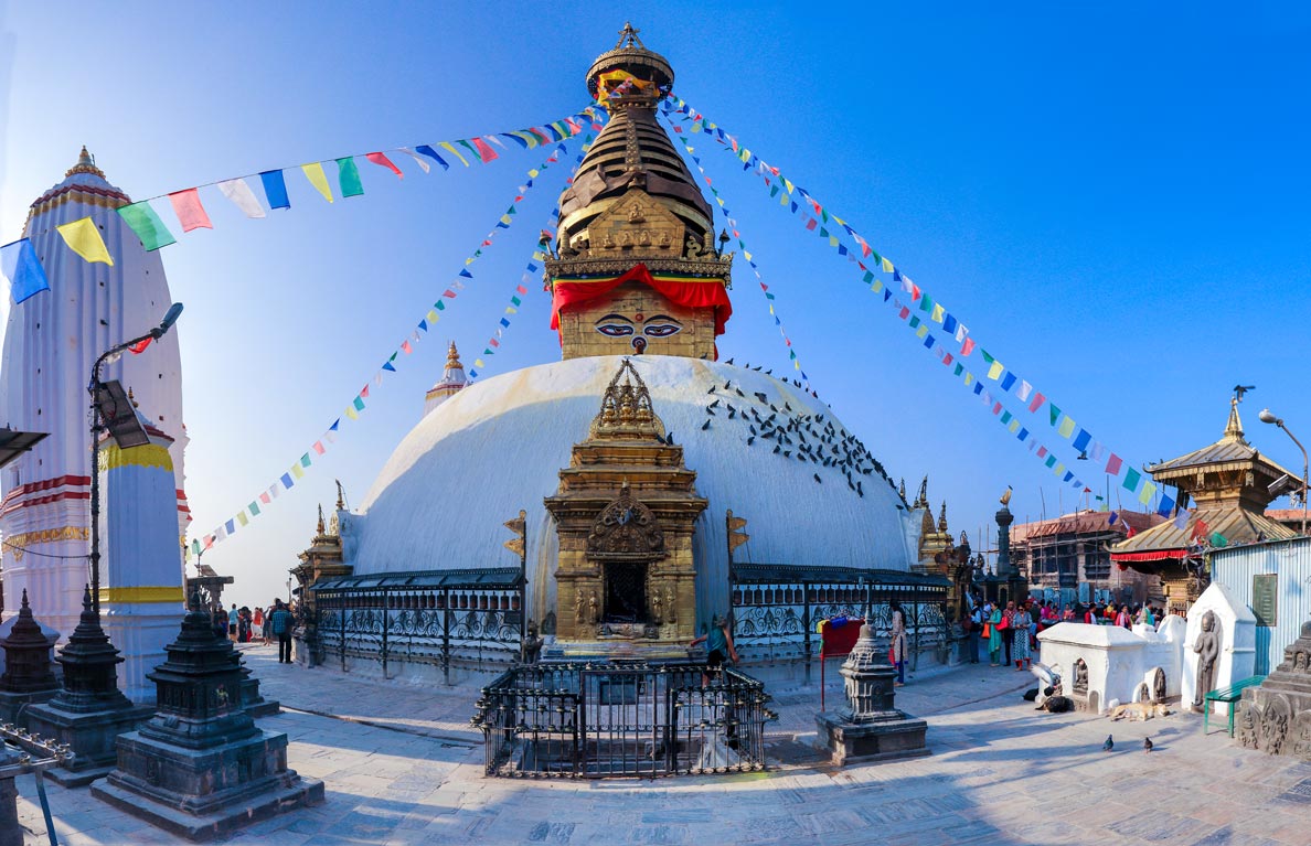
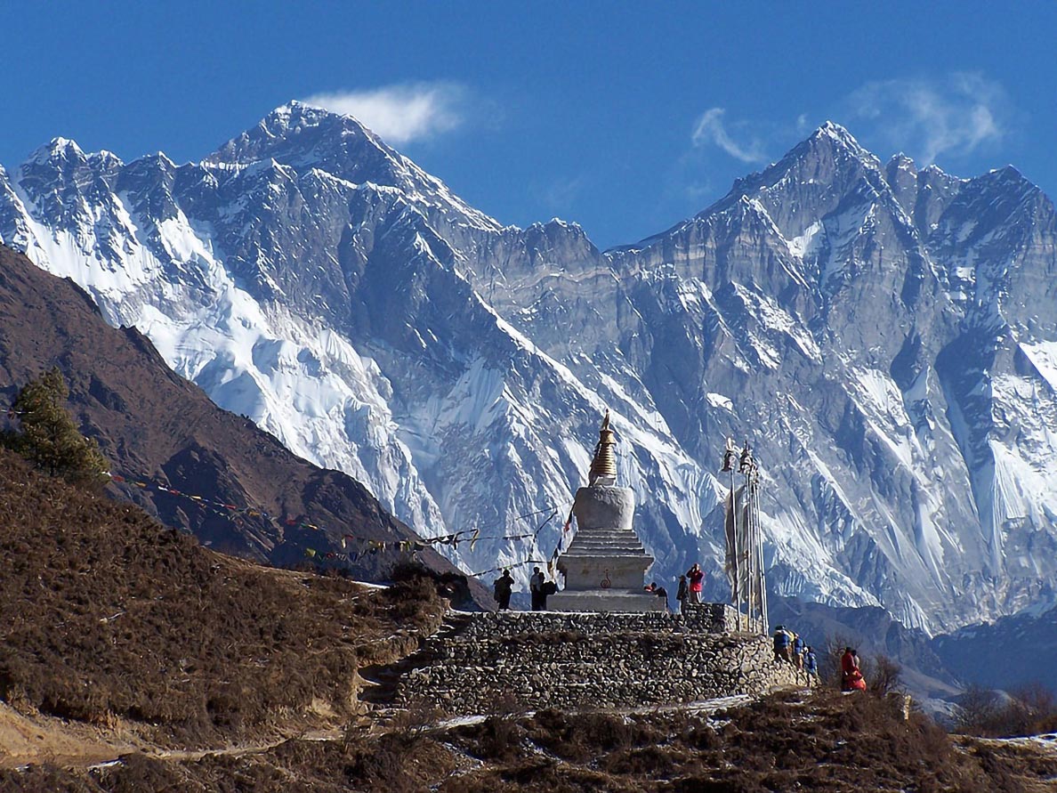
![]() Mount Everest with Nuptse and Lhotse. Image: Wang Lama Humla ![]() Ancient Swayambhu Maha Chaitya, Kathmandu. Image: Quadcopter |
![]() |
|
![]() Kathmandu University High School in the historical city of Panauti, Nepal. Image: Dr. Ram Kantha Shrestha EducationKathmandu University Nepal's National University is an autonomous non-government, public institution, in Dhulikhel, Kavrepalanchok district. Rangjung Yeshe Institute Centre for Buddhist Studies at Rangjung Yeshe Institute. Kathmandu University School of Management (KUSOM) School of Management is a management development institute under the Kathmandu University. |
![]() |
|
![]() ![]() Bagmati River in the 1950s, and in 2009, Kathmandu. Today the Bagmati river is in great peril. As a result of industrialization, urbanization and poor planning, the river faces serious environmental and ecological challenges. Large amounts of water are withdrawn upstream and the quality of the remaining water is very poor. Untreated sewage, household waste and hazardous chemicals are dumped into the river indiscriminately. The state of the river is further aggravated by uncontrolled sand mining, as well as construction of houses, factories and slum settlements. Images: Toni Hagen (left) and Alex Treadway (right) Environment & NatureNational Trust for Nature ConservationThe National Trust for Nature Conservation (NTNC), previously known as the King Mahendra Trust for Nature Conservation was established in 1982 by a Legislative Act as an autonomous, not-for-profit and non-¬government organization, mandated to work in the field of nature conservation in Nepal. UNDP in Nepal UNDP Nepal site with information about various UNDP programs in Nepal. |
![]() Mountain District of Dolpa © Nepal Tourism Board |
![]() |
|
HistoryThe nation-state of Nepal was the creation of King Prithvi Narayan Shah. The ruler of the small principality of Gorkha, campaigned to unite the various kingdoms that dotted the geographical area defined by modern Nepal. The conquest of Kathmandu Valley, which took a total of ten years of planning, siege and diplomacy, was the highlight of his conquests (1769). The work begun by King Prithvi Narayan was continued by his descendants. At the greatest extent the Nepali (then known as the Gorkhali) Empire covered an area that was at least a third more than its present confines. Nepal, the nation-state of dismissed governments. Nepal, the world's only Hindu monarchy, was controlled by a hereditary prime ministership until 1951. The nation's first election was held in 1959, but in 1960, King Mahendra dismissed the cabinet, dissolved parliament, and banned political parties. A 1962 constitution created a nonparty panchayat (council) system of government. After a 1980 referendum approved a modified version of the panchayat system, direct parliamentary elections were held in 1981. A dispute with India led to India's closing of most border crossings from March 1989 to July 1990, and the resultant economic crisis fueled demands for political reform. After months of violence, King Birendra Bir Bikram Shah Dev dissolved parliament. The opposition formed an interim government in April 1990, and a new constitution creating a constitutional monarchy and a bicameral legislature became effective on 9 Nov. 1990. Multiparty legislative elections held in May 1991 were won by the centrist Nepali Congress party; the Communists became the leading opposition party. Mid-term elections in November 1994, which were called after the government lost a parliamentary vote, resulted in a hung parliament and the communists, who emerged as the single largest party, formed a minority government. In January 2005 Nepal's King Gyanendra sacked Prime Minister Sher Bahadur Deuba, dismissed the country's government, assumed power himself and declared a state of emergency. King Gyanendra's direct rule ended under public pressure in April 2006, the monarchy was abolished in May 2008 and a Maoist-dominated government took office in August (Source: Grolier's Encyclopedia and other sources) History of Nepal From the time of the Aheer until today Nepal, brief Nepalese history by the Royal Nepal Embassy. History From Ancient to Modern Nepal. A Brief History of Nepal A chronology of important events. ??The Shah Kings of Nepal Biography of the Nepal Kings. |
![]() |
![]() |
|
Issues NepalDemocratic Movement NepalDemocracy.org Provides information on Nepali politics, government and civil society. Nepali Maoists The People's War in Nepal Revolutionary Worker Online with Maoist Rebels' View of The People's War in Nepal. |
![]() |
|
SearchThe Nepal Home Page DirectoryPart of InfoNepal. Sources and additional Information on NepalAmnesty International: Nepal BBC Country Profile: Nepal FAO: Nepal GlobalEDGE: Nepal The Heritage Foundation: Nepal Human Rights Watch: Nepal OEC: Nepal Reporters Without Borders: Nepal Wikipedia: Nepal The World Factbook -- Nepal |
![]() |
Other Countries in South Central Asia: Afghanistan | Bangladesh | Bhutan | India | Iran | Kazakhstan | Kyrgyzstan Maldives | Pakistan | Sri Lanka | Tajikistan | Turkmenistan | Uzbekistan Major Cities in South Central Asia: Almaty, Ashgabat, Astana, Bishkek, Chandigarh, Chennai (Madras), Kolkata (Calcutta), Colombo, Dhaka, Dushanbe, Islamabad, Kabul, Karachi, Kathmandu, Lahore, Male, Mumbai (Bombay), New Delhi, Tashkent, Tehran, Thimphu, |
One World - Nations Online .:. let's care for this planet Promote that every nation assumes responsibility for our world. Nations Online Project is made to improve cross-cultural understanding and global awareness. More signal - less NOISE |
Site Map
| Information Sources | Disclaimer | Copyright © 1998-2021 :: nationsonline.org![]() ![]() ![]() ![]() ![]() ![]() ![]() ![]() ![]() |