Advertising

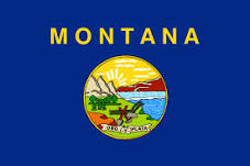
Montana Flag detail
Home Earth Continents The Americas USA Country Profile US State Capitals Montana Map

US States Maps Index
World Maps Index

Map of Montana (MT)


Panorama of Sherburne Lake in the Many Glacier region of Glacier National Park, Montana
Panorama of Sherburne Lake in the Many Glacier region of Glacier National Park, Montana.
Image: GlacierNPS

 
Montana Flag
Montana State Flag
 

About Montana


Location map of Montana state USA
Where in the United States is Montana? Location map of Montana in the US.

 
Montana is a mountainous, landlocked US state east of the Bitterroot Range of the Rocky Mountains and south of Canada. The state is situated in the Northern Rockies and Plains region in the northwestern United States.

It borders the Canadian provinces of British Columbia, Alberta, and Saskatchewan to the north, the U.S. states North Dakota and South Dakota to the east, Wyoming to the south and Idaho to the west and southwest.

The state's nickname is "The Treasure State," on vehicle license plates you can also see "Big Sky Country."


Montana was acquired from France as part of the Louisiana Purchase in 1803; it was explored by the Lewis and Clark Expedition in 1805–06.
Montana was admitted to the Union on the 8th of November 1889 as the 41st state.

 
Montana State Map
Reference Map of Montana, United States
General Map of Montana, United States.

The detailed map shows the US state of Montana with boundaries, the location of the state capital Helena, major cities and populated places, rivers and lakes, interstate highways, principal highways, railroads and major airports.

You are free to use the above map for educational and similar purposes; if you publish it online or in print, you need to credit Nations Online Project as the source.

 
More about Montana State


Some Geography

Montana Topographic Regions Map
Topographic map of Montana. (Click the map to enlarge)
 
Area
Montana occupies an area of 381,154 km² (147,042 sq mi) [1], it is the fourth-largest US state, compared it is somewhat larger than Germany or Japan.


In the western third of Montana, there are numerous mountain ranges. The Northern Rocky Mountains run through the west part of the state; some 100 smaller named mountain ranges are scattered throughout Montana.


The highest elevation in the state is Granite Peak at 3,904 m (12,807 ft) located in central south near the border with Wyoming.


Montana is the source of the Missouri River (near Brower's Spring), North America's longest river (3,767 km).

 
World Heritage Site


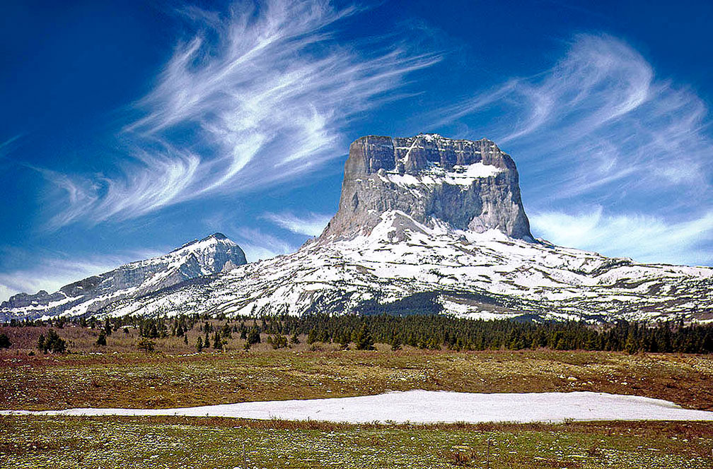
Old Chief Mountain in Glacier National Park, Montana
(Old) Chief Mountain in Montana, located on the eastern border of Glacier National Park. The rock formation is a sacred mountain to Native American people.
Image: Rod Jones
 
Montana has one amazing UNESCO World Heritage Site, known as the Waterton-Glacier International Peace Park. official website

In 1932 Waterton Lakes National Park (Alberta, Canada) was combined with the Glacier National Park of Montana (United States) to form the world's first International Peace Park.
The property is located on the border between the two countries and offers an exceptional landscape backdrop. The park is extremely rich in plant and mammal species and offers prairie, forest, alpine, and glacial landscapes.


Yellowstone National Park
The world-famous Yellowstone National Park is mostly in Wyoming, but the park also spreads into parts of Montana (3%) and Idaho (1%). The park is since 1978 a UNESCO World Heritage Site.


Montana National Parks

Glacier National Park
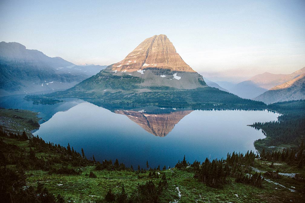
Hidden Lake with Bearhat Mountain in Glacier National Park within Lewis Range, Montana
Hidden Lake with Bearhat Mountain in Glacier National Park within the Lewis Range, Montana. Glacier National Park is a UNESCO World Heritage Site.
Image: Justin Kauffman

 
The GNP (U.S.) is part of the greater Waterton-Glacier International Peace Park, a combined park (Alberta, Canada and Montana, US) and a UNESCO World Heritage Site. The National Park offers more than 700 mi (1,130 km) of trails in 4,000 km² of spectacular mountain scenery, glacial landforms, along rivers and lakes, and encounter with an abundant diversity of wildlife and wildflowers.


The Triple Divide Peak in the Lewis Range is the hydrological apex of the North American continent, rainwater that falls at the summit can flow either to the Pacific, the Atlantic, or the Arctic Ocean.


Other Points of Interest in Montana

Yellowstone River
The Yellowstone River is a tributary of the Missouri River and famous for its scenic beauty, it is the last major undammed river in the lower 48 states.

 
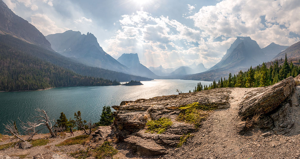
Saint Mary Lake, view from Sun Point Nature Trail in Glacier National Park, Montana
Saint Mary Lake, view from Sun Point Nature Trail in Glacier National Park, Montana.
Image: Bernd Thaller
 
Going-to-the-Sun Road

The Going-to-the-Sun Road is a scenic mountain road in the Rocky Mountains in Glacier National Park in Montana, leading from West Glacier to Saint Mary. Highlights along the route are Lake McDonald, Trail of the Cedars, Heavens Peak, Bird Woman Falls, Garden Wall / Weeping Wall, Logan Pass, Clements Mountain, Mount Jackson / Glacier, Going-to-the-Sun Mountain, Rising Sun, and Saint Mary Lake.


Watson Brake

Watson Brake is an archaeological site in present-day Ouachita Parish, considered to be the oldest earthwork mound complex in North America, older even than the Egyptian pyramids or England’s Stonehenge. The site was developed over centuries by a hunter-gatherer society, rather than by a more sedentary society. Its discovery and dating in a paper published in 1997 changed the ideas of American archaeologists about ancient cultures in the Southeast and their ability to manage large, complex projects over centuries. [2]


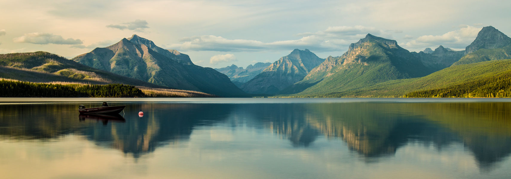
Lake McDonald, Glacier National Park, Montana
Lake McDonald from Apgar Village. Lake McDonald is the largest lake in Glacier National Park.
Image: Robert Shea

 
Population


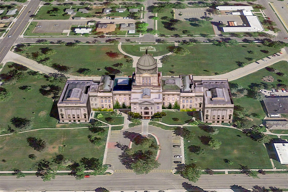
Montana State Capitol in Helena
3D image of Montana State Capitol in Helena, the capital of Montana. The neoclassical building houses the Montana State Legislature.
Image: Google Earth 
Montana has a population of about 1.1 million people (as of 2021). [3] The state ranks 48th in population density.

The capital city is Helena (pop. 32,300 in 2018), the largest city is Billings, and the largest urban area is the Billings Metropolitan Area with a population of 181,600 (in 2019).


Race and Ethnic groups
The population of Montana is predominantly white (86%). The rest of the population consists of Native Americans 6.6%, Hispanics or Latinos 4.0%, Asians 0.9% and African Americans 0.6%. [4]


Cities and Towns in Montana

The map above shows the location of following cities and towns in Montana:

The largest cities in Montana with a population of more than 20,000

Billings (109,550), Missoula (74,400), Great Falls (58,700), Bozeman (48,500), Butte (34,300), Helena (32,300), and Kalispell (24,000)
Population figures in 2018

Montana Airports
The largest airports in Montana shown on the map:

Other cities and towns in Montana:
Anaconda, Baker, Big Timber, Broadus, Browning, Chester, Choteau, Circle, Colstrip, Conrad, Crow Agency, Culbertson, Cut Bank, Deer Lodge, Dillon, Drummond, East Glacier Park, Ekalaka, Eureka, Forsyth, Fort Benton, Fort Peck, Glasgow, Glendive, Grass Range, Great Falls, Jordan, Laurel, Lewistown, Libby, Livingston, Malta, Miles City, Morgan, Plentywood, Polson, Red Lodge, Roundup, Scobey, Shelby, Sidney, Terry, Thompson Falls, Three Forks, Townsend, Virginia City, West Yellowstone, White Sulphur Springs, Whitefish, Wibaux, and Wolf Point.


Weather Conditions Helena:

HELENA WEATHER


Advertisements:


Maps of the 50 U.S. States
Alabama | Alaska | Arizona | Arkansas | California | Colorado | Connecticut | Delaware | Florida | Georgia | Hawaii | Idaho | Illinois | Indiana | Iowa | Kansas | Kentucky | Louisiana | Maine | Maryland | Massachusetts | Michigan | Minnesota | Mississippi | Missouri | Montana | Nebraska | Nevada | New Hampshire | New Jersey | New Mexico | New York | North Carolina | North DakotaOhio | Oklahoma | Oregon | Pennsylvania | Rhode Island | South Carolina | South Dakota | Tennessee | Texas | Utah | Vermont | Virginia | Washington | West Virginia | Wisconsin | Wyoming

20 Most Populous U.S. Cities (in 2018):
1. New York City 2. Los Angeles 3. Chicago 4. Houston 5. Phoenix 6. Philadelphia 7. San Antonio 8. San Diego 9. Dallas 10. San Jose 11. Austin 12. Jacksonville 13. Fort Worth 14. Columbus 15. San Francisco 16. Charlotte 17. Indianapolis 18. Seattle, 19. Denver, 20. Washington D.C.

Other Major U.S. Cities:
Albany, Anchorage, Annapolis, Atlanta, Atlantic City, Augusta, Baltimore, Baton Rouge, Bismarck, Boise, Boston, Carson City, Charleston, WV, Cheyenne, Cincinnati, Cleveland, Columbia, Concord, Des Moines, Detroit, Dover, DE, El Paso, Frankfort, Harrisburg, Hartford, Helena, Honolulu, Jackson, Jefferson City, Juneau, Kansas City, Lansing, Las Vegas, Lincoln, Little Rock, Long Beach, Madison, Memphis, Miami, Milwaukee, Minneapolis, Montgomery, Montpelier, Nashville, New Orleans, Norfolk, Oklahoma City, Olympia, Orlando, Pierre, Pittsburgh, Portland, Providence, Richmond, VA, Raleigh, Sacramento, St. Louis, St. Paul, Salem (OR), Salt Lake City, Santa Fe, Springfield, Tallahassee, Tampa, Topeka, Trenton, Tucson