Advertising

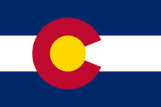
Colorado Flag detail
Home Earth Continents The Americas USA Country Profile US State Capitals Colorado Map

US States Maps Index
Area of the 50 U.S. States
Population of the 50 U.S. States
World Maps Index

Map of Colorado (CO)


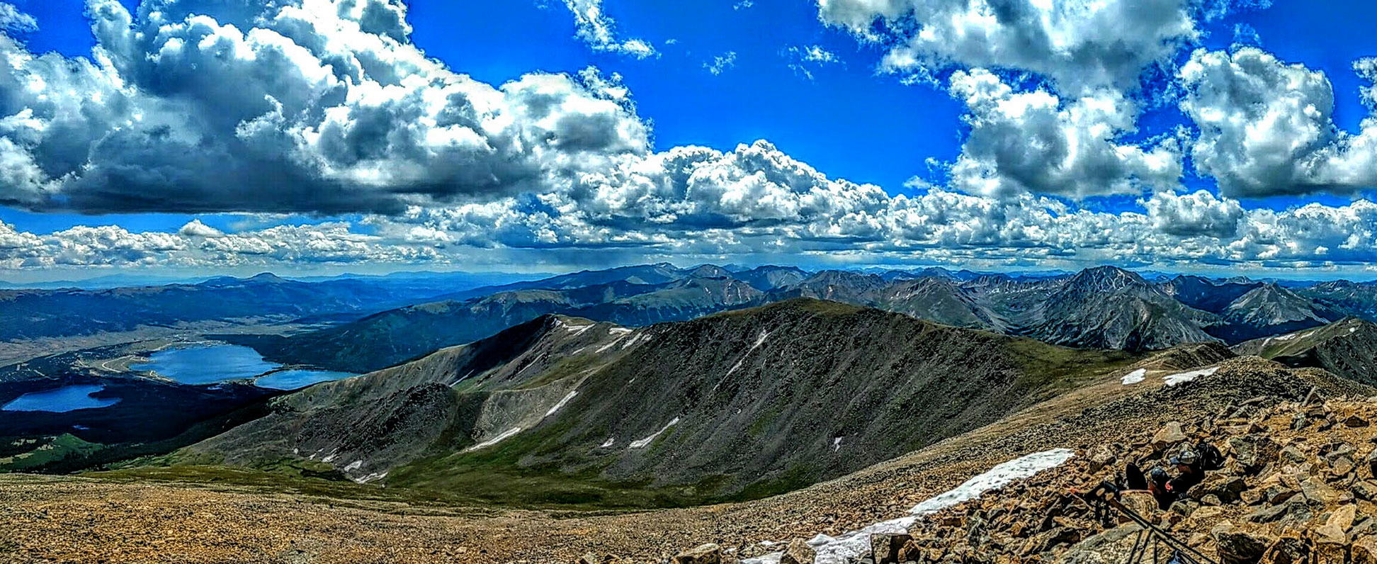
View of the Twin Lakes from Mount Elbert, Sawatch Range, Colorado, US
Dramatic view of the Twin Lakes from Mount Elbert. Mt. Elbert is the second-highest peak in the United States mainland; it is the highest summit of the Rocky Mountains and Colorado's highest peak. The mountain is situated in the Sawatch Range about 32 km (20 mi) southeast of Aspen, Colorado.
Image: Michael Mangin


Colorado Flag
Colorado State Flag


About Colorado


Location map of Colorado state USA
Where in the United States is Colorado? Location map of the State of Colorado in the US.
 
Colorado is one of the 50 US states. The landlocked state, named for the Colorado River, is situated in the central United States; it is one of the three states (the others are Wyoming and Utah) that have only straight lines of latitude and longitude for boundaries.


Colorado borders Wyoming and Nebraska in the north, Kansas in the east, Oklahoma and New Mexico in the south, and Utah in the west.


The US acquired a part of Colorado was with the Louisiana Purchase in 1803, and Mexico ceded the rest of the area in 1848. Colorado joined the Union on 1st August 1876 as the 38th state.


Colorado State Map
Reference Map of Colorado
General Map of Colorado, United States.

The detailed map shows the US state of New Mexico with boundaries, the location of the state capital Santa Fe, major cities and populated places, rivers and lakes, interstate highways, principal highways, railroads and major airports.

You are free to use the above map for educational and similar purposes; if you publish it online or in print, you need to credit Nations Online Project as the source.

 
More about Colorado State


Area
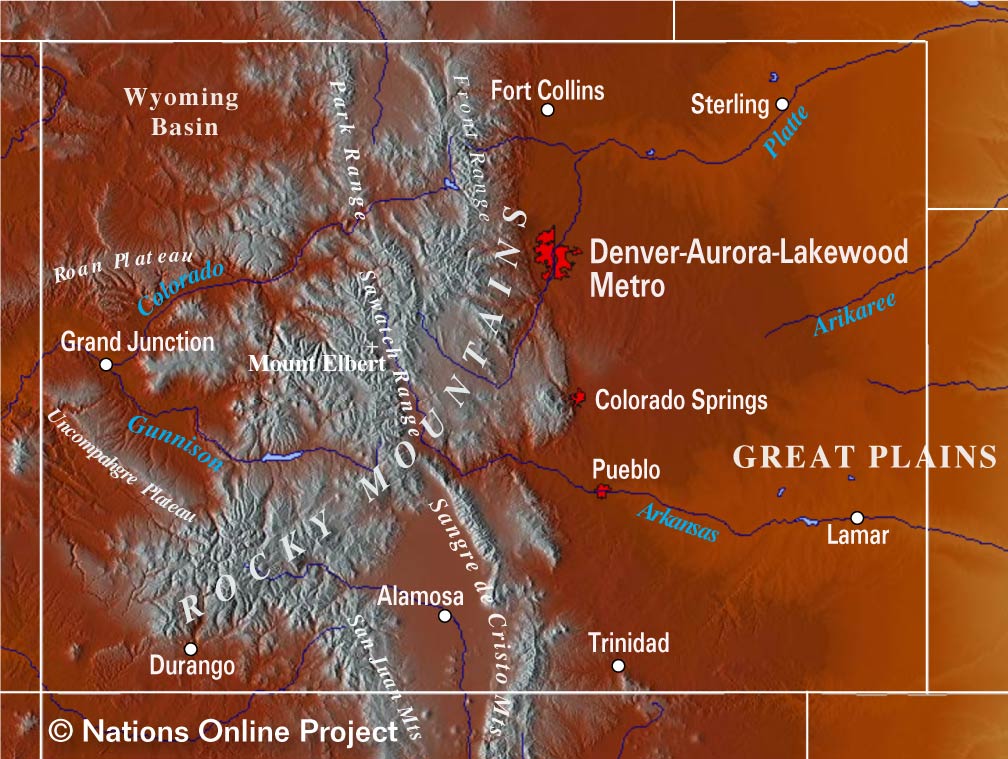
Colorado Topographic Regions Map Topographic Map of Colorado showing the location of the Southern Rocky Mountains and its sub-ranges in the west and the Great Plains of Colorado in the east. (click the map to enlarge)

The Centennial State (its nickname) occupies an area of 269,837 km² (104,094 sq mi) [1], compared, Colorado is about the size of New Zealand (270,467 km²) or somewhat larger than the United Kingdom (242,900 km²).


Colorado's Geographic regions
The Southern Rocky Mountains, a major subrange of the Rocky Mountains, dominate the state in central-west.


The highest point in Colorado is Mount Elbert at 4,401 m (14,440 ft), it is the second-highest peak in the contiguous United States after Mount Whitney in California. The semiarid Great Plains in the east are the agricultural heartland of Colorado. Drought-resistant grama and buffalo grasses are the predominant natural vegetation.


Colorado's four geographic regions:


Storm over the Great Sand Dunes National Park in  Colorado
Storm over the Great Sand Dunes National Park in Colorado.
Image: Ron Cogswell


I. The Great Plains (High Plains) in the east is characterized by flat prairie land with aplenty prairie grass and little trees and shrubs.

II. The Rocky Mountains in the central-west of the state are Colorado's share of the Rockies, the massive mountain range with its subranges dominate the central-western third of the state.

III. The Colorado Plateau in the west is a desert area of the Intermontane Plateaus, roughly centered on the Four Corners region (Arizona, Utah, Colorado, and New Mexico). The region is characterized by sparsely vegetated plateaus, mesas, deep canyons, and barren badlands. [2]

IV. The Intermontane Basin, also known as Wyoming Basin, is a small area northwest of the Colorado Plateau. The Wyoming Basin is an elevated depression, lying between the Middle Rockies and the Southern Rockies. Characteristic features of the Wyoming Basin include hogbacks (ridges), cuestas (hills or ridges), and numerous basins which are separated by mountains of varying size. [3]


Colorado Front Range from North Table Rock Mountain Park
Colorado Front Range from North Table Rock Mountain Park, near Golden, Colorado.
Image: Ed Coyle


World Heritage Site


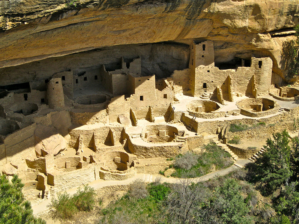
Cliff Palace in Mesa Verde National Park, Colorado
The Cliff Palace in Mesa Verde National Park is the largest cliff dwelling in North America. The complex was built between the 6th and 12th centuries by ancient Pueblo people (Anasazi) on the Mesa Verde plateau.
Image: MPSharwood


Colorado has one World Heritage Site in Montezuma County in south-west Colorado.

A high concentration of ancestral Pueblo Indian dwellings can be found on the Mesa Verde plateau at an altitude of more than 2,600 m.

The landscape in southwest Colorado contains a great number of Indian habitations built of sandstone and mud mortar, constructed by ancient Pueblo peoples on the Mesa Verde plateau between the 6th and 12th centuries.

The archaeological site is now known as Mesa Verde National Park official UNESCO website. The plateau at an altitude of more than 2,600 m contains also imposing cliff dwellings, built of stone and some comprising more than 100 rooms.

See also: Mesa Verde National Park (U.S. National Park Service).
 
Population


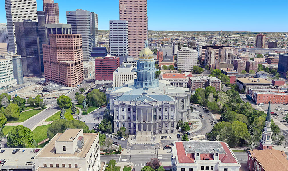
Colorado's State Capitol in Denver
Rendered image of Colorado's State Capitol in Denver. The National Historic Landmark building is home to the Colorado General Assembly.
Image: Google


Colorado has a population of 5.75 million people (est. 2019). [4]

The capital and largest city is Denver, the largest metro area is Denver-Aurora-Lakewood, CO Metropolitan Statistical Area, where you can find half of the state's population (2.8 million).

Ethnic groups
The population of Colorado is white (68%), Hispanics or Latino (22%), African-American (4.6%), and Asian (3.5%). [5]

Spanish is the second-most spoken language in Colorado, after English.


The largest airports in the state are Denver International Airport (IATA code: DEN), and the City of Colorado Springs Municipal Airport (IATA code: COS).


Cities and Towns in Colorado
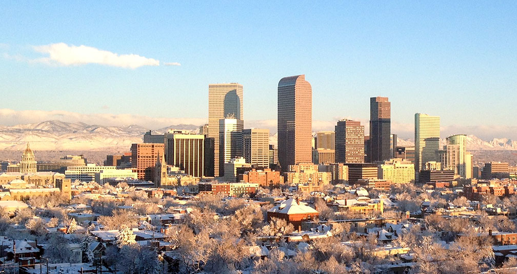
Skyline of Denver Colorado in Winter
Skyline of Denver Colorado in Winter.
Image: R0uge


The map above shows the location of following cities and towns in Colorado:

Major cities are Denver, Colorado Springs, Boulder, Fort Collins, and Aurora.

Other cities and towns in Colorado:
Akron, Alamosa, Antonito, Arvada, Aspen, Black Forest, Brighton, Broomfield, Brush, Burlington, Byers, Canon City, Castle Rock, Cheyenne Wells, Cortez, Craig, Cripple Creek, Del Norte, Delta, Dinasaur, Durango, Eads, Englewood, Estes Park, Fairplay, Florence, Fort, Fruita, Glenwood Springs, Granby, Grand Junction, Greeley, Gunnison, Holyoke, Idaho Springs, Julesburg, La Junta,
Lakewood, Lamar, Las Animas, Last Chance, Leadville, Limon, Littleton, Longmont, Loveland, Meeker, Monte Vista, Montrose, Morgan, Orchard City, Ordway, Ouray, Pagosa Springs, Pueblo, Rangely, Rifle, Rocky Ford, Saguache, Salida, Security, Silverton, Springfield, Springs, Steamboat, Sterling, Telluride, Trinidad, Vail, Walden, Walsenburg, and Wray.

Weather Conditions Denver:

DENVER WEATHER


Advertisements:


Maps of the 50 U.S. States
Alabama | Alaska | Arizona | Arkansas | California | Colorado | Connecticut | Delaware | Florida | Georgia | Hawaii | Idaho | Illinois | Indiana | Iowa | Kansas | Kentucky | Louisiana | Maine | Maryland | Massachusetts | Michigan | Minnesota | Mississippi | Missouri | Montana | Nebraska | Nevada | New Hampshire | New Jersey | New Mexico | New York | North Carolina | North DakotaOhio | Oklahoma | Oregon | Pennsylvania | Rhode Island | South Carolina | South Dakota | Tennessee | Texas | Utah | Vermont | Virginia | Washington | West Virginia | Wisconsin | Wyoming

20 Most Populous U.S. Cities (in 2018):
1. New York City 2. Los Angeles 3. Chicago 4. Houston 5. Phoenix 6. Philadelphia 7. San Antonio 8. San Diego 9. Dallas 10. San Jose 11. Austin 12. Jacksonville 13. Fort Worth 14. Columbus 15. San Francisco 16. Charlotte 17. Indianapolis 18. Seattle, 19. Denver, 20. Washington D.C.

Other Major U.S. Cities:
Albany, Anchorage, Annapolis, Atlanta, Atlantic City, Augusta, Baltimore, Baton Rouge, Bismarck, Boise, Boston, Carson City, Charleston, WV, Cheyenne, Cincinnati, Cleveland, Columbia, Concord, Des Moines, Detroit, Dover, DE, El Paso, Frankfort, Harrisburg, Hartford, Helena, Honolulu, Jackson, Jefferson City, Juneau, Kansas City, Lansing, Las Vegas, Lincoln, Little Rock, Long Beach, Madison, Memphis, Miami, Milwaukee, Minneapolis, Montgomery, Montpelier, Nashville, New Orleans, Norfolk, Oklahoma City, Olympia, Orlando, Pierre, Pittsburgh, Portland, Providence, Richmond VA, Raleigh, Sacramento, St. Louis, St. Paul, Salem (OR), Salt Lake City, Santa Fe, Springfield, Tallahassee, Tampa, Topeka, Trenton, Tucson