Nations Online
All Countries in the World
Nations Online All Countries in the World | |
Home  |
___ Searchable Map and Satellite View of the city of Tampa, Florida |
 Skyline of Tampa, view of downtown from south. Image: J. A. Gaspar |
About Tampa |
 Satellite view is showing Tampa, a port city in Hillsborough County, Florida, Satellite view is showing Tampa, a port city in Hillsborough County, Florida, 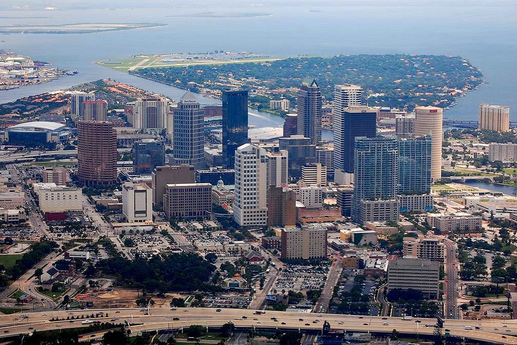 Downtown area of Tampa seen from the air. Image: LoneStarMike Today (in 2017) Tampa has a population of almost 380,000 inhabitants, it is the largest city in the Tampa Bay Area, more than 3 million people live in the Tampa-St. Petersburg-Clearwater, FL Metro Area. The economy of the area is based on service, retail, finance, insurance, tourism and transportation. Port Tampa Bay, which is located south of the city near Tampa's Channel District, is the largest port in Florida, it serves container ships and is one of the major US departure ports for cruise lines leaving for the western Caribbean.  Sunshine Skyway Bridge crossing the Tampa Bay, the bridge is spanning Tampa Bay, it is a vital part of Interstate 275 (I-275) and U.S. Route 19 (US 19), connecting St. Petersburg in Pinellas County and Terra Ceia in Manatee County. Image: Zword97 Florida Aquarium (large scale aquarium); Busch Gardens Theme Park (African-themed animal park); Lowry Park Zoo (Family Friendly Zoo, somewhat over-priced); Tampa Bay Times Forum (arena and event center, now named Amalie Arena); Dinosaur World in Plant City (outdoor dinosaur theme park between Orlando and Tampa); the Tampa Museum of Art (waterfront space for modern and contemporary art); the Museum of Science and Industry (community-based science museum); Henry B. Plant Museum (museum housed in the 1891 Tampa Bay Hotel, exhibits on Florida's early tourism industry plus exhibitions of Asian and European art); Glazer Children's Museum (children's museum, place for families with kids under 8); Tampa Bay History Center (Tampa Bay history). Just zoom in to see Downtown Tampa with Tampa Convention Center. The page shows a city map of Tampa with expressways, main roads and streets. Zoom out to find the location of Tampa International Airport (IATA code: TPA) in a distance of 7 mi (12 km) by road, west of the central business district. To find a location use the form below. To view just the map, click on the "Map" button. |
|
| To find a location type: street or place, city, optional: state, country. |
Local Time Tampa:
Tuesday-April-16 2024 08:58
Standard time zone Eastern (EST): UTC/GMT -5 hoursDaylight Saving Time (EDT) in use from the second Sunday in March, ends on the first Sunday in November; time zone offset: UTC/GMT -4 hours |
One World - Nations Online .:. let's care for this planet Promote that every nation assumes responsibility for our world. Nations Online Project is made to improve cross-cultural understanding and global awareness. More signal - less NOISE |
| Site Map
| Information Sources | Disclaimer | Copyright © 1998-2023 :: nationsonline.org |

