Nations Online
All Countries in the World
Nations Online All Countries in the World | |
Home  |
___ Searchable Map and Satellite View of the City of Charlotte, North Carolina |
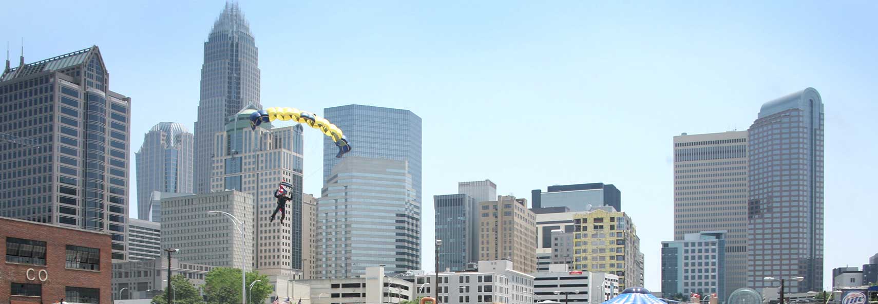 U.S. Navy Flight Demonstration “Team Leapfrogs” during a demonstration at the Food Lion Speed Street festival in front of Charlotte's skyline. Image: Mate Gary Ward |
About Charlotte |
 The satellite view shows Charlotte, largest city, a transportation hub, and the seat of Mecklenburg County in North Carolina in the The satellite view shows Charlotte, largest city, a transportation hub, and the seat of Mecklenburg County in North Carolina in the The Waxhaws area was settled by European immigrants in the mid 18th century near the intersection of the Great Wagon Road (Carolina Road) and the Indian Trading Path, it became the core of what is now Uptown Charlotte. The east–west trading path became Charlotte's Trade Street, and the Great Wagon Road became Tryon Stree. The city was named for the German Princess Charlotte Sophia of Mecklenburg-Strelitz, German noblewoman, Queen of Great Britain and Ireland, and wife of the British King George III. Today Charlotte has a population of 827,000 inhabitants. In the Charlotte-Gastonia-Rock Hill metropolitan area live 2.4 million people (in 2015). Only a few know that the 'Queen City of the Southeast' has become the second largest financial hub in the United States. Bank of America, United States' second-largest bank, and Wells Fargo Securities, the investment banking division of Wells Fargo, have their headquarters in the city. Charlotte's Attractions: Places of Worship: Cathedral of Saint Patrick, Hickory Grove Baptist Church, Calvary Church, Elevation Church, and Billy Graham Library. Museums: Levine Museum of the New South, Discovery Place, the Mint Museum, Bechtler Museum of Modern Art, Carolinas Aviation Museum, Charlotte Nature Museum, and Harvey B. Gantt Center for African-American Arts+Culture. Other Attractions: Carowinds amusement park and the NASCAR Hall of Fame. The Map shows a city map of Charlotte with expressways, main roads, and streets, Charlotte Douglas International Airport (IATA code: CLT) is located 7 mi (11 km) by road, west of the city. Just zoom in to see the intersection of Trade and Tryon streets, the former native American trails in Uptown Charlotte, known as "The Square". To find a location use the form below. To view just the map, click on the "Map" button. |
|
| To find a location type: street or place, city, optional: state, country. |
Local Time Charlotte:
Friday-April-26 2024 05:44
Standard time zone Eastern (EST): UTC/GMT -5 hoursDaylight Saving Time (EDT) in use from the second Sunday in March, ends on the first Sunday in November; time zone offset: UTC/GMT -4 hours |
One World - Nations Online .:. let's care for this planet Promote that every nation assumes responsibility for our world. Nations Online Project is made to improve cross-cultural understanding and global awareness. More signal - less NOISE |
| Site Map
| Information Sources | Disclaimer | Copyright © 1998-2023 :: nationsonline.org |