Advertising

New Hampshire Flag detail
Home Earth Continents The Americas USA Country Profile US State Capitals New Hampshire Map

US States Maps Index
World Maps Index

Map of New Hampshire (NH)


Mount Washington, Coös County, New Hampshire
View of Mount Washington in Coös County, New Hampshire. Mt Washington is the highest peak in the Northeastern United States at 1,916.6 m (6,288.2 ft).
Image: Tony Hisgett
 
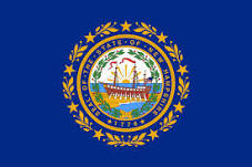
New Hampshire Flag
New Hampshire State Flag


About New Hampshire


Location map of New Hampshire state USA
Where in the United States is New Hampshire? Location map of New Hampshire in the US.


The US state of New Hampshire is one of the six states of New England, a region in the northeastern United States.

New Hampshire is bordered by the Québec province of Canada to the north and northwest, by the US states of Maine in east and Massachusetts to the south.
The Connecticut River forms its border with Vermont to the west.

The Granite State (its nickname) has a short coastline (24 km or 15 mi) at the Gulf of Maine, a gulf of the Atlantic Ocean.

The British Empire began to take shape during the early 17th century, with the English settlement of North America.
The area of today New Hampshire was settled from England. The Province of New Hampshire was established in 1629 and was given a separate charter in 1679. In 1769 Dartmouth College was established. The province became a state in 1776 and ratified the US Constitution on 21st June 1788, as the ninth state of the original thirteen states of the Union.


New Hampshire State Map

Reference Map of New Hampshire
General Map of New Hampshire, United States.

The detailed map shows the US state of New Hampshire with boundaries, the location of the state's capital Concord, major cities and populated places, rivers, streams and lakes, interstate highways, principal highways, and railroads.

You are free to use this map for educational purposes (fair use), please refer to the Nations Online Project.

 
More about New Hampshire


Some Geography
New Hampshire annotated Topographic Regions Map Topographic Regions Map of New Hampshire. (click on the map to enlarge).


Area
Roughly shaped like a right-angled triangle, New Hampshire covers an area of 24,214 km² [1], making it somewhat smaller than Belgium. It is the 5th smallest US state by area. Compared with other US states, New Hampshire is slightly larger than New Jersey, but it would fit into Texas 29 times.


New Hampshire Landscape

Mountains
Several peaks in the White Mountains, are rising above 1,500 m (5,000 ft) in elevation. [2]

The highlight of the state's mountainous landscape is the White Mountains range, the region is known for its winter sports areas. The White Mountain National Forest links the Vermont and Maine portions of the Appalachian Trail.


Highest point
Located within the White Mountains, in the Presidential Range, is Mt. Washington, the highest peak in New Hampshire and the Northeastern United States at 1,916.6 m (6,288.2 ft).


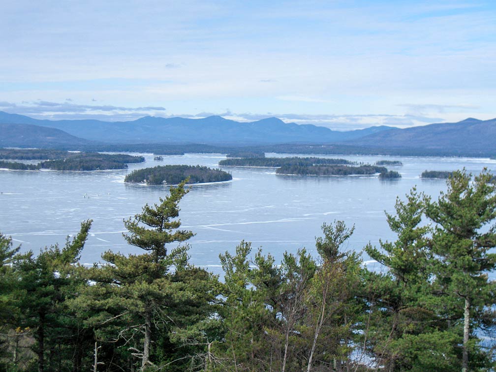
Ice covered Lake Winnipesaukee in the Lakes Region of  New Hampshire
View of Ice-covered Lake Winnipesaukee, looking north toward the Sandwich Range (White Mountains). The largest lake in New Hampshire is located in the Lakes Region.
Image: Ken Gallager

Lakes

To the south of the White Mountains and the Sandwich Range is the New Hampshire's Lakes Region, an area surrounding Lake Winnipesaukee, Winnisquam Lake, Squam Lake, and Newfound Lake. Lakes Region is a popular tourist destination in the summertime. Lake Winnipesaukee is the largest of New Hampshire's many lakes.


North Country
In the north of the state is the Great North Woods Region, a sparsely populated area and a tourism region, also known as the North Country.

The Monadnock Region is an area in southwestern New Hampshire; the region offers abundant opportunities for outdoor recreation like camping, Nordic skiing, and hiking Mount Monadnock.

The Merrimack Valley is a region in the central south of the state along the Merrimack River.
Within the valley are the state capital Concord, and the state's two largest cities, Manchester and Nashua.

The Seacoast Region is a beach New Hampshire style. The 24 km (15 mi) long coast is generally rocky and rough, with a few human-made sandy beaches in between. The region along the shore was the first area of the state to be permanently settled by Europeans in the early 17th century.


Population


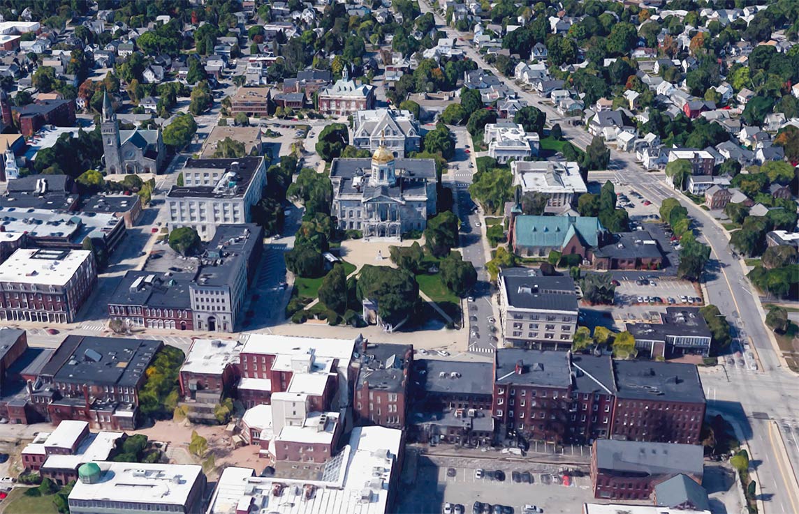
New Hampshire State House in Concord
New Hampshire's cute little State House (in center) is located in Concord, the state's capital. The Greek Revival style capitol houses New Hampshire's General Court, the Governor, and the Executive Council.
Image: Google

New Hampshire has a population of 1.35 million people (est. 2019), [3] ranked 41st. Capital is Concord; the largest city is Manchester (NH), the largest metropolitan area is Greater Manchester, with a population of 400,000 people.

Race and Ethnic groups
The population of New Hampshire is almost pure white (90% White Americans). The rest of the population is made up of 4% Hispanics or Latinos, 3.0% Asians, 1.8% Black or African Americans, and 0.3% Native Americans. [7]


By far the largest airport in the state is Manchester-Boston Regional Airport (IATA code: MHT) in the south of Manchester NH.


Cities and Towns in New Hampshire

The map shows the location of following cities and towns in New Hampshire:

Largest cities in New Hampshire with a population of more than 90,000:
Manchester (110,000), Nashua (68,000), Concord (42,000), Derry (33,000), Dover (30,000), Rochester (30,000)
Population figures in 2014

Other cities and towns in New Hampshire:
Berlin, Claremont, Conway, Exeter, Franklin, Hanover, Keene, Laconia, Lancaster, Lebanon, Littleton, Milford, Plymouth, Portsmouth, and Woodsville.


View of Manchester, New Hampshire
View of Manchester from Rock Rimmon. Manchester is New Hampshire's largest urban area; the city is home to the New Hampshire Institute of Art and the University of New Hampshire at Manchester.
Image: Mike Spenard


Weather Conditions Concord:

CONCORD WEATHER


Advertisements:


Maps of the 50 U.S. States
Alabama | Alaska | Arizona | Arkansas | California | Colorado | Connecticut | Delaware | Florida | Georgia | Hawaii | Idaho | Illinois | Indiana | Iowa | Kansas | Kentucky | Louisiana | Maine | Maryland | Massachusetts | Michigan | Minnesota | Mississippi | Missouri | Montana | Nebraska | Nevada | New Hampshire | New Jersey | New Mexico | New York | North Carolina | North DakotaOhio | Oklahoma | Oregon | Pennsylvania | Rhode Island | South Carolina | South Dakota | Tennessee | Texas | Utah | Vermont | Virginia | Washington | West Virginia | Wisconsin | Wyoming

20 Most Populous U.S. Cities (in 2018):
1. New York City 2. Los Angeles 3. Chicago 4. Houston 5. Phoenix 6. Philadelphia 7. San Antonio 8. San Diego 9. Dallas 10. San Jose 11. Austin 12. Jacksonville 13. Fort Worth 14. Columbus 15. San Francisco 16. Charlotte 17. Indianapolis 18. Seattle, 19. Denver, 20. Washington D.C.

Other Major U.S. Cities:
Albany, Anchorage, Annapolis, Atlanta, Atlantic City, Augusta, Baltimore, Baton Rouge, Bismarck, Boise, Boston, Carson City, Charleston, WV, Cheyenne, Cincinnati, Cleveland, Columbia, Concord, Des Moines, Detroit, Dover, DE, El Paso, Frankfort, Harrisburg, Hartford, Helena, Honolulu, Jackson, Jefferson City, Juneau, Kansas City, Lansing, Las Vegas, Lincoln, Little Rock, Long Beach, Madison, Memphis, Miami, Milwaukee, Minneapolis, Montgomery, Montpelier, Nashville, New Orleans, Norfolk, Oklahoma City, Olympia, Orlando, Pierre, Pittsburgh, Portland, Providence, Richmond, VA, Raleigh, Sacramento, St. Louis, St. Paul, Salem (OR), Salt Lake City, Santa Fe, Springfield, Tallahassee, Tampa, Topeka, Trenton, Tucson