Advertising

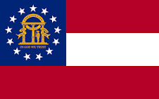
Georgia Flag detail
Home Earth Continents The Americas USA Country Profile US State Capitals Georgia Map

US States Maps Index
World Maps Index

Map of Georgia (GA)

For a map of Georgia, a country in the Caucasus, go to Map of Georgia


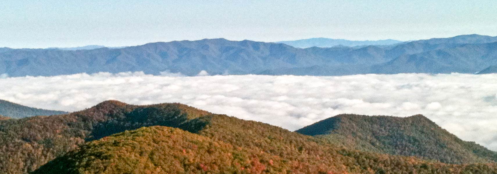
Chattahoochee National Forest, view from Brasstown Bald Mountain
Early morning views from Brasstown Bald looking north, Chattahoochee National Forest, Georgia. Brasstown Bald is the highest point in the state at 1,458 m (4,784-ft).
Image: Julia Schrader

 
Georgia US Flag
Georgia State Flag
 

About Georgia


Location map of Georgia state USA
Where in the United States is Georgia? Location map of Georgia in the US.
 
Georgia is one of the 50 US states situated in the southeastern mainland of the United States. Not to be confused with Georgia, a country in southwestern Asia, and formerly part of the Soviet empire.


US Georgia borders the Atlantic Ocean in the southeast, and it shares state lines with Tennessee and North Carolina in the north. The Chattahoochee River defines a section of Georgia's border with Alabama in the southwest and a short length of its border with Florida. The Savannah River forms a natural border with South Carolina in the east.


The state's nickname is "Peach State," and it is also known as the "Yankee-land of the South."


Georgia State Map
Reference Map of US Georgia state
General Map of Georgia, United States.

The detailed map shows the US state of Georgia with state boundaries, the location of the capital Atlanta, major cities and populated places, rivers and lakes, interstate highways, principal highways, railroads and major airports.

You are free to use the above map for educational and similar purposes; if you publish it online or in print, you need to credit Nations Online Project as the source.

 
More about the state of Georgia


Georgia Topographic Regions Map Topographic Regions Map of Georgia.
 
Founded as an English colony in 1732 and named after King George II of Great Britain, it was one of the original thirteen states. Statehood since 2 January 1788, it was the fourth of the original 13 states to join the Union.


Area
With an area of 153,909 km² (59,425 sq mi), [1] the US state of Georgia is about half the size of Italy.

Compared with other US states, Georgia would fit into California six times.


Georgia's Geography

Four different major regions define Georgia's landscape (from north to south):

1. In the northwestern corner is the Valley and Ridge region, a zone of alternating mountain ridges and valleys in Georgia's portion of the Appalachian Plateau.


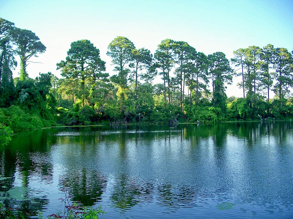
Pond and great egrets, bird rookery on Jekyll Island, Georgia
Pond with great egrets in the background. A bird rookery on Jekyll Island, one of the four barrier islands in Glynn County, Georgia.
Image: mwms1916

 
2. In the northeastern corner is the southern end of the Blue Ridge Mountains, a subrange in the much larger Appalachian Mountain Chain. Situated here is the highest elevation in the state of Georgia, Brasstown Bald (Enotah) at 1,458 m (4,784 ft).


3. The hilly Piedmont part of the state is Georgia's most populated area. Within the region are the fall line cities of Augusta, Macon, and Columbus.

The fall line is the natural border between the lower coastal plain and the higher terrain of the Piedmont. Before the improvement of navigational facilities such as locks, the fall line was usually the head of navigation on rivers due to insurmountable rapids or waterfalls.

Fall line cities developed at the end of the navigable part of a river, where boats could go no further. Trading posts were established in those places, where materials brought from the coastal plains could be traded for goods from the Piedmont.


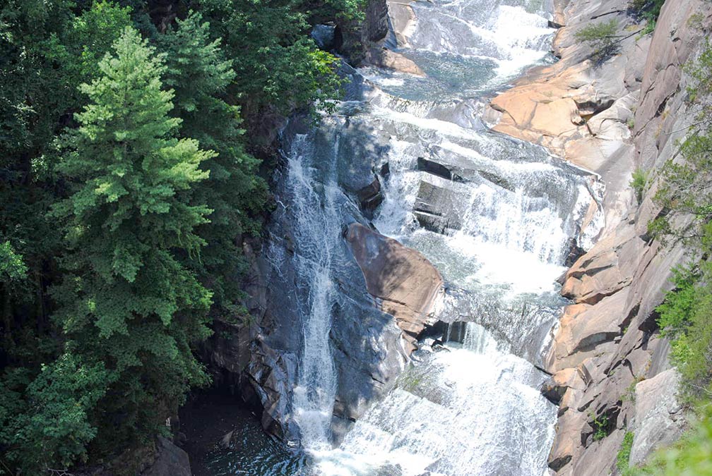
Tallulah Falls in Tallulah Gorge State Park
Tallulah Falls of the Tallulah River at Tallulah Gorge State Park, about 155 km (96 mi) northeast of Atlanta.
Image: chronic-shock

 
4. The relatively flat Coastal Plain is Georgia’s largest geographical region, it covers about 60% of the state, expanding from the Atlantic Ocean to the Fall Line.

In prehistoric times, this area was a seabed, and the coast was near the fall line. When the ocean retreated, it left a vast expanse of limestone, clay, sand, and other 'soft' sedimentary deposits.
The land is usually poorly drained, and there are often marshy areas.
The Okefenokee Swamp in southwest Georgia and northern Florida is a 1,770 km², peat-filled wetland, considered to be one of the Seven Natural Wonders of Georgia. The Suwanee River rises in the Okefenokee Swamp.


Rivers
Other major rivers in Georgia are the Savannah River, the Chattahoochee River, which forms part of the border with Alabama, and the Altamaha River, fed by the Oconee and Ocmulgee rivers.

Lakes
Major lakes in Georgia are Lake Sidney Lanier, a reservoir at the Chattahoochee River; Lake Seminole, a reservoir located in the southwest corner of Georgia; and West Point Lake, a reservoir at the Chattahoochee River.

 
Population


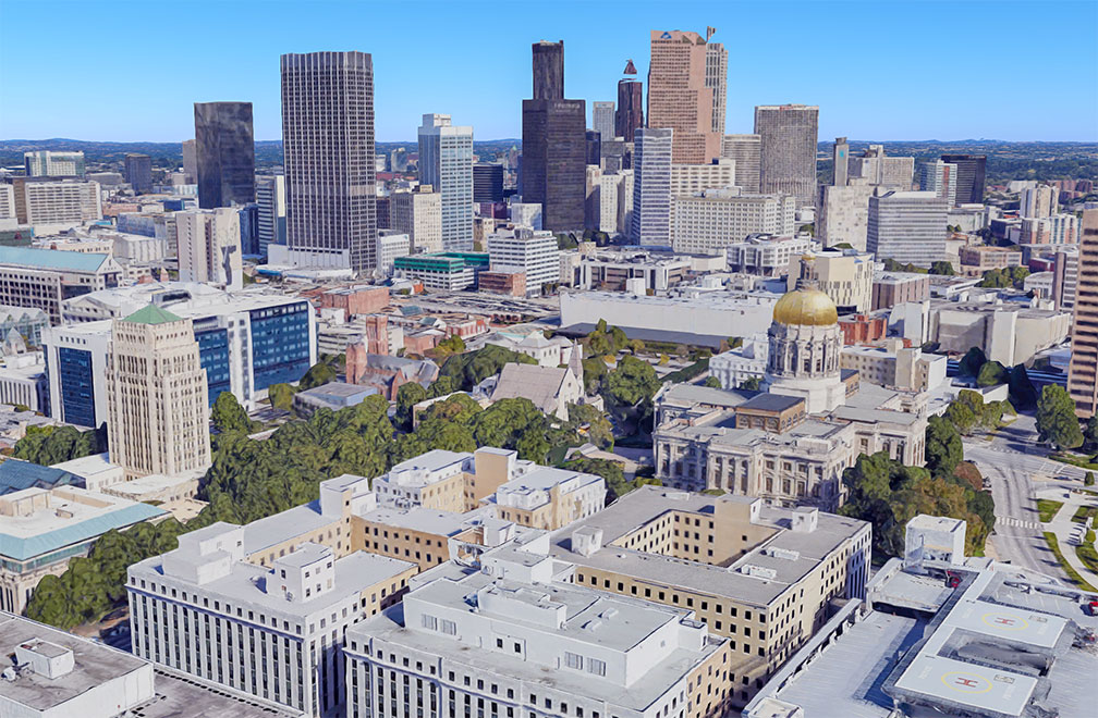
Georgia State Capitol in Atlanta
Rendered image of Georgia State Capitol in Atlanta. The Neo-classical National Historic Landmark building is the primary office of Georgia's government.
Image: Google

Georgia has a population of 10.6 million people (est. 2019). Georgia is the US state with the third-largest African-American population (32.6%). [2]

The flagship city, state capital, and economic and cultural center is Atlanta; it is at the center of the state's largest metropolitan area, Atlanta-Sandy Springs-Roswell, GA Metropolitan Area, also known as Metro Atlanta, with a population of more than 6 million inhabitants (in 2021).


Race and Ethnic groups
The population of Georgia is composed of White alone 52%, African American 32.6%, Hispanic or Latino 9.9%, Asian 4.4%, and Native American 0.5%. [3]


Airports
By far busiest airport in the state is Hartsfield-Jackson Atlanta International Airport (IATA code: ATL).


Cities and Towns in Georgia
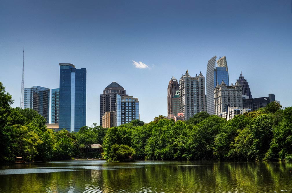

Atlanta Midtown seen from Piedmont Park
Atlanta Midtown viewed from Piedmont Park. Atlanta is Georgia's capital and most populous city.
Image: Mike

 
The map shows the location of following cities and towns in Georgia:

Largest cities are Atlanta (420,000), Augusta (192,000), Columbus (190,000), Savannah (136,000), and Athens (116,000).

Other cities and towns in Georgia


Albany, Alma, Alpharetta, Americus, Bainbridge, Blakely, Bremen, Brunswick, Cairo, Calhoun, Carrollton, Cartersville, Cedartown, Cordele, Covington, Dalton, Dawson, Douglas, Dublin, East Point, Eatonton, Fort Valley, Gainesville, Griffin, Hinesville, Homerville, Jesup, Kingsland, La Grange, Macon, Marietta, Martinez, McRae, Milledgeville, Monroe, Moultrie, Newnan, Peachtree City, Perry, Rome, Roswell, Sandersville, Smyrna, Statesboro, Swainsboro, Sylvania, Thomasville, Tifton, Toccoa, Valdosta, Vidalia, Warner Robins, Waycross, and Waynesboro.
Weather Conditions Atlanta:

ATLANTA WEATHER


Advertisements:


Maps of the 50 U.S. States
Alabama | Alaska | Arizona | Arkansas | California | Colorado | Connecticut | Delaware | Florida | Georgia | Hawaii | Idaho | Illinois | Indiana | Iowa | Kansas | Kentucky | Louisiana | Maine | Maryland | Massachusetts | Michigan | Minnesota | Mississippi | Missouri | Montana | Nebraska | Nevada | New Hampshire | New Jersey | New Mexico | New York | North Carolina | North DakotaOhio | Oklahoma | Oregon | Pennsylvania | Rhode Island | South Carolina | South Dakota | Tennessee | Texas | Utah | Vermont | Virginia | Washington | West Virginia | Wisconsin | Wyoming

20 Most Populous U.S. Cities (in 2018):
1. New York City 2. Los Angeles 3. Chicago 4. Houston 5. Phoenix 6. Philadelphia 7. San Antonio 8. San Diego 9. Dallas 10. San Jose 11. Austin 12. Jacksonville 13. Fort Worth 14. Columbus 15. San Francisco 16. Charlotte 17. Indianapolis 18. Seattle, 19. Denver, 20. Washington D.C.

Other Major U.S. Cities:
Albany, Anchorage, Annapolis, Atlanta, Atlantic City, Augusta, Baltimore, Baton Rouge, Bismarck, Boise, Boston, Carson City, Charleston, WV, Cheyenne, Cincinnati, Cleveland, Columbia, Concord, Des Moines, Detroit, Dover, DE, El Paso, Frankfort, Harrisburg, Hartford, Helena, Honolulu, Jackson, Jefferson City, Juneau, Kansas City, Lansing, Las Vegas, Lincoln, Little Rock, Long Beach, Madison, Memphis, Miami, Milwaukee, Minneapolis, Montgomery, Montpelier, Nashville, New Orleans, Norfolk, Oklahoma City, Olympia, Orlando, Pierre, Pittsburgh, Portland, Providence, Richmond, VA, Raleigh, Sacramento, St. Louis, St. Paul, Salem (OR), Salt Lake City, Santa Fe, Springfield, Tallahassee, Tampa, Topeka, Trenton, Tucson