Advertising

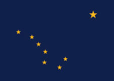
Alaska Flag detail
Home Earth Continents The Americas USA Country Profile US State Capitals Alaska Map

US States Maps Index
World Maps Index

Map of Alaska (AK)


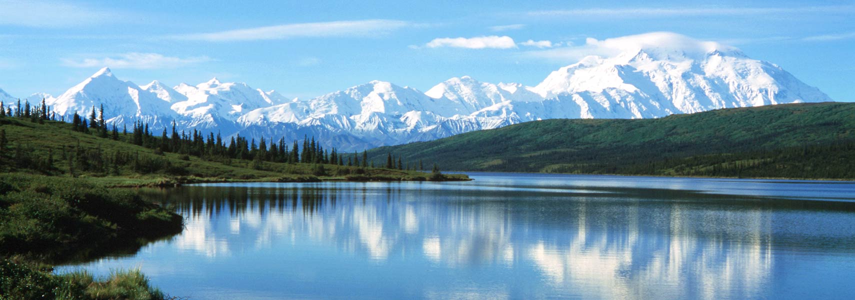
Wonder Lake and Denali mountain at Denali National Park, Alaska
Wonder Lake in Alaska's Denali National Park with the impressive Mount Denali in the background. Denali (formerly Mount McKinley) is at 6,190 m (20,310 ft), the highest mountain peak in the United States and North America.
Image: BillC
 
Flag of Alaska
Alaska State Flag


About Alaska

Location map of Alaska state USA
Where in the United States is Alaska? Location map of the State of Alaska in the US.
 
The largest US state occupies a huge peninsula in the extreme northwest of North America. Its 10,690 km (6,640 mi) coastline stretches along the Beaufort and Chukchi Seas (both marginal seas of the Arctic Ocean), the Bering Strait and the Bering Sea, and the Gulf of Alaska, an arm of the Pacific Ocean.

Alaska is separated from the 48 contiguous U.S. states by Canada. The Bering Strait, a strait between the Pacific and Arctic Oceans, separates Asia (the Chukchi Peninsula of Russia) from North America (the Seward Peninsula of Alaska).
Alaska is one of two US states not bordered by another state; Hawaii is the other.

Alaska borders Canada to the east (the Canadian provinces of Yukon Territory and British Columbia), and it shares a maritime border with Russia to the west. The state's nickname is "The Last Frontier."


Some History
The history of Alaska dates back to the Upper Paleolithic period. Genetic findings suggest that a single population of modern humans migrated from southern Siberia toward the landmass known as the Bering Land Bridge as early as 30,000 years ago. 16,500 years ago, people moved further into the Americas. [1]
Because the Bering Land Bridge is now submerged, archeological artifacts are practically nonexistent. However, archeologists have discovered artifacts on land that provide evidence of human activity in North and South America dating roughly 12,000 years ago.


At the time of European contact by Russian explorers in the mid-18th century, the area was populated by tribes of Alaskan Native people. Alaska was a Russian colony from the 1740s until 1867, when the territory was purchased by the United States from the Russians for $7.2 million. Admission to the Union was on the 3rd January 1959; Alaska was admitted as the 49th state.

After oil was discovered in 1968, a pipeline was completed in 1977 to transport that oil from the North Slope to Valdez, a former gold rush town that became an important port city in Alaska.

 
Alaska State Map

Reference Map of Alaska
General Map of Alaska, United States.

The detailed map shows the US state of Alaska and the Aleutian Islands with maritime and land boundaries, the location of the state capital Juneau, major cities and populated places, ocean inlets and bays, rivers and lakes, highest mountains, major roads, ferry lines (Alaska Marine Highway), railroads and major airports.

You are free to use the above map for educational and similar purposes; if you publish it online or in print, you need to credit Nations Online Project as the source.

 
De Long Mountains in northwestern Alaska
A lone hiker in the De Long Mountains in northwestern Alaska, near the Nakolik landing strip at Noatak National Preserve.
Image: Western Arctic National Parklands


More about Alaska State


Geography of Alaska


Alaska Topographic Regions Map
Topographic Map of Alaska. (Click map to enlarge)

Area
The state covers an area of 1,723,337 km² (665,384 sq mi) [2] [3] and is the largest of all US states. By comparison, Alaska is three times the size of the Iberian Peninsula, compared to other US states, Alaska is 2.5 times the size of Texas, and New Jersey would fit in 76 times.
The U.S. federal government owns and manages approximately 65% of the state as public lands, including 24 national parks, 16 wildlife refuges, and two national forests.


Population
Alaska is among the least populated states in the US. In mid-2021, 732,673 people were residents of Alaska. The capital city is Juneau. Spoken languages are English and 20 indigenous American languages.

Largest cities in Alaska are Anchorage (pop.: 291,538), Juneau (pop.: 32,113), Fairbanks (pop.: 31,516), Wasilla (pop.: 10,529), Sitka (pop.: 8,647), Ketchikan (pop.: 8,289), Kenai (pop.: 7,778), and Kodiak (pop.: 5,968).


Climate
A tundra climate dominates the northern third with temperatures around the freezing point, causing permafrost to prevail (the ground stays frozen all year long.) The southern parts of Alaska are mainly characterized by a subarctic climate with very cold winters and short, cool to mild summers. In December 2021, the coldest US state has recorded its hottest-ever December day, amid an unusual winter warm spell. Temperatures soared to a record 19.4C (67F) on the island of Kodiak. [BBC] At the same time, temperatures in Nuiqsut (North Slope) were around -40F/C.

 
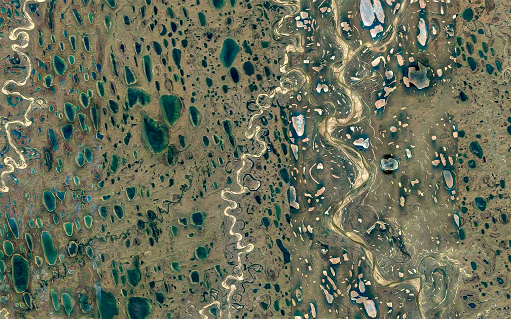
Satellite view of thaw ponds and rivers in the Far North of Alaska A work of art. Satellite view of permafrost thaw ponds and creeks in the great expanse of flatlands north of the Brooks Range in Alaska's Far North. (click image to enlarge)
Image: Google, Digital Globe, Copernicus


Alaska's Regions
Alaska is divided into five major regions (from north to south):


1. The Far North or Arctic Alaska is a vast area roughly between the Yukon River and the Arctic Ocean. Various Alaskan Natives originally inhabited the region; they lived from hunting and fishing.

Along the coast of the Arctic Ocean stretches the flat, boggy coastal plains, known as the Arctic coastal tundra, an ecoregion of solid permafrost characterized by poor drainage with many thaw lakes and ponds which cover up to 50 percent of the surface.

The Brooks Mountain Range (Athabaskan Gwazhał) dominates the landscape south of the gradually rising plains of the North Slope. The mountains extend over 1,100 km (700 miles) in a slight arc from west to east. The Brooks Mountains reach altitudes of between 1,500 and 2,700 m. Mount Isto, with 2.735 m, is the highest peak in the Brooks Range.

Most of Arctic Alaska lies within the Arctic Circle. The area offers midnight sun in the summer and polar nights in winter; the aurora borealis or "northern lights" may be seen between late August and April.

2. South of the Brook Range is the wilderness area of the Interior in central Alaska; it is centered around Fairbanks, the largest city in the Interior and bounded by the Alaska Range in the south. Native Athabaskan people, a hunter-gatherer society, originally inhabited the region.

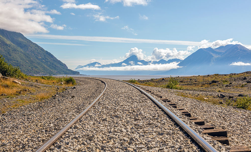
Near Beluga Point Lookout, Anchorage, Alaska
Scenery near Beluga Point Lookout south of Anchorage; the Turnagain Arm (Gulf of Alaska) in the background, seen from the rail tracks of the Alaska Railroad.
Image: Diego Delso

3. Alaska's Southwest region along Kuskokwim Bay and Bristol Bay includes the Nunivak Island, the Yukon Delta area, Alaska Peninsula and the Aleutian Islands chain, and the Kodiak Archipelago.

4. Southcentral Alaska is situated roughly between the Alaska Range and the south coast at the Gulf of Alaska. Centered around Prince William Sound. The terrain is subdivided into the Mat-Su Valley (Matanuska-Susitna), the Copper River Valley, the Anchorage Area, and the Kenai Peninsula.
 
5. The Alaskan portion of the Inside Passage (aka the Alaska Panhandle, aka Southeast Alaska) is situated to the southeast of mainland Alaska. The panhandle extends 840 km (520 mi) from northwest to southeast, south of Canada's Yukon Territory and British Columbia along the Gulf of Alaska. Its rugged landscape offers intricate fjords, glacier-shaped mountains and valleys with temperate rainforests, and sparkling blue and white icefields which generate glaciers.


Mountains

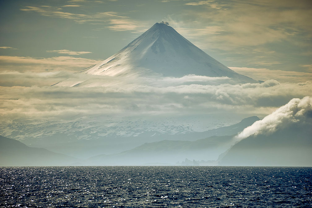
Shishaldin volcano on Unimak Island in the Aleutian Islands of Alaska Shishaldin, an active volcano on Unimak Island in the Aleutian Islands. It is probably the most symmetrical cone-shaped glacier-clad large mountain on the planet.
Image: naql


When the United States bought Alaska from the Russians for $7.2 million, the package included all ten of the USA's highest mountains.

Number one in altitude is Denali (also known as Mount McKinley and Bolshaya Gora), the highest mountain in the United States and North America with a summit elevation of 6190 m (20,310 ft). The mountain is located in the Alaska Range in the southern part of the peninsula; it is the highest mountain range in the world outside Asia and the Andes.
Denali is considered the world's coldest mountain because it combines a high elevation and a location near the Arctic Circle. Permanent snow and ice cover over 75 percent of the mountain, and enormous glaciers, up to 70 km (45 mi) long and 1 km (3,700 ft) thick, spider out from its base in every direction. [WFB]
List of highest mountains in Alaska

Lakes
Alaska has over 3 million lakes; more than 3,000 are officially named. There are 94 lakes with a surface area of more than 25 km² (10 sq mi). The largest natural freshwater lake in the state is Iliamna, with a surface area of 2,978 km² (1,150 sq mi).
 
Rivers of Alaska

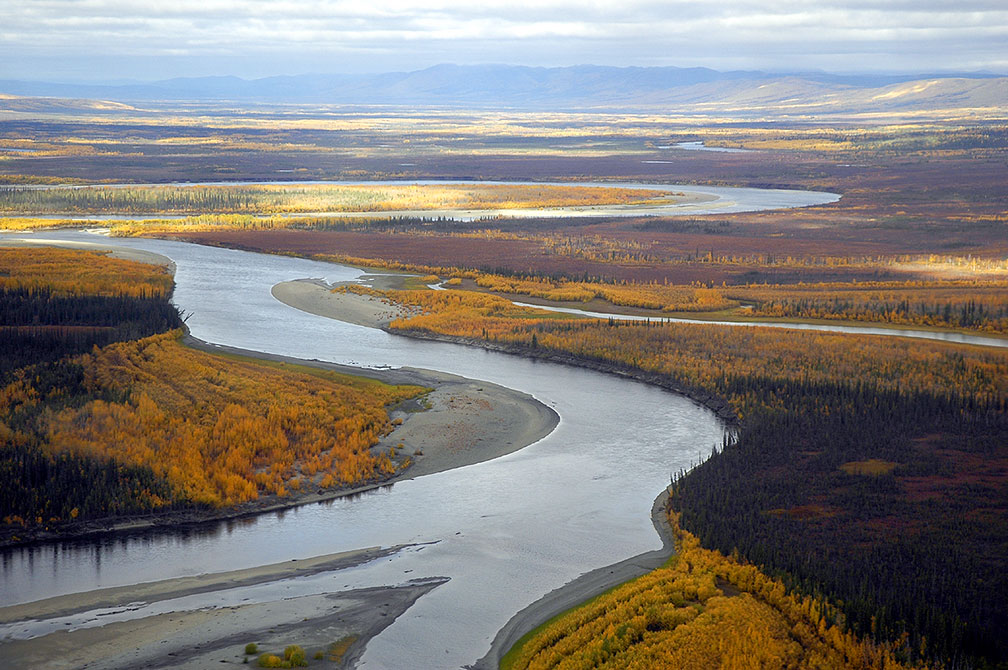
Koyukuk River, Kanuti National Wildlife Refuge Alaska
Koyukuk River in the Kanuti National Wildlife Refuge in late summer. The Koyukuk is a tributary of the Yukon River.
Image: Bill Raften


There are more than 3,000 rivers in the state.


Alaska's chief river is the Yukon; its source is in British Columbia, Canada, and it empties into the Bering Sea. The river is 3,698 km (2,298 mi) long and flows for 3,017 km (1,875 mi) within Alaska. The Yukon ranks third in length of all US rivers, behind the Mississippi and Missouri.
Major tributaries of the Yukon in Alaska are the Porcupine, the Tanana, and the Koyukuk rivers.


Alaska's other big river is the Colville River, one of the northernmost major rivers in North America, rises in the DeLong Mountains and empties into the Beaufort Sea (Arctic Ocean).


Lake Iliamna, largest lake in Alaska
View of Iliamna lake situated at the northern end of the Alaska Peninsula; it is the largest natural freshwater lake in the state with a surface area of almost 3,000 km².
Image: Vlad Karpinskiy

The Noatak is a river north of the Arctic Circle. A long section of the Noatak is part of the National Wild and Scenic Rivers System.


The 450 km (280 mi) long Kobuk River in the Arctic region in northwestern Alaska empties into the Kotzebue Sound.


The Kuskokwim in the southwest of the state provides major drainage for a large area of the Alaska Interior and empties into the Kuskokwim Bay on the Bering Sea.


The Susitna River, the "sandy river," empties into the Cook Inlet of the Pacific Ocean.


The Copper River drains a large region of the Wrangell and the Chugach Mountains; it flows into the Gulf of Alaska.

Islands

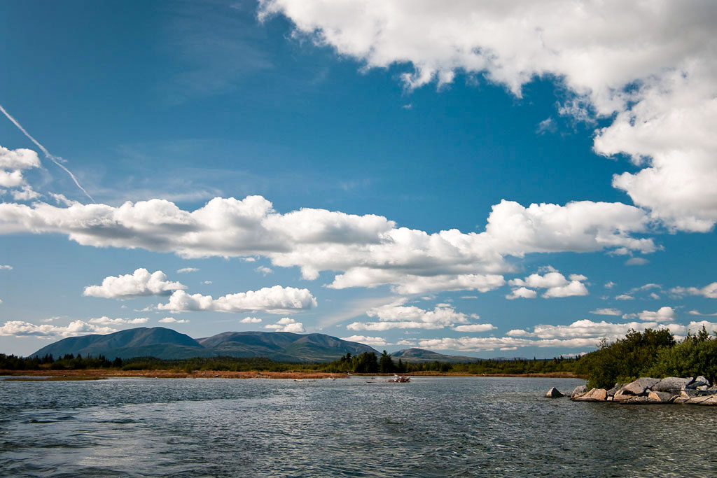
View of Buskin Lake with Pyramid Mountain on Kodiak Island in Alaska
Buskin Lake with Pyramid Mountain on Kodiak Island in Alaska.
Image: naql

There are 1,800 named islands in the state, 1,000 of which are located in Southeast Alaska.

The largest island is Kodiak Island in the Gulf of Alaska; it is separated from Alaska's mainland by the Shelikof Strait. The island has an area of 9,293 km² (3,588 sq mi), making it slightly larger than Cyprus.


Glaciers
Alaska has around 100,000 glaciers. About three-fourths of all freshwater in the state is stored as glacial ice.

Situated southeast of Mount Saint Elias is the largest piedmont glacier in the world, the Malaspina Glacier; it is part of the St. Elias Mountains glacier system. The glacier covers an area of 2,200 km² (850 sq mi); this is about half the size of Rhode Island. [4]

The Bering Glacier complex is the largest glacier in Alaska with 5,827 km² (2,250 sq mi); the complex includes the Bagley Icefield. Ice fields cover approximately 5% of the state, about 75,110 km² (29,000 sq mi). [5]


World Heritage Site

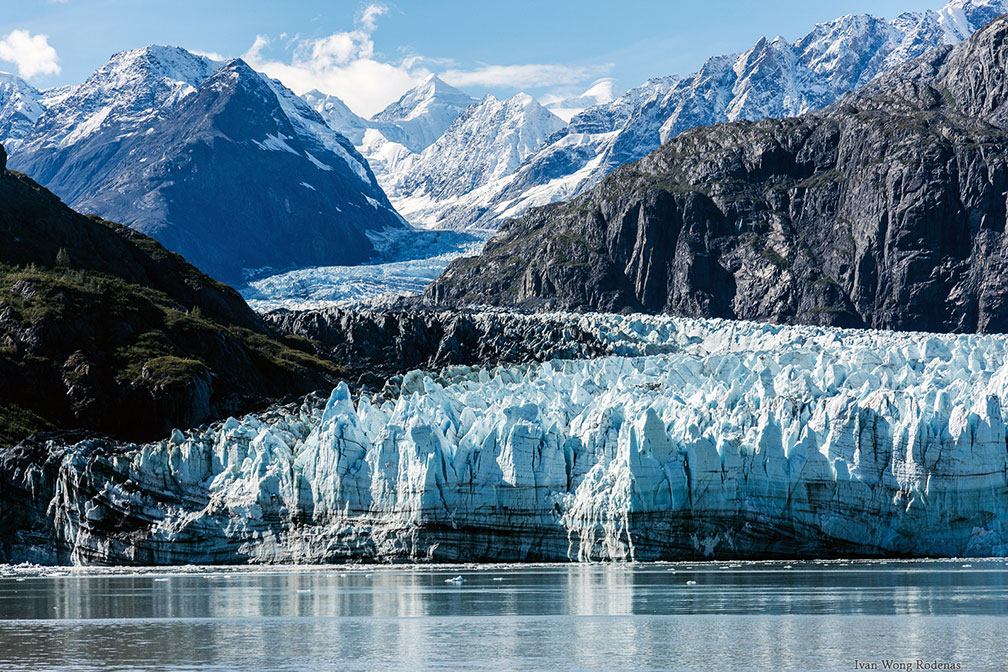
Glacier Bay National Park in Alaska
Glacier Bay National Park in Alaska is part of an international UNESCO World Heritage Site in Alaska. Glacier Bay is one highlight of any Alaska cruise.
Image: Ivan Wong Rodenas
 
Alaska shares a UNESCO World Heritage Site with Canada. The site is named Kluane / Wrangell-St. Elias / Glacier Bay / Tatshenshini-Alsek.official website

The national parks and protected wilderness areas along the border of Canada and the United States contain some of the highest peaks in North America, the largest non-polar icefield in the world, as well as examples of some of the world's longest glaciers.

The spectacular natural landscapes are an area of intense tectonic, volcanic, glacial, and fluvial activities. They are home to an abundance of wildlife with grizzly bears, caribou, Alaskan moose, Canadian lynx, and Dall sheep, marine mammals and migrating (anadromous) fish.
National Parks


Bagley Icefield and Mount St. Elias in background, Alaska
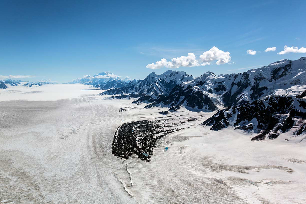
View of the Bagley Icefield in southeastern Alaska along the Saint Elias Mountains looking southeast towards Mount St. Elias, the second-highest mountain in both the United States and Canada.
Image: Jacob W. Frank National Park Service, Alaska Region


The following four parks make up the largest internationally protected landmass on Earth.


Kluane National Park (link) includes the highest mountain in Canada, Mount Logan (5,959 m or 19,551 ft).


Wrangell–St. Elias National Park, (https://www.nps.gov/wrst/) America's largest national park includes Mount St. Elias, the second-highest mountain in both the United States and Canada at 5,489 m (18,008 ft.).


Glacier Bay (https://www.nps.gov/glba/) Glacier Bay National Park is a wilderness area and a biosphere reserve in the Inside Passage (Alaska panhandle) west of Juneau.
The park covers an area of 13,350 km² (5,150 sq mi) [6], features high peaks like Mount Fairweather and glaciers like the vast Grand Pacific Glacier.


Tatshenshini-Alsek is a wilderness park in British Columbia, Canada, established in 1993 after an intensive campaign by Canadian and American conservation organizations to halt mining exploration and development in the area. [7]

 
Population

Alaska State Capitol in Juneau, Alaska
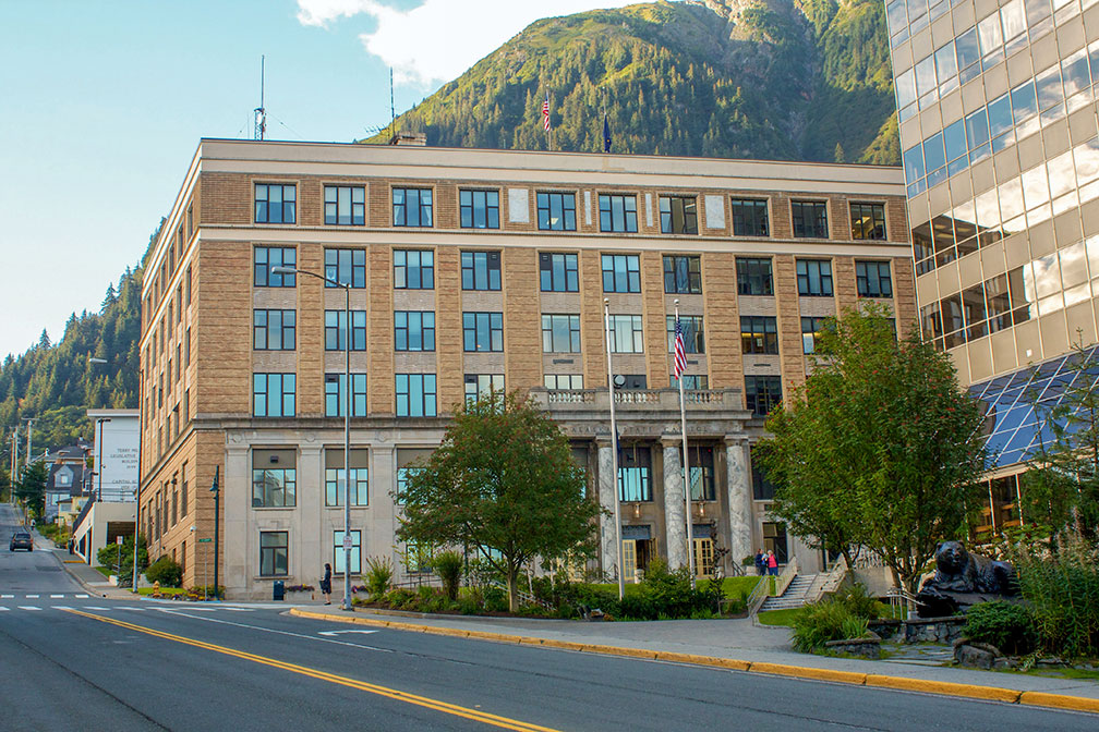
Alaska State Capitol in Juneau, Alaska's capital. The Art Deco style building houses the bicameral Alaska State Legislature.
Image: Jay Galvin

The vast territory of Alaska has a population of just 732,673 people (est. 2021) [8]; it is the third least populated state in the United States. The capital is Juneau; the city is located in the Alaskan panhandle in the southeast region (Inside Passage). The largest and most populous city is Anchorage, a seaport in southern Alaska, on Cook Inlet, a branch of the Gulf of Alaska (Pacific Ocean).

Race and Ethnic groups
Alaska's population is composed of White American 60%, Alaska Native 15.6%, Hispanic or Latino 7.3%, Asian 6.5%, and African American 3.7%. [9]


Cities and Towns in Alaska

The map shows the location of the following cities and towns in Alaska:

Largest cities in Alaska with a population of more than 10,000:

Anchorage (292,000), Fairbanks (32,000), Juneau (31,000), Badger (Fairbanks MSA), Knik-Fairview (Anchorage MSA), and College (Fairbanks MSA).

Major Airports in Alaska
Busiest airports are
Ted Stevens Anchorage International Airport (IATA code: ANC; airport website)
Fairbanks International Airport (IATA code: FAI; airport website)
Juneau International Airport (IATA code: JNU; airport website)

Other cities and towns in Alaska:
Adak, Attu, Barrow, Bethel, Bettles, Chignik, Circle, Council, Dillingham, Galena, Gambell, Glennallen, Holy Cross, Homer, Hooper Bay, Kenai, Ketchikan, King Salmon, Kodiak, Kotzebue, Koyuk, Livengood, Manley Hot Springs, Nenana, Nome, Nuiqsut, Palmer, Prudhoe Bay, Selawik, Seward, Sitka, Skagway, Taylor, Teller, Tok, Unalakleet, Unalaska, Valdez, Wainwright, Wrangell and Yakutat.
 

Weather Conditions Anchorage:

ANCHORAGE WEATHER


Advertisements:


Maps of the 50 U.S. States
Alabama | Alaska | Arizona | Arkansas | California | Colorado | Connecticut | Delaware | Florida | Georgia | Hawaii | Idaho | Illinois | Indiana | Iowa | Kansas | Kentucky | Louisiana | Maine | Maryland | Massachusetts | Michigan | Minnesota | Mississippi | Missouri | Montana | Nebraska | Nevada | New Hampshire | New Jersey | New Mexico | New York | North Carolina | North DakotaOhio | Oklahoma | Oregon | Pennsylvania | Rhode Island | South Carolina | South Dakota | Tennessee | Texas | Utah | Vermont | Virginia | Washington | West Virginia | Wisconsin | Wyoming

20 Most Populous U.S. Cities (in 2018):
1. New York City 2. Los Angeles 3. Chicago 4. Houston 5. Phoenix 6. Philadelphia 7. San Antonio 8. San Diego 9. Dallas 10. San Jose 11. Austin 12. Jacksonville 13. Fort Worth 14. Columbus 15. San Francisco 16. Charlotte 17. Indianapolis 18. Seattle, 19. Denver, 20. Washington D.C.

Other Major U.S. Cities:
Albany, Anchorage, Annapolis, Atlanta, Atlantic City, Augusta, Baltimore, Baton Rouge, Bismarck, Boise, Boston, Carson City, Charleston (WV), Cheyenne, Cincinnati, Cleveland, Columbia, Concord, Des Moines, Detroit, Dover (DE), El Paso, Frankfort, Harrisburg, Hartford, Helena, Honolulu, Jackson, Jefferson City, Juneau, Kansas City, Lansing, Las Vegas, Lincoln, Little Rock, Long Beach, Madison, Memphis, Miami, Milwaukee, Minneapolis, Montgomery, Montpelier, Nashville, New Orleans, Norfolk, Oklahoma City, Olympia, Orlando, Pierre, Pittsburgh, Portland, Providence, Richmond (VA), Raleigh, Sacramento, St. Louis, St. Paul, Salem (OR), Salt Lake City, Santa Fe, Springfield, Tallahassee, Tampa, Topeka, Trenton, Tucson