Advertising

Flag detail New York state
Home Earth Continents The Americas USA Country Profile US State Capitals New York Map

US States Maps Index
World Maps Index

Map of New York (NY)


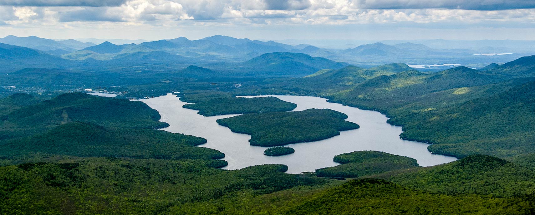
Lake Placid (lake) seen from the top of Whiteface Mountain, State of New York
Lake Placid lake is a lake in the Adirondack Mountains. The picture shows Lake Placid from the top of Whiteface Mountain in Wilmington, New York. There are three islands in Lake Placid called Buck, Moose and Hawk.
Image: Swatigsood

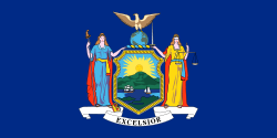
State of New York Flag
New York State Flag


About New York (state)


Location map of New York state USA
Where in the United States is New York? Location map of the State of New York in the US.
 
The State of New York is situated in the northeastern USA, between the Canadian provinces of Québec and Ontario and Lake Ontario in the northwest, and the Atlantic coast in the southeast. It borders the US states of Vermont, Massachusetts, Connecticut, New Jersey, and Pennsylvania. The St Lawrence River forms a section of the state's border with Canada.


The region was initially settled by the Dutch, who surrendered the land to the British in 1664.
The area of today New York was part of the original territory of the United States. When chartered in 1664, it included a much larger area. A portion was sold to create New Jersey in 1664, and title claims were ceded in 1682 to Delaware and Pennsylvania.

New York ratified the U.S. Constitution on 26 July 1788; it was the 11th of the original 13 states to join the Union.


New York State Map
Reference Map of New York
General Map of New York, United States.

The detailed map shows the US state of New York with boundaries, the location of the state capital Albany, major cities and populated places, rivers and lakes, interstate highways, principal highways, railroads and major airports.

You are free to use the above map for educational and similar purposes; if you publish it online or in print, you need to credit Nations Online Project as the source.

 
More about New York State


Some Geography

Area
New York State topographic regions map Topographic Regions Map of New York State. (click map to enlarge)

 
The "The Empire State" (its nickname) covers an area of 141,299 km² (54,556 sq mi), [1] compared, it is somewhat larger than Greece (131,957 km²), but it would fit into Texas almost five times.


New York State Landforms and Recreational Areas

Upstate New York
Upstate New York is the rural hinterland of the New York metropolitan area, comprising all of New York State but the primate city itself. It is the backyard and orchard of the city of New York, providing the megacity with milk and dairy products, fruits (especially apples), wine, water, electricity, and a good deal of recreational areas.


Touristic Highlights


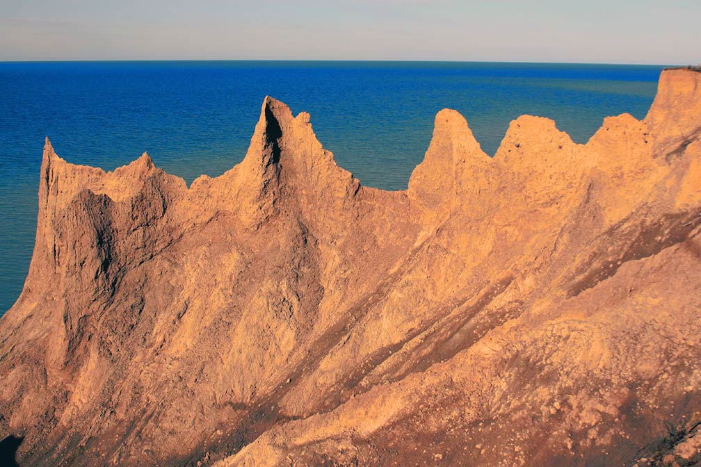
Chimney Bluffs at Lake Ontario
Land and water clash at Chimney Bluffs, sculpting the most dramatic landscape on the Lake Ontario shore near Wolcott, Wayne County, NY.
Image: Rich Engelbrecht

 
Touristic highlights in New York State's mountainous landscapes are the Adirondack Mountains. The mountains are the source of the Hudson, the Black River, and the Mohawk River. They are situated in the north-eastern quarter of the state, between Lake Champlain and the Hudson River in the east, the Lake Plains (Great Lakes Lowlands) of Lake Ontario in the west, and separated from the Appalachian Mountain chain by the Mohawk Valley in the south.

Popular destinations are the Mirror Lake (Lake Placid), Tupper Lake, and The Wild Center in Adirondack Park.
New in the list of Adirondack's tourist attractions is the Wild Walk, a trail of bridges to the treetops of the Adirondack forest.

Within the Adirondacks rises the highest point in the state, Mount Marcy at 1,628 m (5,344 ft), the mountain is situated approximately 20 km (13 mi) south of Lake Placid.

Niagara Falls

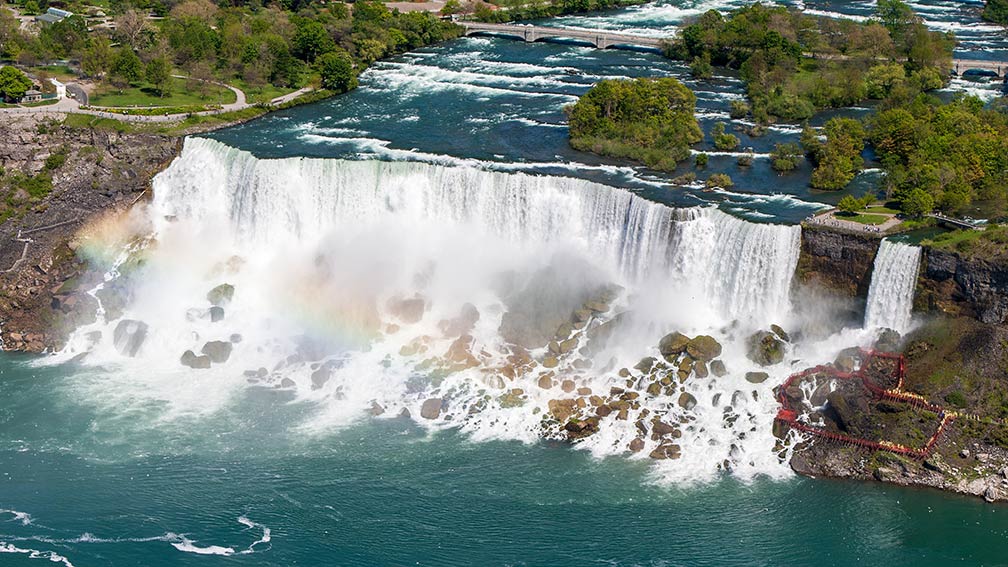
The American Falls and the Bridal Veil Falls of the Niagara Falls in the US
The American Falls and the Bridal Veil Falls of the Niagara Falls in the USA; it is by far the most famous waterfall in North America.
Image: Robert F. Tobler

 
The amazing falling waters of the Niagara River are separated by Goat Island: the Horseshoe Falls adjacent to the western (Canadian) bank and fall 47 m (158 feet); the American Falls adjoin the eastern (US) bank and fall for 50 m (167 feet ).


Allegheny Plateau
The southwestern portion of NY State, south of Lake Ontario and the Mohawk Valley, is occupied by the vast dissected Allegheny Plateau (aka Appalachian Highlands), a series of rugged high plains, which are part of the larger Appalachian system. In the eastern part of the plateau, just two hours north of New York City, rise the hilly Catskill Mountains, known for its abundant wildlife in forested areas, its hiking trails, and ski resorts.

 
Lakes and Rivers

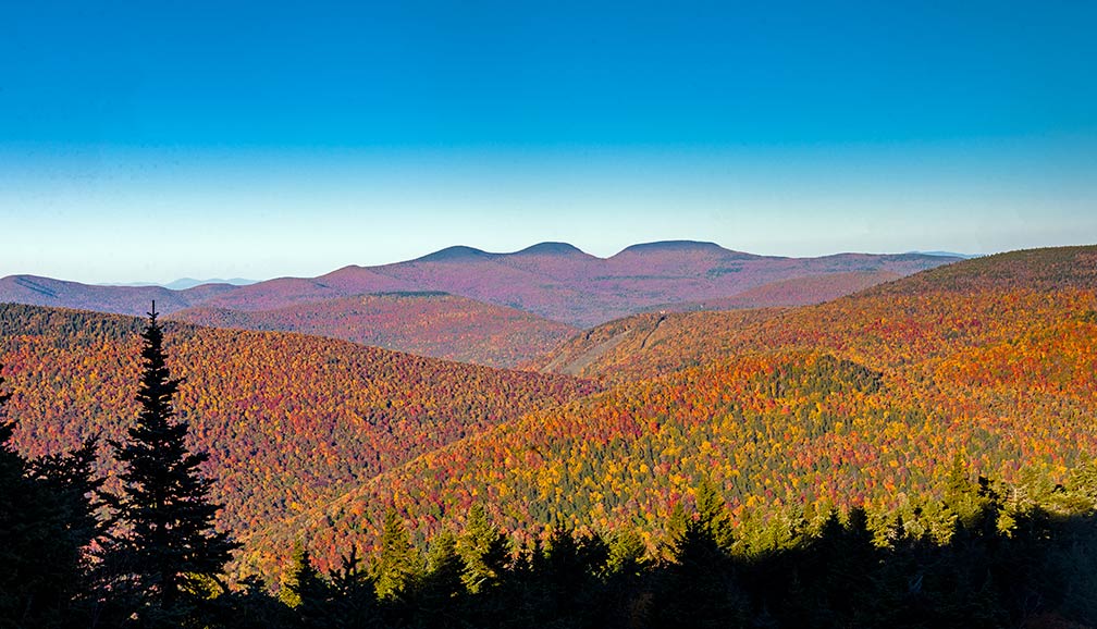
Blackhead Range, New York Catskill Mountains in autumn
The Catskill Mountains in autumn. View towards the Blackhead Range in New York's Catskill Mountains from Buck Ridge Lookout.
Image: Daniel Case

 
New York State has more than 7,600 freshwater lakes, ponds, and reservoirs, as well as portions of two of the five Great Lakes and over 70,000 miles (113,000 km) of rivers and streams [2].
Major rivers in the state are St. Lawrence River, Hudson River, Black River, Susquehanna River, and the Delaware River.

Major Lakes in New York State
The state has shorelines at Lake Ontario and Lake Erie, two of the five Great Lakes. The largest lake within the state is Lake Oneida; to the west of Oneida lake are the Finger Lakes, a group of 11 long, narrow, loch-like lakes.
Lake George (the Queen of American Lakes) in the Adirondack region is since the late 19th century a popular tourist destination.


New York City and its environs


View of Times Square, New York at night
The most famous place in the most famous US city, Times Square, New York.
Image: Andrae Ricketts
 
New York City, a major port and the largest city in the USA is situated on the Atlantic coast at the mouth of the Hudson River.
The city is an international hub for trade, finance, the arts, and culture.

The metropolis boasts of being the World's Capital City. Anyway, it ranks first place on The Economist's Global City Competitiveness Index [3].

New York City is home to over two-fifths of the total population of New York State. [4] The city is divided into five county-level administrative divisions called boroughs. The boroughs are Manhattan, Brooklyn, Queens, The Bronx, and Staten Island. The city is spread over three large islands: Manhattan, Staten Island, and Long Island, only one borough, the Bronx, is on the mainland of the United States.

Long Island, the southeasternmost part of New York state, the island expands eastward from New York City for 190 km (119 mi), south of Long Island Sound, and more or less parallel to the southern coast of Connecticut. Situated on its western tip are New York City's boroughs of Brooklyn and Queens.

 
World Heritage Site


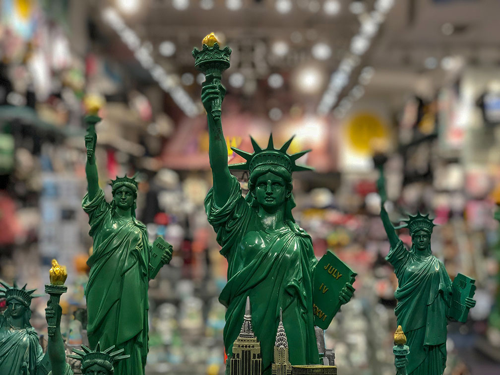
Statue of Liberty souvenirs
Statue of Liberty souvenirs. The Statue of Liberty remains a beacon of the US souvenir industry. It is pictured in hundreds of variations as replicas, snow globes, skyline models, Christmas ornaments, on magnets, t-shirts, clocks, bags, etc., you name it. [5]
Image: Rohan Vijay
 
New York has one amazing UNESCO World Heritage Site. The world-famous Statue of Liberty on Liberty Island in Manhattan, New York City. The Statue of Liberty UNESCO official website is since 1984 a UNESCO World Heritage Site.

The statue was made in Paris by the French sculptor Frédéric Bartholdi, in collaboration with Gustave Eiffel (best known for the world-famous Eiffel Tower, who was responsible for the statue's steel framework).

The artwork, also known as "Liberty Enlightening the World," was a gift from France on the centenary of American independence.

Liberty was inaugurated in 1886. The copper sculpture stands on Bedloe's Island at the entrance to New York Harbor and has welcomed millions of immigrants to the United States ever since.


New York State Population


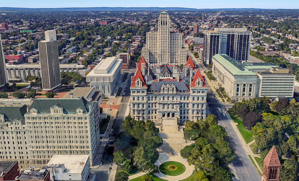
New York State Capitol in Albany
Rendered image of New York State Capitol in Albany. The renaissance-revival capitol building is part of the Empire State Plaza complex, which houses several departments of the New York State administration.
Image: Google
 
The 3rd-most populous state in the US has a population of about 20 million people (est. in 2021) [6].

The capital of New York is Albany; the largest city is New York City, the largest metro area is the New York City Metropolitan Area with a population of 22.2 million. The reason the New York metropolitan area has more residents than New York State is that the metropolitan area includes parts of Connecticut and New Jersey.

Other major cities in New York State are Buffalo, Rochester, and Syracuse.


Race and Ethnic groups
The population of the State of New York is composed of White alone 55.4%, Hispanic or Latino 19.2%, African American 17.6%, Asian 9.0%, and Native American 1.0%. [7]


Airports
The largest airports in the state of New York are:


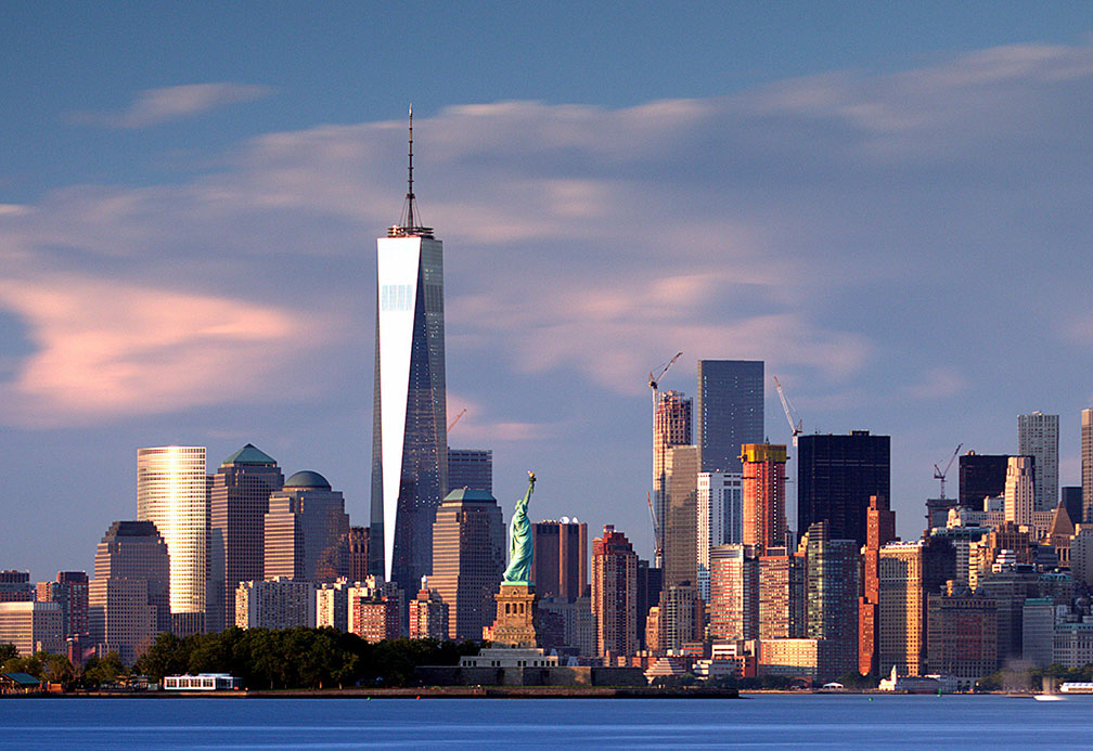
New York City Downtown with Statue of Liberty and One World Trade Center
New York City Downtown and Statue of Liberty, a UNESCO World Heritage Site.
The Freedom Tower, or One World Trade Center, in the center of the photo, is the main building of the rebuilt World Trade Center complex in Lower Manhattan. It is the tallest building in the Western Hemisphere.
Image: John Cunniff

 
Cities and Towns in New York State

The map shows the location of following cities and towns in New York State.

Most populated cities are (in 2019):
New York (8.3 million), Buffalo (255,000), Rochester (205,000), Syracuse (142,000), and Albany (96,500).

Other cities depicted on the map:
Amsterdam, Auburn, Bath, Binghamton, Catskill, Cheektowaga, Corning, Cortland, Dansville, Dunkirk, Elmira, Endicott, Fredonia, Fulton, Geneseo, Geneva, Glens Falls, Gloversville, Hempstead, Hornell, Hudson, Ilion, Irondequoit, Ithaca, Jamestown, Johnstown, Kingston, Lake Placid, Levittown, Lockport, Long Lake, Malone, Massena, Middletown, Montauk, Monticello, New York, Newark, Newburgh, Niagara Falls, North Tonawanda, Norwich, Ogdensburg, Olean, Oneida, Oneonta, Oswego, Ottawa, Peekskill, Plattsburgh, Potsdam, Poughkeepsie, Rome, Saranac Lake, Saratoga Springs, Schenectady, Seneca Falls, Sidney, Troy, Tupper Lake, Utica, Watertown, Wellsville, White Plains, and Yonkers.


Downtown Brooklyn, view across the East River from Lower Manhattan Downtown Brooklyn skyline at the western end of Long Island, the Manhattan Bridge (far left), and the Brooklyn Bridge (near left), seen across the East River from Lower Manhattan.
Image: Nick Amoscato

Weather Conditions Albany:

ALBANY WEATHER


Advertisements:


Maps of the 50 U.S. States
Alabama | Alaska | Arizona | Arkansas | California | Colorado | Connecticut | Delaware | Florida | Georgia | Hawaii | Idaho | Illinois | Indiana | Iowa | Kansas | Kentucky | Louisiana | Maine | Maryland | Massachusetts | Michigan | Minnesota | Mississippi | Missouri | Montana | Nebraska | Nevada | New Hampshire | New Jersey | New Mexico | New York | North Carolina | North DakotaOhio | Oklahoma | Oregon | Pennsylvania | Rhode Island | South Carolina | South Dakota | Tennessee | Texas | Utah | Vermont | Virginia | Washington | West Virginia | Wisconsin | Wyoming

20 Most Populous U.S. Cities (in 2018):
1. New York City 2. Los Angeles 3. Chicago 4. Houston 5. Phoenix 6. Philadelphia 7. San Antonio 8. San Diego 9. Dallas 10. San Jose 11. Austin 12. Jacksonville 13. Fort Worth 14. Columbus 15. San Francisco 16. Charlotte 17. Indianapolis 18. Seattle, 19. Denver, 20. Washington D.C.

Other Major U.S. Cities:
Albany, Anchorage, Annapolis, Atlanta, Atlantic City, Augusta, Baltimore, Baton Rouge, Bismarck, Boise, Boston, Carson City, Charleston, WV, Cheyenne, Cincinnati, Cleveland, Columbia, Concord, Des Moines, Detroit, Dover, DE, El Paso, Frankfort, Harrisburg, Hartford, Helena, Honolulu, Jackson, Jefferson City, Juneau, Kansas City, Lansing, Las Vegas, Lincoln, Little Rock, Long Beach, Madison, Memphis, Miami, Milwaukee, Minneapolis, Montgomery, Montpelier, Nashville, New Orleans, Norfolk, Oklahoma City, Olympia, Orlando, Pierre, Pittsburgh, Portland, Providence, Richmond, VA, Raleigh, Sacramento, St. Louis, St. Paul, Salem (OR), Salt Lake City, Santa Fe, Springfield, Tallahassee, Tampa, Topeka, Trenton, Tucson