Nations Online
All Countries in the World
Nations Online All Countries in the World | |
Home  |
___ Searchable Map and Satellite View of the City San Antonio, Texas (45-degree view available) |
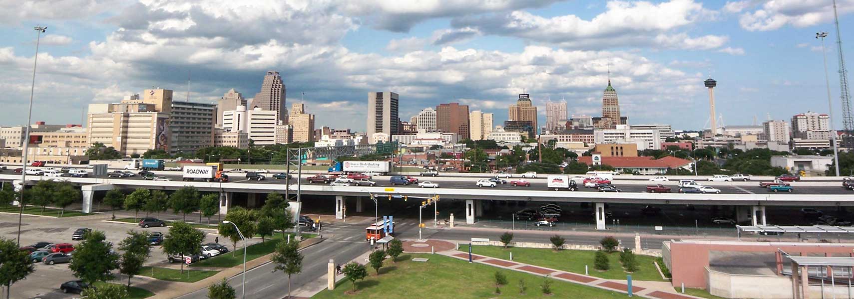 Panorama of Downtown San Antonio, Texas, view from UTSA's Downtown Campus. Image: King of Hearts |
About San Antonio |
 Satellite view showing San Antonio, one of the largest and fastest growing cities in the 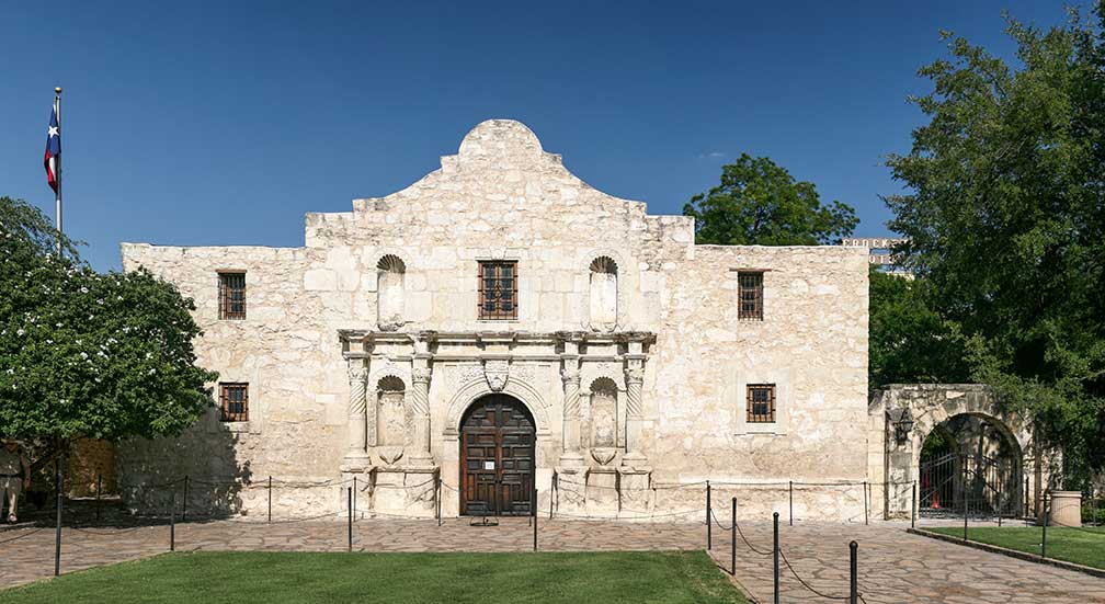 The chapel of the Alamo Mission (originally known as Misión San Antonio de Valero) in San Antonio, Texas, was founded in the 18th century as a Franciscan mission, after the missionary order left the compound became a military fortress in 1803. Image: Daniel Schwen San Antonio is a popular tourist destination visited by approximately 26 million tourists per year. It is famous for its San Antonio Missions National Historical Park, the Alamo, a former Roman Catholic mission and fortress, and the River Walk (also known as Paseo del Río), a network of walkways in the downtown area along the banks of the San Antonio River. The city is home to University of Texas at San Antonio, the Museo Alameda, the San Antonio Museum of Art (SAMA), and the Witte Museum. The Buckhorn Museum and the Texas Ranger Museum offering a glimpse into San Antonio's history. Just zoom in (+) to see the Tower of the Americas, San Antonio's tallest landmark. In 2016 San Antonio was among the ten winners of the 2016 All-America City Awards (AAC). Other large cities in Texas: Austin, Dallas. The page shows a city map of San Antonio with expressways, main roads and streets, zoom out to find San Antonio International Airport (IATA code: SAT) located north of the central business district. To find a location use the form below. To view just the map, click on the "Map" button. |
|
| To find a location type: street or place, city, optional: state, country. |
Local Time San Antonio:
Wednsday-April-17 14:56
Standard time zone: Central Standard Time (CST); UTC/GMT -6 hoursCentral Daylight Time (CDT) in use from the second Sunday in March, ends on the first Sunday in November; time zone offset: UTC/GMT -5 hours |
One World - Nations Online .:. let's care for this planet Promote that every nation assumes responsibility for our world. Nations Online Project is made to improve cross-cultural understanding and global awareness. More signal - less NOISE |
| Site Map
| Information Sources | Disclaimer | Copyright © 1998-2023 :: nationsonline.org |

