Advertising

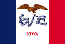
Iowa Flag detail
Home Earth Continents The Americas USA Country Profile US State Capitals Iowa Map

US States Maps Index
World Maps Index

Map of Iowa (IA)


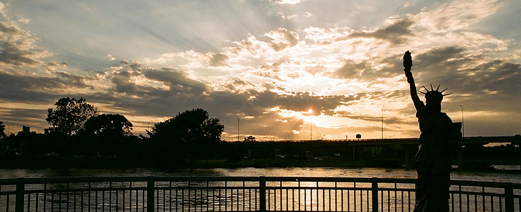
Lady Liberty of Cedar Rapids, part of “Strengthen the Arm of Liberty”
Iowa has its own Lady Liberty, in Cedar Rapids, the state's second largest city. The replica is part of the 40th anniversary theme of the Boy Scouts of America's: “Strengthen the Arm of Liberty”, 200 small versions of the Statue of Liberty were placed in communities across the country in the early 1950’s.
Image: Robert Wolterman

Iowa Flag
Iowa State Flag


About Iowa


Location of Iowa state in the USA
Where in the United States is Iowa? Location map of the State of Iowa in the US.
 
Iowa is a landlocked Midwestern U.S. state, bordered by Minnesota to the north, Wisconsin to the northeast, Illinois to the east and southeast, Missouri to the south, Nebraska to the west, and South Dakota to the northwest.

Iowa is the only state whose eastern and western borders are created entirely by rivers.

In the west, the Big Sioux River marks most of the border with South Dakota, then the river joins the Missouri, which constitutes the entire section of the state's border with Nebraska. The Mississippi River defines Iowa's eastern borders with Wisconsin and Illinois.


Some History
In colonial times the area of today Iowa was first part of French Louisiana and later part of Spanish Louisiana when Spain acquired the more or less uncharted territory from France. But Spain was slow to take actual possession of its newly acquired colony, and French colonists were understandably upset and even resentful to the idea of Spanish rule.


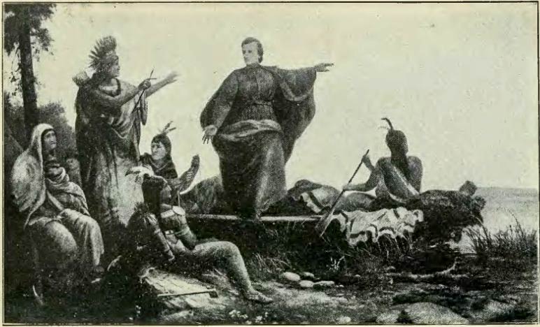
Father Marquette discovers Iowa, 17 June 1673
Father Marquette discovers Iowa, 17 June 1673. Illustration from the book History of Iowa From the Earliest Times to the Beginning of the Twentieth Century
 
But the Spaniards had a problem with this property, many of the colony's officials were either French or of French ancestry.
Eventually, Spain returned the territory to France, just three weeks before the French sold the region to the United States for $15 million, the deal is known as the Louisiana Purchase.

After the Louisiana Purchase, first American settlers moved to Iowa in June 1833, people and families from Ohio, Pennsylvania, New York, Indiana, Kentucky, and Virginia in search of new frontiers.

In 1838, the U.S. Congress established the Territory of Iowa (Population 23,242).
Eight years later, on 28 December 1846, Iowa became the 29th state in the Union.

Short after admittance to the Union, Iowa organized campaigns for settlers and investors, boasting the young frontier state's fertile farmlands, with fine citizens, a free and open society, and a good government.


Iowa State Map
Reference Map of Iowa
General Map of Iowa, United States.

The detailed map shows the US state of Iowa with boundaries, the location of the state capital Des Moines, major cities and populated places, rivers and lakes, interstate highways, principal highways, and railroads.

You are free to use this map for educational purposes (fair use); please refer to the Nations Online Project.
 
More about Iowa State


Some Geography

Area
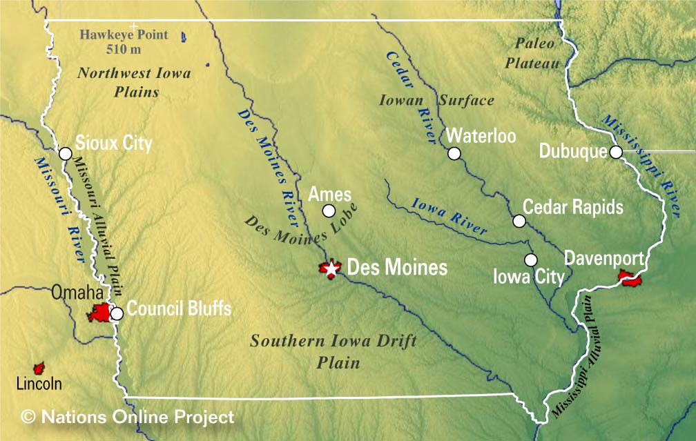
Iowa Topographic Regions Map
Topographic Map of Iowa showing landform regions of the state in the Midwestern United States. (Click the map to enlarge)

Iowa covers an area of 145,746 km² (56,272.81 sq mi) [1], compared it is slightly larger than Greece. Compared with other US states by area, Iowa is 6.5 times larger than New Jersey, but it would fit into California almost three times.


The 'Land of the Rolling Prairie' offers rolling prairies and cornfields, plus some steep hills and valleys in the paleozoic plateau area, the Driftless Area in the northeast, a region that has escaped the flattening effects of glaciation during the last ice age.

Most of Iowa's land is used for agriculture; crops cover about 60% of the state, 30% is grasslands (pasture and hay with some prairie and wetland).

Highest point
The highest natural point is Hawkeye Point at a whopping 509 m (1,671 ft). Situated close to the state line with Minnesota in the northwest, north of Sheldon. The hill is easy to find, there is a flagpole, a picnic bench, a tile mosaic, and several granite markers.


Rivers
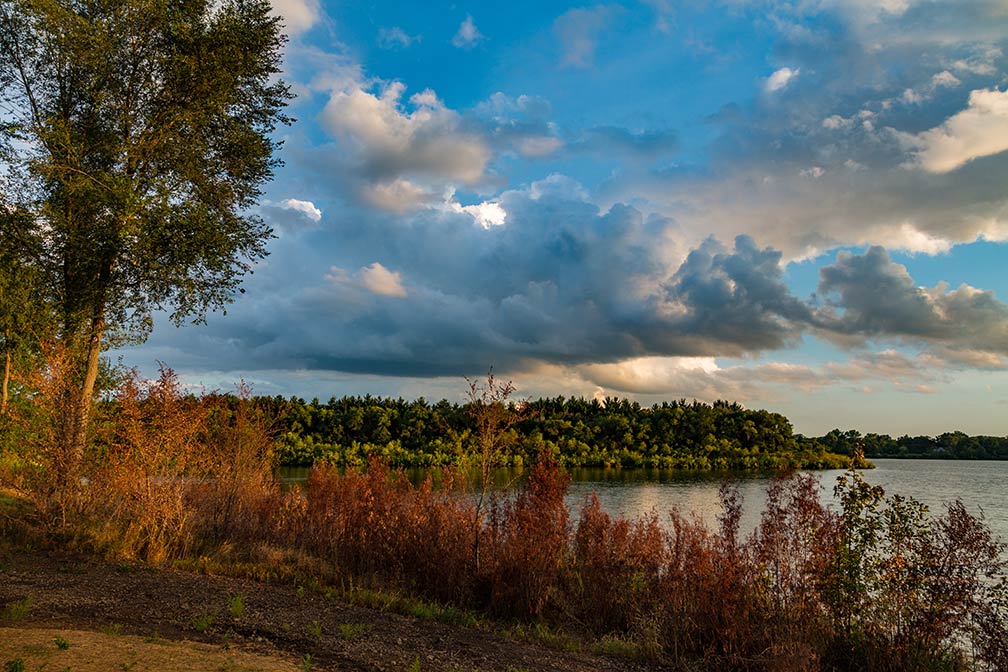
Big Woods Lake in Cedar Falls, Iowa
Sunset over Big Woods Lake, as seen from the Big Woods Lake Campground in Cedar Falls, Iowa.
Image: Tony Webster

 
The Missouri River and the Mississippi are border rivers which define Iowa's border in west and east.
Other major rivers are the Des Moines River, the Cedar River, the Iowa River, and the Wapsipinicon River (Wapsi); they are all tributaries of the Mississippi.
The Big Sioux River, in the northwest, is a tributary of the Missouri River, it marks a section of Iowa's border with South Dakota. The Chariton River and the Grand River have their sources in Iowa.


Lakes
Largest lakes in Iowa are Lake Red Rock, a reservoir on the Des Moines River, and Iowa's Great Lakes, several deep glacial lakes in the northwest corner of the state. They are the largest natural lakes in the state. Rathbun Lake, Iowa's second-largest lake is located in Appanoose County; West Okoboji Lake and Spirit Lake are the two largest lakes of Iowa's Great Lakes, Saylorville Lake, another reservoir on the Des Moines River. Clear Lake is one of the largest natural lakes in the state.

 
National Monuments


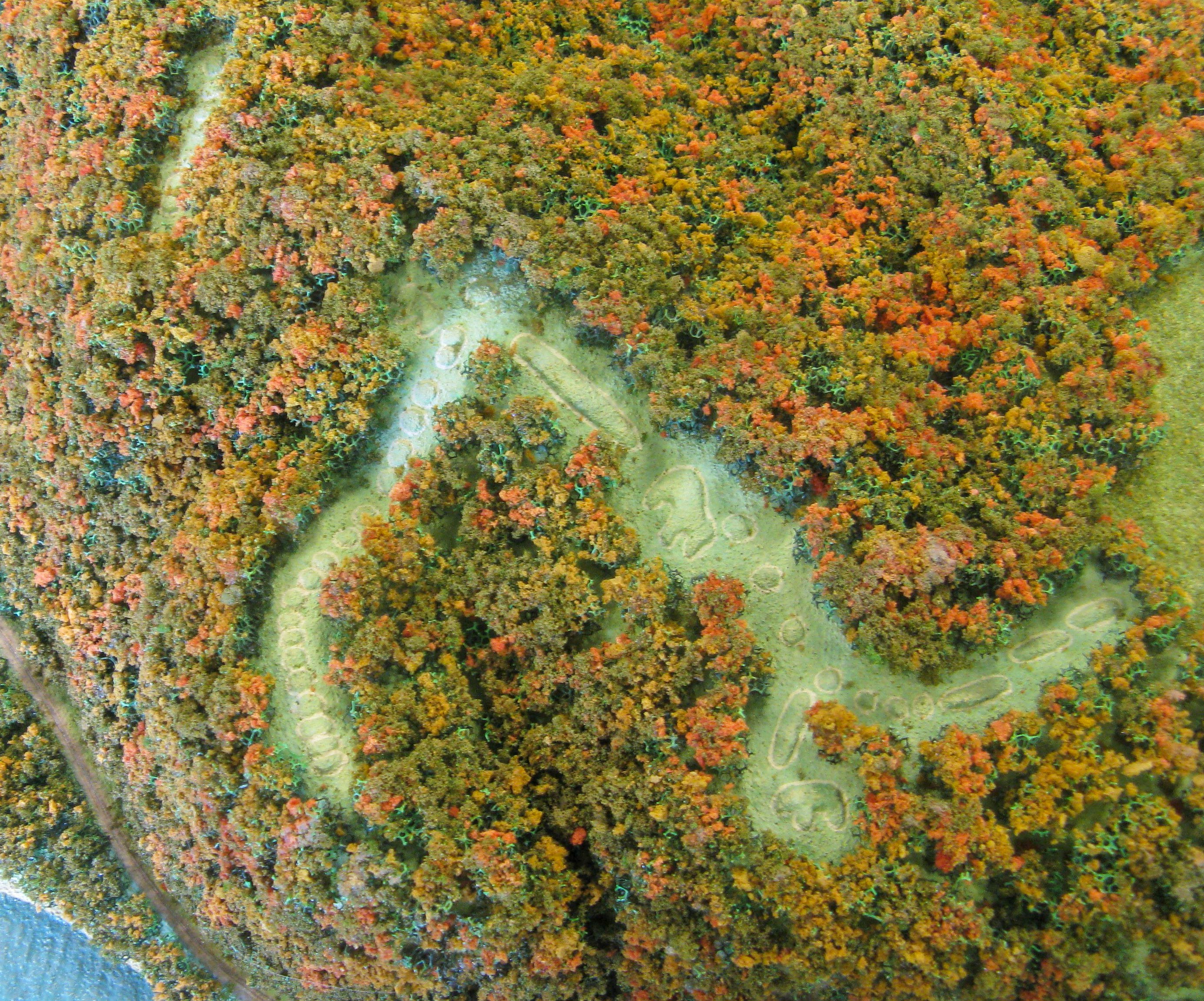
Aerial View of the Effigy Mounds in Allamakee County of Iowa
Aerial view of the Effigy Mounds in Allamakee County north of the confluence of the Mississippi and the Yellow River in Iowa. It is the state's only National Monument.
Image: Travis

Effigy Mounds National Monument in Allamakee County is an archaeological reserve and a National Monument in the Mississippi River valley in northeastern Iowa.

Effigy Mounds preserves over 200 artificial hill structures called Mounds, built by Native Americans from the Woodland period (1000 BC - 1000 AD).

About 30 mounds are shaped in the outlines of mammals, birds, and reptiles. These hills are considered sacred by many Americans.

 
Population


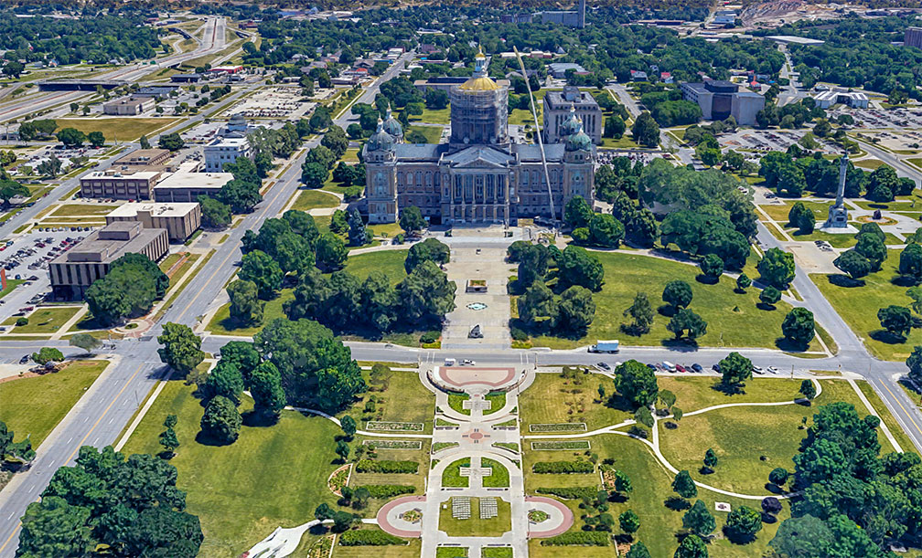
Iowa State Capitol in Des Moines, state capital of Iowa
Rendered image of Iowa State Capitol in Des Moines. The modified Renaissance style building is the seat of Iowa's General Assembly.
Image: Google


Today, Iowa has a population of 3.15 million people (est. 2019). [2] The capital and largest city is Des Moines, other major cities are Cedar Rapids, Davenport, and Sioux City.


Race and Ethnic groups
The population of Iowa is 85% white, 6.3% Hispanic or Latino, 4.1% African American, 2.7% Asian, and 0.5% Native American. [3]


The two busiest airports in the state are Des Moines International Airport (IATA code: DSM), and Cedar Rapids' The Eastern Iowa Airport (IATA code: CID).


Cities and Towns in Iowa

The map shows the location of following cities and towns in Iowa:

The largest city is Des Moines (pop. 215,500)
Second largest city is Cedar Rapids (pop. 131,100), other major cities are: Davenport (100,000), Sioux City (83,000), Iowa City (74,400), Waterloo (68,000), Ames (66,200), West Des Moines (64,560), Council Bluffs (62,500), and Dubuque (58,500).
Population figures in 2016


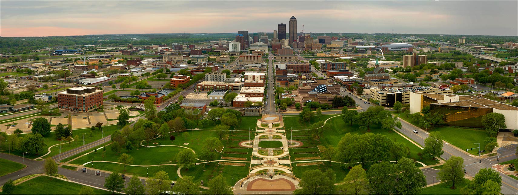
Downtown Des Moines, view from top of Iowa Capitol Building
Downtown Des Moines as seen from the top of the Iowa Capitol Building.
Image: Jason Mrachina


Other cities and towns in Iowa:
Ankeny, Atlantic, Bettendorf, Boone, Burlington, Carroll, Cedar Falls, Centerville, Chariton, Charles City, Cherokee, Clarinda, Clinton, Creston, Decorah, Denison, Emmetsburg, Estherville, Fairfield, Fort Dodge, Fort Madison, Grinnell, Indianola, Iowa Falls, Keokuk, Knoxville, Le Mars, Maquoketa, Marion, Marshalltown, Mason City, Mount Pleasant, Muscatine, Newton, Osceola, Oskaloosa, Ottumwa, Red Oak, Sheldon, Shenandoah, Spencer, Spirit Lake, Storm Lake, Urbandale, Washington, Waverly, and Webster City.
 

Weather Conditions Des Moines:

DES MOINES WEATHER


Advertisements:


Maps of the 50 U.S. States
Alabama | Alaska | Arizona | Arkansas | California | Colorado | Connecticut | Delaware | Florida | Georgia | Hawaii | Idaho | Illinois | Indiana | Iowa | Kansas | Kentucky | Louisiana | Maine | Maryland | Massachusetts | Michigan | Minnesota | Mississippi | Missouri | Montana | Nebraska | Nevada | New Hampshire | New Jersey | New Mexico | New York | North Carolina | North DakotaOhio | Oklahoma | Oregon | Pennsylvania | Rhode Island | South Carolina | South Dakota | Tennessee | Texas | Utah | Vermont | Virginia | Washington | West Virginia | Wisconsin | Wyoming

20 Most Populous U.S. Cities
1. New York City 2. Los Angeles 3. Chicago 4. Houston 5. Phoenix 6. Philadelphia 7. San Antonio 8. San Diego 9. Dallas 10. San Jose 11. Austin 12. Jacksonville 13. Fort Worth 14. Columbus 15. San Francisco 16. Charlotte 17. Indianapolis 18. Seattle, 19. Denver, 20. Washington D.C.

Other Major U.S. Cities
Albany, Anchorage, Annapolis, Atlanta, Atlantic City, Augusta, Baltimore, Baton Rouge, Bismarck, Boise, Boston, Carson City, Charleston, WV, Cheyenne, Cincinnati, Cleveland, Columbia, Concord, Des Moines, Detroit, Dover, DE, El Paso, Frankfort, Harrisburg, Hartford, Helena, Honolulu, Jackson, Jefferson City, Juneau, Kansas City, Lansing, Las Vegas, Lincoln, Little Rock, Long Beach, Madison, Memphis, Miami, Milwaukee, Minneapolis, Montgomery, Montpelier, Nashville, New Orleans, Norfolk, Oklahoma City, Olympia, Orlando, Pierre, Pittsburgh, Portland, Providence, Richmond, VA, Raleigh, Sacramento, St. Louis, St. Paul, Salem (OR), Salt Lake City, Santa Fe, Springfield, Tallahassee, Tampa, Topeka, Trenton, Tucson