About Santa Fe
The satellite view shows Santa Fe, the capital of
New Mexico in the
 United States
. The city is located in the north-central part of the state, in the northern Rio Grande Valley on the Santa Fe River. Santa Fe lies at an altitude of 7,000 feet (2,134 m) above sea level, (making it the highest state capital in the United States), and about 65 mi (105 km) northeast of Albuquerque, the largest city in New Mexico.
 The New Mexico State Capitol in Santa Fe Building, houses the government of the U.S. state of New Mexico. It is the only round state capitol in the United States, and is known informally as "the Roundhouse".
Image: Ken Lund
The New Mexico State Capitol in Santa Fe Building, houses the government of the U.S. state of New Mexico. It is the only round state capitol in the United States, and is known informally as "the Roundhouse".
Image: Ken Lund
Don Pedro de Peralta, at that time Governor of Spanish New Mexico, founded La Villa Real de la Santa Fe at the foot of the Sangre de Cristo Mountains in 1607. Three years later in 1610, Peralta made it the capital of the province. In 1848 the territory was ceded to the United States.
At the beginning of the 19th-century, the town became a trade center at the end of the Santa Fe Trail.
Santa Fe is not only the highest state capital but also the oldest continuously inhabited state capital in the US.
Today the city of Santa Fe has a population of about 84,000 inhabitants (in 2018), some 145,000 people live in its metropolitan area (Santa Fe County).
The city is home to three private liberal arts colleges: St. John's College, Santa Fe University of Art and Design, and the Southwestern College, a consciousness-centered graduate school; plus the public Santa Fe Community College and the Institute of American Indian Arts, a college focused on Native American art.
Santa Fe points of interest:
List of Tourist Attractions
 The hotel Inn and Spa at Loretto is famous for its traditional pueblo architecture.
Image: JuliusR
The hotel Inn and Spa at Loretto is famous for its traditional pueblo architecture.
Image: JuliusR
Historic places:
New Mexico State Capitol, the only round state capitol in the US, it is known as "the Roundhouse". The Capitol building was designed to resemble the ancient Sun symbol of New Mexico's Zia people, a red circle with four groups of four rays pointing in four directions. The sacred Zia sun symbol is also on the flag of the state of New Mexico. New Mexico State Capitol houses the New Mexico State Legislature and the Office of the Governor.
The Santa Fe Historic District has two national historic landmarks,
the Santa Fe Plaza, a traditional small city-square in Spanish-American colonial style, known as the Plaza, a one-block square and the core of the city; and the
Palace of the Governors (El Palacio Real), an adobe building which served as the seat of New Mexico's government for centuries, it now houses the New Mexico History Museum (palaceofthegovernors.org).
El Rancho de Las Golondrinas (golondrinas.org) is a former ranch which has been recreated as a Spanish Colonial living history museum.
San Miguel Mission, also known as San Miguel Chapel, a Spanish colonial mission church built in the early 17th century.
Museums:
Museum of New Mexico (www.newmexicoculture.org), the New Mexico Department of Cultural Affairs is the umbrella organization of eight museums and several historic sites.
Museum of Indian Arts and Culture (indianartsandculture.org), the Laboratory of Anthropology, the museum is dedicated to Native American art and culture.
Museum of International Folk Art (internationalfolkart.org) is a state-run museum with the world’s most extensive collection of international folk art.
Wheelwright Museum of the American Indian (wheelwright.org), contemporary and historic Native American art.
Visual arts:
Georgia O'Keeffe Museum (okeeffemuseum.org), the museum is dedicated to the artistic legacy of Georgia O'Keeffe.
New Mexico Museum of Art (nmartmuseum.org) a state-run art gallery of the Museum of New Mexico and the oldest art museum in New Mexico.
Performing arts:
Santa Fe Opera (santafeopera.org) unconventional open sided opera house.
Lensic Performing Arts Center (lensic.org) a movie theater and vaudeville house.
Hotels:
La Fonda Hotel (lafondasantafe.com), La Fonda on the Plaza is the grand dame of Santa Fe's hotels.
Churches:
Loretto Chapel is a contributing property in Santa Fe's historic district, the former Roman Catholic church is now a museum and sometimes used as a wedding chapel.
Cathedral Basilica of St. Francis of Assisi, the Romanesque Revival style Roman Catholic cathedral was built between 1869 and 1887.
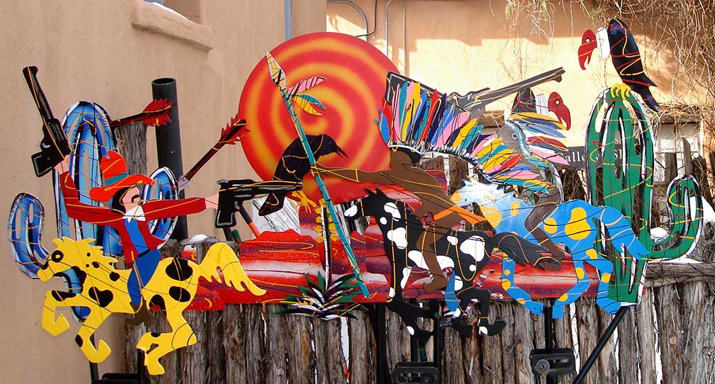 Artwork at Canyon Road.
Image: M.Bucka
Artwork at Canyon Road.
Image: M.Bucka
Shopping:
Santa Fe Farmers Market (
santafefarmersmarket.com), fresh vegetables year-round on Saturdays and until beginning November on Tuesdays.
Canyon Road (
canyonroadarts.com), the former residential neighborhood is now an art district with dozens of art galleries and studios, the road is also the site of the annual farolito festival (festival of lights).
Parks:
Santa Fe Botanical Garden (
santafebotanicalgarden.org) evening primrose, cane cacti, amaranth, and false Virginia creepers on display.
Randall Davey Audubon Center (
nm.audubon.org) has birds and other wildlife.
Hyde Memorial State Park is a state park, the pine-surrounded natural area is used for hiking and camping.
Sports:
Fort Marcy Park (formerly the site a fort, now a ballpark)
The page shows a city map of Santa Fe with expressways, main roads and streets, zoom out to find the location of
Santa Fe Municipal Airport (
IATA code: SAF), about 23 km (14 mi) by road southwest of the central business district.
Just zoom in to see the New Mexico State Capitol.
To find a location use the form below.


