Nations Online
All Countries in the World
Nations Online All Countries in the World | |
Home  |
___ Searchable Map and Satellite View of New Orleans, Louisiana (45-degree view available) |
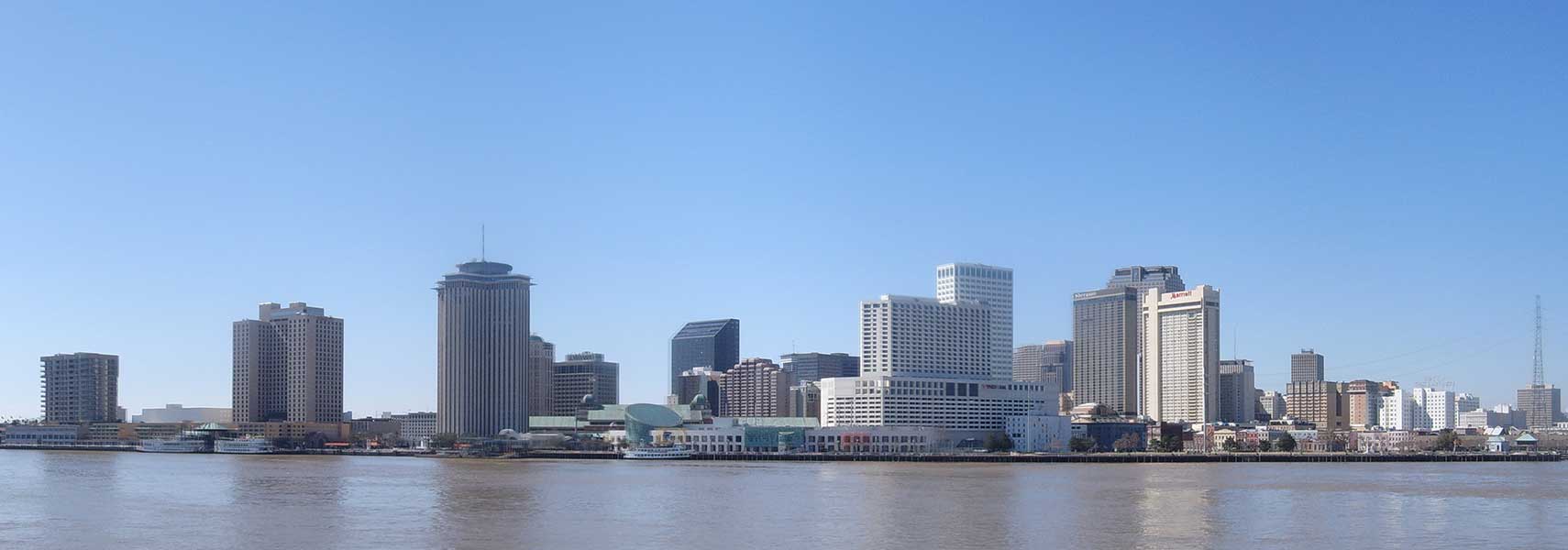 Panorama of Downtown New Orleans, Louisiana. Image: Louisiana Thunder |
About New Orleans |
 Satellite view showing New Orleans (in French: La Nouvelle-Orlèans). "The Big Easy", (the city's nick name) is an important port city in Louisiana in the Satellite view showing New Orleans (in French: La Nouvelle-Orlèans). "The Big Easy", (the city's nick name) is an important port city in Louisiana in the 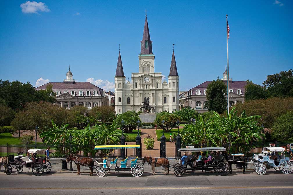 Cathedral-Basilica of Saint Louis, King of France, is one of the oldest cathedrals in the United States. The cathedral in the French Quarter of the city seen from across Decatur Street opposite Jackson Square is the seat of the Roman Catholic Archdiocese of New Orleans. Image: Royalpt78 Today, New Orleans is the largest city in Louisiana, a melting pot of French, African and American cultures. In the wake of Hurricane Katrina in 2005, the population decreased, now in 2015 the city has a population of 390,000 inhabitants, 1.26 million people live in the New Orleans-Metairie-Kenner metropolitan area. New Orleans' economy is still based on tourism and the activities of its port, but also on health care and bioscience research especially by New Orleans' LSU Health Sciences Center with its state-of-the-art academic medical center for medical, dental, and allied health education. New Orleans points of interest: 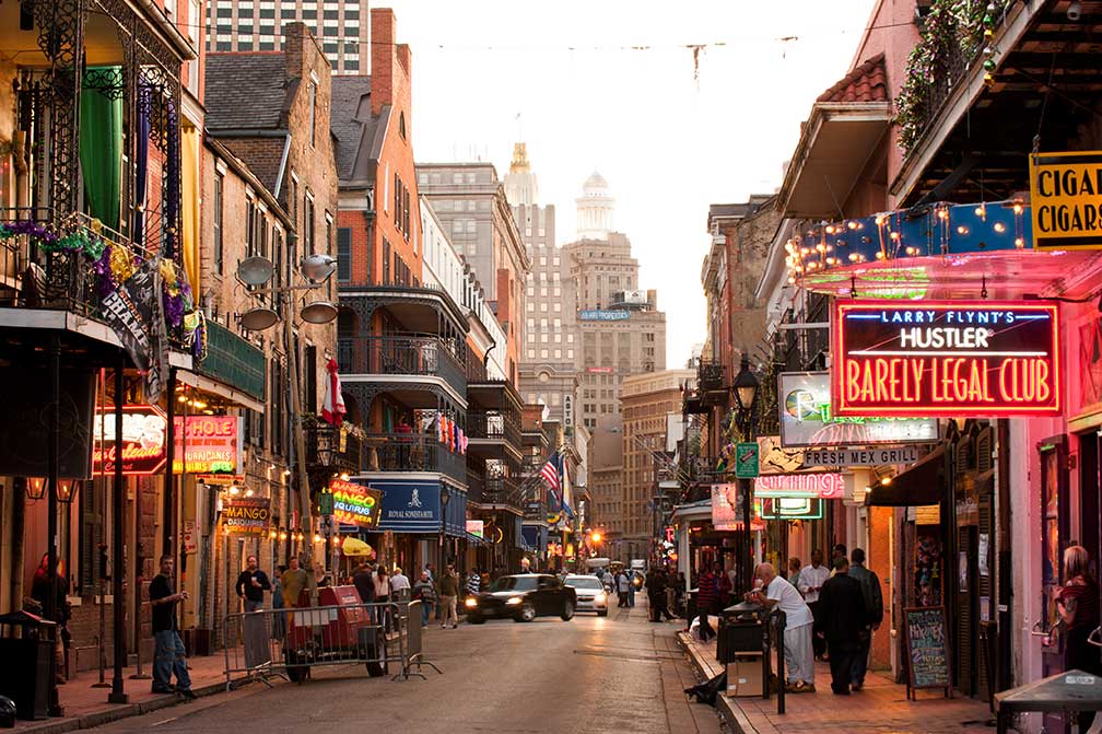 Bourbon Street New Orleans. Image: Chris Litherland The Streetcars of New Orleans are a tourist attraction as well as an integral part of the city's public transportation network with currently four operating streetcar lines. New Orleans is also world-famous for its music, particularly as the birthplace of jazz. The city even has the New Orleans Jazz National Historical Park at the Old U.S. Mint, which hosts live educational performances most days of the week at either the Old U.S. Mint or its French Market location. Places: the French Quarter (Vieux Carré, the oldest neighborhood in the city), Jackson Square, in the center of Vieux Carre district is surrounded by buildings dating from the days of Spanish Louisiana, the square was in 1803 the scene of the transfer of Louisiana from Spain to France and from France to the United States. Bourbon Street (known for its strip clubs and iconic bars like Jean Lafitte's Blacksmith Shop and The Old Absinthe House, or Cafe Lafitte In Exile), Frenchmen Street (musical district and hangout for locals), Preservation Hall (historic, all-ages place for jazz), Snug Harbor Jazz Bistro (Live jazz and upscale Creole fare) Museums: The Historic New Orleans Collection, a museum and research center. The New Orleans Museum of Art: NOMA, situated within City Park. Its permanent collection features over 40,000 works of art, from the Italian Renaissance to the modern era. Ogden Museum of Southern Art, located in the Central Business District, has a collection of artworks from the 18th century to the present, related to the history and culture of the American South, the fifteen southern US states. Louisiana Children's Museum (children’s museum), The Cabildo (former seat of colonial government is today part of Louisiana State Museum) Mardi Gras World (see the working warehouse where the floats are made for Mardi Gras parades). Churches: St. Louis Cathedral (built between 1789-1794, seat of the Roman Catholic Archdiocese of New Orleans), St. Patrick's Church (Catholic church and parish in the Archdiocese of New Orleans, built in 1837) Convent: Old Ursuline Convent (finest surviving example of French colonial public architecture in the country) Parks: City Park, large urban greenspace. Audubon Nature Institute operates ten museums and parks dedicated to nature. The Aquarium of the Americas (aquarium on the banks of the Mississippi River next to Entergy Giant Screen Theater) and the Butterfly Garden and Insectarium (bugs in action), Audubon Zoo (zoo) and Audubon Park in Uptown New Orleans, formerly a plantation in the colonial days now a city park with a Par 3 executive golf course. Lakes: Lake Pontchartrain (large brackish estuary to the north of the city) Sports: Mercedes-Benz Superdome (sports and exhibition venue and home stadium of the New Orleans Saints), Smoothie King Center (multi-purpose indoor arena) Nearby Attractions: Jean Lafitte National Historical Park and Preserve (Jean Lafitte's six sites are scattered across south Louisiana: the Barataria Preserve in Marrero, the Chalmette Battlefield in Chalmette, the French Quarter Visitor Center in New Orleans, the Acadian Cultural Center in Lafayette, the Prairie Acadian Cultural Center in Eunice and the Wetlands Acadian Cultural Center in Thibodaux) The page shows a city map of New Orleans with expressways, main roads and streets, Louis Armstrong International Airport (IATA code: MSY) is located 15 mi (24 km) by road, west of central business district. Just zoom in to see Jackson Square with Saint Louis Cathedral. |
|
| To find a location type: street or place, city, optional: state, country. |
Local Time New Orleans:
Thursday-April-18 03:06
Standard time zone: Central Standard Time (CST); UTC/GMT -6 hours
Central Daylight Time (CDT) in use from the second Sunday in March, ends on the first Sunday in November; time zone offset: UTC/GMT -5 hours |
One World - Nations Online .:. let's care for this planet Promote that every nation assumes responsibility for our world. Nations Online Project is made to improve cross-cultural understanding and global awareness. More signal - less NOISE |
| Site Map
| Information Sources | Disclaimer | Copyright © 1998-2023 :: nationsonline.org |

