Nations Online
All Countries in the World
Nations Online All Countries in the World | |
Home  |
___ Searchable Map and Satellite View of the City of Cincinnati, Ohio
|
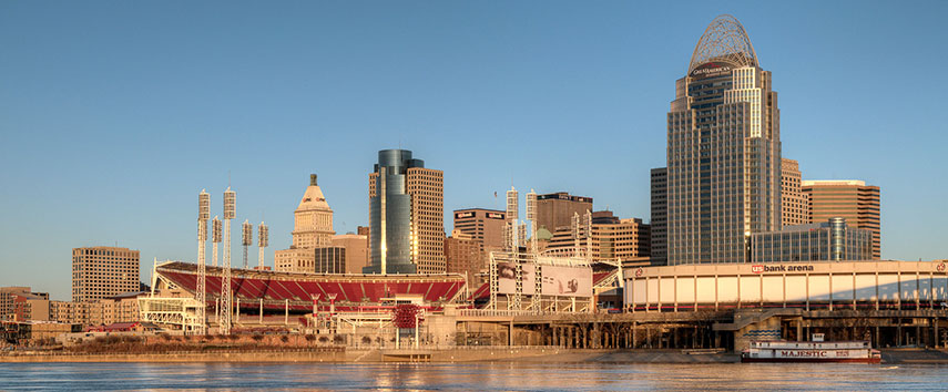 Skyline of Cincinnati at the Ohio River, with Great American Tower at Queen City Square (right) behind U.S. Bank Arena, Cincinnati, Ohio Image: Cathy |
About Cincinnati |
 The satellite view shows Cincinnati, third largest city in Ohio in the The satellite view shows Cincinnati, third largest city in Ohio in the The city (nickname: the Queen City) is located in southwestern Ohio on a hilly landscape along the Ohio River, at the Ohio-Kentucky border opposite Covington and Newport, Kentucky. 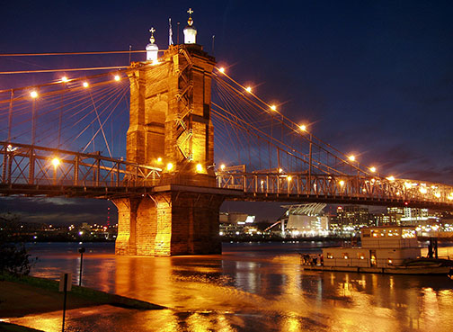 John A. Roebling Suspension Bridge, spanning the Ohio River (a tributary of the Mississippi) between Cincinnati, Ohio and Covington, Kentucky. Photo: Derek Jensen Today (in 2016) the city has a population of just under 300,000 inhabitants, 2.2 million people live in the Cincinnati-Northern Kentucky metropolitan area. Cincinnati is home to the main campus of the University of Cincinnati which traces its foundation to the Medical College of Ohio. Procter & Gamble, the world's largest consumer products company has its headquarters in Cincinnati. Cincinnati's main attractions: 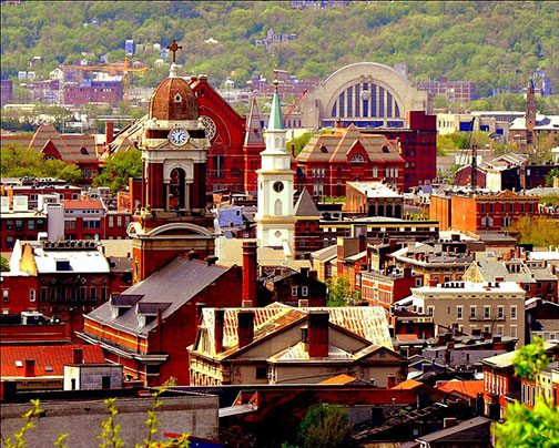 Over-the-Rhine, a Cincinnati neighborhood and the largest, most intact urban historic district in the United States. Image: Chuck Eilerman (OTR) Museums: National Underground Railroad Freedom Center (Freedom Center), Taft Museum of Art (historic building with a fine art museum), Cincinnati Art Museum (one of the oldest art museums in the United States, founded in 1881), Contemporary Arts Center - CAC (art museum with focus on new developments in painting, sculpture, photography, architecture, performance art and new media) Outdoors: Coney Island (historic fun park with a giant pool) Parks: Cincinnati Zoo and Botanical Garden (second oldest zoo in the United States), Mount Airy Forest (urban reforestation project and largest park in Cincinnati's park system), Ault Park (flower garden and Italian Renaissance-style pavilion) Stadiums: Great American Ball Park (home field of Major League Baseball's Cincinnati Reds), Paul Brown Stadium (home to NFL's Cincinnati Bengals) Just zoom in to see Cincinnati's Central Business District. The Map shows a city map of Cincinnati with expressways, main roads, and streets, Cincinnati/Northern Kentucky International Airport (IATA code: CVG) is situated in Hebron, Kentucky 12.6 mi (20 km) by road, south west of Cincinnati's city center. To find a location use the form below. To view just the map, click on the "Map" button. |
|
| To find a location type: street or place, city, optional: state, country. |
Local Time Cincinnati:
Monday-April-15 2024 13:53
Standard time zone Eastern (EST): UTC/GMT -5 hoursDaylight Saving Time (EDT) in use from the second Sunday in March, ends on the first Sunday in November; time zone offset: UTC/GMT -4 hours |
One World - Nations Online .:. let's care for this planet Promote that every nation assumes responsibility for our world. Nations Online Project is made to improve cross-cultural understanding and global awareness. More signal - less NOISE |
| Site Map
| Information Sources | Disclaimer | Copyright © 1998-2023 :: nationsonline.org |

