Advertising

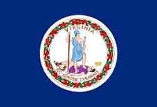
Virginia Flag detail
Home Earth Continents The Americas USA Country Profile US State Capitals Virginia Map

US States Maps Index
World Maps Index

Map of Virginia (VA)


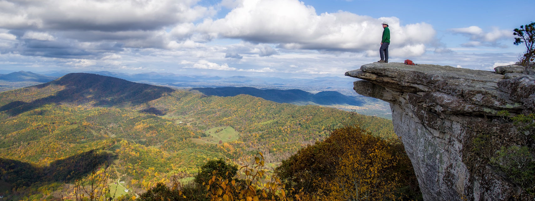
Catawba Valley from the McAfee Knob overlook along the Appalachian Trail.
Catawba Valley from McAfee Knob, Catawba Mountain. For some folk, the most scenic point along the Appalachian Trail in the Roanoke Region of Virginia.
Image: Frank Kehren

Virginia Flag
Virginia State Flag


About Virginia


Location map of Virginia state USA
Where in the United States is Virginia? Location map of Virginia in the US.
 
The US state of Virginia, officially the Commonwealth of Virginia, is situated in the eastern United States, bordering the Chesapeake Bay and the Atlantic Ocean in the east.

It borders Maryland and the District of Columbia to the northeast, North Carolina and Tennessee to the south, Kentucky to the southwest and West Virginia to the north and west.

The state's nickname is The Old Dominion.


Virginia State Map
Reference Map of Virginia
General Map of Virginia, United States.

The detailed map shows the US state of Virginia with boundaries, major rivers and lakes, the location of the state capital Richmond, major cities and populated places, rivers and lakes, interstate highways, principal highways, railroads and major airports.

You are free to use the above map for educational and similar purposes; if you publish it online or in print, you need to credit Nations Online Project as the source.

 
More about Virginia


Short History
Virginia Topographic Regions Map Topographic Regions Map of Virginia (click map to enlarge)

 
The colonization of the New World began as an enterprise of investors. [1]

In April 1606, King James I of England granted the Virginia Company a charter to establish colonies in Virginia. However, the king demanded 20% of the colony's profits. The original 1606 charter included much of the Eastern Seaboard.

On the 13th of May, in 1607, three English ships, the Susan Constant, the Godspeed, and the Discovery with about 145 settlers and sailors, arrived at the west bank of the James River estuary.

The motley crew of about 100 settlers had the intention to establish the first settlement in the New World. And so they founded Jamestown, the first permanent English settlement in North America.

The tobacco economy of the colony led to constant expansion and seizure of native Powhatan lands. After the Powhatan attack of 1622, where 347 English settlers were killed, King James I of England revoked the colony's charter and placed it under royal rule.

The area of Virginia was part of the original territory of the United States. The Commonwealth entered the Union on 25th June 1788, as the 10th of the original thirteen states.


Some Geography

Area
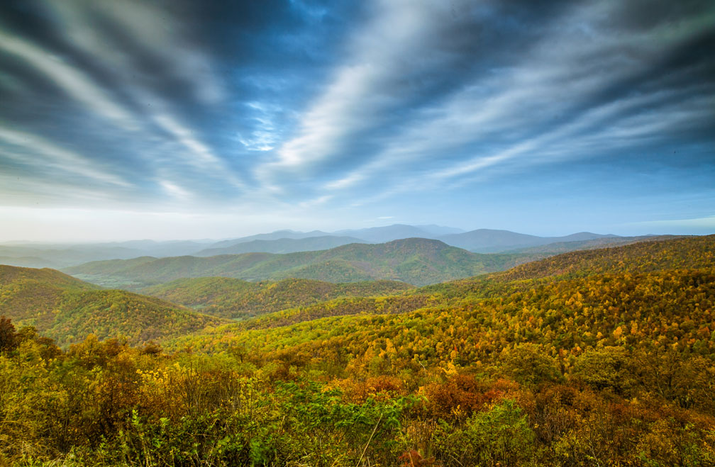
Skyline Drive in Shenandoah National Park
Painted by Nature. View from Skyline Drive in Shenandoah National Park within the Blue Ridge Mountains of Virginia. Shenandoah National Park includes the Shenandoah River valley and Virginia's Piedmont region.
Image: dpbirds

The Commonwealth of Virginia occupies an area of 110,787 km² (42,775 sq mi) [1], making Virginia about the size of Bulgaria or Cuba.

The state consists of 95 counties.


The Regions of Virginia
Virginia has several distinct geographical regions (from east to west)

The Atlantic Coastal Plain is a coastal lowland known as the Tidewater region; within that region are major estuaries of the Chesapeake Bay and the Eastern Shore of Virginia. It includes the southern part of the Delmarva Peninsula, which separates the Chesapeake Bay from the Atlantic Ocean.


The Piedmont is a moderately fertile, gently inclined region with rolling hills rising from the coastal plain to the foothills of the Blue Ridge Mountains. In the northern corner of the Piedmont is the densely populated urban area of Virginia's portion of the Washington metropolitan area, known as Northern Virginia (NOVA); it is the most populous region of Virginia.


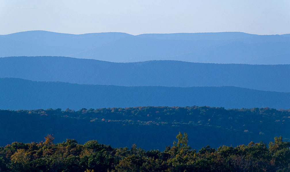
Blue Ridge Mountains in Virginia's Shenandoah National Park
View of the Blue Ridge Mountains in Shenandoah National Park, part of the Appalachians in Virginia.
Image: Sathish J


The Blue Ridge Mountains are a densely wooded mountain range within the Appalachians, stretching from southern Pennsylvania to northern Georgia.


The Ridge-and-Valley Appalachians are the remains of an ancient fold-and-thrust belt within the Appalachian Mountains; alternating ridges and valleys form an arc between the Blue Ridge Mountains and the Appalachian Plateau.


The Appalachian Plateau (aka Cumberland Mountains) is located in the western corner of the state and is the western part of the Appalachian Mountains. It comprises the Cumberland Plateau and the Allegheny Plateau, the rugged high plains on the west side of the Appalachian Highlands.


The highest elevation in Virginia is Mount Rogers, at 1,746 m (5,729 ft), located in the Blue Ridge Mountains, which geologically belong to the Appalachians.

 
World Heritage Site


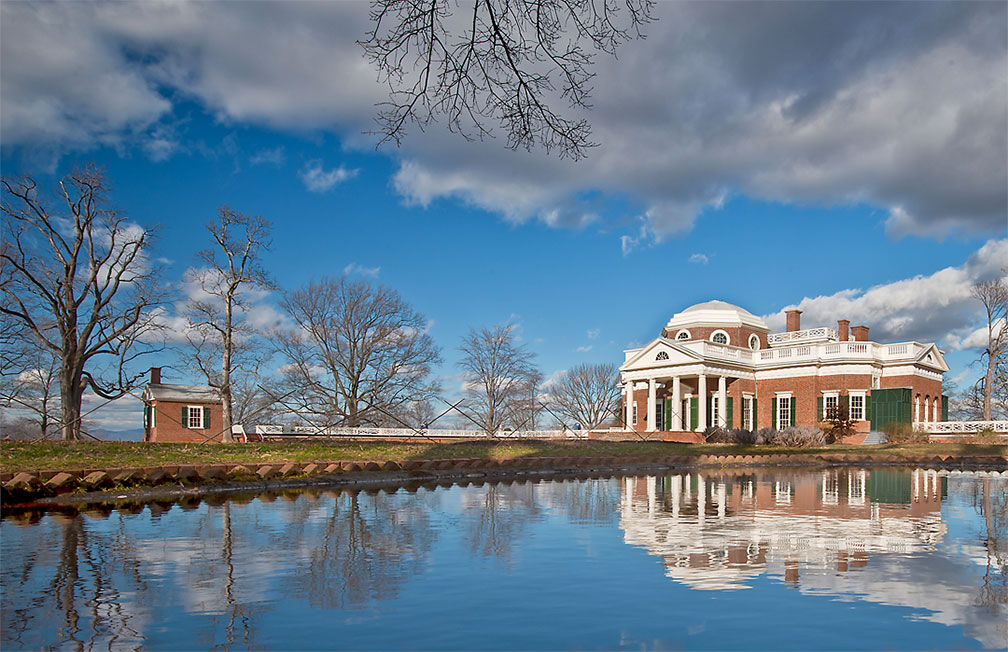
View of Monticello and the North Pavilion
View of Monticello and the North Pavilion reflected in the fish pond. Monticello, near Charlottesville, Virginia, is a UNESCO World Heritage Site.
Image: © James Marshall

Virginia has one UNESCO World Heritage Site, known as Monticello and the University of Virginia in Charlottesville. UNESCO official website

Thomas Jefferson (1743–1826), one of the authors of the American Declaration of Independence and the third president of the United States, was also a talented architect of neoclassical buildings.
He designed Monticello (1769–1809), his plantation home, and his ideal 'academical village' (1817–26), which is still the heart of the University of Virginia. University of Virginia official website

Jefferson's use of an architectural vocabulary based upon classical antiquity symbolizes both the aspirations of the new American republic as the inheritor of European tradition and the cultural experimentation that could be expected as the country matured.

 
Population


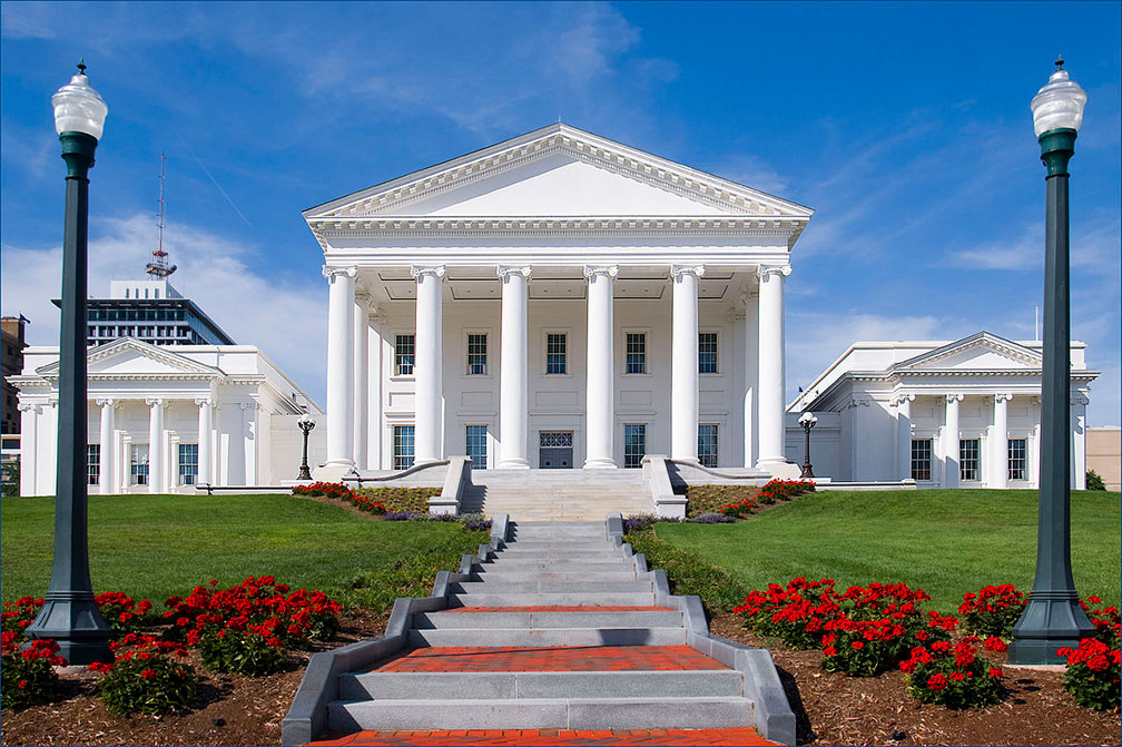
State Capitol of the Commonwealth of Virginia in Richmond
State Capitol of the Commonwealth of Virginia in Richmond, the state's capital city. Architects: Thomas Jefferson and Charles-Louis Clérisseau.
Image: Ron Cogswell
 
Virginia has a population of about 8.5 million people (2019 est.) [2]

The state's capital is Richmond; the largest city is Virginia Beach (pop. 450,000). The largest metropolitan area is the Northern Virginia metropolitan area (NOVA), part of the BaltimoreWashington metropolitan area.

Other major cities are Norfolk, Chesapeake, Newport News, Alexandria, and Hampton.


Race and Ethnic groups
Virginia's population is composed of White alone 61.2%, African American 19.9%, Hispanic or Latino 9.8%, Asian 6.9%, Native American 0.5%. [3]


Cities and Towns in Virginia

The map shows the location of the following cities and towns in Virginia:
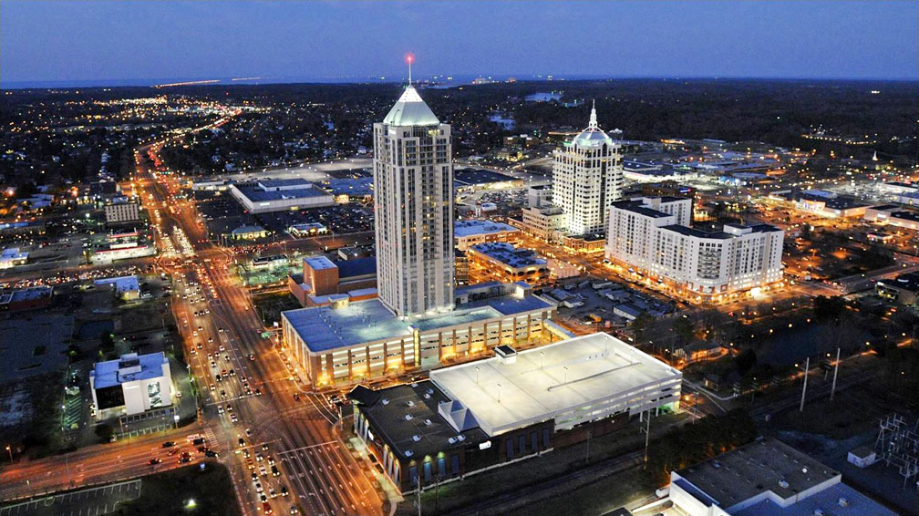
Virginia Beach Town Center, Virginia
Aerial view of Virginia Beach Town Center, Virginia, with Westin Virginia Beach Town Center (in center) and Armada Hoffler Tower (in the background).
Image: Steve Budman

Largest cities in Virginia with a population of more than 100,000:
Virginia Beach (450,000), Chesapeake (242,600), Norfolk (244,000), Richmond (228,700) Newport News (178,600), Alexandria (160,500), Hampton (134,300)


Other cities and towns in Virginia:
Abingdon, Arlington, Blacksburg, Bluefield, Bristol, Buena Vista, Charlottesville, Chester, Chincoteague, Clifton Forge, Covington, Culpeper, Dale City, Danville, Dillwyn, Emporia, Farmville, Franklin, Fredericksburg, Front Royal, Galax, Harrisonburg, Hillsville, Hopewell, Leesburg, Lexington, Luray, Lynchburg, Marion, Martinsville, Monterey, Norton, Onancock, Petersburg, Portsmouth, Pulaski, Radford, Reedville, Reston, Roanoke, Salem, Saluda, South Boston, South Hill, Staunton, Suffolk, Tappahannock, Warrenton, Waynesboro, Williamsburg, Winchester, and Wytheville.


Virginia Airports

Virginia's two largest airports are Washington Dulles International Airport (IATA code: IAD) and Ronald Reagan Washington National Airport (IATA code: DCA).
Other major airports are Norfolk International Airport (IATA code: ORF) and Richmond International Airport (Byrd Field; IATA code: RIC).
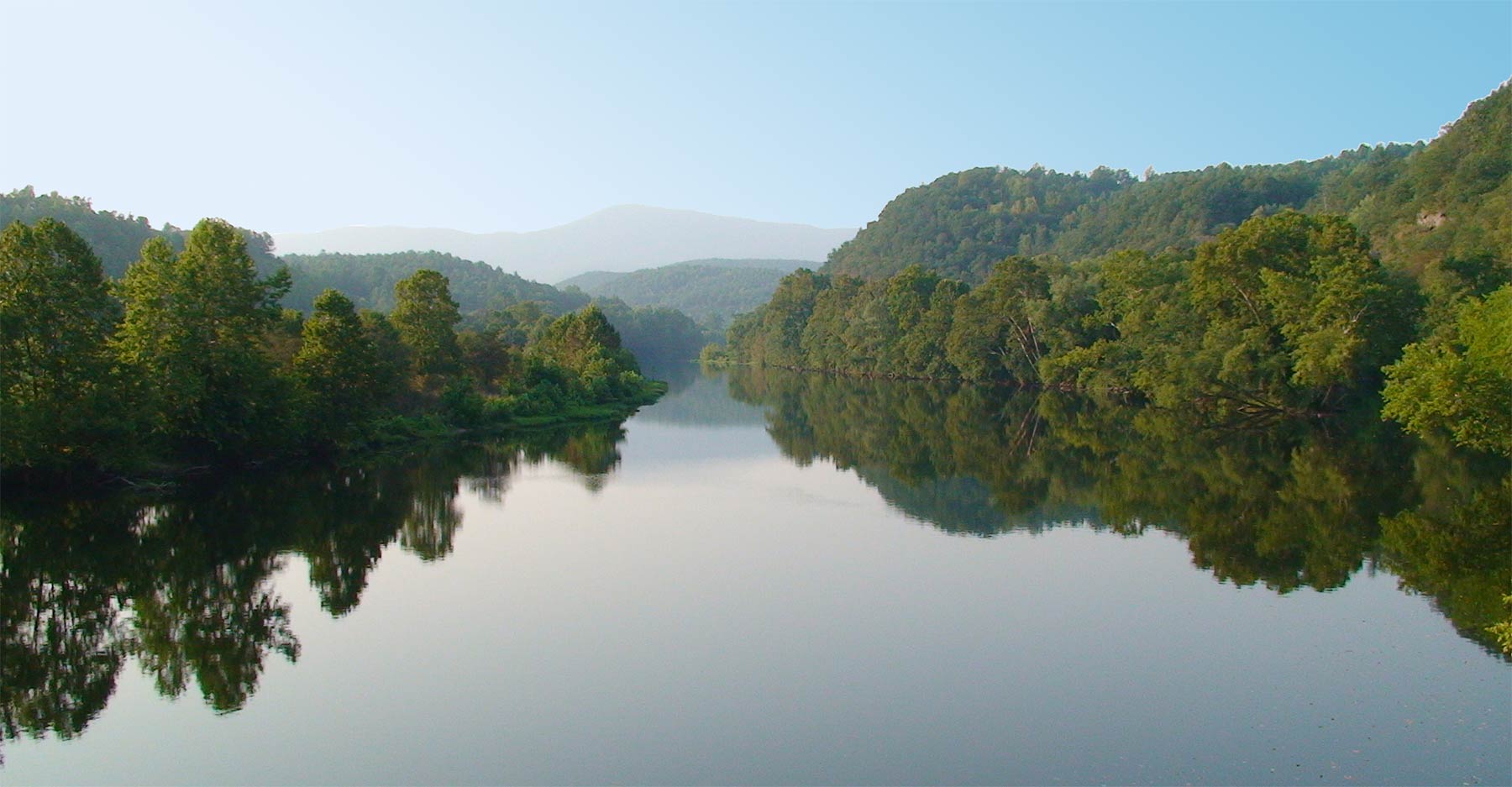

James River at the crossing of the Blue Ridge Parkway
James River at the crossing of the Blue Ridge Parkway. The James River is Virginia's largest tributary to the Chesapeake Bay. The first permanent English colonists named the longest river in Virginia after King James I of England.
Image: Thea Ganoe

Weather Conditions Richmond:

RICHMOND WEATHER


Advertisements:


Maps of the 50 U.S. States
Alabama | Alaska | Arizona | Arkansas | California | Colorado | Connecticut | Delaware | Florida | Georgia | Hawaii | Idaho | Illinois | Indiana | Iowa | Kansas | Kentucky | Louisiana | Maine | Maryland | Massachusetts | Michigan | Minnesota | Mississippi | Missouri | Montana | Nebraska | Nevada | New Hampshire | New Jersey | New Mexico | New York | North Carolina | North DakotaOhio | Oklahoma | Oregon | Pennsylvania | Rhode Island | South Carolina | South Dakota | Tennessee | Texas | Utah | Vermont | Virginia | Washington | West Virginia | Wisconsin | Wyoming

20 Most Populous U.S. Cities
1. New York City 2. Los Angeles 3. Chicago 4. Houston 5. Phoenix 6. Philadelphia 7. San Antonio 8. San Diego 9. Dallas 10. San Jose 11. Austin 12. Jacksonville 13. Fort Worth 14. Columbus 15. San Francisco 16. Charlotte 17. Indianapolis 18. Seattle, 19. Denver, 20. Washington D.C.

Other Major U.S. Cities
Albany, Anchorage, Annapolis, Atlanta, Atlantic City, Augusta, Baltimore, Baton Rouge, Bismarck, Boise, Boston, Carson City, Charleston, WV, Cheyenne, Cincinnati, Cleveland, Columbia, Concord, Des Moines, Detroit, Dover, DE, El Paso, Frankfort, Harrisburg, Hartford, Helena, Honolulu, Jackson, Jefferson City, Juneau, Kansas City, Lansing, Las Vegas, Lincoln, Little Rock, Long Beach, Madison, Memphis, Miami, Milwaukee, Minneapolis, Montgomery, Montpelier, Nashville, New Orleans, Norfolk, Oklahoma City, Olympia, Orlando, Pierre, Pittsburgh, Portland, Providence, Richmond, VA, Raleigh, Sacramento, St. Louis, St. Paul, Salem (OR), Salt Lake City, Santa Fe, Springfield, Tallahassee, Tampa, Topeka, Trenton, Tucson