Advertising

Louisiana Flag detail
Home Earth Continents The Americas USA Country Profile US State Capitals Louisiana Map

US States Maps Index
World Maps Index

Map of Louisiana (LA)


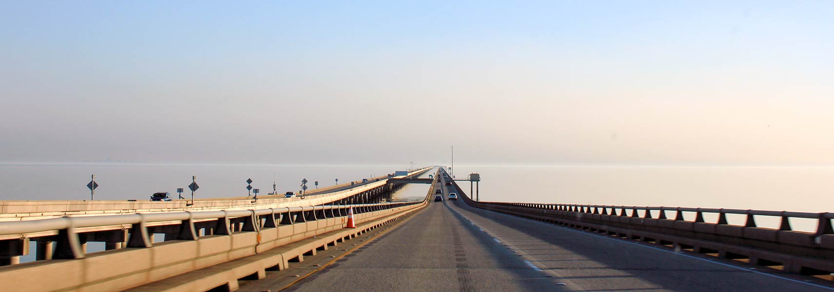
The Maestri Bridge or Lake Pontchartrain Causeway in Louisiana
The Maestri Bridge, also known as Lake Pontchartrain Causeway, carries US Route 11 over Lake Pontchartrain in southeastern Louisiana. Lake Pontchartrain is a brackish estuary north of New Orleans; it is the second-largest saltwater lake in the United States after the Great Salt Lake.
Image: Navin75
 
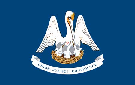
Louisiana Flag
Louisiana State Flag


About Louisiana


Location map of Louisiana state USA
Where in the United States is Louisiana? Location map of Louisiana in the US.

 
Louisiana is one of the 50 states in the US, located in the West South Central region of the mainland, between Texas and Mississippi, and south of Arkansas. The state features 4,800 km (3,000 mi) of twisty, meandering shorelines along the Gulf of Mexico in the south.


The Sabine River forms two-thirds of the border with Texas, the Mississippi and the Pearl River define sections of the border with the state of Mississippi.


Louisiana originally designated the vast region of the Mississippi basin, which the French explorer La Salle claimed for France in 1682. The French sold the land to the USA as part of the Louisiana Purchase of 1803. The smaller area now known as Louisiana became the 18th state of the USA in 1812.


Louisiana State Map
Reference Map of Louisiana
General Map of Louisiana, United States.

The detailed map shows the US state of Louisiana with boundaries, the location of the state capital Baton Rouge, major cities and populated places, rivers and lakes, interstate highways, principal highways, railroads and major airports.

You are free to use the above map for educational and similar purposes; if you publish it online or in print, you need to credit Nations Online Project as the source.

 
Short History


Louisiana Topographic Regions Map Topographic Regions Map of Louisiana. (Click the map to enlarge)
 
Groups of indigenous peoples have inhabited the territory of what is now Louisiana for at least 5,500 years. Archeologists have identified more than 100 sites belonging to this mound-builder culture, which also formed an extensive trade network in the eastern part of what is now the United States.

The Watson Brake archaeological site in present-day Ouachita Parish is considered the oldest earthwork mound complex in North America, dating back about 5400 years ago.

First European explorers came to visit Louisiana in 1528 when Spanish conquistadors led by Panfilo de Narváez located the mouth of the Mississippi River. In the late 17th century, French and French Canadian expeditions established footholds on the Mississippi River and the Gulf Coast.

With the Louisiana Purchase in 1803, the United States acquired almost all of the territory of Louisiana from France. Louisiana was admitted to the union on 30 April 1812 as the 18th state.


More about Louisiana State


Some Geography


Area
Agricultural country near Poverty Point in Louisiana
Agricultural country near Poverty Point in Louisiana.
Image: Google Map
 
With a total area of 135,658 km² (52,378sq mi) [1], the Pelican State (Louisiana's official nickname) is about half the size of Colorado or somewhat larger than Greece.

There are no counties in Louisiana; the state is divided into 64 parishes.

Louisiana's landscape is mostly flat; the highest point is Driskill Mountain, the hill with an elevation of  163 m (535 ft) is the highest natural summit in the state, located 80 km (50 mi) east of Shreveport.


The state's geography offers a coastal marsh, known as the wetlands of Louisiana, a water-saturated coastal swamp region of bayous (more or less standing water) and cheniers (ridges) in the southern part of the state.
But the wetlands of Louisiana in the Mississippi Floodplain have suffered severely from human interference in the last decades. Other features of Louisiana's landscape are the Red River Valley, the Terraces, and the Hills.
 
Lakes

City Park in New Orleans, Louisiana
City Park in New Orleans, Louisiana.
Image: Susan Yin
 
The largest lake is Lake Pontchartrain (not really a lake but an estuary); other major lakes are Calcasieu Lake, the Grand and the White lakes, and the Toledo Bend Reservoir on the Sabine River between Texas and Louisiana. The Sabine Lake is a saltwater estuary shared by Texas and Louisiana.

Rivers
Important rivers are the Mississippi, the Red River, the Ouachita River, the Atchafalaya River, and the Sabine River.


Islands
The largest island in Louisiana is the marshy uninhabited Marsh Island southwest of the Atchafalaya Delta.


Reconstruction of the Monumental Earthworks of Poverty Point, Louisiana
Reconstruction of the Monumental Earthworks of Poverty Point.
Image: National Park Service

 
World Heritage Site

Louisiana has one amazing UNESCO World Heritage Site, known as the UNESCO: Monumental Earthworks of Poverty Point official website

The Poverty Point National Monument is a vast area of earthen architecture built by an ancient indigenous hunter-gatherer society that inhabited the region of the Lower Mississippi Valley.

The monument consists of a complex of earthworks constructed 3,700-3,100 years ago in the Late Archaic period. It is the oldest ancient earthwork of this size in the Western Hemisphere. Poverty Point was more or less abandoned around 1100 CE.

Poverty Point World Heritage Site
The Story of Poverty Point World Heritage Site by the Louisiana Office of Tourism.


Panorama from the top of Mound A at Poverty Point Historic Park.
Panorama from the top of Mound A at Poverty Point Historic Park. What you see in the image is supposed to be a 3,000-year-old giant earthen bird, with the south wing to the left, the north wing to the right, and the bird's body in the center.
Image: Michael Homan
Population


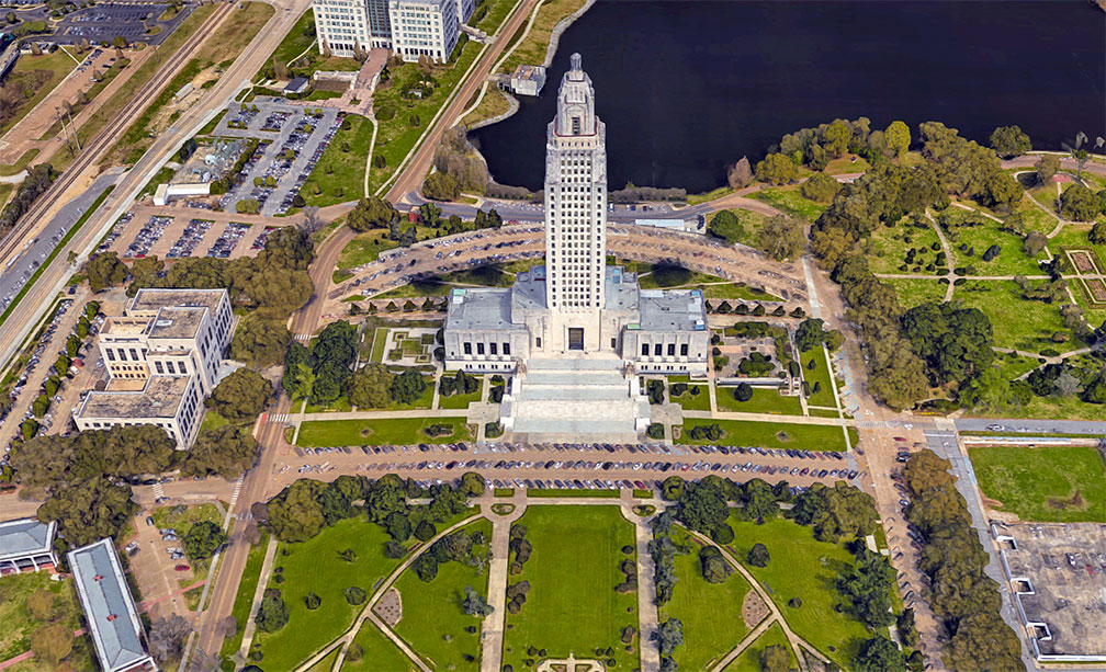
Louisiana State Capitol in Baton Rouge
Rendered image of the Louisiana State Capitol in Baton Rouge, the state capital. The Art Deco building, opened in 1932, houses the bicameral State Legislature of Louisiana. At 137 m (450 ft), it is the tallest capitol in the United States.
Image: Google

 
Louisiana has a population of 4.6 million people (est. 2021) [2]; the state capital is Baton Rouge.

The largest cities are New Orleans, Baton Rouge, Shreveport, Metairie (part of the New Orleans Metropolitan Area), Lafayette, and Lake Charles.


Airports
The busiest airports in Louisiana are

Louis Armstrong New Orleans International Airport
(IATA code: MSY)
Baton Rouge Metropolitan Airport (Ryan Field; IATA code: BTR)
Shreveport Regional Airport (IATA code: SHV)
Lafayette Regional Airport (IATA code: LFT)


Race and Ethnic groups
The population of Louisiana is composed of White alone 58.6%, African American 32.7%, Hispanic or Latino 5.2%, Asian 1.8%, and Native American 0.8%. [3]


Cities and Towns in Louisiana
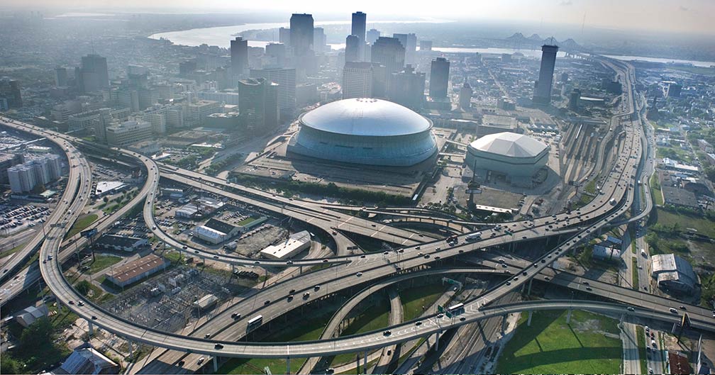

New Orleans Central Business District and Mercedes-Benz Superdome,  Louisiana
New Orleans' Central Business District with the Mercedes-Benz Superdome in the foreground, New Orleans is Louisiana's flagship city.
Image: Nowhereman86


The map shows the location of the following cities and towns in Louisiana:

The largest city is New Orleans (391,500).
The second-largest city is Baton Rouge, the capital city, 227,500.

Shreveport (195,000), Metairie (part of the New Orleans metropolitan area; 138,500), Lafayette (127,600)
Population figures in 2017

Other cities and towns in Louisiana:
Abbeville, Alexandria, Bastrop, Bogalusa, Bossier City, Bunkie, Chalmette, Crowley, De Ridder, Eunice, Ferriday, Franklin, Hammond, Houma, Jennings, Kenner (part of New Orleans metro), Kinder, Lake Charles, Leesville, Mansfield, Minden, Monroe, Morgan City, Natchitoches, New Iberia, Oakdale, Opelousas, Ruston, Slidell, Springhill, St. Francisville, Sulphur, Tallulah, Thibodaux, Tullos, Ville Platte, Winnfield, and Winnsboro.


ExxonMobil oil refinery in Baton Rouge ExxonMobil oil refinery in Baton Rouge, Louisiana, seen from the Capitol tower. The refinery alongside the riverbank of the Mississippi is the fourth-largest oil refinery in the United States.
Image: Adbar

Weather Conditions Baton Rouge:

NEW ORLEANS WEATHER
 

Advertisements:


Maps of the 50 U.S. States
Alabama | Alaska | Arizona | Arkansas | California | Colorado | Connecticut | Delaware | Florida | Georgia | Hawaii | Idaho | Illinois | Indiana | Iowa | Kansas | Kentucky | Louisiana | Maine | Maryland | Massachusetts | Michigan | Minnesota | Mississippi | Missouri | Montana | Nebraska | Nevada | New Hampshire | New Jersey | New Mexico | New York | North Carolina | North DakotaOhio | Oklahoma | Oregon | Pennsylvania | Rhode Island | South Carolina | South Dakota | Tennessee | Texas | Utah | Vermont | Virginia | Washington | West Virginia | Wisconsin | Wyoming

20 Most Populous U.S. Cities (in 2018):
1. New York City 2. Los Angeles 3. Chicago 4. Houston 5. Phoenix 6. Philadelphia 7. San Antonio 8. San Diego 9. Dallas 10. San Jose 11. Austin 12. Jacksonville 13. Fort Worth 14. Columbus 15. San Francisco 16. Charlotte 17. Indianapolis 18. Seattle, 19. Denver, 20. Washington D.C.

Other Major U.S. Cities:
Albany, Anchorage, Annapolis, Atlanta, Atlantic City, Augusta, Baltimore, Baton Rouge, Bismarck, Boise, Boston, Carson City, Charleston, WV, Cheyenne, Cincinnati, Cleveland, Columbia, Concord, Des Moines, Detroit, Dover, DE, El Paso, Frankfort, Harrisburg, Hartford, Helena, Honolulu, Jackson, Jefferson City, Juneau, Kansas City, Lansing, Las Vegas, Lincoln, Little Rock, Long Beach, Madison, Memphis, Miami, Milwaukee, Minneapolis, Montgomery, Montpelier, Nashville, New Orleans, Norfolk, Oklahoma City, Olympia, Orlando, Pierre, Pittsburgh, Portland, Providence, Richmond, VA, Raleigh, Sacramento, St. Louis, St. Paul, Salem (OR), Salt Lake City, Santa Fe, Springfield, Tallahassee, Tampa, Topeka, Trenton, Tucson