About Annapolis
The satellite view shows Annapolis, a port city on the western coast of Chesapeake Bay. It is the seat of Anne Arundel County, and the capital of
Maryland, a state located in the Mid-Atlantic region of the
 US
US. The town is located about 48 km (30 mi) south of
Baltimore and 32 mi (50 km) east of
Washington D.C., at the mouth of the Severn River at the Chesapeake Bay, a large serrated sea arm reaching inland from the Atlantic Ocean.
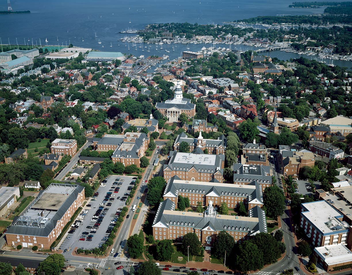 Aerial view of Annapolis.
Photo: Carol M. Highsmith
The town was founded on the north shore of the Severn River in 1649 by Puritan exiles from
Virginia; the settlement was then known as Providence.
This small town was the stage of some significant events in American History. According to Alex Haley, Kunta Kinte, who was kidnapped in the
Gambia in 1767 and transported to Annapolis in the Province of Maryland to be sold as a slave. Kunta Kinte is the central character in Haley's book
Roots: The Saga of an American Family. The book made Haley to one of the United States' best-selling African-American authors.
In reality, Annapolis was a major center of the Atlantic slave trade and became very wealthy. But the city's commercial success declined rapidly after Baltimore, with its deeper harbor, was made a port of entry in 1780.
It was only in 1864 that the Maryland Constitution outlawed the practice of slavery; the convention that drafted the document assembled on 27 April 1864 in the Maryland State House in Annapolis.
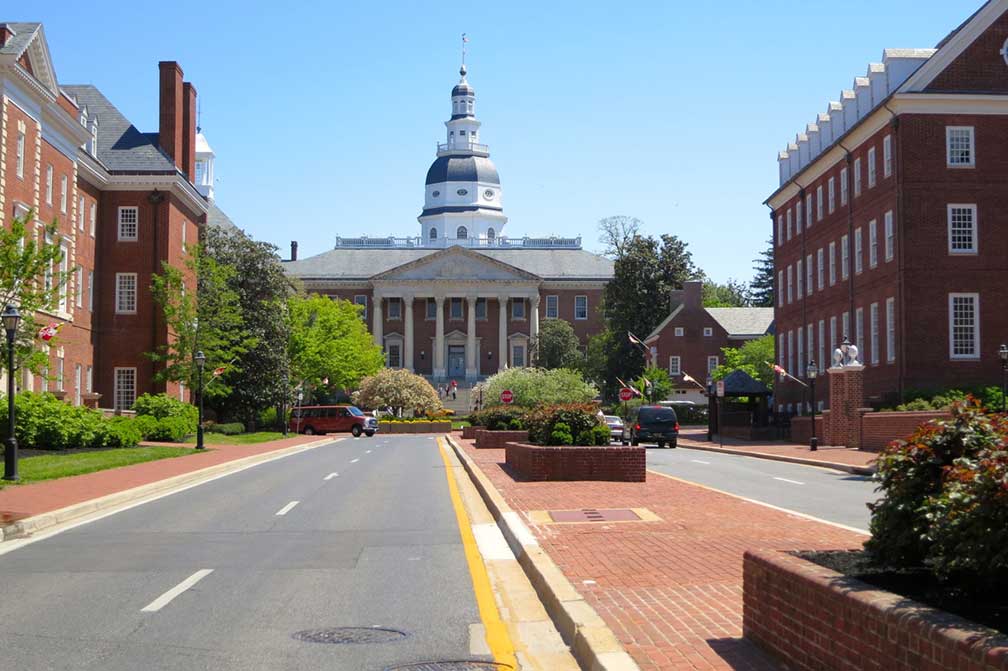 Maryland State House. It is the oldest state capitol in continuous legislative use, completed in 1779. It houses the Maryland General Assembly and offices of the Governor and Lieutenant Governor.
Photo: Frank DiBona
The Treaty of Paris, signed on the 3rd September 1783 by the US and
Great Britain, ended the American Revolution. In November 1783 Annapolis became the temporary capital of the fledgling United States (from 26 November 1783 to 19 August 1784).
It was also in Annapolis on the 23rd December 1783 that General Washington voluntarily resigned as Commander in Chief of the Army.
Also in that year, the Governor of Maryland commissioned John Shaw, a local cabinet maker, to create an American flag. The present-day U.S. flag is based on John Shaw's design.
Annapolis is one of the small US State capitals, with a
population counts of about 38,000 souls.
The city is home to St. John's College, the United States Naval Academy, the United States Sailboat Show, and a Yacht Club. The town is the home port for a large number of sailing vessels and pleasure boats.
Annapolis' fine tourist attractions:
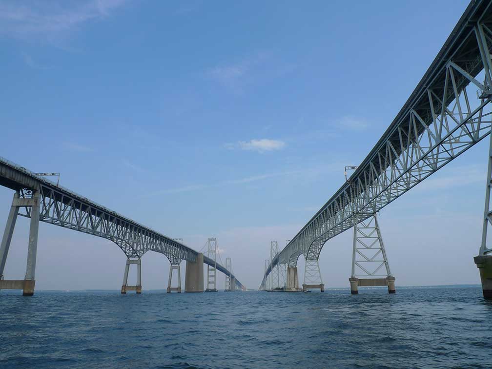 Chesapeake Bay Bridge near Annapolis is spanning the Chesapeake Bay, connecting Anne Arundel County with Queen Anne's County on the Delmarva Peninsula.
Photo: ezioman
Even so, the capital is small there are some attractions to see:
Maryland State House, the oldest state capitol in continuous legislative use, from the 18th century until now, and the
Government House home to the Governor of Maryland since 1870.
Museums:
Annapolis Maritime Museum (
amaritime.org), the museum features the ecology, maritime history and the arts of Chesapeake Bay),
U.S. Naval Academy Museum (
www.usna.edu/Museum/), is a museum with four galleries showing American naval history.
Thomas Point Shoal Lighthouse (
www.thomaspointlighthouse.org) is a historic lighthouse in the Chesapeake Bay, constructed in 1875.
Banneker-Douglass Museum (
bdmuseum.maryland.gov), the former African Methodist Episcopal Church is now a small museum dedicated to preserving Maryland's African American heritage.
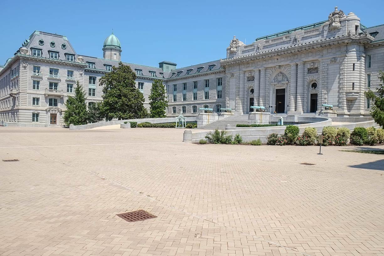 Memorial Hall (part of Bancroft Hall) at the US Naval Academy in Annapolis.
Photo: Paul Sableman
plays host to a handful of Annapolis’ most prominent events.
Maryland Federation of Art (
mdfedart.com), the oldest continuously operating non-profit gallery in the state.
National Cryptologic Museum (
www.nsa.gov/about/cryptologic-heritage/museum/), the museum is situated about 22 mi (35 km) north-west of Annapolis at Annapolis Junction. The museum shows (almost) everything you want to know about cryptology, code making, and code breaking.
Historic mansions in Annapolis:
Brice House, Hammond-Harwood House, the Stanton Center, and the William Paca House are 18th-century Georgian style brick houses in Annapolis.
Churches:
St. Anne’s Episcopal Church (
stannes-annapolis.org), the city's first church, founded in 1692, is located on Church Circle.
Parks/Outdoors:
Jonas Green State Park is a park and a public recreation area on the Severn River and starting point of the Baltimore and Annapolis Trail, a trail on a former rail line through the suburban region between Annapolis and Baltimore.
Sports:
Navy-Marine Corps Memorial Stadium (
navysports.com) open-air stadium and home field of the Navy Midshipmen football team, the men's lacrosse team, and the Chesapeake Bayhawks lacrosse team.
United States Sailboat Show, (
www.annapolisboatshows.com), the world's largest in-water boat show.
The Map shows a city map of Annapolis with expressways, main roads, and streets, nearest international airports to Annapolis are Baltimore-Washington International (
IATA code: BWI), the other is Reagan Washington National Airport (
IATA code: DCA).
To find a location use the form below.


